

Sierra National Forest-Yosemite NP Loop
Share: The link to this page has been copied to your clipboard
Intro
We keep being reminded: having flexible plans is a must.
After two very memorable backpacking trips to the Yosemite area in 2015 and 2016, we wanted to explore a bit further north, and for our "usual" weeklong August trek, we made plans for an exciting figure-8 loop in the Emigrant Wilderness. No super-high elevations, but varied terrain, lots of lakes, a bit of cross-country, and – most importantly – fewer crowds.
However, with all that late snow in 2017, I realized we had to keep our options open. First, around the end of July, I called the rangers and inquired about conditions. "All bridges are still intact, crossings are doable, but the mosquitoes are horrendous." Oh, my. The area is supposedly mosquito heaven anyway (there's even a Mosquito Pass), and this year, they hatched late and really went crazy.
So I sat down to come up with another plan, one where we would be above the tree line as much as possible.
After looking at several maps, somehow I ended up examining the area west of Thousand Island Lake in the Ansel Adams Wilderness. The map said there's a pass called North Glacier Pass between Mt. Banner and Ritter, but there was no trail marked. I read up on it, and people wrote there's a use trail from Thousand Island to Lake Catherine via this pass.
Then I saw a trail to the south leading from the general area of Clover Meadows (in the Sierra National Forest) past a place called Hemlock Crossing, then Stevenson Meadows, dead-ending in a canyon below Lake Catherine.
A plan started to crystallize, and after reading several trip reports, I came up with the following idea: start at Clover Meadows (actually, Isberg Trailhead), go to the end of the trail mentioned above, cross-country up to place called Twin Island Lakes, then up to Lake Catherine, over North Glacier Pass, down to Thousand Island Lake, then spend another few days circling back to the south, avoiding the PCT/JMT as much as possible, exploring several of those lakes on the east side of the Minarets, finally returning to Isberg Trailhead via the Mammoth Trail (Granite Staircase).
According to all reports, that cross-country section is steep, but very much doable and can be kept at category 2 or 2+. However, with the late snow and the swollen streams, nothing seemed sure. We decided to give it a shot, while keeping in mind not to push anything.
I got a permit for this trip, and we started preparing. The last month before leaving was very busy, both in our private lives and with work, so we were both a bit exhausted. Still, we somehow managed to squeeze in a short trip to Mineral King, and then of course couldn't wait to get away again, this time for an entire week.
Keeping mosquitoes in mind, I treated our clothing with Permethrin and made sure we had a full bottle of eucalyptus oil.
Everything seemed set. Then, just one day before the trip, we had to change plans again. To make sure everything is OK, I called the ranger station in Oakhurst. They told me our itinerary is a no-go. There's a fire south of the Mammoth Trail and they had to close that entire area. It will be at least two weeks until they could even consider reopening it. Other than that, everything was fine.
Shoot. Our return leg just got cut off. As soon as I hung up, I was on the map, trying to find an alternative. Several options came to mind, even abandoning this and going to the Emigrant Wilderness. I called those guys again, and they told me the mosquitoes are as bad as ever.
After consulting with Em, I came up with the following idea: let's do the Isberg Trailhead trip, but with a big change. First leg, same as before: up to Lake Catherine and over to Thousand Island Lake. From there, however, turn north on the PCT/JMT (yeah, I know), follow it over Donohue Pass, down into Lyell Canyon, but then turn west, up to Vogelsang. From there, repeat a few miles of last year's trip, namely down to the Merced River, up along it, then climb out over Isberg Pass and return to the car. Total mileage: around 80, with approximately 18 being an encore. Not ideal, but it's a gorgeous area and still better than the alternatives.
This was less than 24 hours before leaving. We were tired anyway and didn't have tremendous amounts of time to prepare, but luckily, neither of us was working on this last day (a Friday), so we hustled until late in the evening to make everything ready. Even so, contrary to our usual practice, our backpacks weren't even trail ready, we just assembled everything and planned on packing them at the trailhead.
Day 1 – L.A. to Oakhurst, Isberg Trailhead and campsite south-west of Hemlock Crossing
We left the city relatively late, around 7am. By the time we got to Oakhurst, it was almost 11am. At least we got lucky, and picking up the permit took little time. Then we started the long, tedious, but nonetheless gorgeous drive towards Clover Meadows. Beashore Road is in great condition for the first dozen miles or so, but then it deteriorates, and the last few miles are in relatively bad shape. It's still very easily manageable with a low-clearance car and actually in much better condition than the road we took a year before to Chiquito Pass Trailhead.
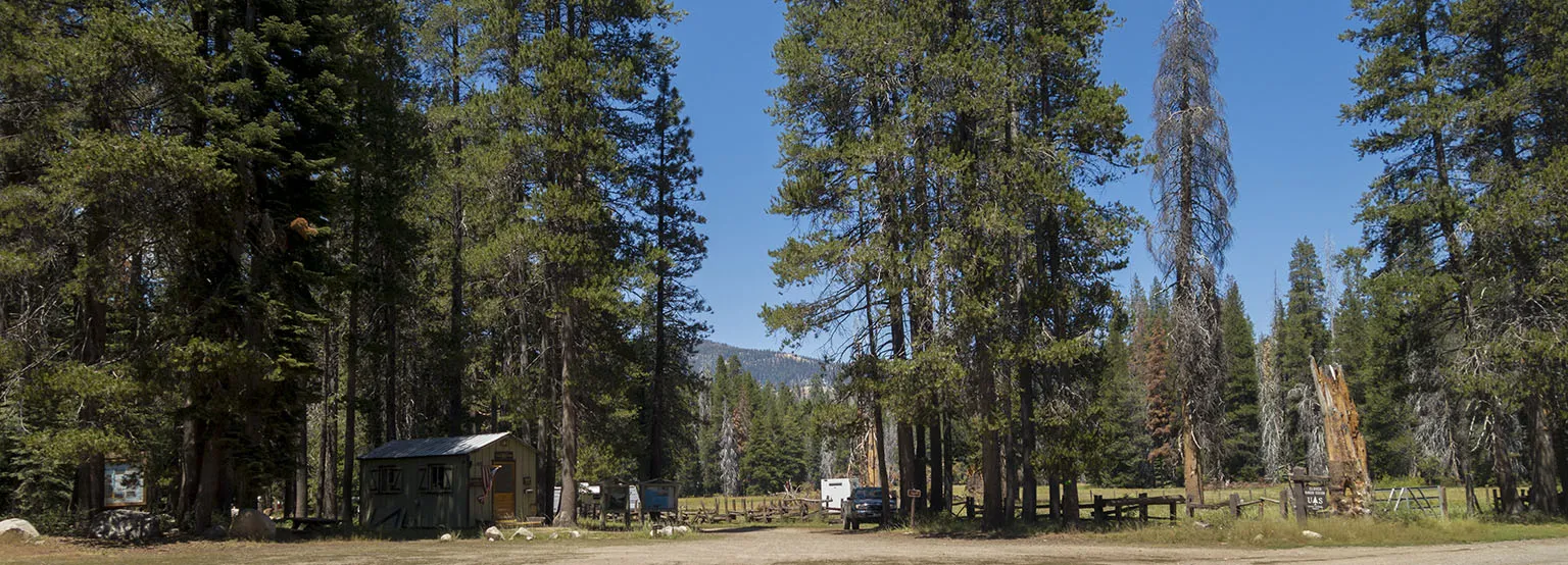
We stopped at beautiful Clover Meadows to talk to the ranger. He was a very friendly guy and loved our itinerary. He also confirmed that the cross-country part up to Lake Catherine is not bad at all. He asked where we planned on camping the first night, and when we told him we'll try to push all the way to Hemlock Crossing, he informed us to expect quite crowd as there's a trail crew working there, plus some geologists set up long-term camp for a study.
We then drove the last, short stretch to Isberg Trailhead. This was by far the worst road surface so far, but still manageable. The trailhead parking was almost entirely full, and we needed a few minutes to figure out where to put the car. We took the last reasonable parking spot.
It was hot and the car was in the sun, so we laid out the tarp in the shade, ate something, then started packing the backpacks. Time flew, with that long drive and all the delays, it was almost 3pm! Finally, we were off.
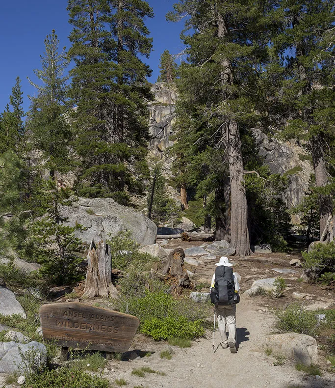
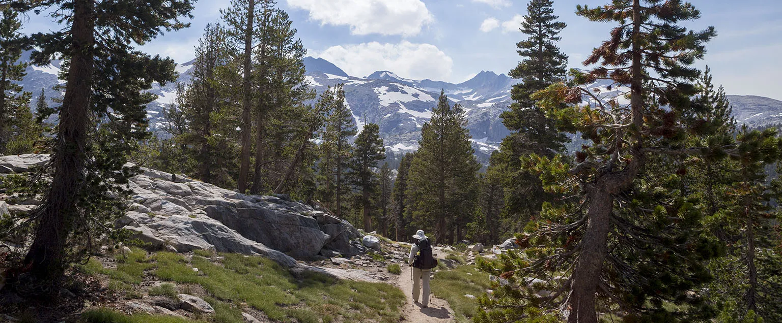
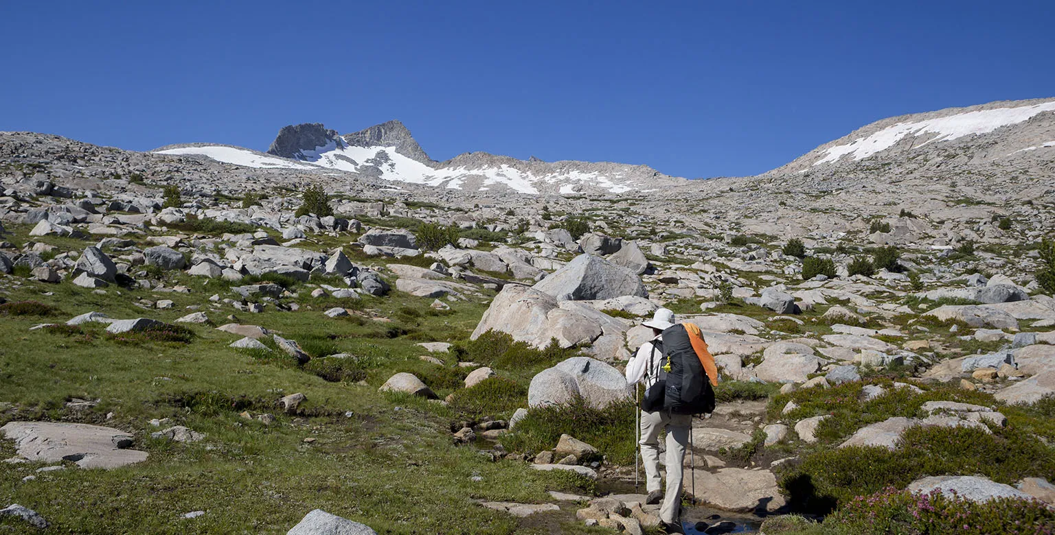
The Isberg Trail starts on the other side of the road from the parking lot, a few dozen feet back from where you came. It's easy to miss, but some friendly hikers (who just got out from there) were nice enough to point it out for us.
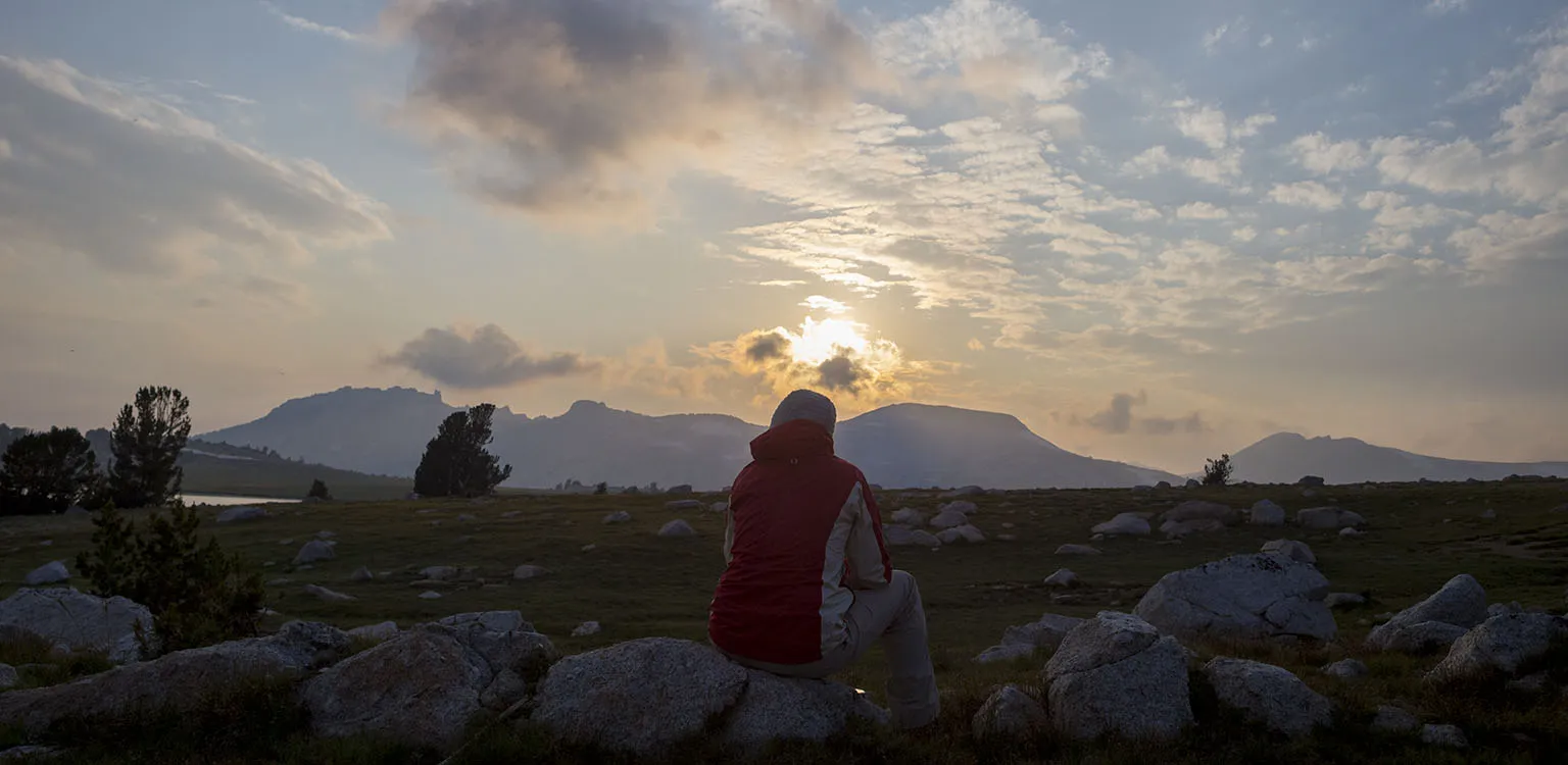
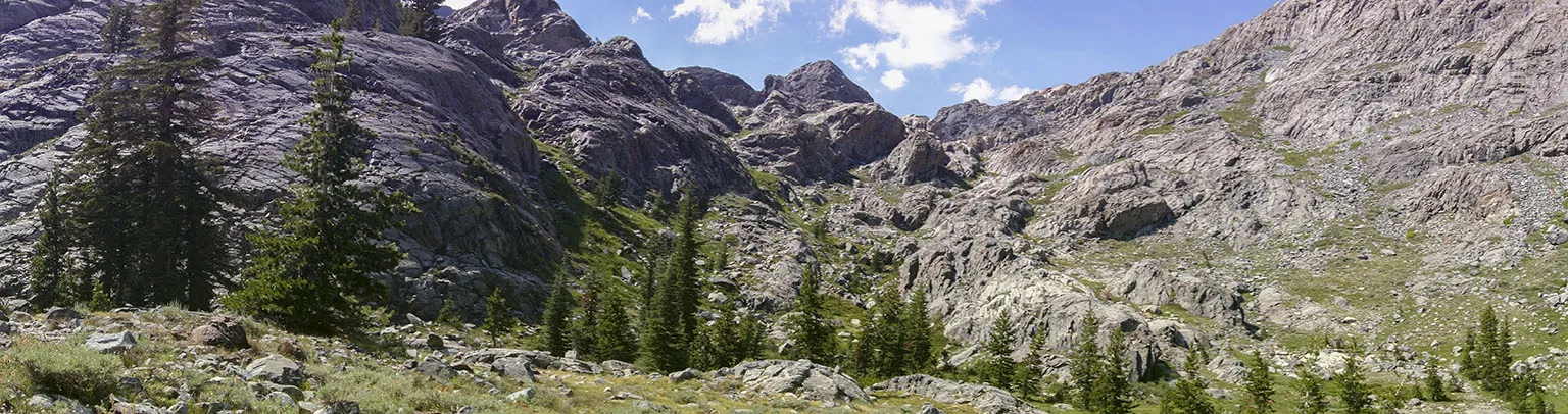
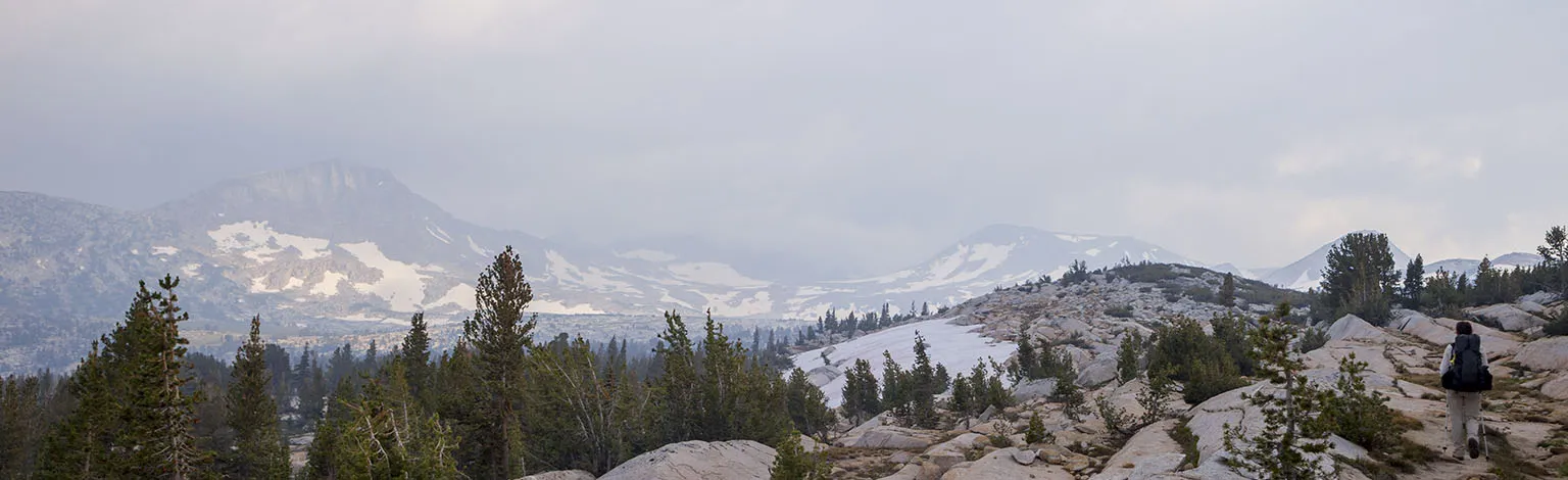
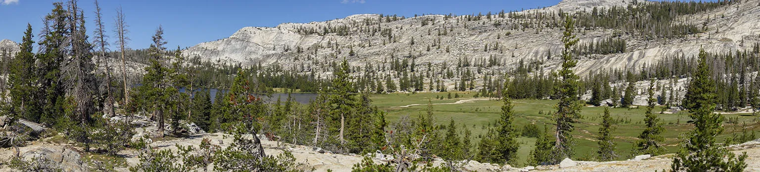
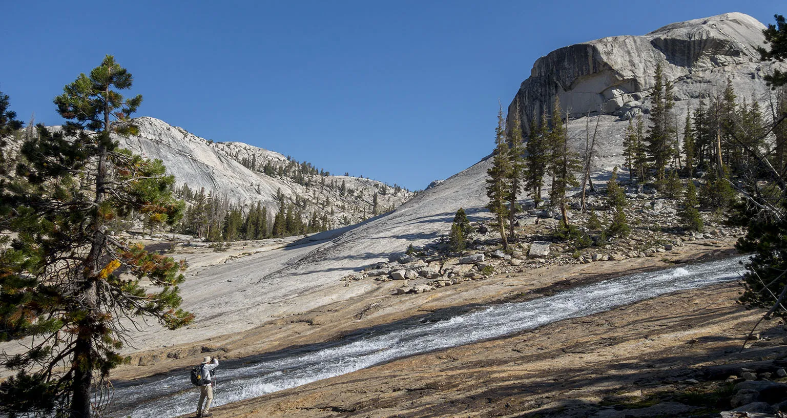
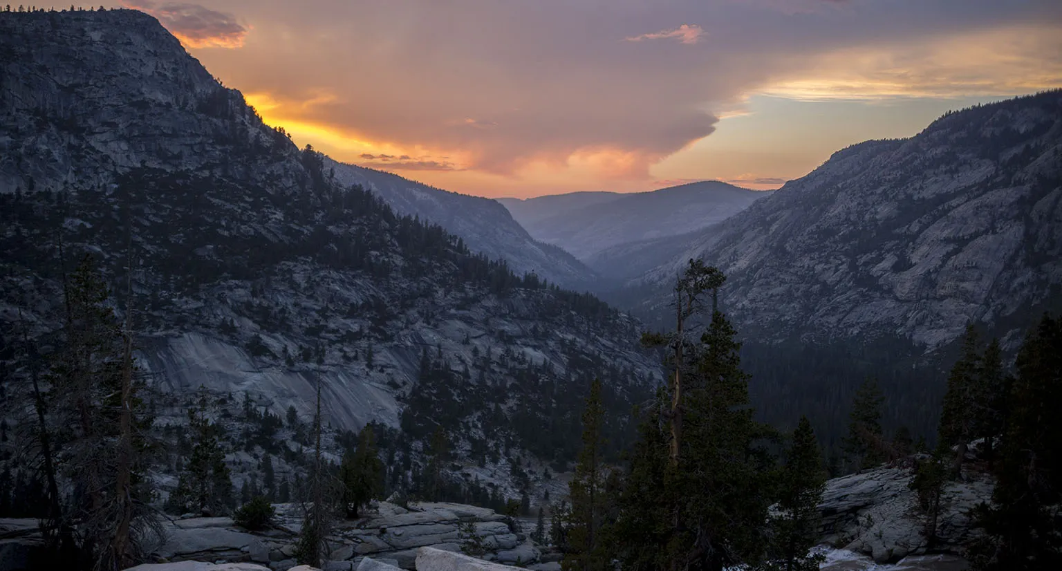
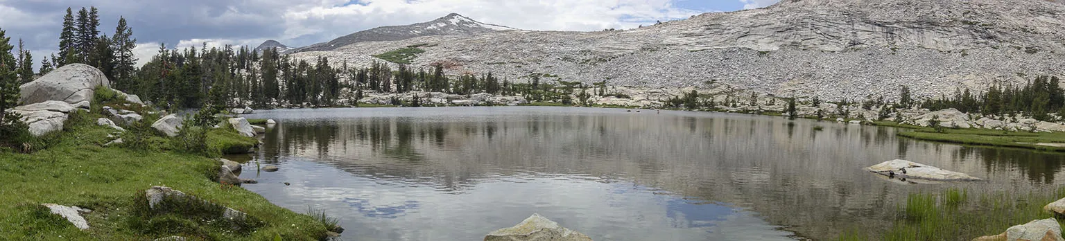
First, the trail undulates in the forest, climbing a bit. Then it becomes steeper and enters the Ansel Adams Wilderness. There are a few junctions towards Cora Lake and a stream crossing or two. Around mile 6, it climbs a big hill and the vista opens up, offering great views into the canyon of the San Joaquin River. The smoke from the fire closing the Mammoth Trail was clearly visible to the south-east. On the other side of the canyon, the Minarets rose like jagged fingers. Amazing.
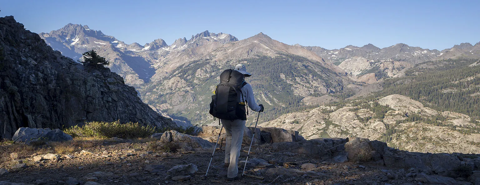
It was late by this time, past 6:30pm. Nonetheless, we couldn't help it but stop and take a few pictures. We knew we were at the highest point of the day and a descent of about 1,200' over almost 4 miles awaited us to Hemlock Crossing. It looked like we'd get there a bit after sundown. Making camp in the dark would not have been a problem, but as we heard there are few spots, and all those are supposedly taken by the trail crew and the geologists. Also, in all honesty, we were tired – it's been a long day. According to the map, at least one or two small creeks crossed the trail between here and Hemlock, so we planned on camping there if conditions allowed.
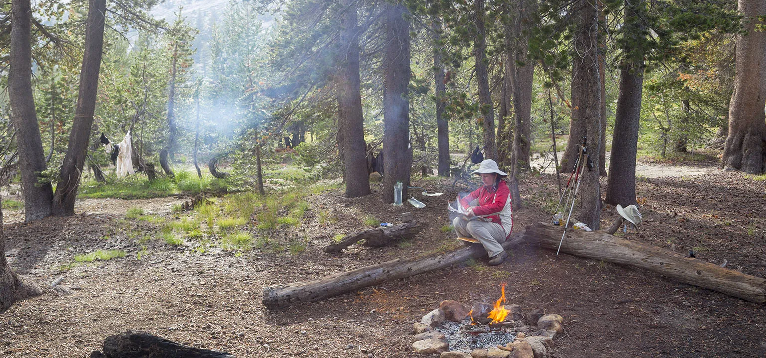
We got lucky, at one of those creeks, about two miles before Hemlock, there was a great little campsite with room for a few tents, a fire ring, and some dry logs to sit on. It was 7:30pm, with less than half an hour of light left. It was "the" time for mosquitoes, and they were swarming. The Permethrin on our clothes and the eucalyptus oil we sprayed on each other kept them at bay, but this was a great time to break our usual routine of not making fires in the backcountry. While Em was unpacking, I gathered a few dry twigs, made a tiny fire, then threw a few moist leaves and branches (found on the ground, not broken from a tree) on top. Thick, fragrant smoke rose and dissipated around our site. The mosquitoes were gone in a minute. Neither of us got a bite that evening.
We ate soup, pitched the tent, then cooked dinner quickly and went to bed as soon as we could. I can't say we had any trouble sleeping that night.
Day 2 – Campsite south of Hemlock Crossing to Twin Island Lakes
We got up at the usual 6am, hoping the beat the mosquitoes to their wake-up call around sunup. It sort of worked, but of course they started attacking before we could leave.
The trail descends sharply into the canyon, alternating between meadowy and rocky areas. Shortly after leaving the campsite, we met the trail crew, four really cool ranger guys with big saws. They cheerfully explained how they cleared most of the trees up to Stevenson Meadow and now they're going back after a week of hard work. Most importantly, they day-hiked up to Lake Catherine only a day before and said it's easy and there are no major obstacles.
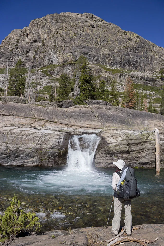
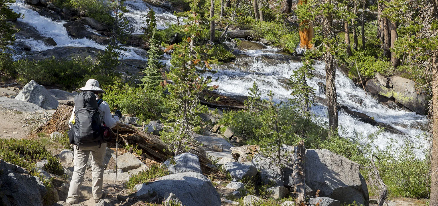
We got to Hemlock Crossing around 9am. It's truly gorgeous. There's a big bridge crossing the stream, with the turquoise water rushing below in an exciting rapid. Just north of the bridge, a small waterfall cascades into a nice-sized pool. Supposedly this is a popular swimming spot, but the ranger at Clover Meadows told us he's been down here a few days before, and the water with all that snowmelt was way too cold, even for him. Observing the bank, one could see how the river was a few inches above its normal level.
We also met one of the geologists, a tough cookie of a girl from England who explained that they mule-packed in three weeks ago and they're working on PhD dissertations. She was headed somewhere up to the mountain to camp for a few days by herself, geologist's hammer merrily hanging from her chest strap.
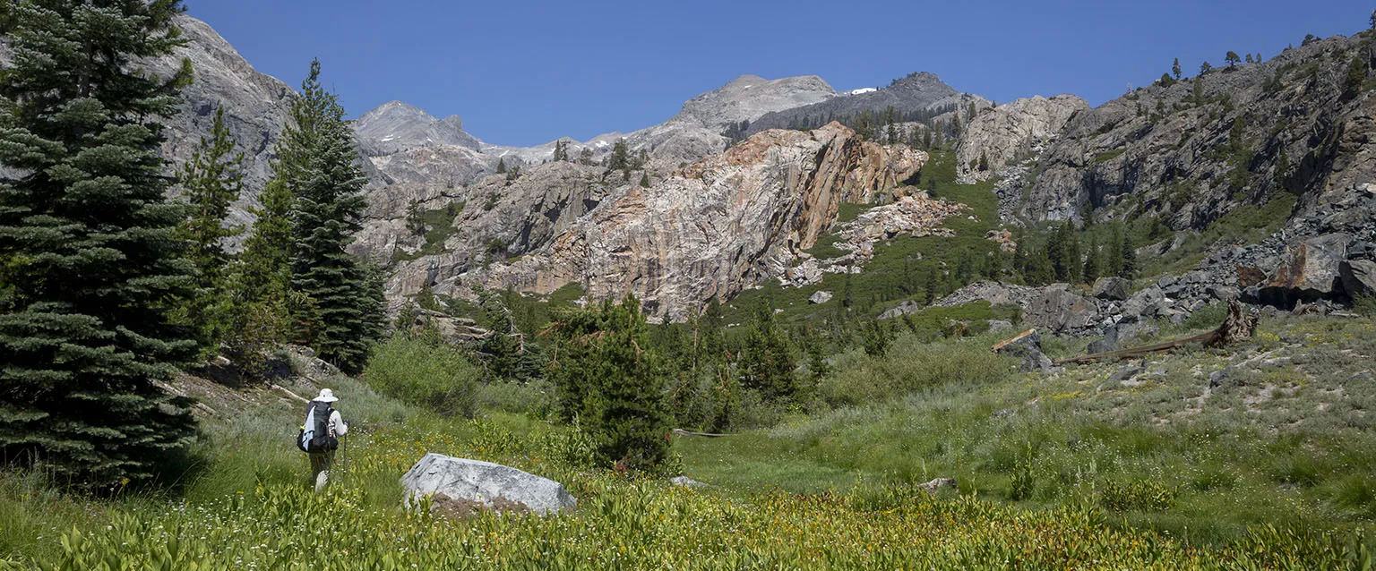
Past the crossing, the trail becomes truly steep, but only for about half a mile or so, before entering the general area of Stevenson Meadows.
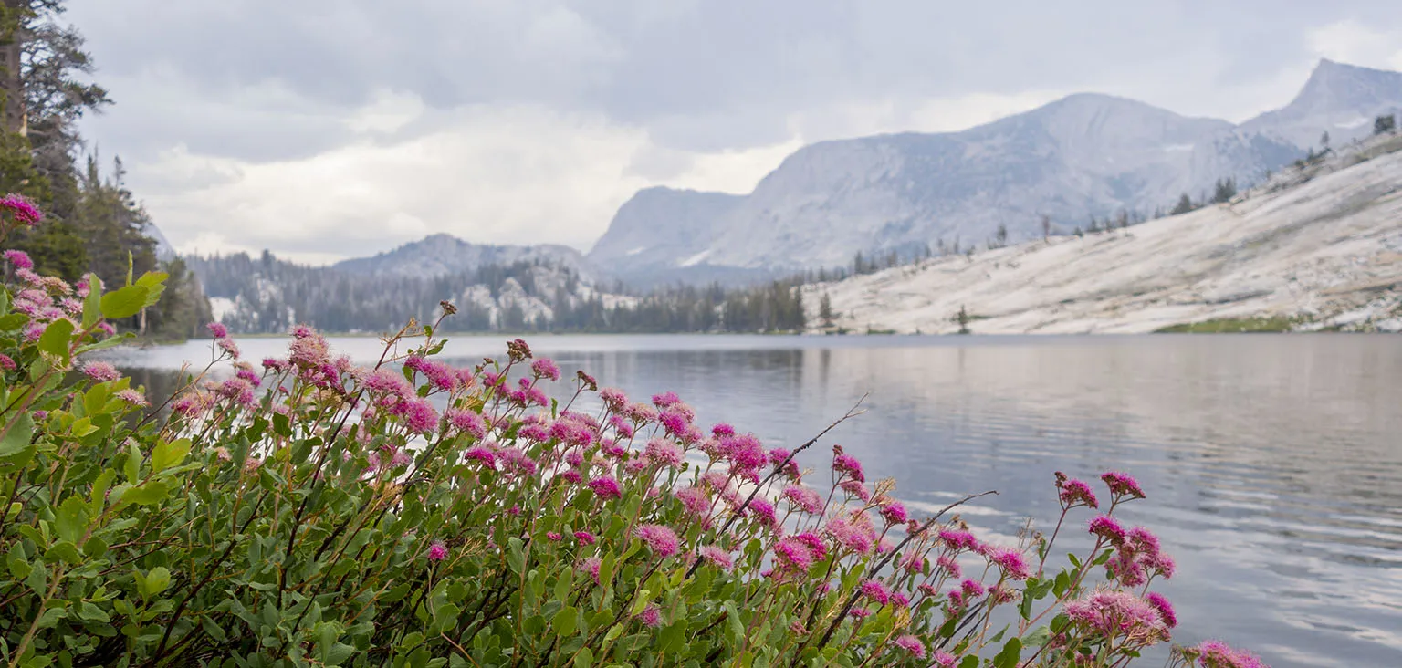
It's hard to give a sense how gorgeous this place is. Stevenson is actually a series of several smaller meadows, all longish, nestled deep in the canyon. It was wet. Very, very wet. "Brimming with life" and "teeming with wildflowers" are clichés, but I can't think of a better way to put it.
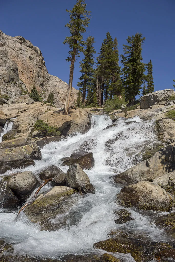
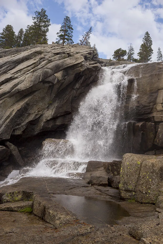
The trail was easy to lose in the tall grass and it was also overflown in many places. Several of the small creeks burbling from the side required serious rock-hopping. The end of the meadow is a step headwall, with the trail circling around the climbing out of it, turning more east-ish by some truly scenic waterfalls. We stopped here briefly and even saw what looked like a pair of golden eagles teaching their youngling to fly.
Up and up we went, through the rocky-meadowy-foresty-flowery canyon. At this point, though the official trail was over, the use trail was still easy to follow, though overgrown and submerged in water here and there.
A word of caution about how not to die: I went down to the riverbank to take a picture. There was a beautiful, relatively smooth rock about the size of a living room, gently sloping down into the water by a small pool. Right next to the pool, there was a rapid, but the pool's water was almost calm, though flowing, nonetheless. I stepped up all the way to the water's edge to take a picture, making sure I stayed on the dry part of the rock. However, I took another half-step forward, and I slipped, falling on my butt. The rock's slope was no more than 8-10 degrees, but I started sliding into the water right away. The pool in front of me was at least 5-6 feet deep and the current strong enough to sweep me away with my heavy pack. Once in the water, I would have had to somehow jettison my pack and fight the current out of there.
I did two things: first of all, I yelled as loud as I could. Em was about 100' further back on the trail, looking the other way. There was no chance of her hearing me above the rushing water's sound.
At the same time, I rolled on my side, and managed to somehow grab onto a small crack in the rock. This allowed me to turn all the way, and I ended up on all fours, with my fingers holding on to that crack. Then it was easy to get up. Only the tips of my shoes got wet.
All the while, Em was oblivious to all this. The water could have swept me away and she'd never known.
The most important thing I'm trying to say here is how innocent the place looked. I did not walk up on wet, steep rock to some precipice with rushing whitewater raging below. Still, I almost got in real serious trouble.
We pressed on, past some more rocks, flowers and meadows, even crossing a small snowfield. Lunch break was by the stream in the shadow of a nice big rock. There was no sign of anyone since the geologist at Hemlock.
Another mile past the lunch spot, we got to the point where the canyon ended. To our right (east), Ritter and Banner rose, with the stream from the hidden lakes (Catherine, Ritter) cascading down in a gorgeous waterfall. As the bird flies, that would have been the shortest way to next day's destination. That's way too steep, though, and everybody said to keep north-west in the canyon, climb towards Twin Island Lakes first, then contour around to Lake Catherine from there. Even the trail crew guys confirmed this in the morning.
First, we had to cross the creek. The use trail crossed at a point that should not have been a problem in a normal water year. However, as I keep saying, this was not a normal year. It wasn't as wide here as only a mile below, but it was still something to reckon with. It looked like we need to take our shoes off. Just when I wanted to explore a bit further, we saw a lady on the other side, and then realized there are a few more people behind her, apparently camping there.
She saw us, came closer, and by shouting over the water's sound and mimicking, she told us there's a crossing upstream. Indeed, many big rocks were positioned in the water, allowing us to get over with our shoes still on.
The other side had an impossibly scenic meadow - huge pine trees lined the side with cozy camp spots nestled between them. A party of six people and two dogs set up camp here. They were a cool bunch, one of the guys said earlier in the day he made that crossing we used. For the following day, their plan was also to day-hike up towards Lake Catherine, maybe bag Banner.
We continued past their camp, going north in the canyon as the trail petered out almost entirely and the going became steeper and steeper. It was pretty easy, though. We stopped a few times, trying to discern the best possible route, then kept climbing. Which way to go was actually pretty obvious and in some spots, faint footprints of previous hikers could be seen.
Around 4pm, we got to the snow-covered saddle east of Twin Island Lakes. The route towards Catherine was up, to the right. Our plan was to camp around one of the Twin Island Lakes, so we turned left, dropping a few hundred feet. The creek coming from the north burbles through the rocky terrain into a big meadow, where it forms a tarn, then it cascades into the northern lake.
There's another, very similar lake a just a bit to the south, and both have an almost identical-looking island each, thus the name Twin Island Lakes.
The only reasonable campsite we found was close to the northern tarn, next to an Indian paintbrush-covered, grassy field. The site was a bit too close to the water for my taste, but it was somewhat protected from the pesky wind that started blowing. I left Em by the site and went down to the lake proper, scrambling around its steep east shore in hopes of finding something better. No luck.
I went back to Em, we set up camp, cooked soup, and I started fishing. It was a bit windy and it also looked like it could rain at any moment, but nothing happened.
The smoke came, however. Heavy bands of thick smoke started filling the basin, seemingly coming from the west. The fire we knew about was to our south. We were concerned for a bit that some new fire started, but later this turned out to be unfounded.
By sundown, the smoke cleared a bit and we had a great evening. After eating the fish and then having proper dinner, we tried – and failed, of course – to go bed early. The weather looked unstable and changing by the minute, I was expecting rain any time, but it didn't materialize.
Day 3 – Twin Island Lakes to Rush Creek
We got up at the usual time and left as soon as we could. First, we had to climb back to the saddle, cross the snowfield again, climbing away from it to the east. There we met previous day's guys and the dogs. After discussing the basic route, we kept ahead as they said they're really slow and we should not wait for them. One of the dogs became completely enamored with Em and followed us until being sternly called back by his owner. This is normal for Em, she always has that effect on animals (including me).
Up, up, up, we climbed on the steep rocks. It was not terrible. There were a few parts where we had to use our hands a bit, but mostly it was just about going uphill. First stop was another mini-saddle directly east of the previous one, then some contouring to the north around a small basin through another snowfield, and climbing to some terraces on the other side. The view was even more breathtaking than the walking on the steep terrain. The Minarets Range, the canyon, both Twin Island Lakes… We could even see the fire's smoke to the south and nothing to the west, confirming that the wind just blew the smoke around.
It was mostly cloudy, and we liked this as we weren't roasting in the sun on the exposed southerly rock face.
From that basin, we needed to contour around and upwards to the lake. The question was whether there's a ledge good enough to take us around. We were already high up, and the alternative – dropping about 200' and scrambling up next to the waterfall – seemed very unappealing.
After some more climbing, we found a ledge that took us partway. It was time for a snack break, so we sat down to eat and enjoy the view. The people with the dogs just crested the mini-saddle, trailing about 90 minutes behind us.
We also spotted two hikers below us, on the other side of the creek, working their way up at quick pace. Then we lost sight of them as we tried to find the next ledge.
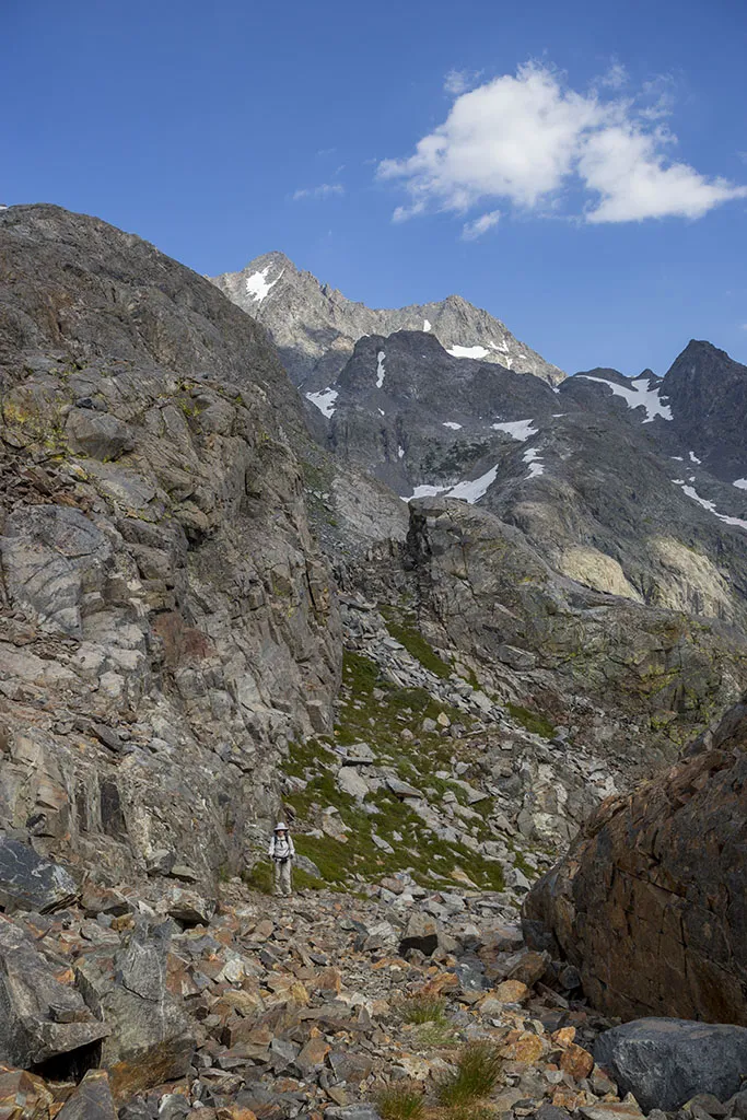
At a contentious point, Em stayed behind while I scouted the route. There was a moment where I started cursing a bit. It looked like the ledge just dropped off into nothing, meaning we're cliffed out, we need to backtrack and climb down. However, after a few more steps, to my biggest relief, I saw that I was wrong. There was a very short (20-30'), manageably steep drop, and from there, the ledge continued to a point just below the lake. I knew we're good.
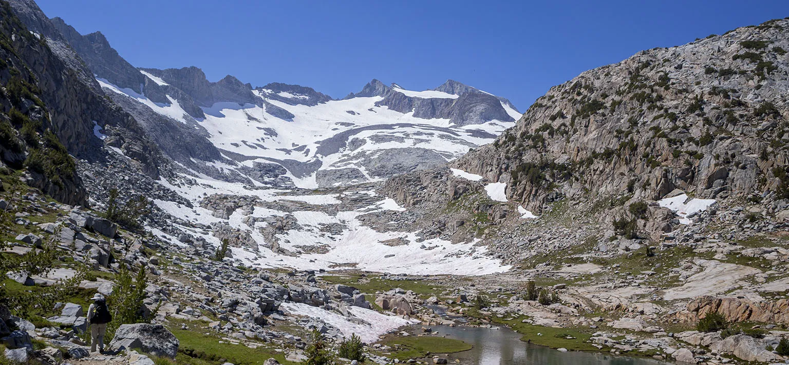
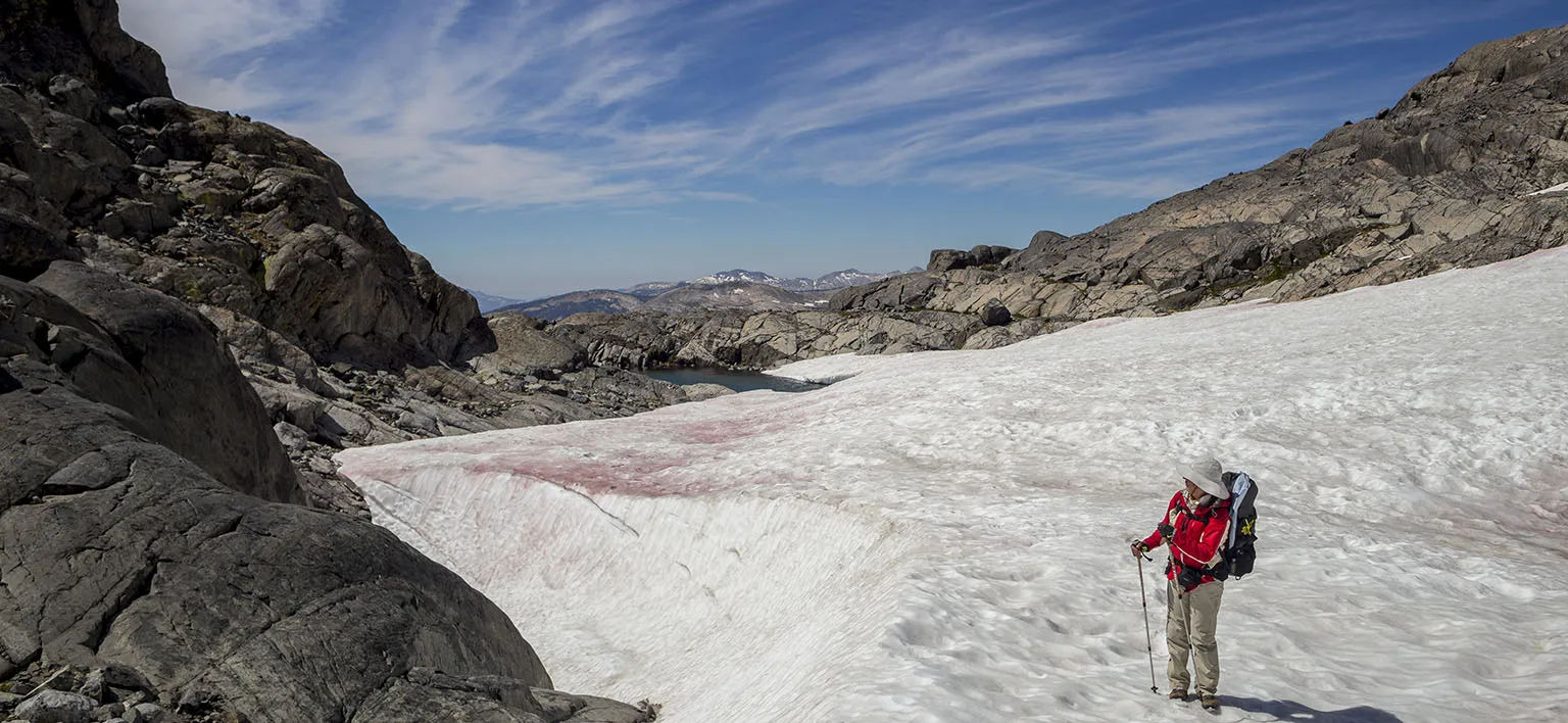
After a bit more climbing and traversing a small snowfield or two, we got to the point below the lake's "dam". A huge snowfield was covering the outflow with a hill on the right side, also partially covered in snow. The lake should be just on the other side.
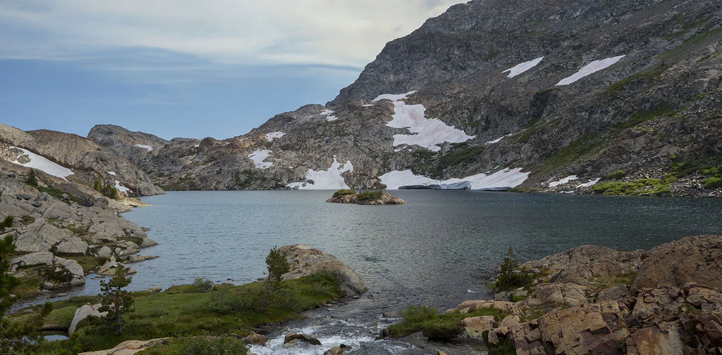
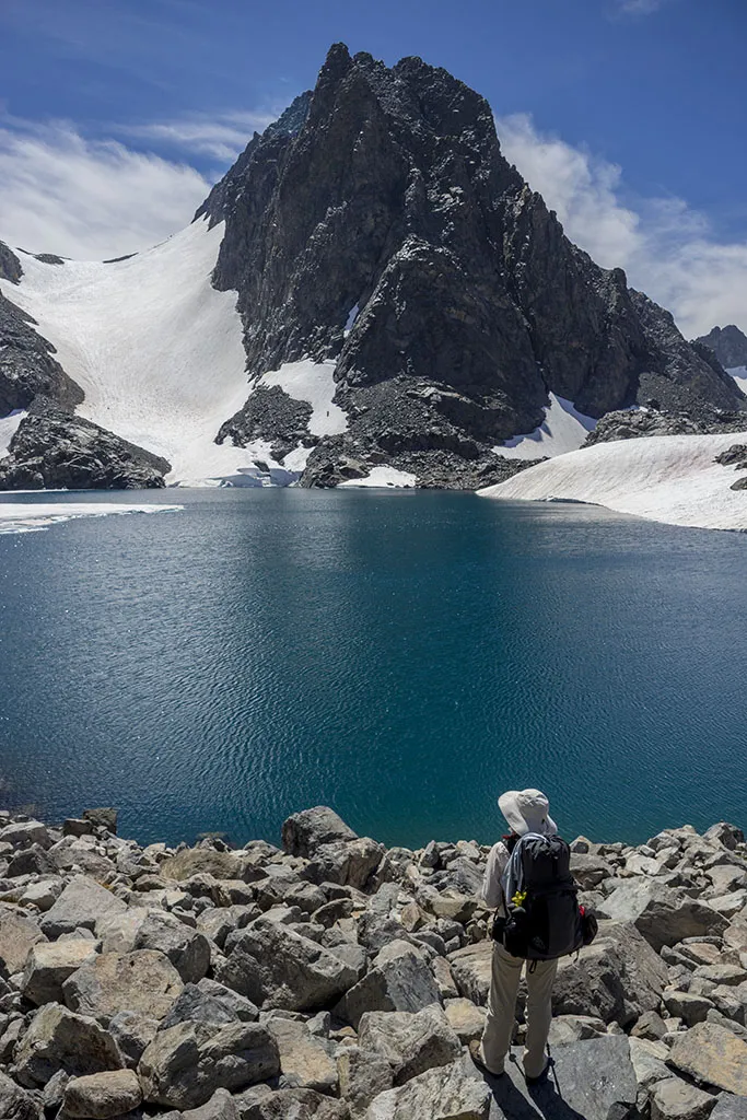
The snowfield looked many feet thick and stable - we crossed it without a problem. Lake Catherine greeted us on the far side, its partially frozen surface sparkling in the sunshine, the water impossibly turquoise from all the glacial silt, Mt. Ritter towering above it like a grumpy sentinel.
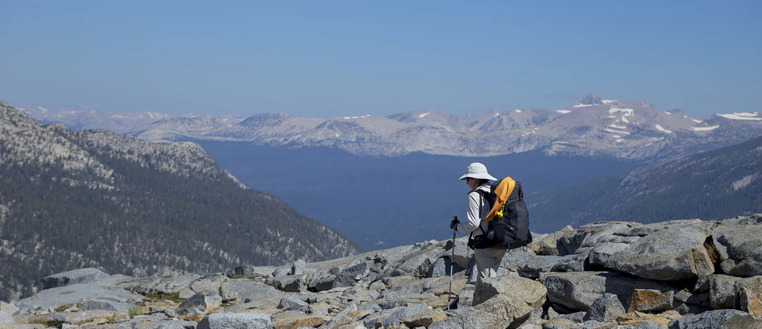
Tedious boulder-hopping followed, tracing the lake's northern shore towards the pass. North Granite Pass itself is an unmarked, but obvious notch without any sign of a trail. Right on top of the pass, the terrain acted as a perfect amplifier for the wind, sucking up the air from below at a steady pace of around 40 mph or maybe even more. At least it was warmer air from the valley and we didn't linger anyway. Holding on to our hats, we quickly moved downward and the wind eased up almost right away.
On the east side of the pass, after some more boulder-hopping, a huge snowfield awaited us. It was not very steep, though, and going down was easy.
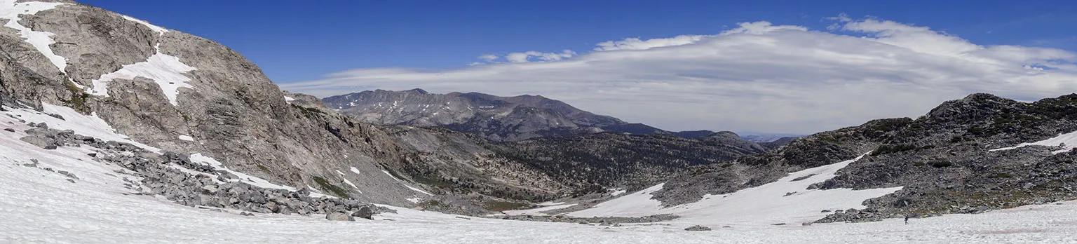
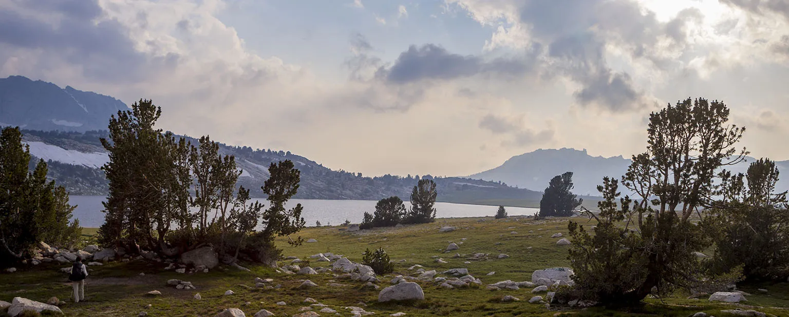
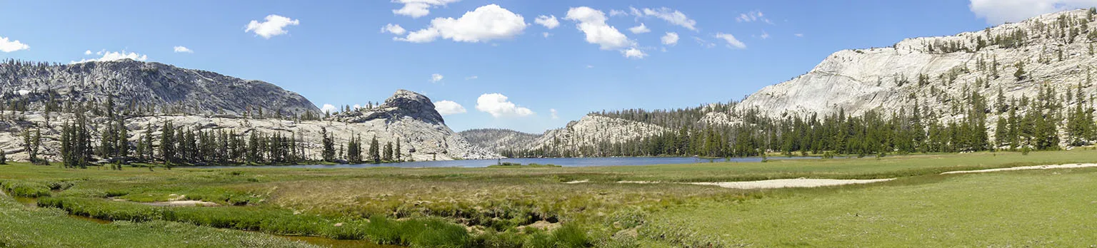
On the far side of the snowfield, by the creek, we found the use trail in better condition than many marked trails. We followed that for a few hundred feet, then stopped for lunch. Thousand Island Lake was just below us. It's no wonder some are mocking this as Thousand People Lake. It's one of the most scenic spots in the Sierra, that's sure. The huge lake with all those islands and the big mountains around it make for a prime destination, especially when taking into account that it's relatively easily accessible.
Originally, we planned to go down on the trail to the PCT/JMT at the lake and turn north from there. However, when studying the map a day before, I got the idea of contouring around to Island Pass and thus saving a thousand feet of elevation gain and a mile or two. Now, observing the terrain, I saw it's a no-brainer. We had to drop another bit more, maybe 100', but from there, it should be a gentle climb and easy cross-country walk to the pass.
After lunch, we did just that, abandoning the trail and walking north-east on the gorgeous terrain covered with wildflowers.
Despite the lack of trail, the terrain was easy, and we should have made good time, but it was impossible to ignore the flowers and not to stop every few steps to take pictures. Also, in one of the creeks, Em found a strange contraption: it was made of thick, sturdy bubble-insulation, cut and duct-taped together in the shape of a small bucket. I'm sure it was insulaton for a bear canister during a winter expedition, and somehow they lost it. We plucked it from the creek, drained it as much as possible, and put it in my backpack's outer pocket. We ended up carrying it out. It weighed about a pound, but what else could we have done. At least, in the days that followed, we used it to cover our pot when soup or dinner was steeping. It worked great, keeping the food hotter.
Around 3pm, we got to Island Pass. Right before, we started seeing signs of civilization in the form of a small camp with two tents and another with a stash of gear. Three hikers were going south on the PCT in the distance.
We hit the trail exactly at Island Pass, right by those small tarns where it starts descending. This is a gorgeous place, by the way, the Ritter Range with the tarns and the trees make for a very scenic combination. Mosquitoes were abundant, so we quickly made our way down, heading north.
In the last three days, we saw 13 people on the trail altogether. As soon as we got on the "freeway", we saw at least 30 in the first half an hour. By the end of the day, I'm sure we met at least 60 other hikers.
From Island Pass, the trail drops sharply into the basin of Rush Creek. It's a beautiful, forested area with a few smaller crossings and then Rush Creek at the bottom. The creek was raging terrifyingly, but the actual crossing is at a very easy place and we didn't even have to take our shoes off. We could also see Waugh Lake in the distance, looking eerie as they completely emptied it.
Quick backstory: parts of the Rush Creek Trail from June Lake have been closed this year because "water levels will likely exceed seismic safety ratings for a period of more than 25 days in Waugh Reservoir"(1). This affected quite a few trails, including access from June Lake to the PCT/JMT. I can only guess that in order to reduce stress on dam, they slowly drained the lake, thus the end-of-the world feeling of the empty lake with the dam rising in the distance.
The plan was to camp somewhere well before Donohue Pass, but the exact location was uncertain. We asked a few hikers for advice, and they said there are many suitable spots, with the mosquito density varying between normal and "holy shit".
Finally, just before 5pm, we found a very nice spot. There were some very obvious campsites right next to the trail, but we ignored those and spotted a log crossing the creek, with possible camping on the other side. We were right, there were at least half a dozen sites to choose from, all sheltered from the wind and view by various degrees. We decided on a cozy shelf between some rocks, about 120' from the creek.
Like most of the time, we cooked soup, then took a shower. A bit further from the creek, we found a tiny tarn with clean and warm (well, warmer) water. I put some of that in the shower and hung it on a tree far enough away. We both waded into the tarn, rinsed the dirt off without soap, then walked dripping wet to the shower and washed up properly. While one of us showered, the other helped keeping mosquitoes at bay by fanning a towel. The weather was still nice with the sun out and almost no wind. It was a great feeling to be at least somewhat clean.
Back in camp, we could see other neighbors arriving and setting up, but far away, on the other side of the creek, at those sites by the trail we didn't like. Well, for good reason.
We had a great sunset, leading into a pleasant evening. The night was a bit chilly, but warmer than the first. I was still concerned about the weather, as the forecast predicted 20% chance of rain, but again, nothing came.
Day 4 - Rush Creek to Evelyn Lake
It was going to be a long day. We got up at the usual 6am to a crisp, almost cloudless morning. Before doing anything, we lingered a bit on top of a rock next to our tent, watching the sunrise. Awesome.
Then I came up with the oh-so-brilliant idea to use our sporks as a hairbrush. We always take a tiny hairbrush with us. We don't care how we look, but tangled hair is messy and uncomfortable. This time, I somehow forgot to pack it. This was already day 4, and the only thing we did the last few days was run our fingers through our hair. Not very efficient. This morning it occurred to me that we could try using our wonderful Sea-to-Summit titanium sporks. Em didn't even flinch at the idea, and we got down to it. The very tips of the sporks are a bit sharp, so we had to be careful, but it worked surprisingly well. Of course, I made sure I washed them thoroughly before eating breakfast with them.
We were even slower than usual to pack up and only left our cozy creekside campground not much before 9am. We encountered a marmot, apparently highly pregnant, munching on flowers right next to the trail. Compared to the usual marmots, she was not afraid and just kept grazing there while we were taking pictures.
There were less than 2.5 miles to climb to Donohue Pass. The trail stayed in the sparse forest for a little bit, then slowly left the tree line, passing a few small tarns and creeks. The going was nice and easy, uphill, of course, but not very steep. Like everywhere before, everything was very wet, green, and full of wildflowers. About a mile before the pass, we found a huge patch of white and purple mountain heathers, a patch bigger than any I've ever seen.
We got to the pass around 10:30am, crossing a small snowfield, then taking a break at the very top. This is one of those wide passes, with no steep high-point, but the view was still gorgeous in either direction. It's also the entrance to Yosemite National Park.
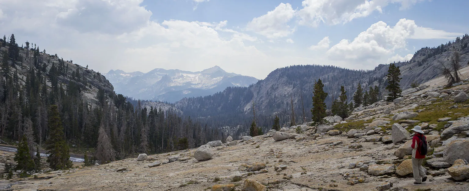
We could see all the way back to the Ritter Ranger and the other peaks far to the south, the other way all the big peaks to the north of Tuolumne Meadows. On the left side, there was Amelia Earhart Peak with Potter Point below it. I knew we'll have go down all the way past Potter Point, then turn west just past it, climbing again way higher than its top.
With this view and the gorgeous terrain, the descent into Lyell Canyon can only be described as formidable. First, there's a big boulder field to cross (there was a bit of snow here, too), then it descends sharply, crossing the treeline again, curving back towards the south, making a huge U. A few mule deer were hanging out by the trail, calmly sitting at the edge of the boulder field, watching us watching them as we sat down to have a snack.
At the apex of the U, the first crossing of the Lyell Fork awaited us, a breathtaking place with a tarn and the river running out of it. Then there's a very short uphill section before plunging down to the next big terrace of the canyon for the second crossing. This looked like a very popular place with many, many tent sites, but nobody was camped there at that moment. A guy was fly-fishing and a lady was looking for the trail (she was right on it).
The crossing was a bit problematic, with either a shoes-off option or - as we found out - a rock-hopping option that featured many unstable rocks and was right above a small rapid. Em almost took a swim, but she has great balance and got away unscathed.
Then it was downhill again in the forest, crossing the river once more, this time via a small bridge, guarded by a fierce marmot. Well, I don't know about fierce, he was sitting in the middle of the bridge when we walked up, but scurried away as soon as he saw us. At least we didn't have to cut him into pieces.
More downhill followed, even steeper than before, offering impossibly scenic views of the first truly huge meadow in the canyon, with the river meandering in the middle. Soon we were hiking by this meadow, in awe of the scenery. For the n-th time: the wildflowers… Oh, my…
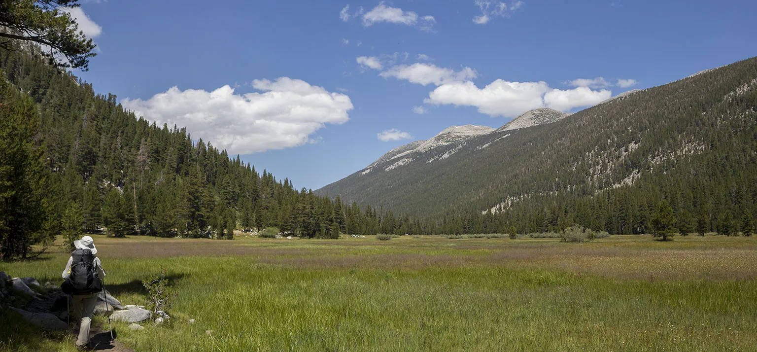
There was no choice but to stop every few steps and take in the place. I even ventured out into the meadow to take some pictures from the riverbank. It was very much worth it.
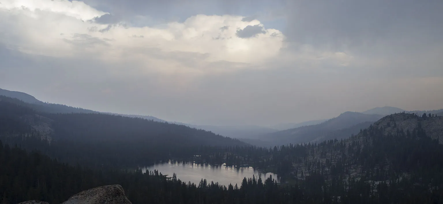
We kept going and going, there were about 9.5 miles to do between the pass and the turnoff to the west. It was past 2pm, and I knew we're close, but we were hungry, so we stopped for lunch by a small creek. While eating, the wind changed and the canyon filled up with smoke in the matter of minutes. It's hard to describe how quick this happened, even without the wind blowing hard. It wasn't very thick smoke tough, but the view was ruined. Well, what can you do?
Less than half a mile away from our lunch spot, the trail crossed Ireland Creek (balancing act on a nice wide fallen log), and then there it was, the trail up towards Vogelsang. We were at around mile 12 or 13 for that day, it was pretty late (3:30pm), and we still had at least four miles to go, more than half of that uphill. We just took it easy, going at a slow, but steady pace. At least we got off the PCT/JMT and away from the crowds. The trail was in great shape, though, nicely graded as it steadily climbed in the forest.
About an hour later, we got to the small meadow just below the gorgeous waterfalls coming from Ireland Lake. The place was still filled with smoke, and I was bummed I couldn't take any decent pictures.
Then the trail contours around the side of the hill, passing the trail junction to Ireland Lake (a few people were camped here), and climbs some more to a mini saddle with a glimpse of Evelyn Lake plus great views of the Cathedral Range to the west and Amelia Earhart Peak to the east. Just a few hours and around 12 trail miles ago on top of Donohue Pass, this peak was to our north-west.
This was about 5:30pm. The gathering clouds with the lowering sun made for dramatic pictures, but we wanted to hurry so we can make camp before it rains - if it does.
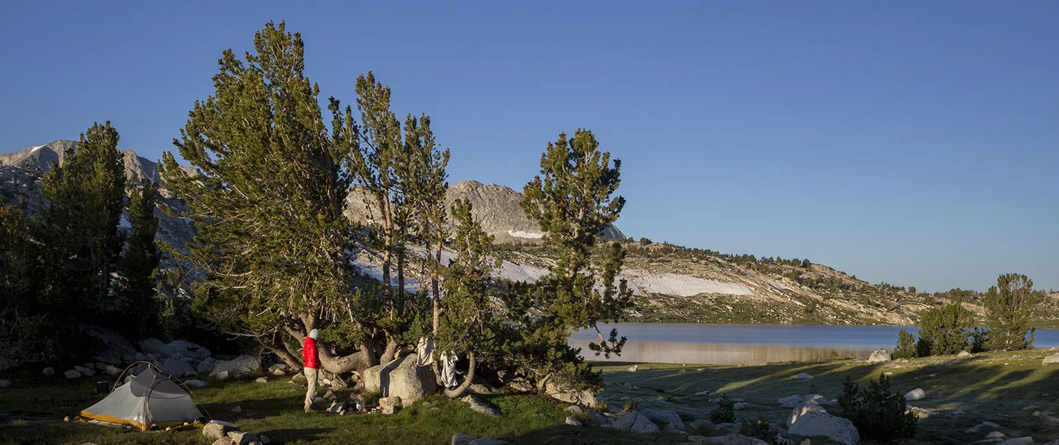
It was nice and downhill from there, passing a small unnamed lake, arriving at Evelyn Lake at 6pm. The clouds were racing back and forth, and it looked like the Cathedral Range is getting some, but we stayed dry.
Evelyn is a pretty big, but shallow lake, flanked by partly by a boulder field, a meadow, and a sparse forest. We found a great spot on the north shore, among the trees, somewhat sheltered from the wind (that wasn't very strong anyway). The creek running into the lake was about 300' to our left, making for a great source of fresh water. On the other side of this creek, we saw a couple camping with their young son. It looked like there were having a great time.
We set up camp, then I got some water in the shower, and we washed up quickly while waiting for our soup to steep. The trout looked very active in the lake, so I even tried fishing, but no luck.
The mosquitoes, though - wow. I haven't seen this many in a while. As soon as the breeze died down a bit, they came by the dozens. We kept applying the eucalyptus oil and made sure everything else is covered. Regardless, we still got a bite or two, but it wasn't bad.
Sunset found us on the lakeshore, taking a nice walk (and still trying to catch fish). Then the fog came, enveloping everything for about an hour before retreating. At least the wind stopped almost completely and there was no rain.
It's been a long and hard day, but we were in high spirits, looking forward to a short day 5.
Day 5 - Evelyn Lake to Emeric Lake
As we planned to go only five miles, we decided to sleep in, not setting the alarm. Regardless, we woke up at 6:30am, as soon as the sun hit the tent. The morning was clear and cool. Of course, the mosquitoes started swarming like crazy as soon as it warmed up a bit, but with all the usual precautions, we didn't get bitten. However, it was extremely annoying to have a dozen of them in front of your face all the time.
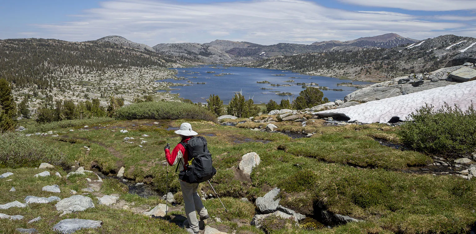
Regardless, we didn't' hurry much and only left camp at 8:45. The trail goes around Evelyn Lake, climbs a tiny hill, then drops towards Fletcher Lake (very scenic) and Vogelsang High Sierra Camp. Judging by last year's experience when we hiked by this place coming from Vogesang Pass, we expected many people here. However, the camp was closed, and only two parties camped in the backpacker's campground. We only stopped for a few quick pictures, then continued downhill to the Emeric Lake turnoff, about 2.2 miles south.
This meadow became a favorite of ours last year as it's impossibly gorgeous with Fletcher Creek meandering in the middle and a beautiful, rocky hump bordering it from the north-west.
The lake is off the trail behind this hump. We got there less than an hour after leaving Vogelsang, getting our first glimpse of the lake and the meadow as soon as we climbed the little hill. Judging from that vantage point, it seemed obvious that the best campsite should be on the far (north) side of the lake, but that side also looked a bit windier.
However, decided to explore the southern shore first. We saw a few campsites around where the trail drops down into the valley, but they were too close and not very appealing. We kept following the trail on the southern shore, but then soon realized there are no more sites, so we turned around and crossed the meadow and Emeric Creek. The entire area looked very wet and unstable from a distance, but it turned out it was mostly dry and easily navigable.
Off to our right, on the northern end of the meadow, we saw a group of trees, looking like they could shelter a few nice campsites. Also, that end was way more protected from the wind. We walked up there, and yep, there was a very nice site between those trees. We settled down there without much debate.
Another consideration was neighbors. It was reasonable to expect more people arriving during the day, and this spot was far enough from any other sites so we don't bother each other.
We planned on taking a "serious" shower a bit later, so the first thing I did was to walk back to Emeric Creek, fill up the shower, and lay it in the full sun so it warms up a bit. Then we set up camp, ate something, and did laundry. Like always, Em did the washing, far away from the water, on a gravel, while I was carrying the water in the bear canister.
This was around 1pm. Clouds started gathering, with the sun coming and going every few minutes. Rain seemed almost sure for later.
In the meantime, we saw two backpackers arrive and disappear in the trees on the north shore.
It would have been nice to wait a bit more for warmer shower water, but it looked like the weather will only get worse, so as soon as we were done with laundry and hung all the stuff to dry, we retreated to a place behind our campsite where I found some nice smooth rocks to stand on and a tree to hang the shower from. Perfect place for a shower with lukewarm water. It was heavenly.
I even wanted to take a swim in the lake, but the wind picked up, and I really hate being in wind when I'm wet, so I abandoned the idea. Instead, we went for a walk on the north shore. Just as suspected, it had many campsites, most of the pretty close to each other. The couple we saw earlier had already set up.
We walked all the way to the southern end of the lake, to the outlet, then continued for another few hundred yards, out onto the rocks to get a view of the canyon where Emeric Creek flows into Fletcher Creek and they drop towards Babcock Lake. The main trail is just on the other side of the canyon and we remembered this place from last year. The water running wide on the smooth rock is very dramatic. To the south, we had great views of the Clark Range, and it looked like it's raining there. We just sat there for a few minutes, taking in the scenery and waving to some hikers on the main trail.
As soon as we returned to the lake, it started drizzling. It didn't turn into real rain, though, so I started fishing. Almost right away, I caught a beautiful brook trout, bigger than the "usual" high lake size. If I could only get three more of this size, they would make an excellent dinner.
The drizzle kept going on and off, and at a point it even turned into what you could call light rain, but it was still nothing. Our clothes were still "drying" on the line, but there was no reason to retrieve them. I kept fishing and Em kept taking pictures of the flowers.
Around 4pm we had three fish, and the decision was made for Em to go back to camp and start preparing the fire. As I mentioned before, we almost never make a fire in the backcountry, however, this was a another great opportunity for an exception. One, it was legal here, two, there already was a fire ring and plenty of firewood at our site, and three, these trout were relatively big, they would not have fit our little cooking pot easily.
I kept fishing in the drizzle, and the fourth trout took a while, but then it was finally nice enough to get hooked. Right away, I started cleaning them, standing on the shore in the drizzle. Distant thunder echoed all around the valley. My hands were a bit cold, I had to hurry, but I was having a hell of a time. After each trip, if I think back, I can pinpoint the moment where I completely disconnected from everyday life and worries and was truly copped out. For this outing, that was the moment, on the shore of Emeric Lake, cleaning fish in the rain.
I had no idea of this then, of course. That's the whole point. I cleaned the fish and walked back to camp. Em did a great job, the wood was built up for the fire, we got it going quickly, then walked around and gathered some more. The drizzle kept up the same on-and-off pattern, but it didn't bother us much. Then it got weaker and weaker, finally stopping. Even the sun came out now and then.
We kept the fire small, letting it burn for about an hour to get enough hot coals, then placed the aluminum foil with the seasoned trout on top some small rocks on the coals and cooked them slowly. Oh, were they tasty!
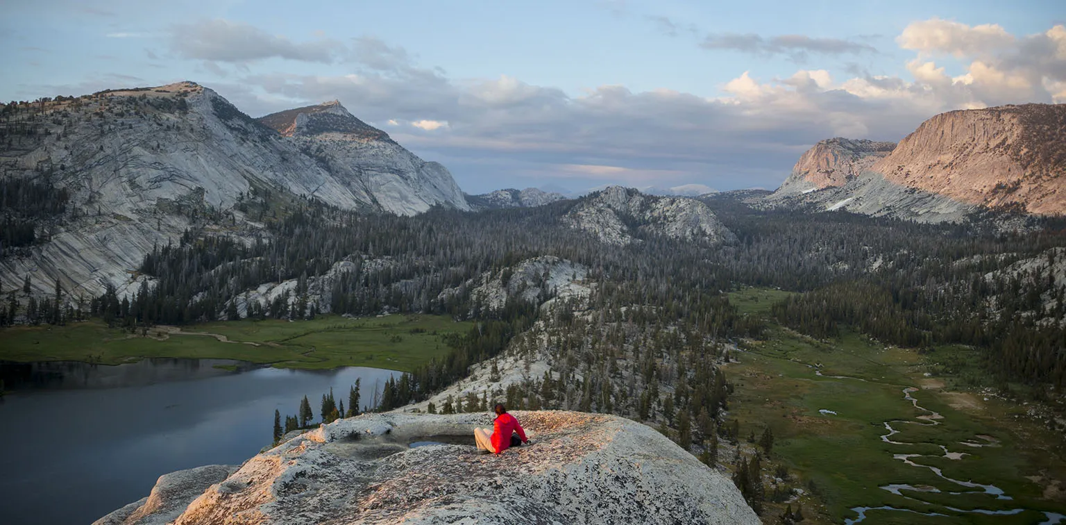
By the time we were done eating, it was around 7pm. Most of the clouds cleared away and we knew we were in for a great sunset. Thus we embarked to climb the hump. By the way, if anybody knows the name of this rock, please shoot me an email.
The rock stands only about 200' taller than most of the surroundings, but it offers fantastic views. Climbing it is very easy, you just have to walk up the spine, and at the very end, there are a few ledges and outcroppings where the use of hands might be required for a little bit.
I can't describe how cool it was. The perfect weather, the air cleaned by the rain, the clouds with the sunset… And then of course the views of the lake, the gorgeous meadow and all the mountains in the distance. We spent over half an hour up there, having a great time. We even found a "Jacuzzi", a hole on top of the rock about two feet deep, perfectly sized for a few people, even featuring even small holes on the side that could work as cup holders. It was full of stale, algae-saturated water, but man, just to imagine how it would be so sit there in clean, hot water…
Well, enough with the fantasies. We went back to camp. In the meantime, a few more people arrived, we saw one guy set up close to the trail, and another couple settled down on the far side of the lake. Later they made a huge fire around the outlet, way too big to manage safely, but at least it wasn't windy anymore. By this time, the sky cleared up completely and I could take a pictures of the Milky Way.
Day 6 - Emeric Lake to ledge next to Triple Peak Fork
Again, we slept in a bit. During breakfast, the coyotes treated us to a musical (?) show, howling all around us for a few minutes. Most of them were on the far side of the meadow, but a few could not have been more than 50 yards away. Here's a short video of us listening to them.
It was a perfect morning, clear, sunny, not very cold. We took our time and only left camp at 8:45, climbing back over the hill to the meadow with Fletcher Creek. Here we had another small the delay: the creek was so high, we had to take our shoes off in order to cross.
The meadow was even more gorgeous than last year, being even greener. At the southern end, where the trail drops, I took some comparison photos so we can show the difference between the two years. In 2016, I easily crossed the stream here, now it would have been a dangerous undertaking. Further down, a few really nice waterfalls break the creek.
We continued on, past the Babcock Lake junction, but kept stopping to take some more pictures of the waterfalls. The trail is truly steep here, losing 1,200' on 3.6 miles, most of that in the 1.6 miles between the Babcock Lake junction and Lewis Creek. It was very hard on the knees, but of course I'd still rather go down here than up. We got to the Lewis Creek crossing at 11am, sat down for a quick snack, then kept walking, still downhill.
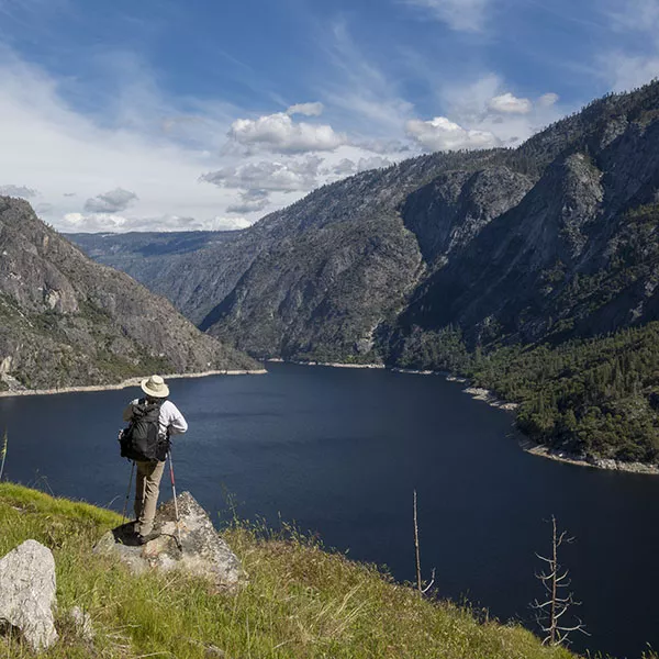
Just like the year before, at the Merced Lake Ranger station, we turned left (south), going up the canyon following the Merced River. I really like this place, is has that "enchanted forest" quality. Huge pine trees, silence, filtered sunlight…
1pm found us at Washburn Lake, about 3.5 miles up the canyon. Talk about a scenic lake. At least it wasn't windy, like last time, and we settled down on the shore for a long lunch break coupled with a quick rinse in the lake. An osprey swiped the surface of the lake, plucking a fish. We saw them in 2016, too, a pair playing in the strong wind. Now it was much calmer, but clouds started gathering again. It didn't look like rain, though, at least not yet.
A small group of hikers passed by us, practically running up the trail. We never saw them again.
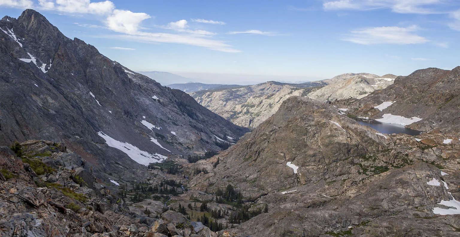
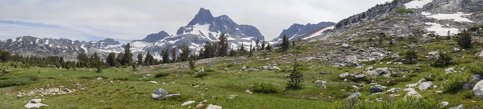
The canyon gets much wilder past Washburn Lake, with the forest slowly thinning out and the river becoming more unruly, featuring many cascades and waterfalls. I kept going off trail to take pictures of them. This would turn out to be a source of big contention later, as you'll see.
Around 3:30pm, we got to the first, "big" bridge crossing the river. From there, the climb is a bit steeper, offering great views of the complex waterfall coming down from the Triple Peak Fork on the left. The trail eventually ends up oon top after circling around and doing some more climbing. Again, I kept going on and off to take pictures, but we also had to hurry a bit as the clouds were getting worse and it looked like rain to the south of us. The plan was to climb to the high valley of the Triple Peak Fork and camp somewhere there. However, it was not to be.
The trail crosses the river again - this time it's only the Merced Peak Fork and the bridge is much smaller - and the more serious part begins, going up past the waterfalls and eventually to the valley. Yeah, it is steep, but the trail is very well graded and the view compensates for the effort. At 4:30, we arrived at the spot where there's great access to base of the topmost waterfall sections, and I went out to take some pictures. Em sat down for a quick break. When I walked back to her, she looked at me and asked where my sunglasses were. Oh, crap.
On this trip, for this first time, I put my sunglasses on a lanyard so I can take them off easily when not needed. They won't stay on top of my Tilly Hat, so the lanyard seemed like a good option.
This was one of those days when the light changed often, and I kept letting them hang from my neck. Now they were gone. The problem was they were pretty expensive Natives, and even worse, I got them from Em as a present, so they had big emotional value. We were both really upset, we take care of our stuff really well and almost never lose things.
However, I had an idea. We sat down for a minute and looked at our pictures. We could see that just before crossing the big bridge, they were already gone. Then we saw that I still had them a mile and a half further down. So I must have lost them somewhere on that mile and a half, but the problem was, I went off trail so many times, retracing my steps would be very difficult.
Still, we decided to try. First, we considered leaving our packs there, but then from 2016 I remembered seeing possible campsites not much further up, so we climbed a bit further up and got extremely lucky. Just on top of the waterfall, there was a fantastic ledge with a very nice and safe campsite, easy access to the water and even great views. As it looked like rain was imminent, we quickly pitched the tent, secured it as much as we could and left most of our gear inside. With only our headlamps, a bit of water and a few energy bars, we speed-hiked down the hill. We were almost running. In 30 minutes, we were back at the big bridge.
From there we slowed down to look for the glasses, but I was convinced we'll be looking until dark and won't find anything. However, I couldn't believe my luck. Only about a 100 yards past this point, there they were, laying in the middle of the trail! My, how happy we were.
We had to stop for water and ate an energy bar, then quickly hiked back the steep incline. In the meantime, the clouds started breaking up. Again, we got away without getting soaked.
Back in camp, we filled the shower, cooked soup, then sat on the rock next to our site. This was just above the waterfall, offering great views of the Merced River's canyon and the mountains beyond. The sunset colored everything orange and pink, with some darker clouds to the north accentuating this.
We had an amazing time. Being in high spirits after having found those sunglasses, eating hot soup while sitting there… Perfect evening. Later we saw that somebody camped by Washburn Lake and they made a small fire, but other than that, no light or traces of people could be seen or heard.
The night was great, not too cold, and we were lulled into sleep by the sound of the water and the long day (four miles of extra hike included). During the night, I thought I heard some rustling, but I wasn't sure and didn't want to wake Em by shaking the tent. I should have.
Day 7 - Ledge next to Triple Peak Fork to Isberg Lakes
We awoke to yet another perfect morning - well, almost perfect. It turned out the rustling I heard was from a marmot chewing on my hiking pole's strap. The marmots do these things, they are very mineral-deprived up there and pounce of every source of salts they can find. If you leave your backpack unattended, they chew on the shoulder straps as they are salty from your sweat. Same with the straps of the hiking pole. I've even seen them lick up pee from the rock or chew on earth that's been pee-saturated. I know, this sounds gross to some, but that's the reality of it.
Anyway, so our poles were right by the side of the tent outside, a foot away from my head, but the sneaky little marmot was so quiet, I barely heard him. The strap was damaged, but not useless - he didn't chew it through completely. Take a look.
As there was no wind, we went back to the top of the rock to drink tea/coffee and have breakfast. It was simply stunning.
After leaving camp, we only had to go up another 200' or so in elevation before reaching the high valley to hike about 2.5 miles to the Isberg/Red Peak junctions. These miles are gorgeous, too, with the river and nice meadows, barely any elevation gain, and of course the memories of the high trail on the other side where we were going north last year. Clouds were already amassing and this being early in the day, rain seemed guaranteed.
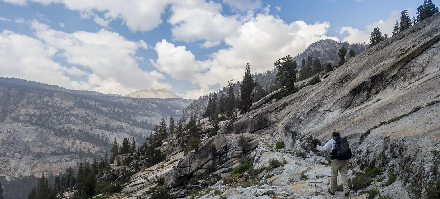
We got to the junction not much after 9am. In 2016, we turned right here towards Red Peak Pass. Now we made a left, crossing the river (more like a creek here), then stopping for a quick snack break before following the trail as it climbed in the forest. This part seemed longer than it really was, but in about an hour, we were up on the high trail and turned towards Isberg Pass. The clouds kept getting worse, but there was still no rain.
The view was really enhanced by the clouds, though. The Clark Range is amazing from this vantage point as it is, but the uneven cloud cover made them look even better, with blotches of light here and there and white-dark-blue background in the sky.
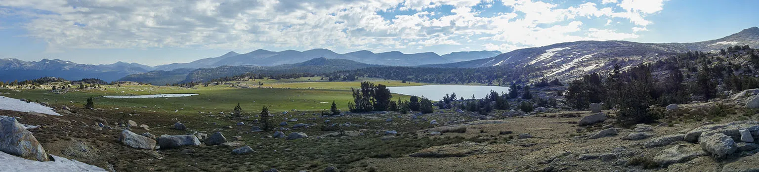
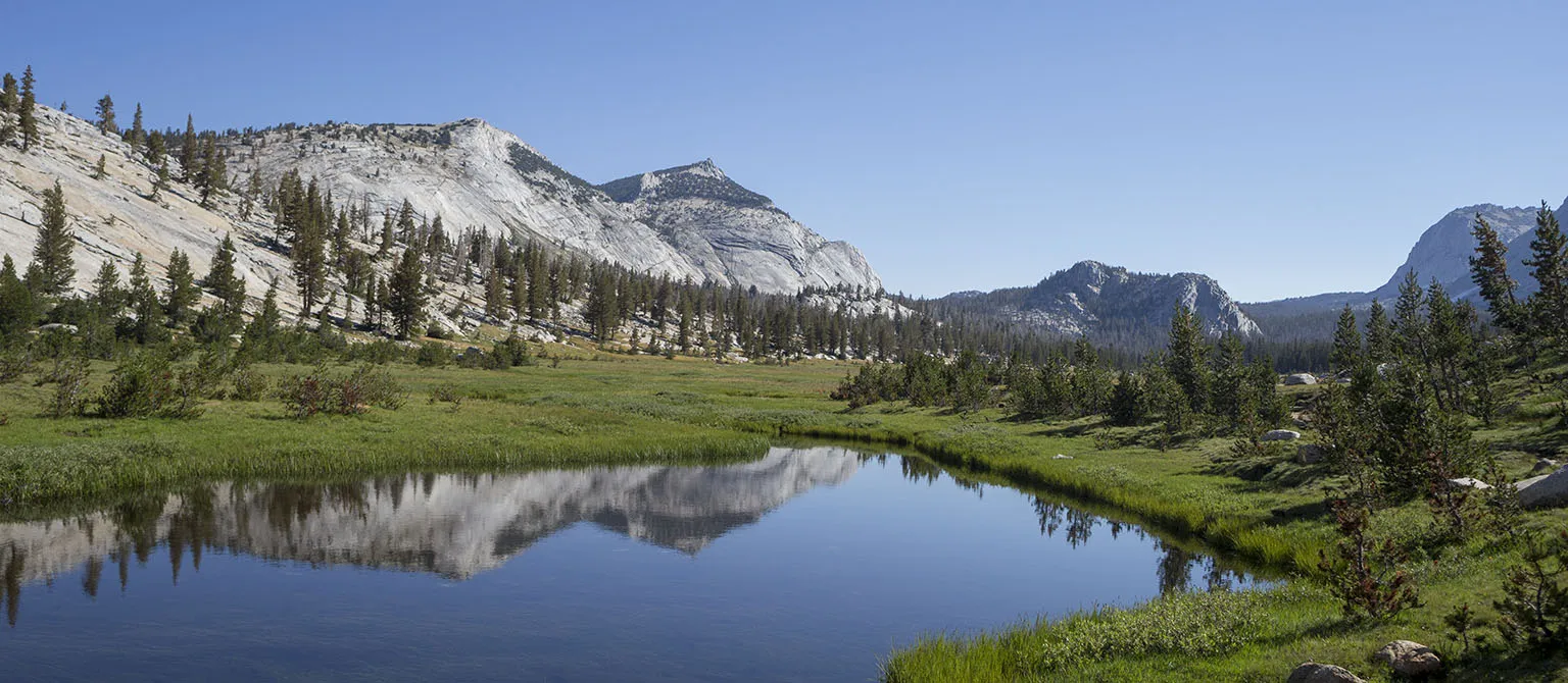
This place west of Isberg is amazing. There's a huge meadow with two lakes, called Whiskey Flats, according to some, but this name is not on any map I've seen. The trail goes all around this expansive meadow, then climbs on the other side, passes the junction to Post Peak Pass, finally topping off at Isberg Pass. I can't help repeating again: the views are unbelievable.
Just before Isberg Pass is the "you gotta be kiddin' me" part of less than a quarter mile in distance, but it's crazy-crazy. The trail goes up and down 20-30' five or six times, over huge boulders with steps 2-3' high. It's beyond annoying. At least now we expected this.
Earlier, I was concerned about lightning on the pass, but we were OK, no thunderheads were around for many, many miles.
On the pass, we left Yosemite National Park and went back into the Sierra National Forest. After crossing a snowfield, we lost the trail for a bit (should have remembered that it goes north first without much elevation loss), and ended up boulder-hopping our way down. In no time, we were back on the trail and descended a bit more to the lower Isberg Lake. The plan was to find a nice spot here and spend the last night. We briefly discussed pushing it and hiking out all the way, but that would have put our total to around 20 miles and we wanted to spend one more day out here. Another idea was to go another two miles down to Sadler Lake as there's fish (we knew there are none at Isberg Lake), however, Sadler would have more people and more mosquitoes. When I asked Em to choose between eating fish, but having more neighbors and mosquitoes, versus no fish, but more privacy and less mosquitoes, she chose the latter. As much as I love fishing, I agreed.
It really looked like rain, though. We arrived at the lower lake at 1pm. It's very beautiful, too, and we had a great time here in 2016 when we stopped here for a snack'n'swim. I recalled seeing some campsites on the north shore, but they didn't look very appealing this time. We trekked to the east shore instead and found many spots, none of them occupied. Finally we chose one in a relatively secluded part, but still with great views and not very far from the water. It started drizzling a tiny little bit, but stopped before we could even finish pitching the tent.
Then we went down to the lake. The shore was dotted with an unbelievable density and variety of wildflowers. I got into the water for a swim - well, the lake is about 2-3 feet deep in most spots, but at least it's relatively "warm" for this reason. I walked all the way into the middle before the water got chest deep. There was a tiny island (ahem, two rocks) jutting out, and I wanted to swim out there, but then abandoned the plan as it looked like there could be some branches under the water. The light wind was disturbing the surface just enough so I couldn't see clearly, and I turned back, not wanting to get tangled on something underwater, this far away from shore.
Em rinsed herself off and was sitting on the rocks, waiting for me. I even got the camera, waded back out for about two hundred feet to take some pictures of her with water between us.
Back at camp, we took a shower, then walked out onto the rocks to get a view east: Sadler Lake below and the mountains in the distance. The area around Sadler was getting a bit of patter, but it didn't seem like heavy rain.
After preparing for rain, we retreated to the tent and took a nice nap. A bit later, it drizzled again, and the other side of the pass was obviously getting some real rain. We could even see lightning and hear thunder.
When we went up to look at Sadler one more time, the rain to the east and south was heavier, too. However, our location got spared. There was a hole in the weather system, about two miles wide, and we were sitting right in the middle of it. It kept staying like this the entire afternoon. I'm not saying this lake never gets any rain, but we were extremely lucky, somehow the terrain pushed all the clouds to either side of this ledge. There were moments where it was obviously raining and thundering all around us, but nothing or almost nothing reached our location.
Between soup and proper dinner, 7-ish in the evening, we took a nice walk around the lake, taking cheesy pictures of the lake and the breaking clouds in sunset light. This was yet again a perfect time with calm air, silence, no neighbors, etc.
In the evening, while having dinner, we were thinking back on the trip, what a great time we had. I even said I would happily continue for another week, but of course I'm very content these 7 days worked out well.
Day 8 - Isberg Lakes to Isberg Trailhead and to L.A.
We had 13 miles to go, but all downhill, and our packs were relatively light. We picked up about three pounds of trash on this particular trip, and I even took a picture of all the stuff we found: the insulation thingy, half a Croc, a metal lens shade, a rubber hiking pole tip, a pair of cheap sunglasses. Then there was a small baggie full of nylon and paper scraps we gathered along the way.
After leaving just past 8am, we got to Sadler Lake in 40 minutes. It's a beautiful lake and like most areas, it was wetter and greener than in 2016. We took a few quick pictures and continued on.
Unsurprisingly, the creek flowing out of Sadler (I think it's called East Fork Granite Creek) was of course flowing much better, and when we got to our 2016 lunch spot just north of the Joe Crane Lake turnoff, it was great to see an actual flowing creek there, not just puddles of water like we remembered.
Despite all the photo stops for the scenery and flowers, we were making great time. The trail is downhill all the way, but in great shape and not steep at all. We took a snack break in a meadow, looking back from where we came from, but other than that, we just kept pushing. Em was leading, and true to her form, she was blazing down the trail at an unbelievable speed.
Not much before Cora Lake we met a group of guys coming up the trail, the first humans since we met those hikers at Washburn Lake, almost two days ago.
By 10:45, we got to Cora Lake and I almost didn't want to believe it, but at exactly 12:15pm, we walked into the parking lot at Isberg Trailhead. The car was untouched, but of course really dirty from all the dust and then a bit of rain.
Driving down towards Oakhurst, we made a quick stop by a pond that had amazing water lilies, blooming bright yellow amongst all the green leaves.
Then it was back to civilization, almost crashing head-on into some idiot chick who was speeding up at 60 mph on the narrow Beashore Road in her brand-new SUV, cutting corners.
Well, the evening found us back in L.A., happy and relaxed after a week in the wilderness.
Outro
I can't say enough times how amazing the wildflower-aspect of this trip was. After that huge winter, spring stayed in the Sierra pretty much the entire season. Other than that, it's hard to believe how lucky we got with the weather. Of course, we were prepared for rain and we don't mind hiking in ponchos for a while, but not being soaked through all the time makes it so much better. We can't wait to back to Yosemite, there's plenty more to explore.
Tons and tons more pictures in the full gallery.


