

Trans%20Sierra%20(Lodgepole%20-%20Horseshoe%20Meadows)
Share: The link to this page has been copied to your clipboard
Intro
I'll never forget how during our the first trip to the Sequoia National Park, I looked at the map with awe, imagining how cool it would be to trek all the way from Lodgepole to Mt. Whitney or just to the other side of the Sierra. Of course, at that time, it seemed about as impossible to us as a trip to the moon. That was only five years before this.
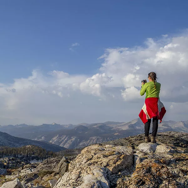
In 2012, we spent two nights at Twin Lakes with our friends from back home. On day two, we all stood on top of Silliman Pass, looking towards the big mountains in the distance. For a moment, I thought we can see Mt. Whitney, but then I realized that must be impossible, we must be looking at the Great Western Divide. Mt. Whitney et al. have to be way beyond. At that moment, the idea reared its head, and there was no way it was going to go away: all this beautiful country we see in front of us, we should cross. Having been on Mt. Whitney only a month prior, we felt pretty confident, and when on top of this pass, I told Em about what just occurred to me, she didn't even look like I was that crazy. We both felt we can give it a shot.
Of course, I had no idea about the route yet. Not the High Sierra Trail, that seemed sure. Way too many people. Other than that, I couldn't wait to lay out the map on the carpet of the living room floor and start putting the trip together. Once I started studying the map, the route became clear pretty quickly: Lodgepole to Silliman Pass, then down into Sugarloaf Valley, past the Roaring River ranger station (try saying this fast, three times in a row), up Cloud Canyon to the Whaleback, up some more to Colby Pass, down into the Kern River Valley, then follow the HST to Crabtree Meadows. We decided not to visit Mt. Whitney this time (again, way too many people), but trek from Crabtree over Rock Creek and New Army Pass to Horseshoe Meadows. This last part was identical with the first leg of the Whitney trip (going the other way, of course), but we didn't mind. We secured the permit in April and started preparing. I did all the research I could, and in May, when we briefly visited Lodgepole, I ran the plan by a ranger and asked for possible trouble spots. He really liked the plan and said there should be no problems.
Transportation was an issue, though. Our friend who helped us with the Mini-Trans Sierra trip in 2011 moved away, so he was out of the question. We talked to a few other people, but nothing materialized for a while. Then a friend from Europe and his girlfriend came to L.A. for three months to take care of some business and do lots of sightseeing. They wanted to do a big road trip, and the timing was right, so we made a deal: we'll all go together to Lodgepole, spend a day in the park, then they leave us, go on their trip with our car and pick us up a week later in Horseshoe Meadows. So the journey began.
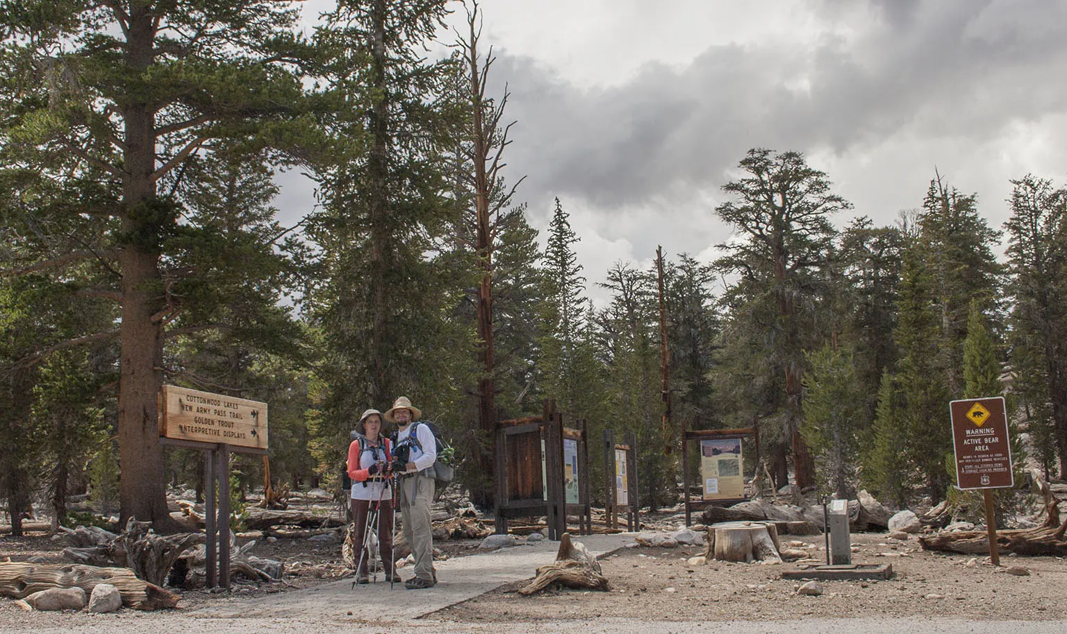
Day 0 - L.A. to Lodgepole
Even after many trips to Lodgepole, we've never been to the Watchtower. There was either no time or the trail was closed due to snow. This time there was no reason not to do it and it served as a nice acclimatization hike. We parked at Wolverton and made our way up the trail. It's a very easy hike - our friends are not big hikers, but in good shape, and they didn't have any problems. The Watchtower and the view from there is one of a kind. If you go anywhere near Lodgepole, it should be on your to-do list. The rock juts out about 1,500' on top of the valley, and there's a sheer drop-off all the way into the canyon, with Tokopah Falls below.
In the evening, after a nice big dinner, we watched the meteors for a while (it was the peak night of the Perseid Shower) then we all slept in our big tent.
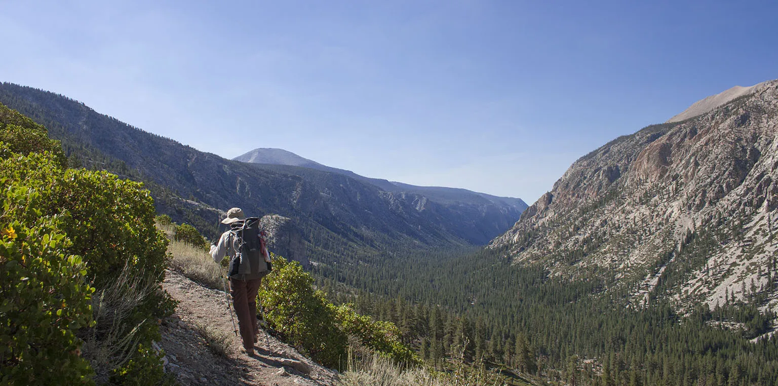
Day 1 - Lodgepole to Ranger Lake
Despite getting up at 7am, with all the packing and last-minute organizing, it took us until 10am to say goodbye to our friends and get on the trail. We had ten miles to go with fully loaded packs. Like before, the section from Clover Creek junction up to Twin Lakes was brutal. It's very steep, longer than it seems, but gorgeous. I read some reports from a few weeks earlier that there are huge swarms of biting flies here, but they were gone by this time.
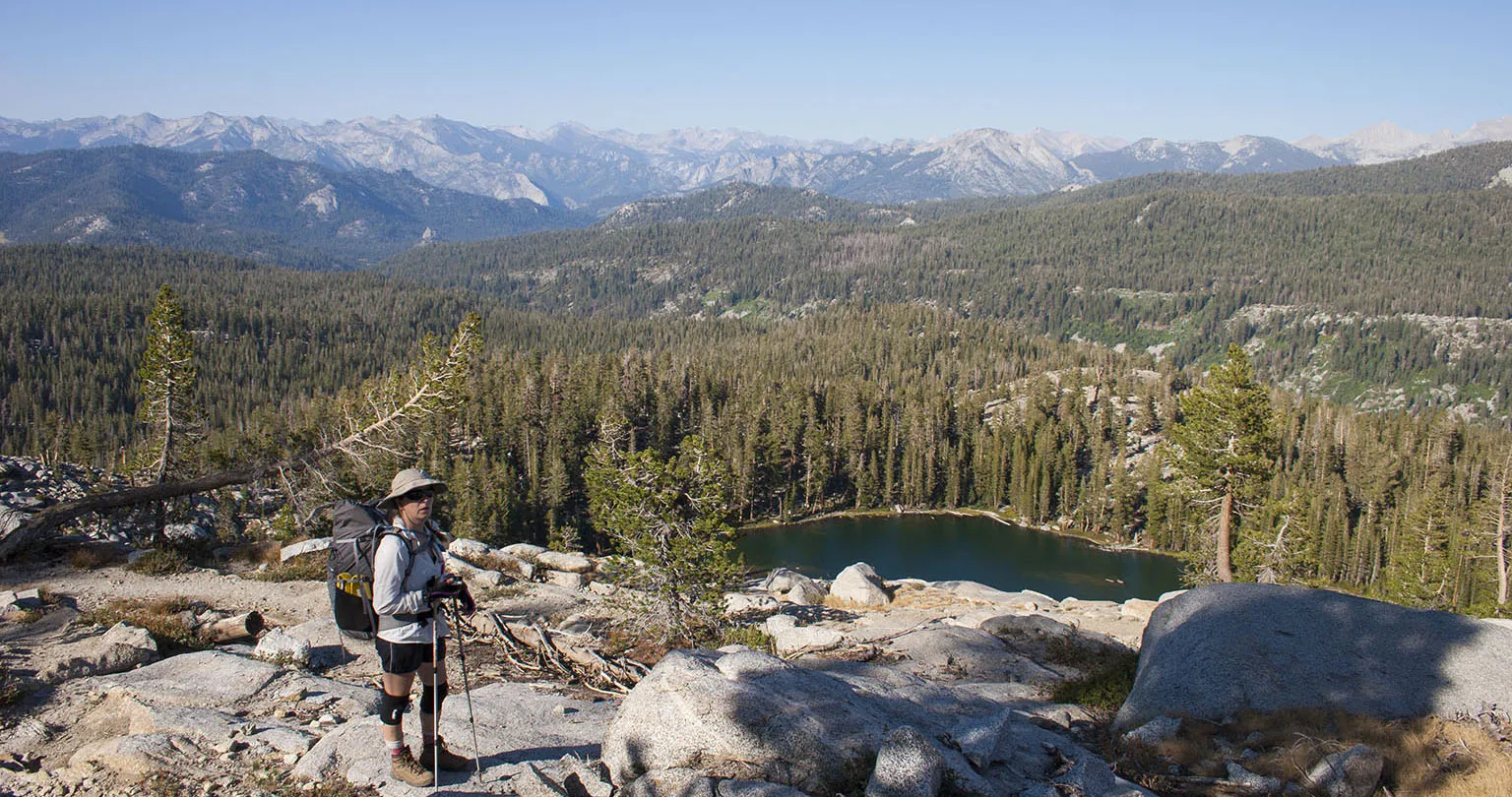
We took a lunch break at Twin Lakes to recover, then slowly climbed over Silliman Pass. I simply love this pass - once you made it up to Twin Lakes, the climb is nothing compared to what you just did, and the view is amazing. As we discovered a year before, you can see all the way into the San Joaquin Valley. There was no reason to linger on the pass, so we quickly made our way down to Ranger Lake. We were both exhausted, but I told Em I think the hardest day of the whole trip is behind us. We had the most elevation gain and the heaviest packs. After discussing the trip later, we both agreed the assessment was right.
Ranger Lakes was pretty crowded, but we found a very nice spot in the forest, still relatively close to the lake. The whole area was somewhat windy, too, but it died down by the evening. After spending some time relaxing on the lakeshore, we ate a big dinner and fell asleep quickly.
Day 2 - Ranger Lake to Cloud Canyon
The morning greeted us with great weather and bright sunlight filtering through the tent. We felt like the adventure is just beginning.
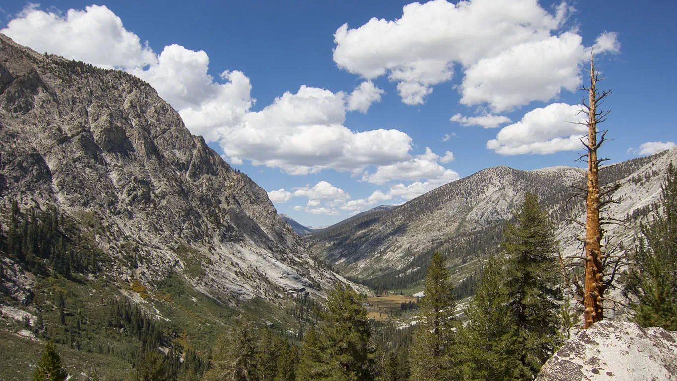
This day was to be our longest as far as mileage goes (15-16), but I hoped it will be our easiest, because most of the trail was downhill and not steep. In the morning, the sun hit the tent almost right after sunrise, warming us nicely. Of course, it took us until about 9am to get going, but after that, we proceeded very quickly. The trail gently slopes down towards Rowell Meadow in the forest that becomes thicker with every step. Rowell Meadow is the "usual" lush low-lying meadow of the Sierra. If there are no mosquitoes (I know, that's rare), these meadows are the nicest places. Though somehow, Em and I both agree that high lakes, like Colby Lake (see later), Charlotte Lake or Golden Trout Lakes are our absolute favorites.
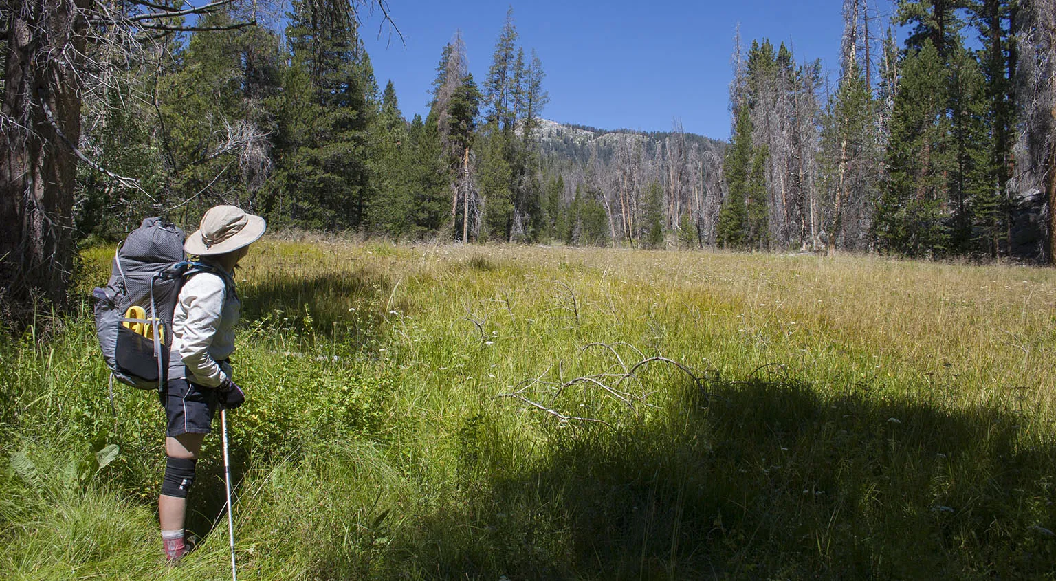
Sugarloaf Valley alternates between wet and dry spots, and this being a low snow year (again), the trail was pretty dusty. We kept trying different approaches not to eat each other's dust, with moderate success. The aptly named Sugarloaf is a neat little rock, I'm sure rock climbers have a grand old time getting to the top.
From the valley, the trail traverses another forest with a few creeks (we had lunch at one of those), climbs a hump, then descends to the Roaring River in Scaffold Meadow with the Sphinx Crest looming above. Our route took us beyond the Roaring River Ranger Station and up Cloud Canyon. I knew there's camping around the station, but the plan was to keep going for another few miles up the canyon. We had no idea whether there's any decent camping up there before reaching Big Wet Meadow (that was too far, though). However, we met some nice guys doing trail work, and picked their brains. They explained that if we go up another two miles or so, there will be a nice camping spot on the right side of the trail. This was good news, indeed.
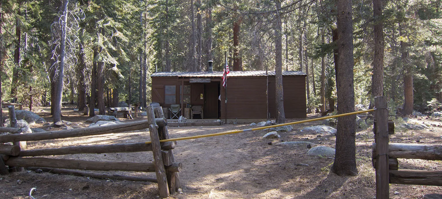
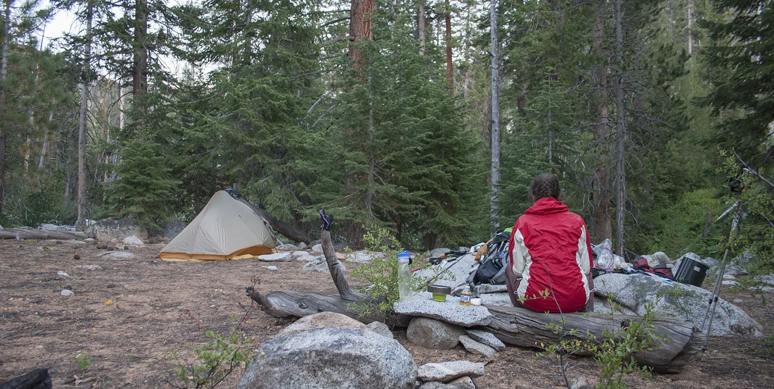
The station is very cool place, by the way - oh, how I'd love to work there for a season. We signed the registry, and after a quick break on the riverbank next to the bridge, we entered Cloud Canyon. An hour or so later, we found the camping spot those guys talked about. It was very nice, indeed, and even after that many miles, it was still early, so Em did some laundry while I pitched the tent. It was a very peaceful, quiet place, and blissfully void of mosquitoes.
Day 3 - Cloud Canyon to Colby Lake
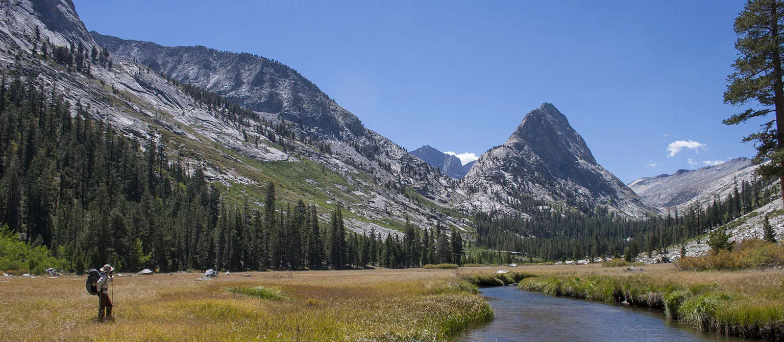
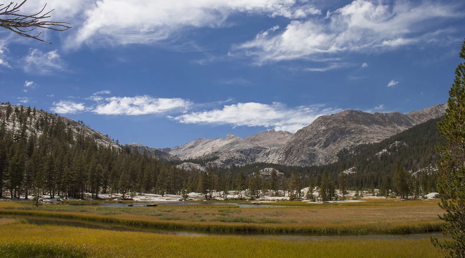
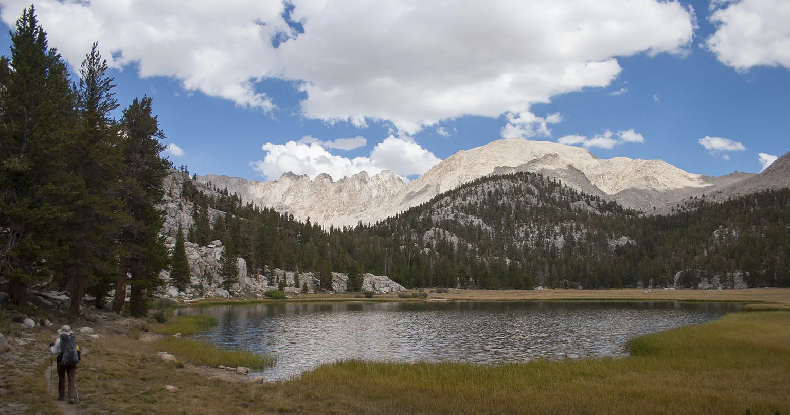
After an uneventful night, one of the first things we saw on the trail was a big, fresh pile of bear scat. No sign of the bear, however. The trail slowly gains elevation in Cloud Canyon, following the river in the jungle-like, dense forest into Big Wet Meadow. The name does not do this place justice. To Em and I this is one of the most scenic places in the Sierra. There's a huge meadow with the wide river flowing in the middle, and the Great Western Divide to one side, the Whaleback in the far end.
The trail goes all along the edge, and there's a great campsite near the far (south) end. A tent and other gear was there, but we couldn't see any people. Later, we met the occupants, an elderly couple coming our way on the trail, back from a a day trip to Colby Lake. The climb from the meadow to the lake is very, very steep, but also extremely rewarding as far as view and change of vegetation goes.
The trail leaves the meadow on the south end, and starts ascending sharply towards the base of the Whaleback. From here, there are impossibly great views of Cloud Canyon with the meadow and the Great Western Divide. After turning into a small canyon, there's yet another very steep incline, finally leveling out at Colby Lake.
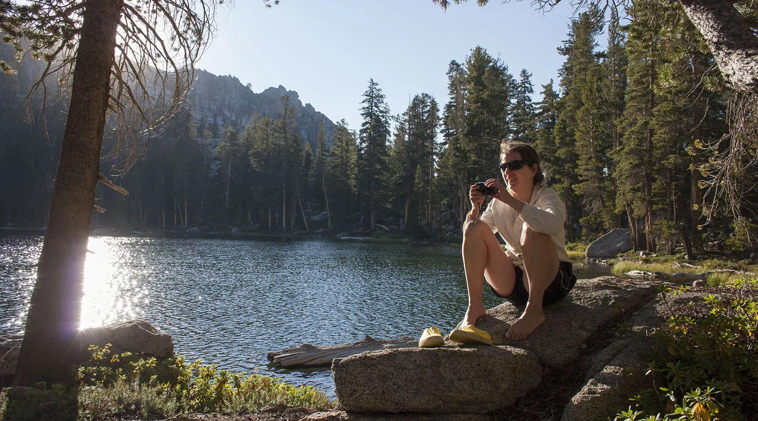
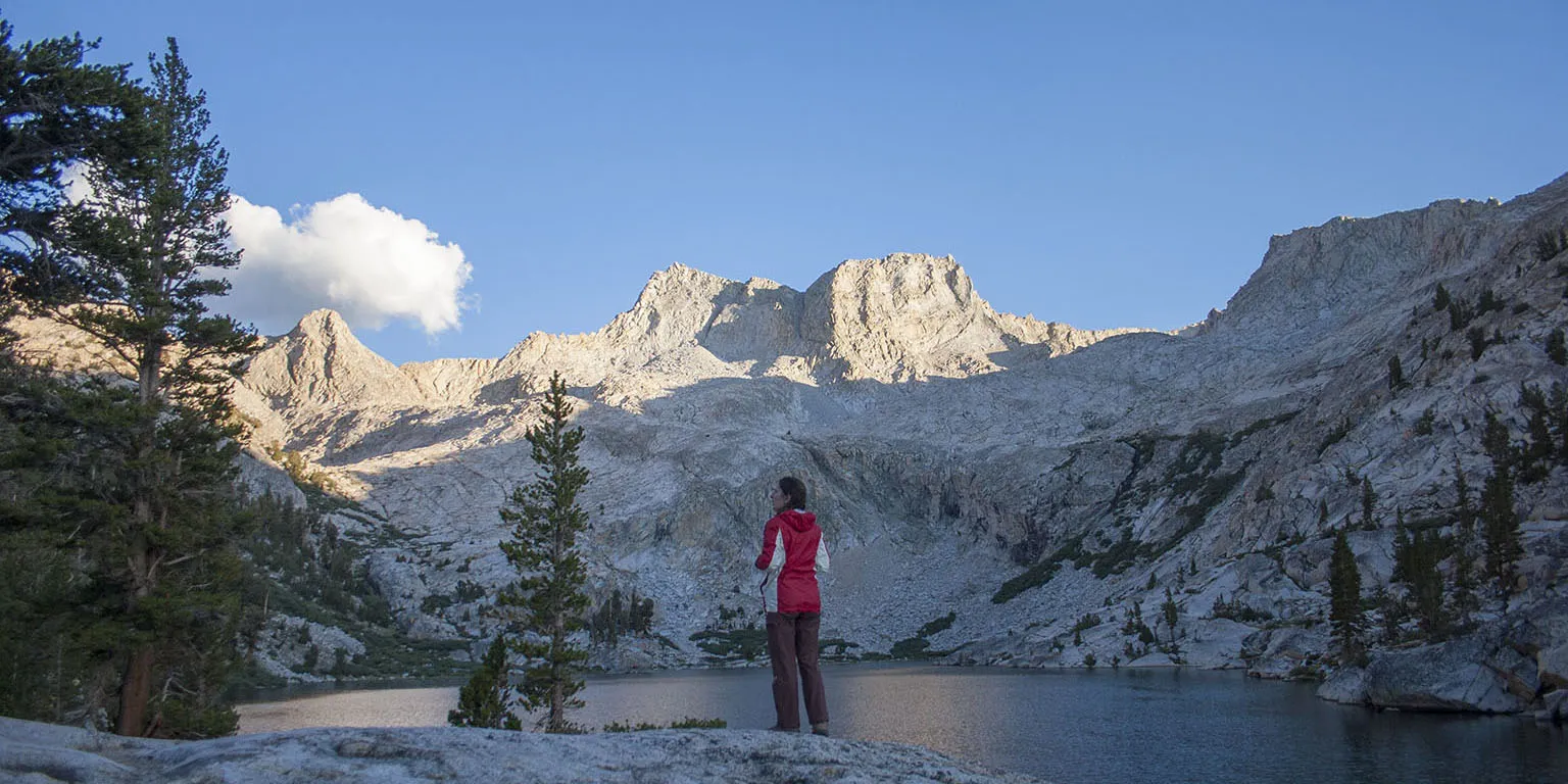
This last part is way longer than it looks on the map. After all the breaks and the slow climb, it was past 4pm when we got there, but we were in high spirits. The lake is gorgeous beyond description and the weather was nice and warm with almost no wind. We set up camp about 200' from the lake, close to a small stream, then took a quick bath in the shallow water (no soap, of course). There was still time - I quickly caught trout for dinner and then there was nothing left to do other than enjoying the evening.
Day 4 - Colby Lake to Kern River Junction
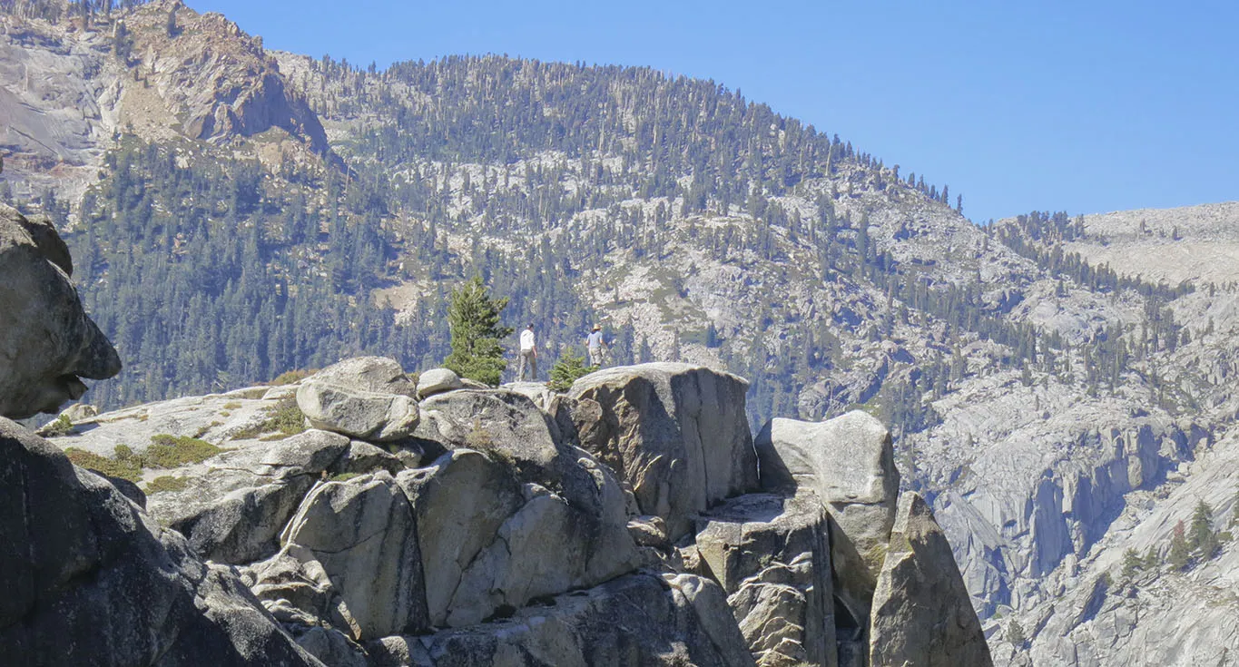
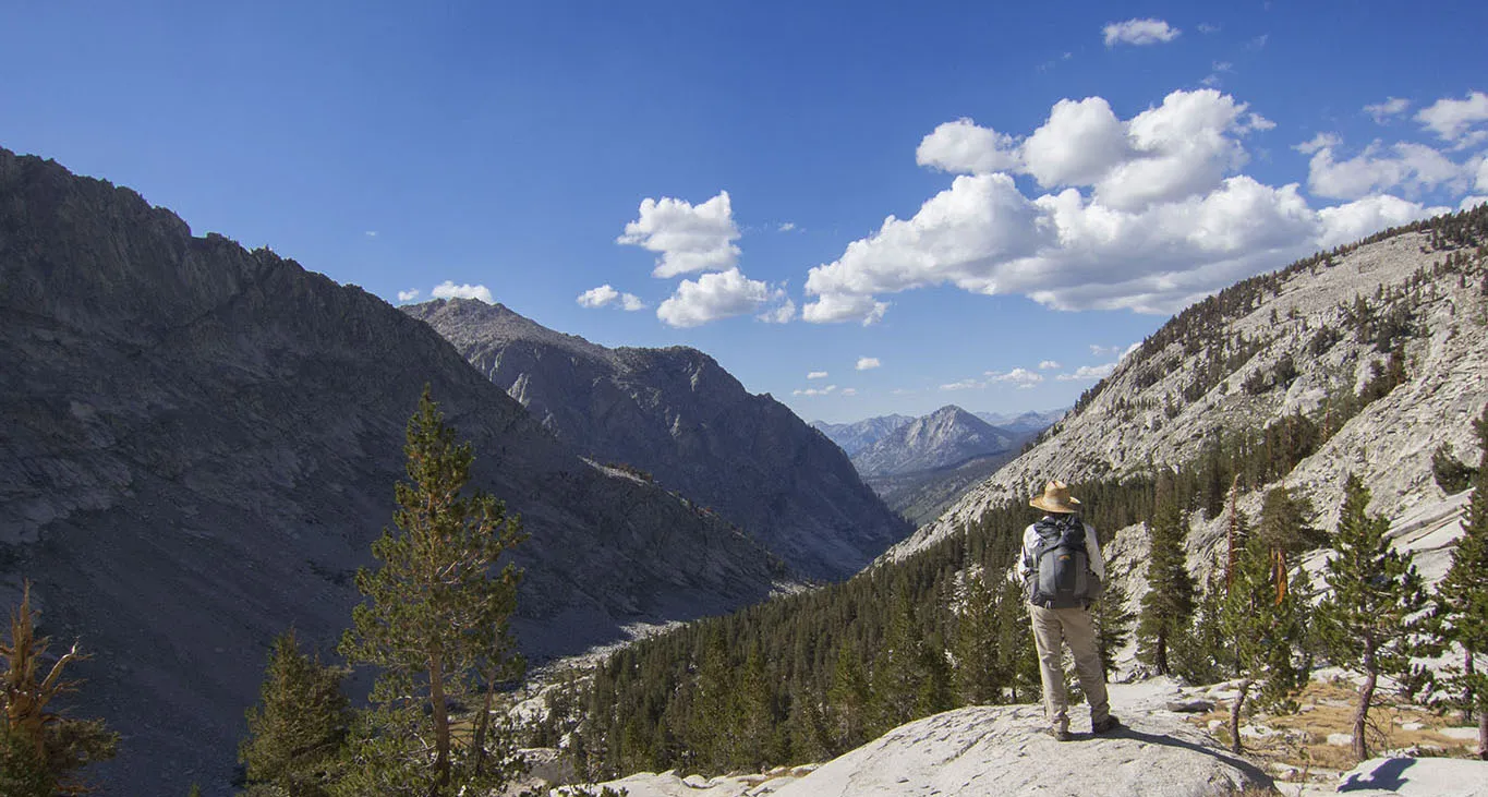
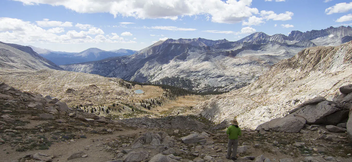
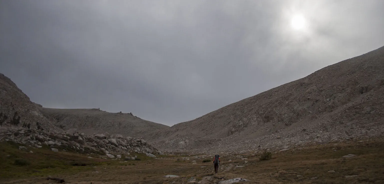
It was a crisp, chilly morning, but we quickly warmed up in the sun and headed up Colby Pass. The day before, we met a young gentleman coming down from the pass and he said it's very hard, he was even afraid in some places. This guy was soloing in a very remote area, meaning he must have had some cojones, so I really don't understand what he meant. The trail first follows the lakeshore, steadily climbing, then zigzagging up sharply to a tiny high valley that leads to a gully which has the pass on top. From this valley, we could see an almost vertical rock face in front of us, with no obvious sign of the trail.
I thought I can make out the trail here and there, but couldn't be sure. Maybe the guy yesterday was right? After climbing it, as far as I'm concerned, he wasn't. The trail is steep. It goes high up. There are huge steps you sometimes have to take. However, there's no exposure whatsoever, it's pretty well maintained, very easy to follow, and the footing is always secure. So honestly, I have no idea what he was talking about. It was arduous, sure. We stopped many times to catch our breath, but a few minutes after 11am, we were up top. We took a very long break, much longer than usual. As soon as we started eating our snacks, three marmots appeared - a mama and two youngsters. One of the little marmots was very shy, but the other was really brave, maybe even too brave. He kept coming close, begging for food. Of course, we didn't give them any, but at least we took some funny pictures.
The view from is pass is one you don't get very easily. You are truly surrounded by mountains from every side, with no chance of glimpsing anything that has to do with civilization. In the distance, I think there's a view of Mt. Langley, and the map kind of supports the idea, but I can't be 100% sure.
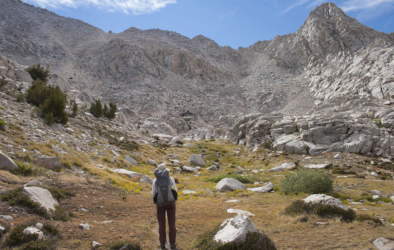
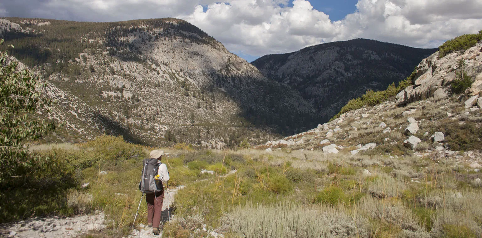
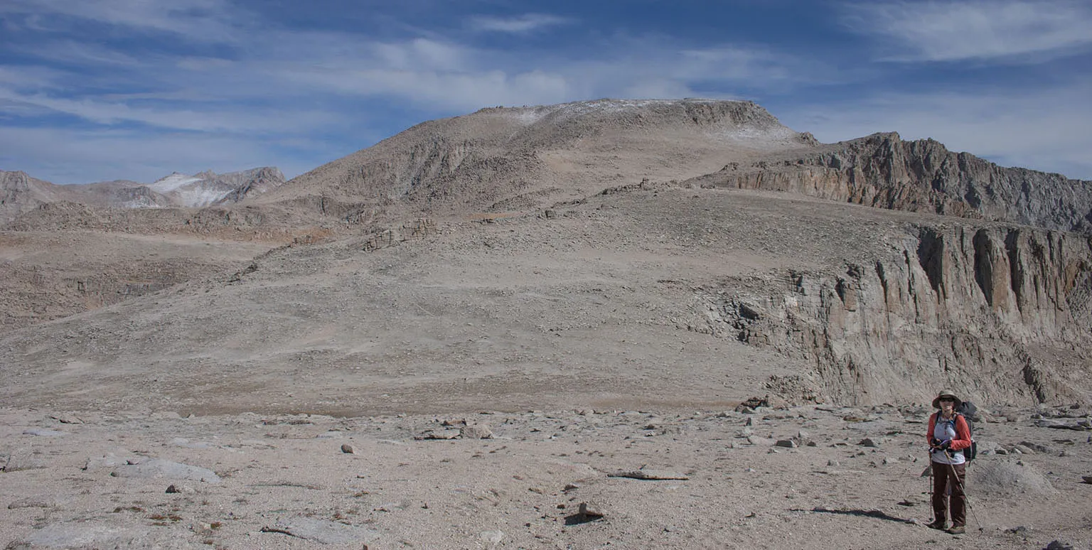
The descent from the pass is pretty gentle and goes down into this high plateau, then drops sharply towards Gallats Lake. Now that's a hard part. There's a two-mile-long stretch of the trail where it's all lose dirt and sometimes dropping at 45 degrees. If I can ever avoid it, I never want to come up this way, that's sure.
Gallats Lake, like most other places around here, is very beautiful, but there's no lake. I knew we had to be close, the mileage was right, but wasn't certain until I checked the GPS. According to the unit, we were standing in water, when in reality we were on the side of a giant meadow with very high grass and the river meandering back and forth in the middle. According to the map, this used to be a (shallow) lake, but the water levels must have dropped in recent times. It's still a stunning place.
The water was pretty far off the trail, so we walked into the grass and woods, found a very nice spot on a rock next to the river, and had lunch. I was tempted to take a quick dip, but decided against it - it was getting cloudy and the wind was picking up. I hate coming out of the water and being cold in the wind.
The trail keeps dropping towards the Kern River Valley, passing scenic spots after even more scenic spots. Before the final descent into the valley, there's one last sharp incline. The trail ascends at last 200' in a hundred yards or so. It' steeeep. After coming downhill all day, it wasn't that bad, just unexpected. The place has opportunities for some pretty cool pictures, though. From there, it descends among manzanita groves to the Kern River. On the other side, the trail where we'll be hiking up next day was clearly visible. In the manzanita grove, we saw some extremely fresh bear scat right in the middle of the trail, and like usually, no bears.
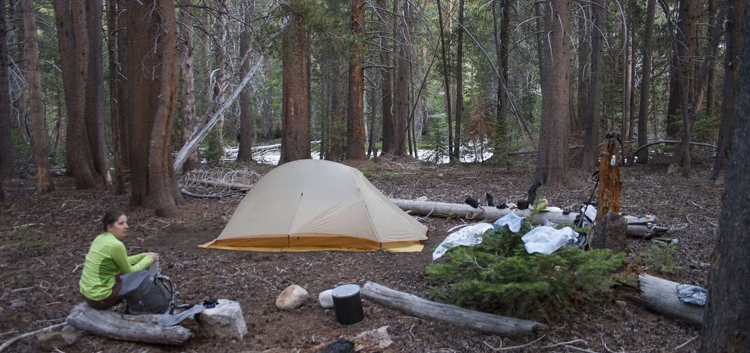
The Kern River Junction sits in the middle of the sparse pine forest where Picket Creek and Wallace Creek flow into the Kern River. It's the High Sierra Tail, and this was August, so it was extremely busy. After seeing only 3-4 people for the last two days, and as we prefer solitude anyway, we decided to look for a spot away from the other campers. It was pretty early and we weren't very beat, so there was some energy left. A friendly hiker who was going up to where we came from, told us there's a "village" a quarter mile down the main trail with lots of people. OK, so that's where we don't want to go. Then we found a great-looking camping spot with no people, but it was right on the trail, so I ventured a bit further.
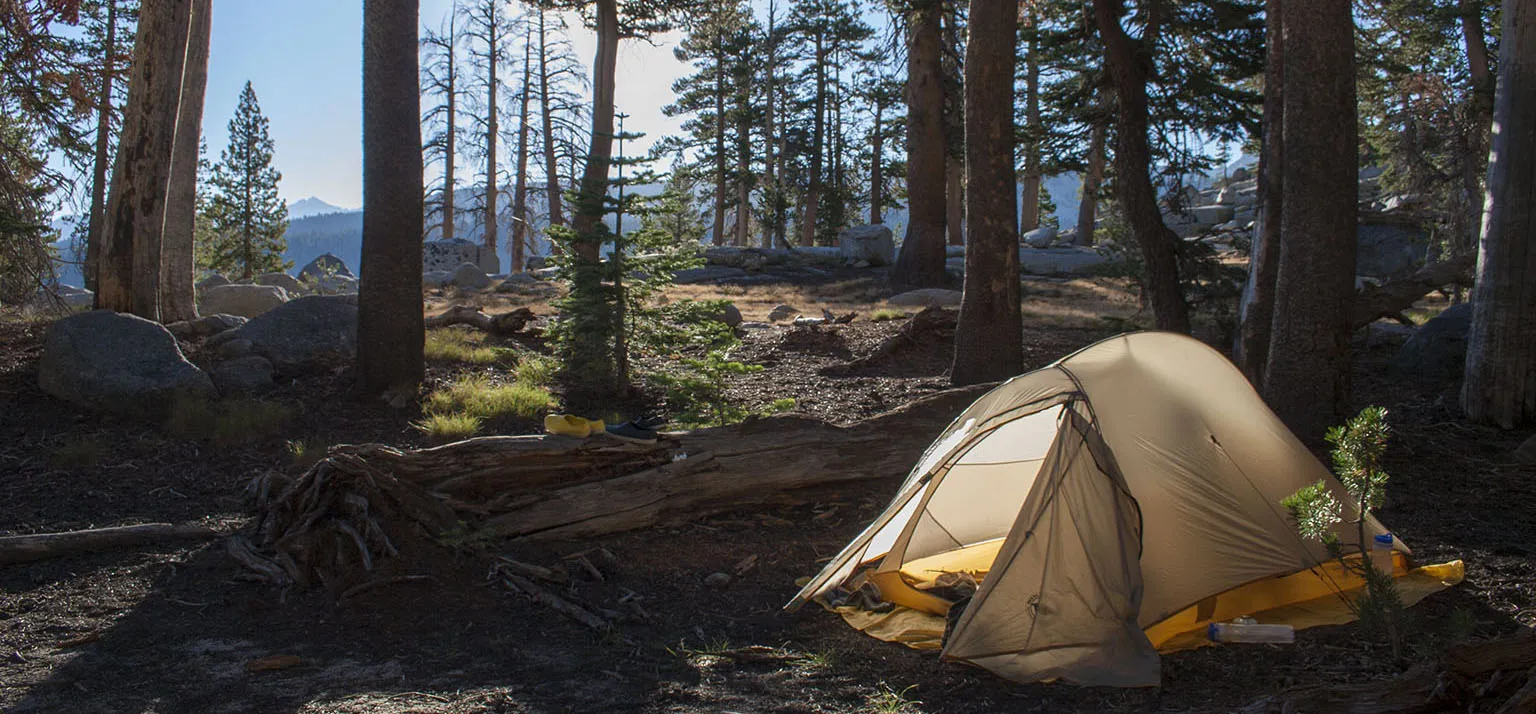
After crossing a small creek, there was a stone-covered clearing (obviously water flows here during the wet season), with the river beyond. It was surrounded by the same sparse pine forest, and after looking around a bit, I found what must have been an old camp spot. By the looks of it, nobody has been using it for at least a season or two. It was pretty far away and out of sight of any trail and there was nobody else around, so we set up camp there. The place was in complete shade, so we placed the solar shower in the clearing, and by the early evening, we had lukewarm water for a “luxurious” bath. I lugged some water from the river in the bear canister, and Em did some more laundry. We were having a very, very nice time, away from the crowds, in the middle of the quiet forest. Two deer visited us around sunset, but we decided not to have them for dinner :-)
Day 5 - Kern River Junction to Crabtree Meadows
The morning was even better, with beautiful sunlight seeping through the trees and birdsong all around. We took a tally of our food supplies, and after making sure we had more than enough, we were on our way.
From the junction, we slowly made our way up the hillside, getting fantastic views of the Kern River Valley before turning into the canyon of Wallace Creek up to the junction. This was a crowded place. The HST/JMT/PCT go all together here, and the Wallace Creek junction is a very nice area, so I was expecting many people, but not that many. There must have been at least 40 or so other hikers around.
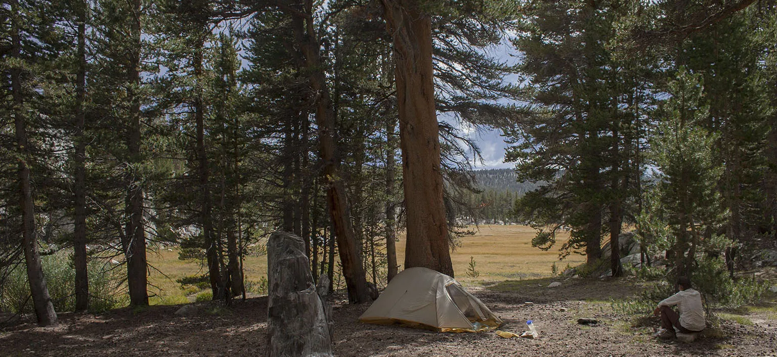
We climbed over the hill and past Sandy Meadows, then descended into Crabtree Meadows. This will always be a favorite place of mine, even with the crowds. Like on the Whitney trip, we went up to the ranger station and looked for camping there, even though this time it was almost a mile out of the way. Of course, it was crowded, but we found a perfect spot not far from the toilet, close to the main trail, but above it. People were walking by us less than 100' away, but we could not see them and barely hear them. We even met the ranger and had a very nice talk with him. He told us now he's living in a tent for a few weeks while crews are building a new ranger station in place of the old one. I'm sure it's ready by now.
Day 6 - Crabtree Meadows to Heart Lake
For the last few days, the weather forecast we've been receiving looked worse each time. However, until now, we got no rain. Some hikers said they got a little hail on Forester Pass, and I knew our luck will eventually run out. Oh boy, was I right.
We tried to leave early and were on the trail by 7:45am - yes, that's early for the slowpokes we are in the morning - but at least we didn't futz around once we were on our way. Taking almost no photo- or other breaks, we were at Guyot Flats after 9:30am and crossing Rock Creek before 11am. The clouds started gathering and looking more and more rain-prone, but no precipitation so far. Climbing up from Rock Creek we met two guys who were boy scout leaders - they told us their big troupe is up at the end of Heart Lake in the big campground with the bear boxes. We remembered that spot, it looked like a frequently used, but very scenic place. I also remembered seeing a much smaller campsite at the far end of the lake - this is what we were hoping to reach. One of the scout leaders remarked that he doesn't believe we'll get much rain that day - they were on a walk without any rain gear or much else other than some water.
I was not convinced at all, so after a quick snack break, we kept pressing on. By around 1:15pm, we passed the scout group at the big campsite. I told one of the other leaders we met his colleagues, they are having beers and hamburgers down at the ranger station. At his questioning look I explained that the rangers are doing this event every year - they mule trek a lot of supplies up the mountain and give out free beers and hamburgers to the hikers who come by - that what his friends are having now. I saw in the guy's eyes he believed me for a few seconds before bursting out laughing. There was no time to waste, though, so 15 minutes later we were at the far end of the lake, setting up camp. This is a very nice spot, indeed, but right on the trail. It didn't matter this time.
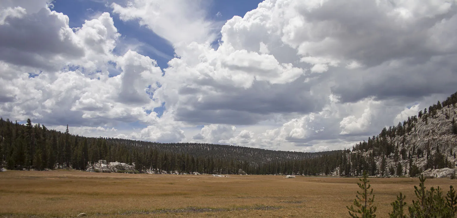
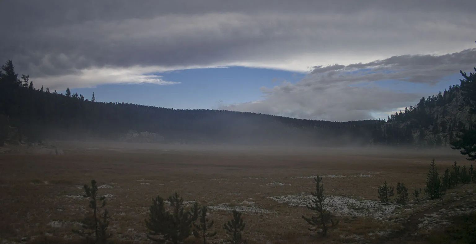
The clouds kept racing on and on, and one time we saw that further back in the valley it was coming down hard. The two scout leaders must have been soaked. The rain moved up towards us, the big scout group must have gotten some, too, but then it dissipated, and we were spared for a while. We took it easy, resting, relaxing, taking pictures of the lake and the meadow with the clouds, drinking hot chocolate.
First it started drizzling a bit, but then stopped. I was out of the tent, taking pictures again, when I saw it coming. I was practically running back. It started hailing like I've never seen it before. It wasn't the size, the pebbles weren't bigger than snow peas, but the intensity and the duration was unbelievable. It hailed in a very dense shower for almost 45 minutes.
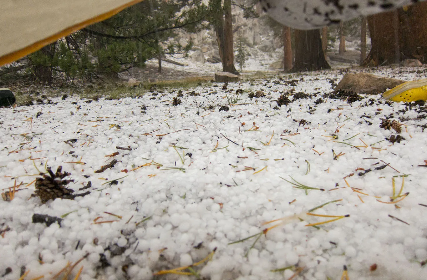
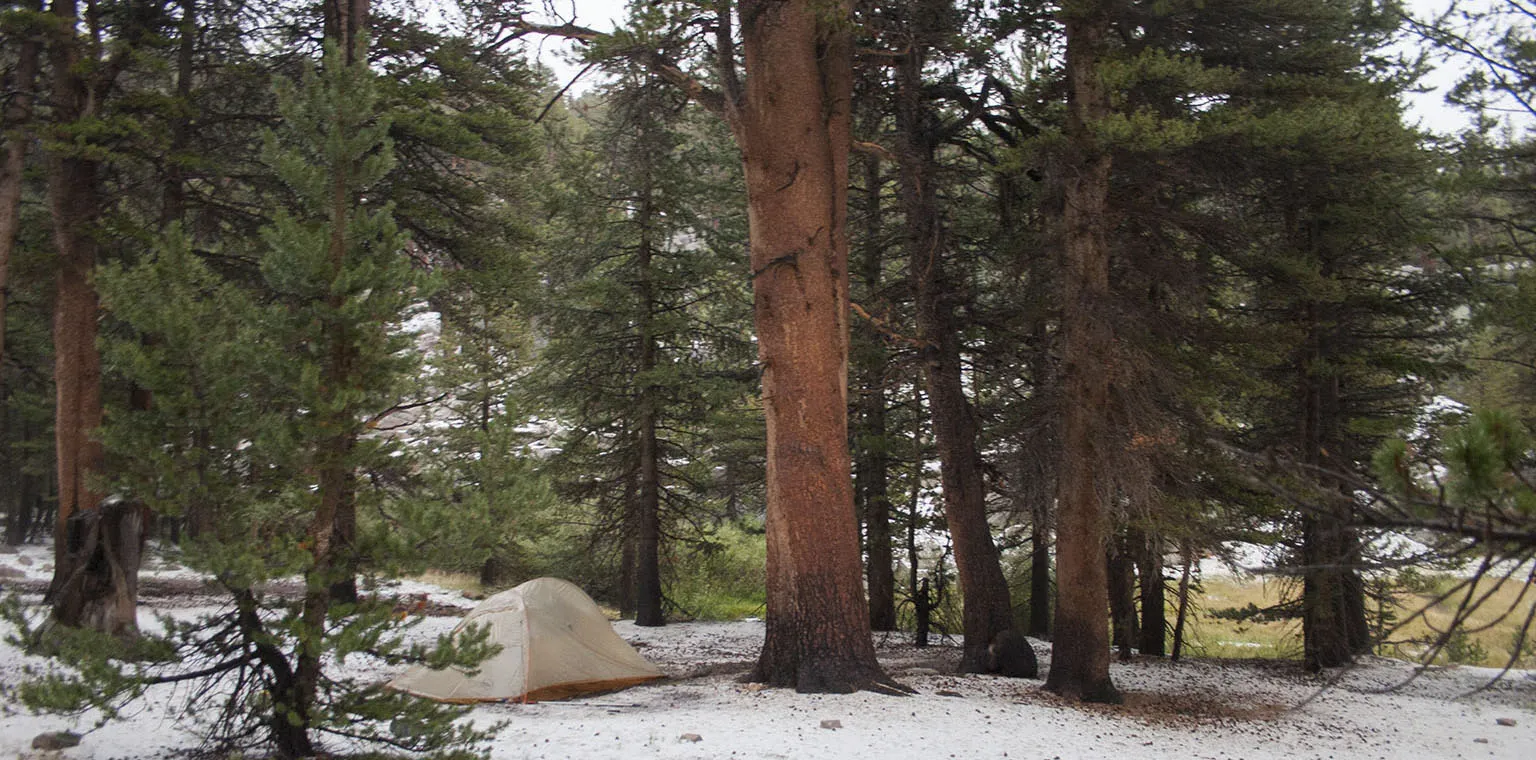
By the time it turned into regular rain, the ground was covered about 3 inches thick with ice. It looked like winter. Of course I dug a trench around the tent, but the hail filled it up, so as soon as the rain started, I was halfway hanging out the tent, clearing the trench. We didn't get one drop of water inside the tent.
After it stopped, around 7pm, we went outside and to enjoy our "winter landscape". The rain melted most of the ice, but there was at least another 1" on the ground.
Before the deluge began, we wanted to make chili for dinner, but then abandoned the plan and ate cold stuff. We made a big mistake, though. The type of chili we were making required the beans and rice to be soaked way ahead of the other ingredients. When we’re hiking all day, we sometimes soak them during a snack break in the afternoon and carry them with us until the evening. This time, in the big efforts to secure the tent and to take pictures of the "snowy" environment, we completely forgot about the little baggie we left in the vestibule area. To make matters worse, I placed a Platypus bag on top before going to sleep. During the night, we heard some rustling of a small animal, probably mouse, but as neither of us remembered the food we left, we just rustled the tent a few times and went back to sleep.
Day 7 - Heart Lake to Horseshoe Meadows to L.A.
The morning was wet and cold and there was still some ice on the ground. We were warm and cozy, though, but despite all this, the damp cold got to Em and uncharacteristically for her, she was pretty grumpy. Then, while packing up, we found the forgotten baggie with the beans/rice mix and sure enough, there was a big hole in the bag with some of the food missing. The real bad part was that as the Platypus was on top, the mouse must have inadvertently bit that, too, so there was a little whole in it. That was not so bad, I fixed it in a minute with the vinyl patch and we left.
After about half a mile, Em had a pretty bad meltdown. She was tired, cold and hot and the same time, and just had enough. She got very angry about her sleeves being too long and interfering with the hiking poles, then them being too short and feeling cold. We never, ever fight in the backcountry, but this was going on my nerves, too, and we exchanged some unkind words. Happens.
There was no time for quarrel, though, we needed to make it over the pass before more bad weather arrived. It was cloudy, but they were not thunderclouds. According to the forecast, though, there was thunder and lightning in store for the afternoon.
By the time we left the Soldier Lake junction and started climbing towards the pass, we were both in good spirits again, more or less. We got very luck weather-wise. A mile or so before the pass, it was still cloudy. Then it started breaking up, and by the time we were on top, around 10am, it was bright and sunny.
In the meantime, I texted via the inReach to our friends, telling them we're on our way. They confirmed and I hoped neither of us will have to wait very long for the other.
We didn't stop at the pass for long, but descended past High Lake to Long Lake quickly, had some lunch, then cut cross country to South Fork Lakes and down towards Horseshoe Meadows on the shortcut trail (see about this at the Whitney trip). Behind us, clouds started gathering again, and this time, they were dark and menacing thunderheads. Not much before Horseshoe Meadows, there was a quick shower. We put on the ponchos, but took them off again soon.
Em proclaimed earlier that if she can make this trip, she'll do a cartwheel when we get back to the trailhead. We arrived a few minutes past 2pm, and true to her word, as soon as she shed her pack, she did a cartwheel right there on the pavement.
Timing was impeccable, we barely caught our breath when I saw our car with our friends pull up. High above us, from where we came, a huge thunderstorm was taking place. After tidying up a bit, we were on our way to Lone Pine for a well-deserved hamburger.
Notes
I highly recommend this route to anyone who is up to it, especially Cloud Canyon - Big Wet Meadow - Colby Lake/Pass. This is supposedly one of the most remote trail-accsible spots in the Sierra, and it's truly gorgeous. We'll definitely go back there if we can.


