Intro
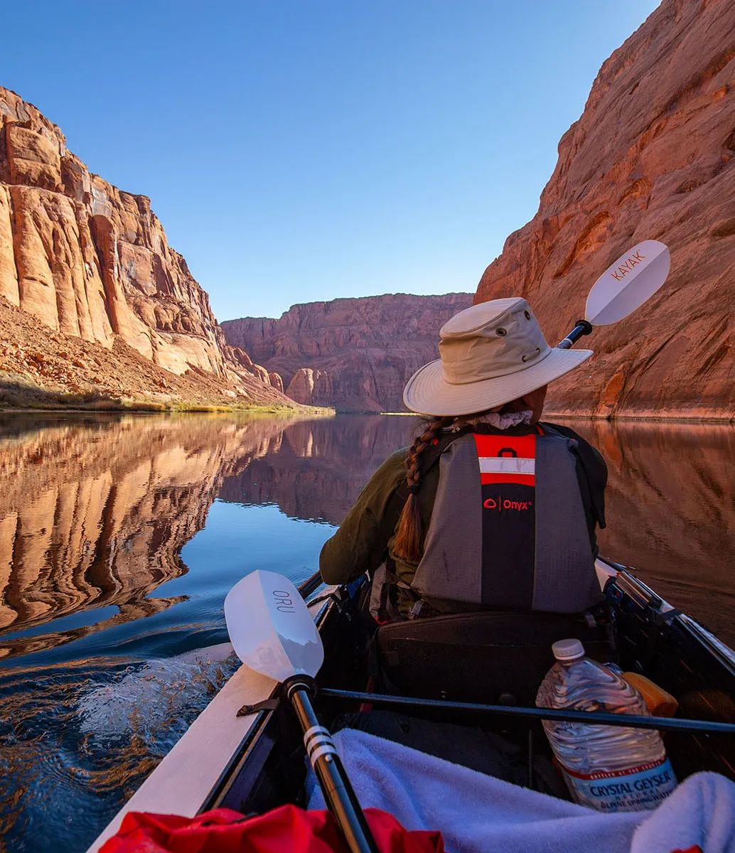
This backpacking trip was part of a longer outing which included kayak camping on the Colorado in Glen Canyon. Reading that first is highly recommended.
Let's start with the logistics of this trip:
The Paria River is part of the Vermilion Cliffs National Monument, managed by the BLM. Permits are need and can reserved on recreation.gov. As they as highly sought after, many popular dates sell out as soon as the window opens (right now, it's three months). Fun fact: even dogs must be included in the permit.
Use of wag-bags is mandatory. The BLM provides them with the permit, one per person per day, single-use kind (at least that's what they gave in 2021).
Permits can be picked up in several locations, including the Paria Contact Station, right there by the turnoff to Whitehouse Trailhead, our starting point. However, this time of the year, the contact station was closed, our only option was the visitor center a Kanab. As we knew we'll be there after hours, I talked to the rangers, and they said the permit, along with the wag bags, will be in the back of the building in bear canisters, labeled with our name. It took a minute to find, but our package was there.
However, we took our own wag bags as we had some that can be used several times and they even weigh less than the single-use kind. Wagbagging is never fun, but it's an understandable inconvenience and we're used to it.
Water management, both for drinking and otherwise is the biggest issue, or at least it was for us. First of all, if any chance of flash floods is in the forecast, don't go. People have died here after ignoring warnings.
Count on being in cold water most of the time. Make sure you can dry off in the evening when camping on a dry "island".
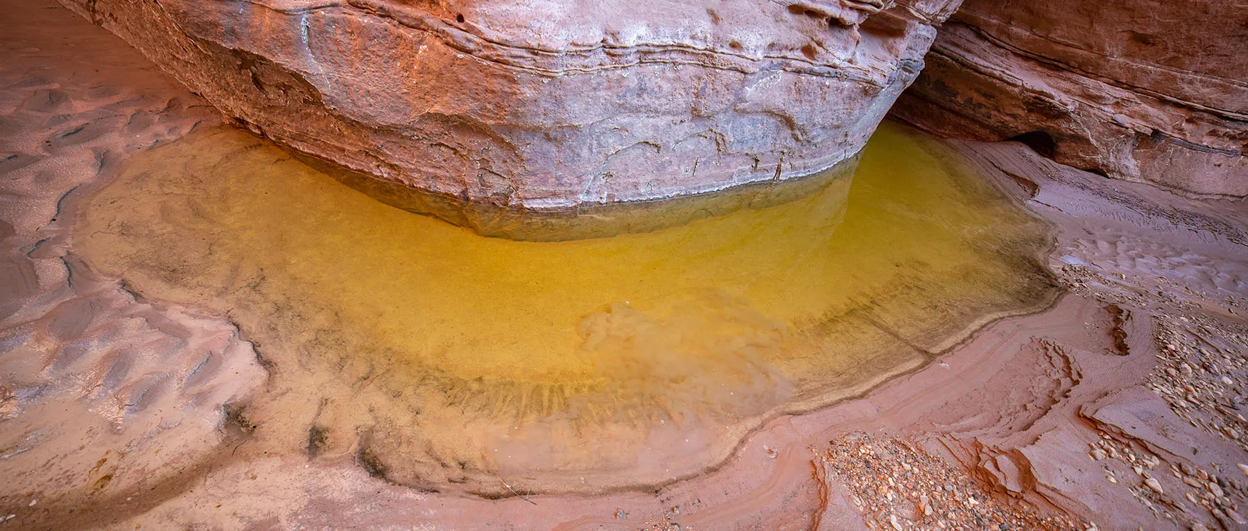
Drinking water sources are few and far apart. The river itself is silty and very polluted. In an emergency, it would be possible to drink from the river by letting some water settle (adding alum would also help), then filtering it. Trying to filter the water as-is would almost certainly result in killing the filter right away.
There are a few springs in the canyon, but some flow only seasonally, and even reliable ones can be hard to find. Fill up at every chance you get.
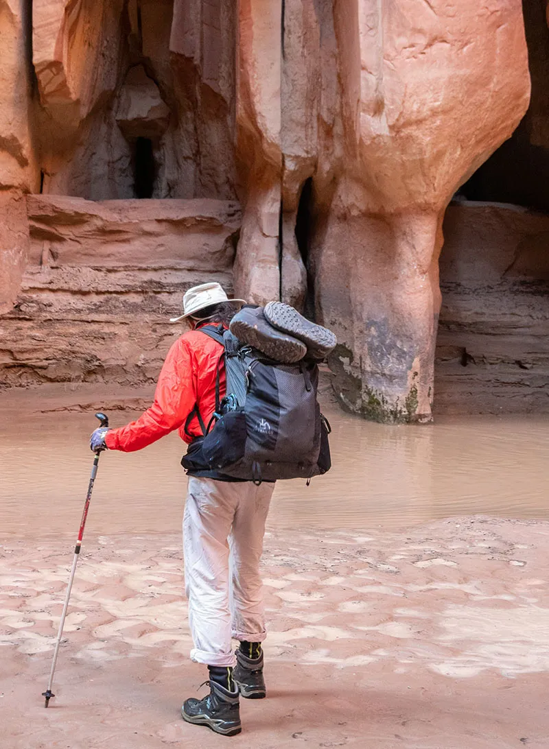
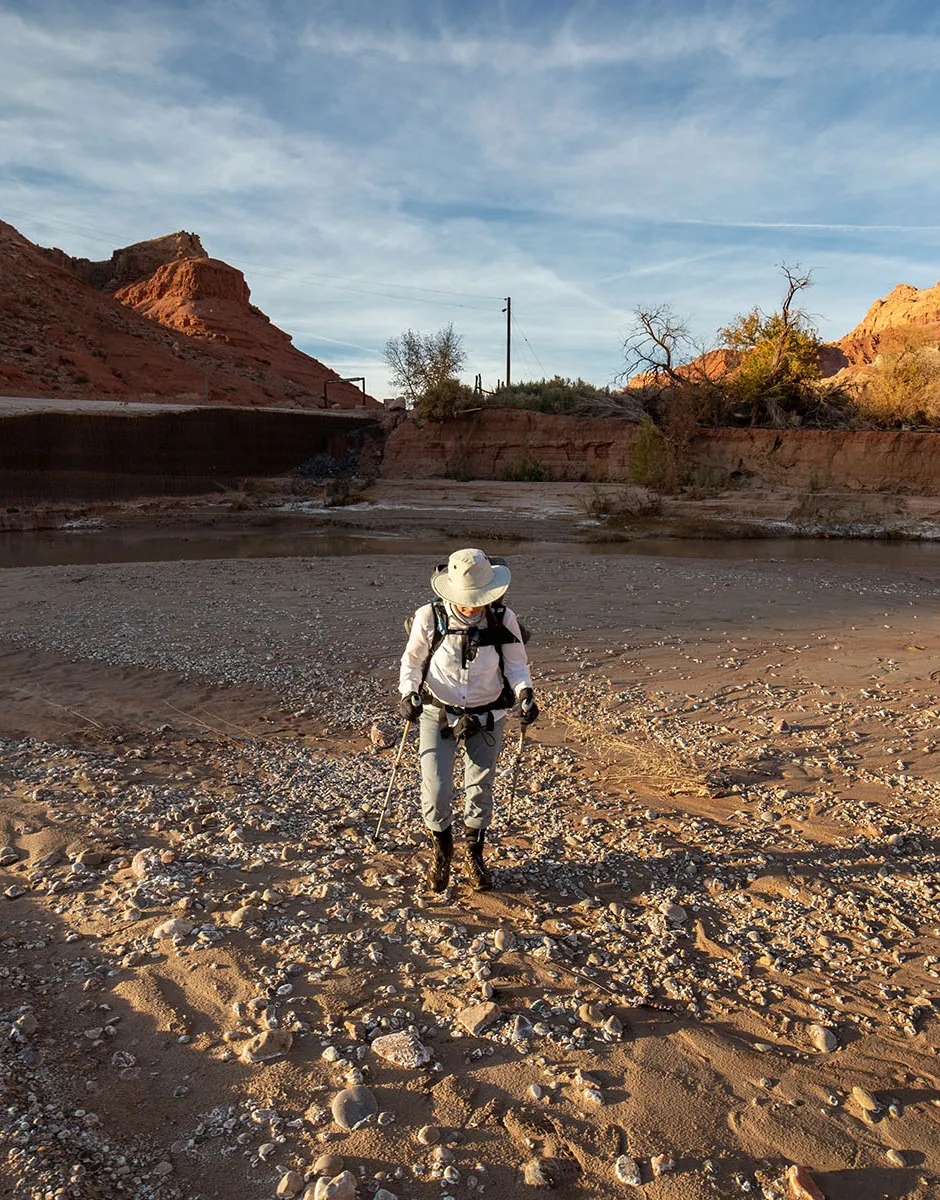
Shoes: water shoes and neoprene socks are a must. Initially, we were thinking about taking light, non-waterproof hiking shoes. However, several people told us the mud destroyed their shoes, saturating them with silt and literally sucking the soles off. We had new light hikers in great shape which we didn't want to ruin and older pairs bad shape, especially around the soles, which we were concerned won't hold up.
We decided on regular hiking boots. We each had an older pair where the waterproof liner was damaged, hence pretty much useless for its original purpose, but the soles were in decent shape. We took those, plus our good light hikers for the dry parts and to serve as extra shoes in the evenings.
The logic went that in the cold water, we'll wear those old hiking boots with neoprene socks. This setup should give us decent grip and some protection from the cold. We knew they won't drain fast, but that was a tradeoff we were willing to risk. Post-trip, we'll throw those old shoes away, they will be too saturated with mud.
Mud and quicksand: everybody warned us about getting stuck in the mud or quicksand. The former is just wet soil, the latter is much more dangerous. It occurs when sandy soil is completely saturated with water, but the water can't drain away, so the mixture acts like a very thick liquid. There are places in the world where it can be so deep, people and animals die in it.
The Paria River has many spots with quicksand, but most are way too shallow to be a deadly. However, they're still dangerous. If you get stuck and sink below approximately knee level, it's very hard to get yourself out without help. Also, the silt seeping into your gear destroys pretty much everything.
Once, a friend of ours got stuck here up to her waist, and after she got freed by her companions, she had a very hard time cleaning up with the dirty river water. The best way to avoid quicksand is to... well, avoid it. One can learn how to recognize most spots. Usually, it's standing water in the corners or on the sides of the canyon. Regardless, it's also important to keep checking one's footing with hiking poles. If you see flowing water and feel rocks on the bottom, it's most likely safe. However, not lingering in any water is always a good idea.
Day 1 – Marble Canyon to Lee's Ferry, to Whitehouse Trailhead, then camp by Wall Spring
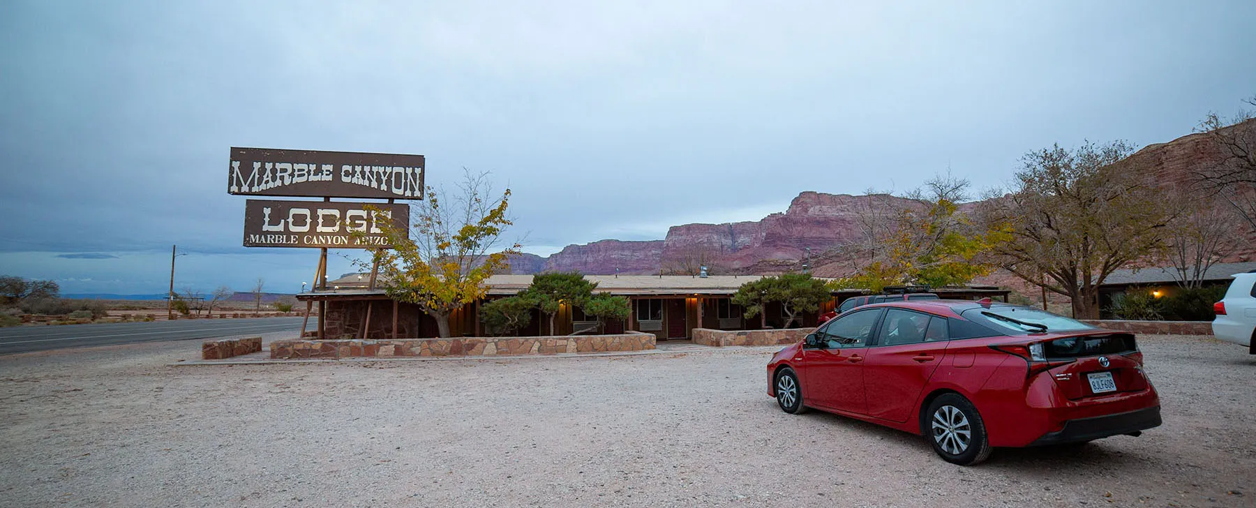
After checking out from the motel, we drove back to the overnight parking lot at Lee's Ferry. The weather was cold and cloudy, but with no possibility of rain.
We secured our car, covering all the kayaking equipment as best as we could. Our shuttle showed up not much later and we were off. The driver was a very nice and friendly guy, he gave us lots of valuable information about what to expect. The drive took us over the river, back up to the plateau, to Page, then over the Glen Canyon Dam bridge. Now we could truly see just how low Lake Powell's level has fallen. Horrible.
A few miles past Page, we crossed into Utah again, then turning from the main highway and after a short trundle on a dirt road, we arrived at Whitehouse campground and trailhead. It's a pretty remote place, beautiful in its desolate way. The Paria River is on the west side, flowing south.
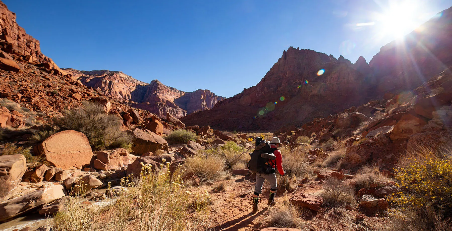
After saying our goodbyes and readying our packs, we set out, walking into the river's wash past a large sign warning us to expect flash floods any time of the year. Thankfully, after checking with the rangers one last time the day before, the chances of that were truly minimal.
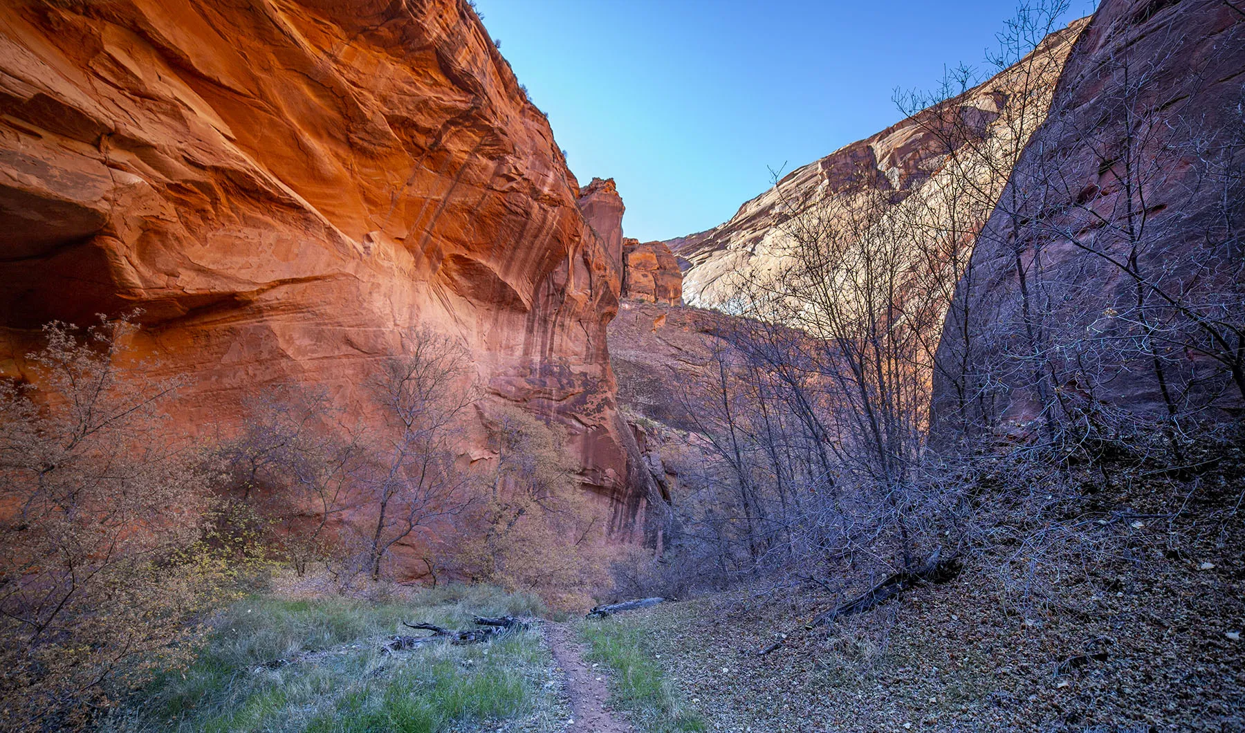
The wash here is wide, the landscape almost flat. A sparse riparian area adorns the bank.
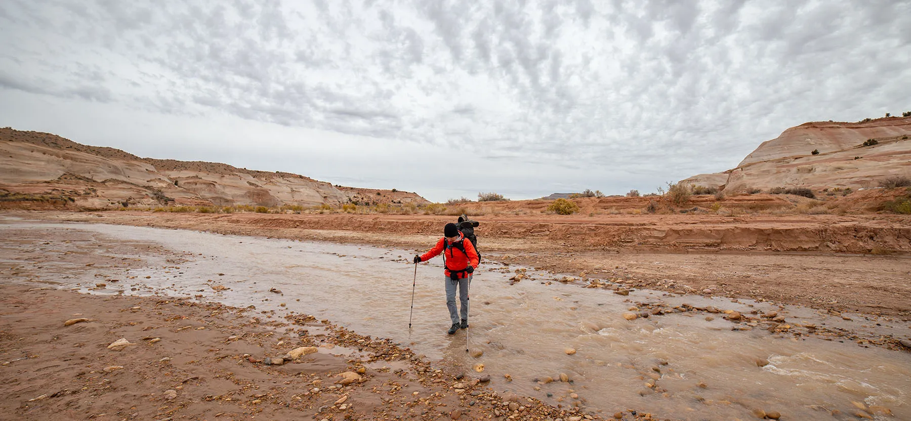
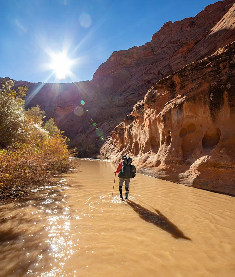
We were told the river is running medium-low this time, to expect little water first, then up to our knees at most. We were wearing our light hiking shoes and resolved to try and keep our feet dry as long as feasible. The very first two crossings were almost impossible to do without a rock-hop, but we managed.
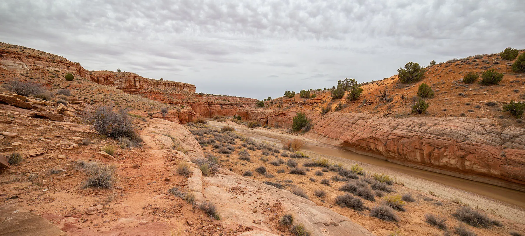
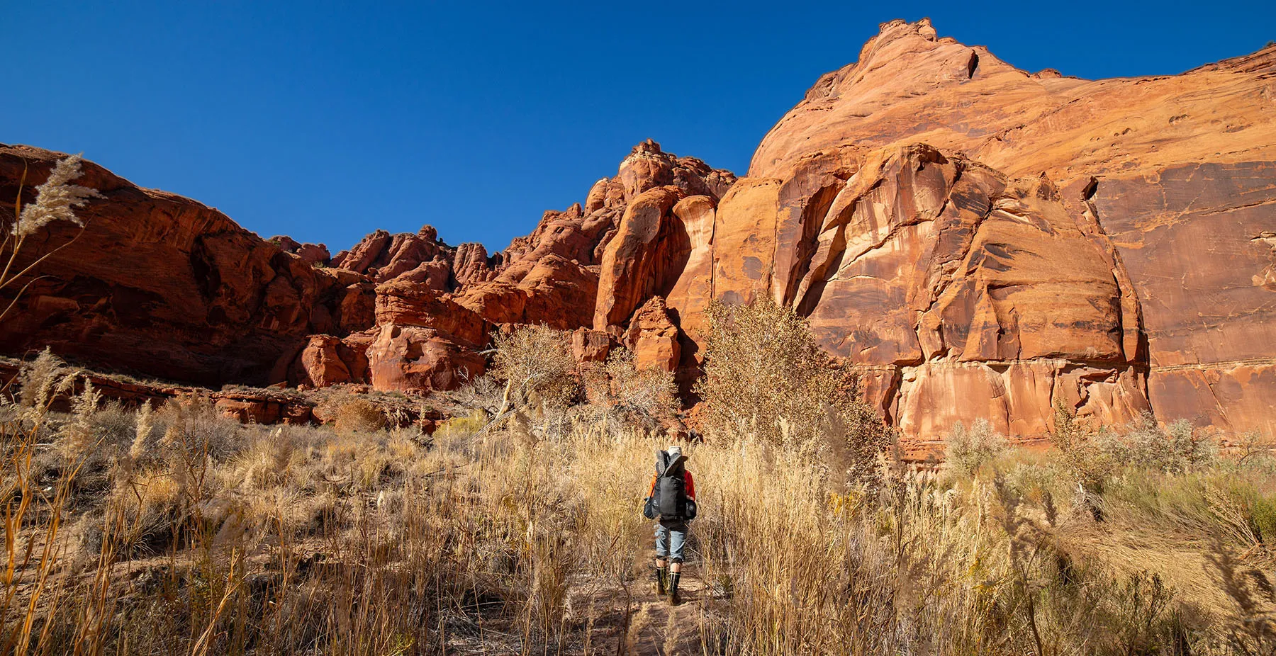
Then the wash got a bit deeper and it looked like one version of the trail goes up on the left bank, bypassing at least two crossings. That's where we went, eventually climbing about 50 feet in elevation and continuing south on the lip of what you could now call a shallow canyon. Beautiful juniper trees and creosote bushes made for few splotches of green.
There was an obvious trail, but we soon realized that it won't go back down into the canyon. The walls were not very high, but there was no way down. As we knew it will only get deeper; we have to descend to the river. Thankfully, we only had to backtrack about a hundred yards to find a safe downward spot and minute later we were back by the water.
About 10 minutes later, we got to spot where dry crossing looked doubtful. I made the mistake of trying and got a bit of water in my light hikers, the ones we were supposed to keep dry for the evening. Bummer.
It was time for a snack anyway, so we ate an energy bar and changed shoes, putting on the neoprene socks, then the hiking boots.
Into the water we went, carefully checking for quicksand first. There was an obvious trouble spot on the side, but the bend where we crossed was OK with a rocky bottom.
Of course, the feeling of cold water rushing into our boots was a shock, but we knew we'll have to get used to this as it will be our life for the next few days.
On we went southward. This was still the wide part, but the canyon was gorgeous nonetheless with amazing rock formations and saturated colors, even without sunshine. There was a camp with a fireplace and logs to sit on, and I can imagine it would be fun to spend a night there, but there's no drinking water and we hate dry camping. Maybe there some springs on seeps nearby in the wet season.
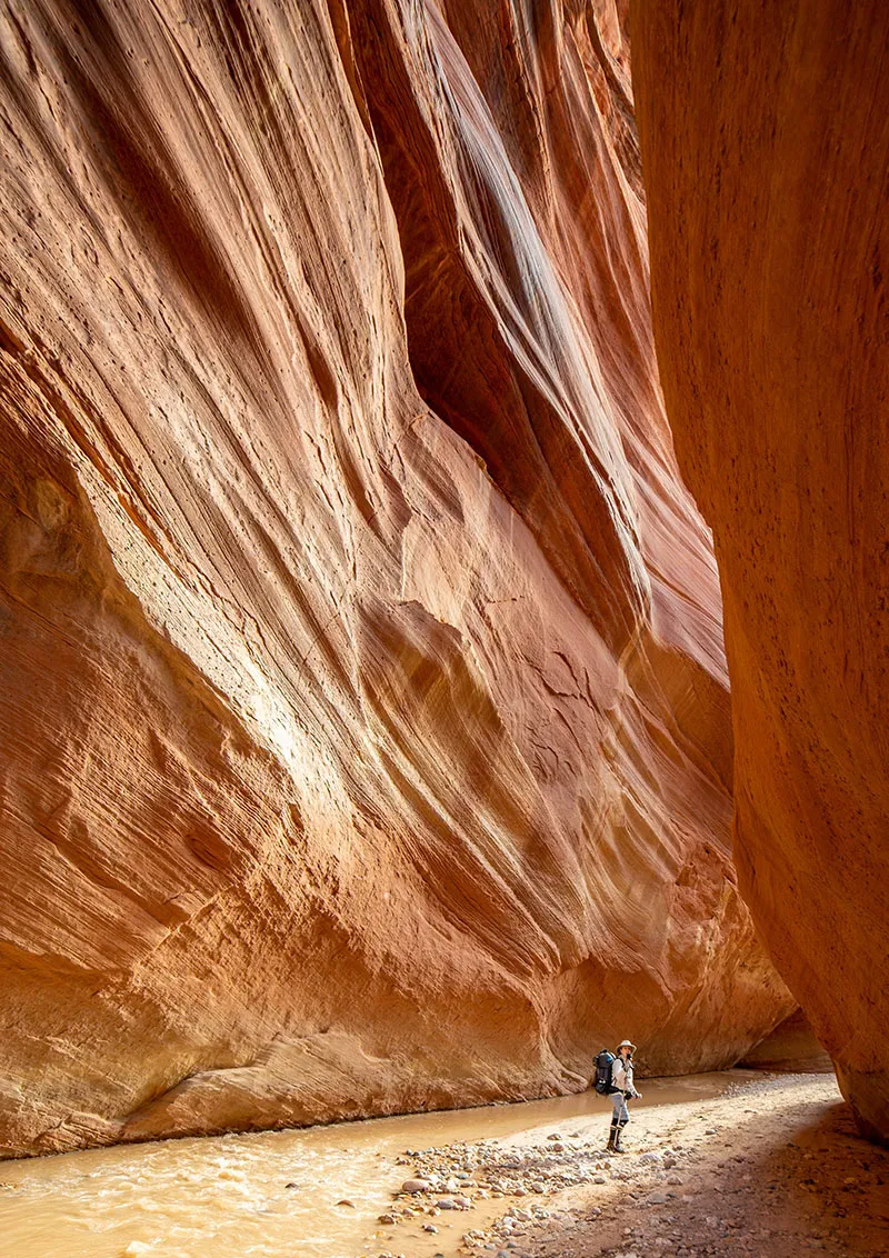
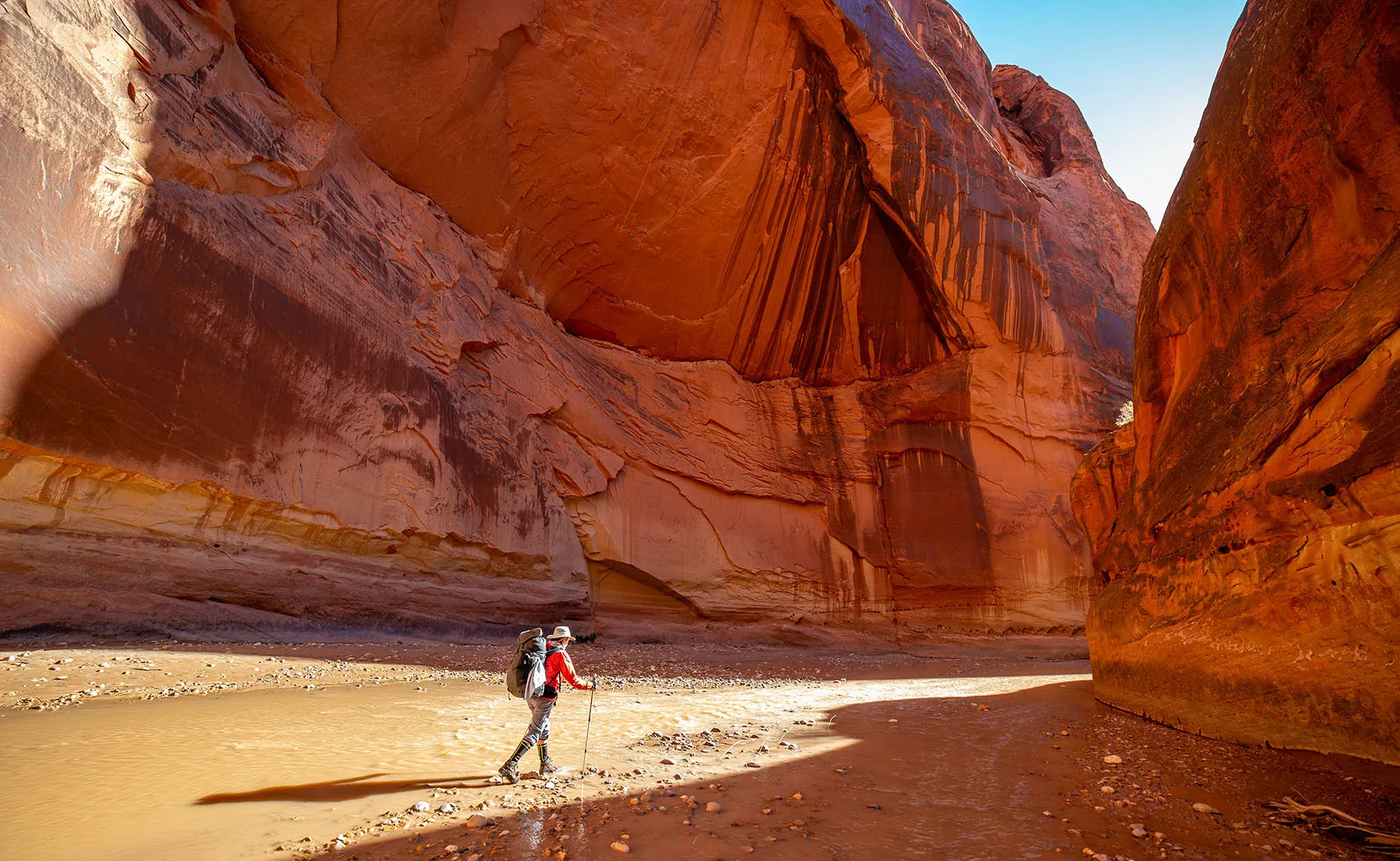
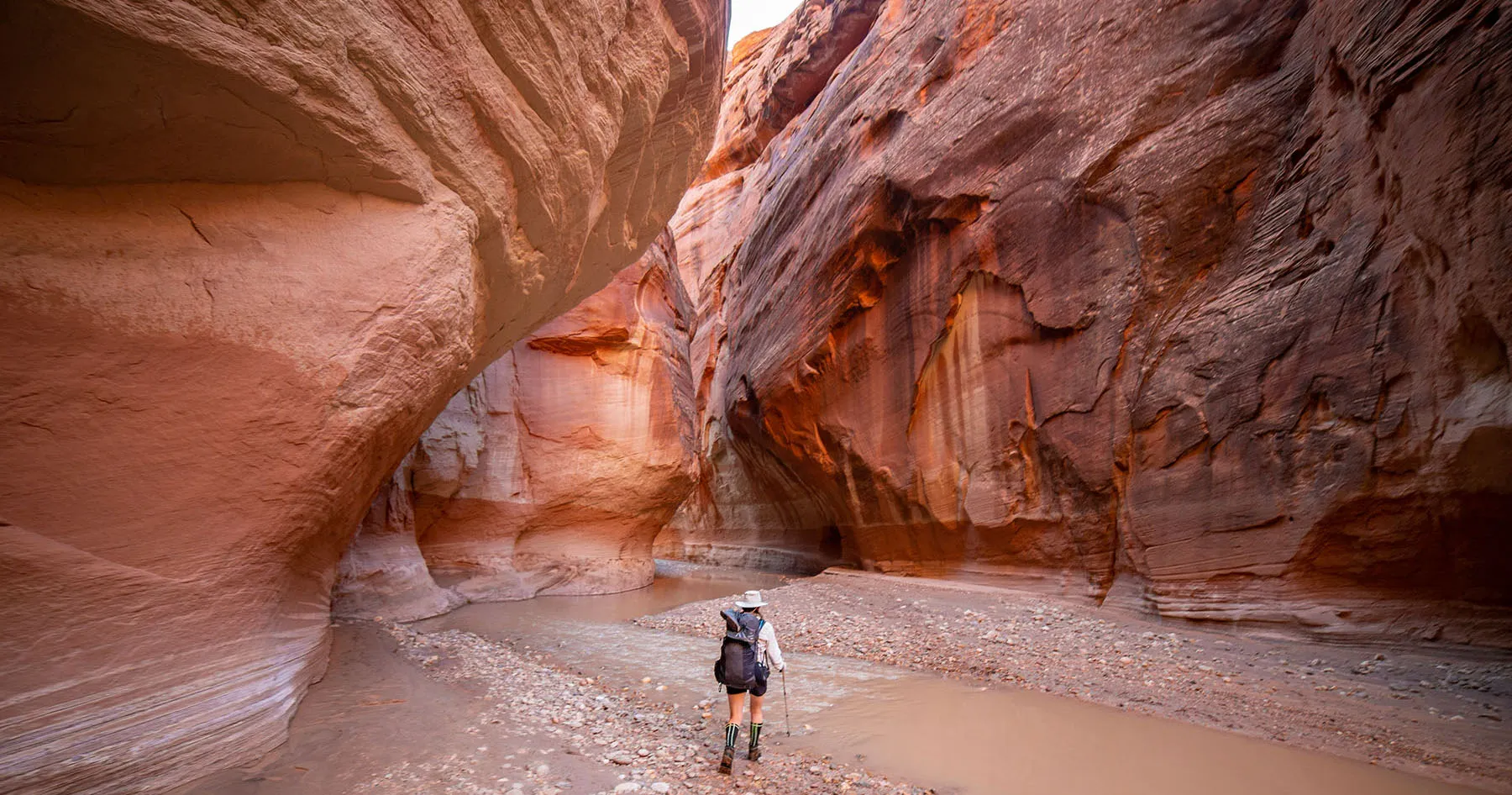
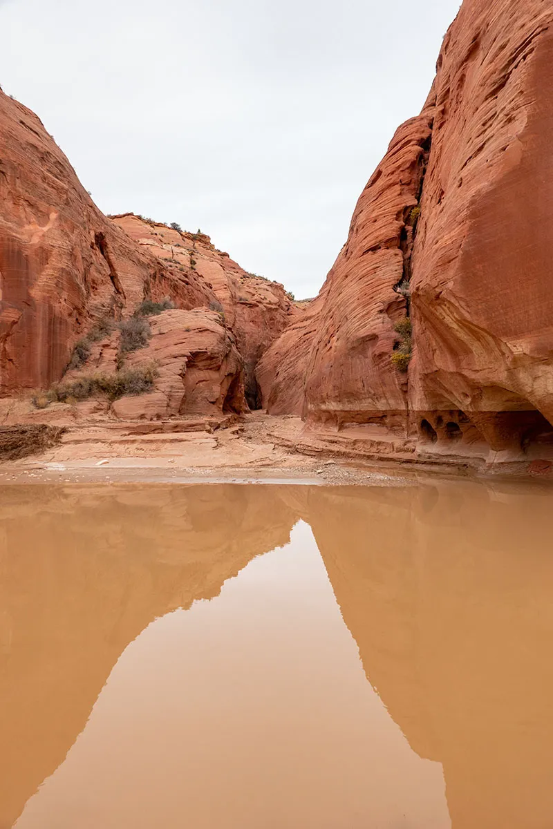
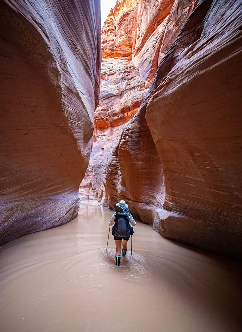
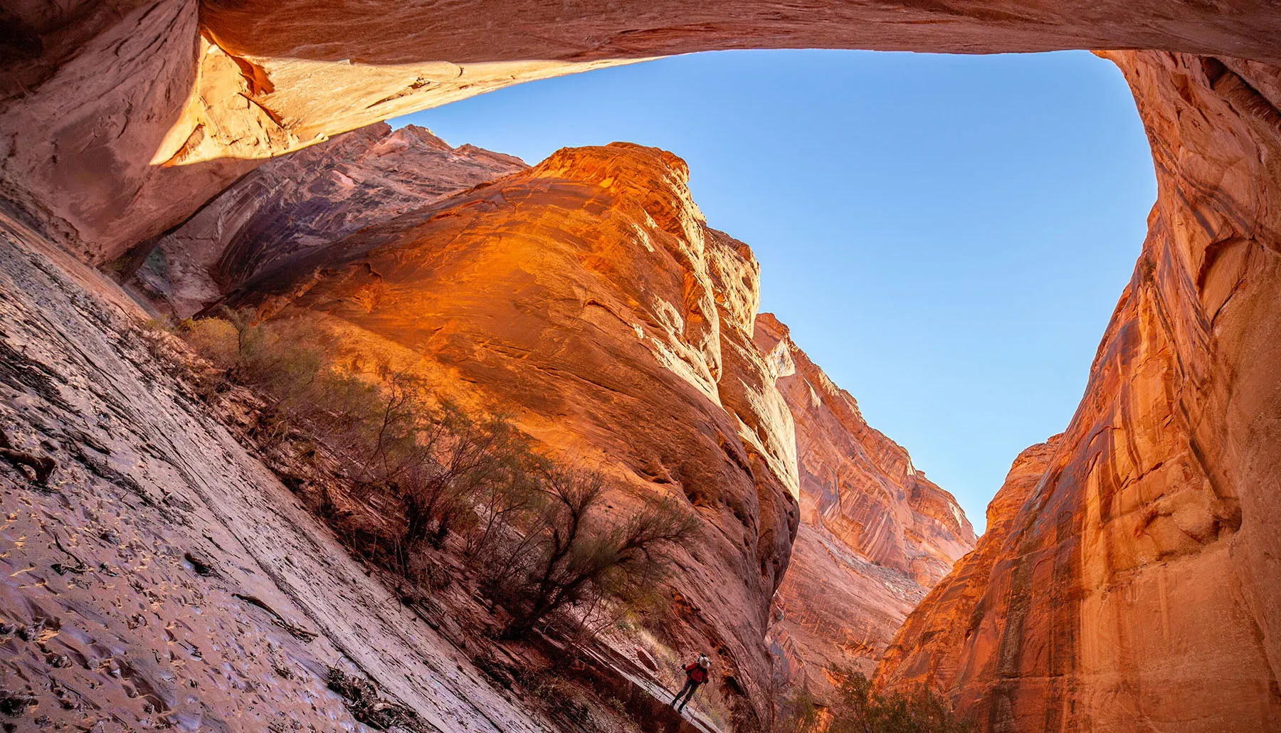
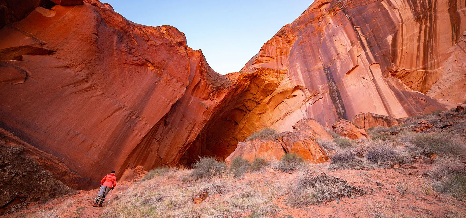
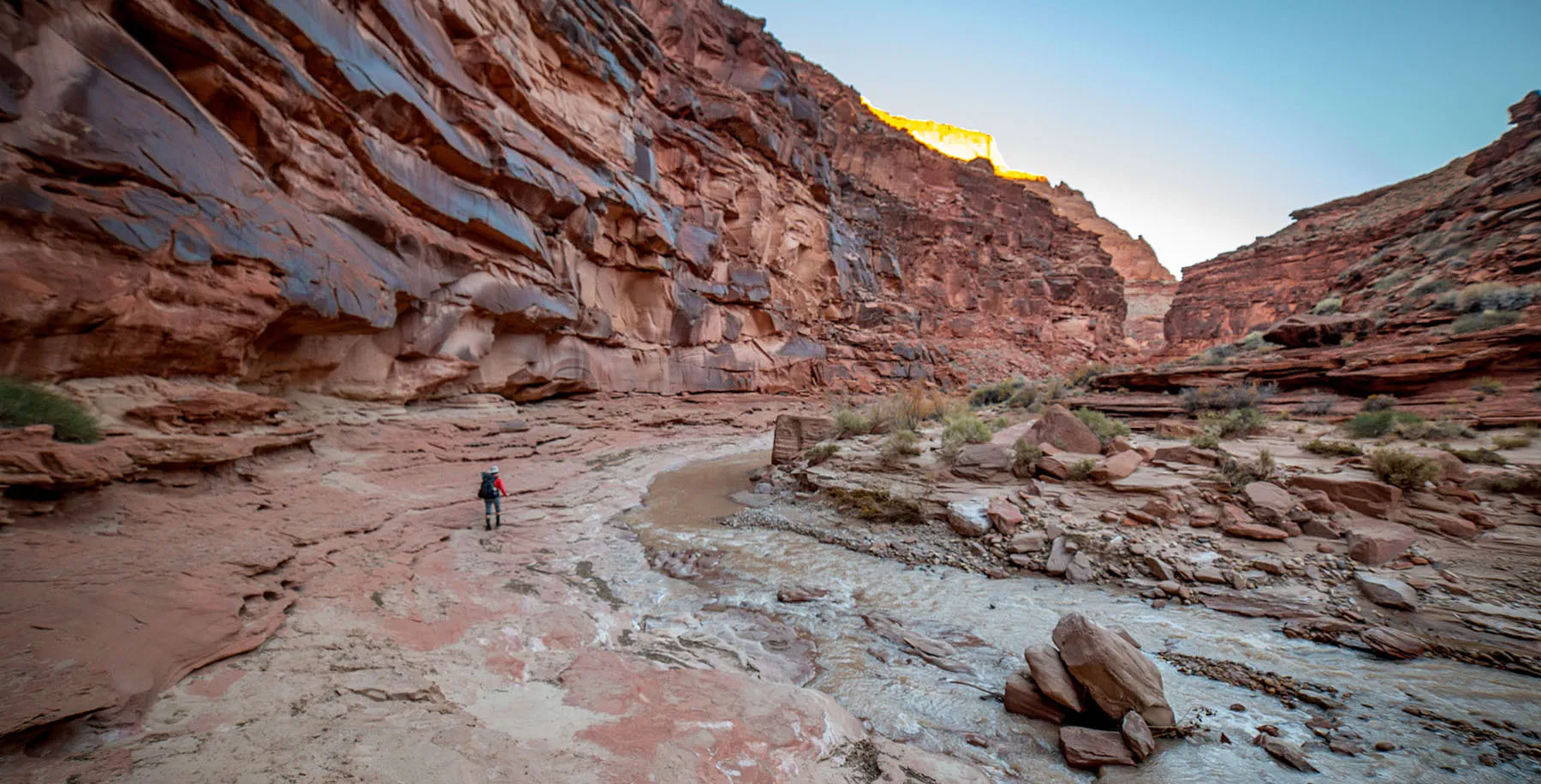
The real fun begins about four miles from Whitehouse: the Narrows! It's like the name says, the canyon closes up dramatically, with water-carved walls rising only a few dozen feet from each other.
In some places, the river filled up the canyon wall-to-wall, but the water was only ankle-deep. On most stretches, though, there was enough room on the sides not to have to walk in water, not that it mattered much. Even the sun came out a bit, making for more vibrant colors. It was very awe-inspiring. We tried to keep moving to keep warm, but of course it was hard, we couldn't help stopping for pictures every few minutes.
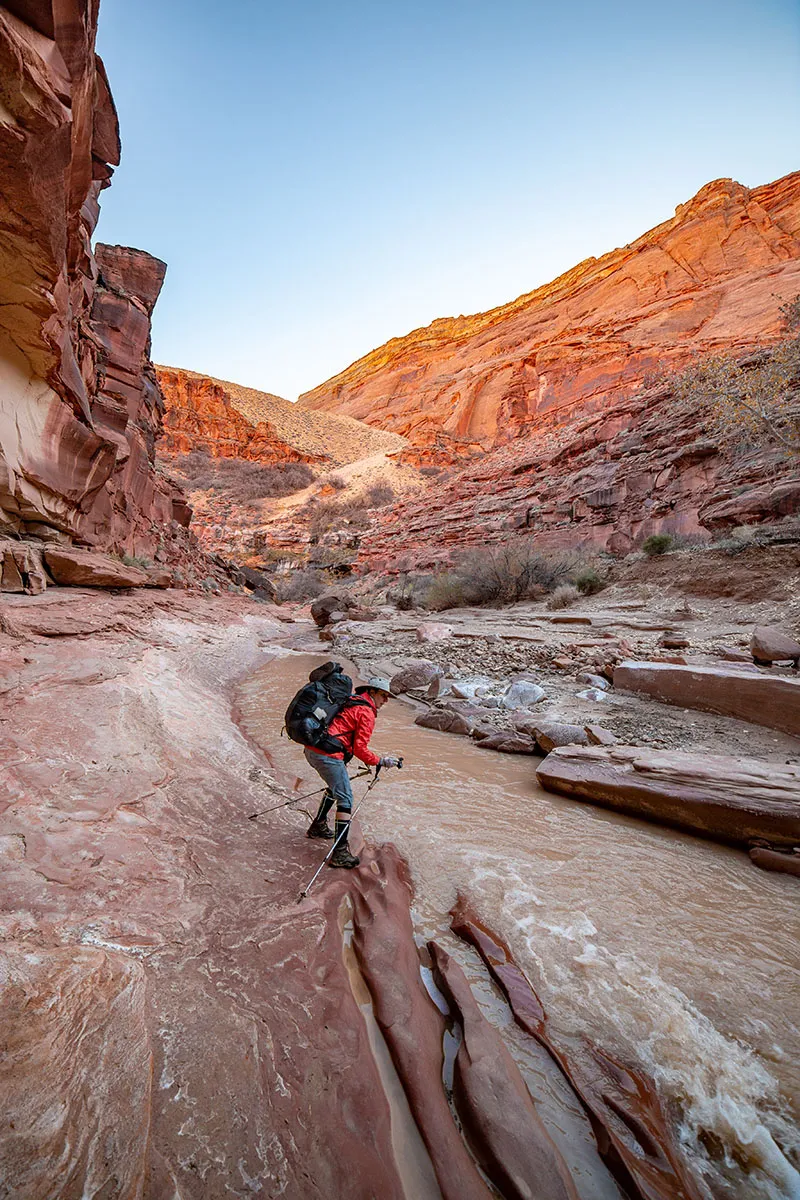
About 45 minutes into the Narrows, we got to a short choke point where the canyon bottom got narrowed down to about 7-8 feet in width by a large boulder. Because of this, it looked like the river ran deep here. I probed with the hiking pole, and sure enough, it went down a bit over two feet, well above knee-height for me. This deepest part was only a few steps in width, but nonetheless, we had to strip down to our shorts. Other than that, it was easy, the current was not particularly strong and the bottom solid gravel.
Not knowing what to expect, we decided to keep hiking in our shorts.
A minute later we met a guy on horseback, out for a day trip, making his way back towards Whitehouse. We chatted briefly, then went our way.
Each twist and turn in the canyon brought new wonders, with all sorts of shapes and patterns carved into the rocks, huge boulders fallen from above, and a really cool stretch where the river filled the bottom from side to side for at least 300 feet in length, but the water itself was shallow and easy to navigate.
We stayed vigilant for quicksand, and other than in very obvious pits on the sides, we didn't encounter any. Somebody walking here a few days prior was clearly looking for quicksand, their bootprints went all over the place, testing various sketchy-looking spots. It looked like he (hunch based on boot size) never found much.
It was past 2:30pm by the time we got to the confluence. Buckskin Gulch emerged from the right and as planned, we ventured up into it. A few hundred yards up there's a sizable shelf with some trees and a few empty camp spots. No water here, though. We went a bit further, but it was late and had to turn around.
Back down past the confluence we saw another camp spot with two tents, but nobody around. Here we crossed the Utah-Arizona border again, for the sixth and last time on this trip.
The plan was to see if we can find the spring (some call it Wall Spring) indicated river right about two miles from the confluence, the first "reliable" water source. Supposedly, there's also a camp spot there. If there's no water in that spring, we'll have to push another two miles to Big Spring, but that place is most likely crowded and we might get there only after dark anyway.
The goal was not to rush, but enjoy the views and take it all on (plus photograph it), cold water be damned.
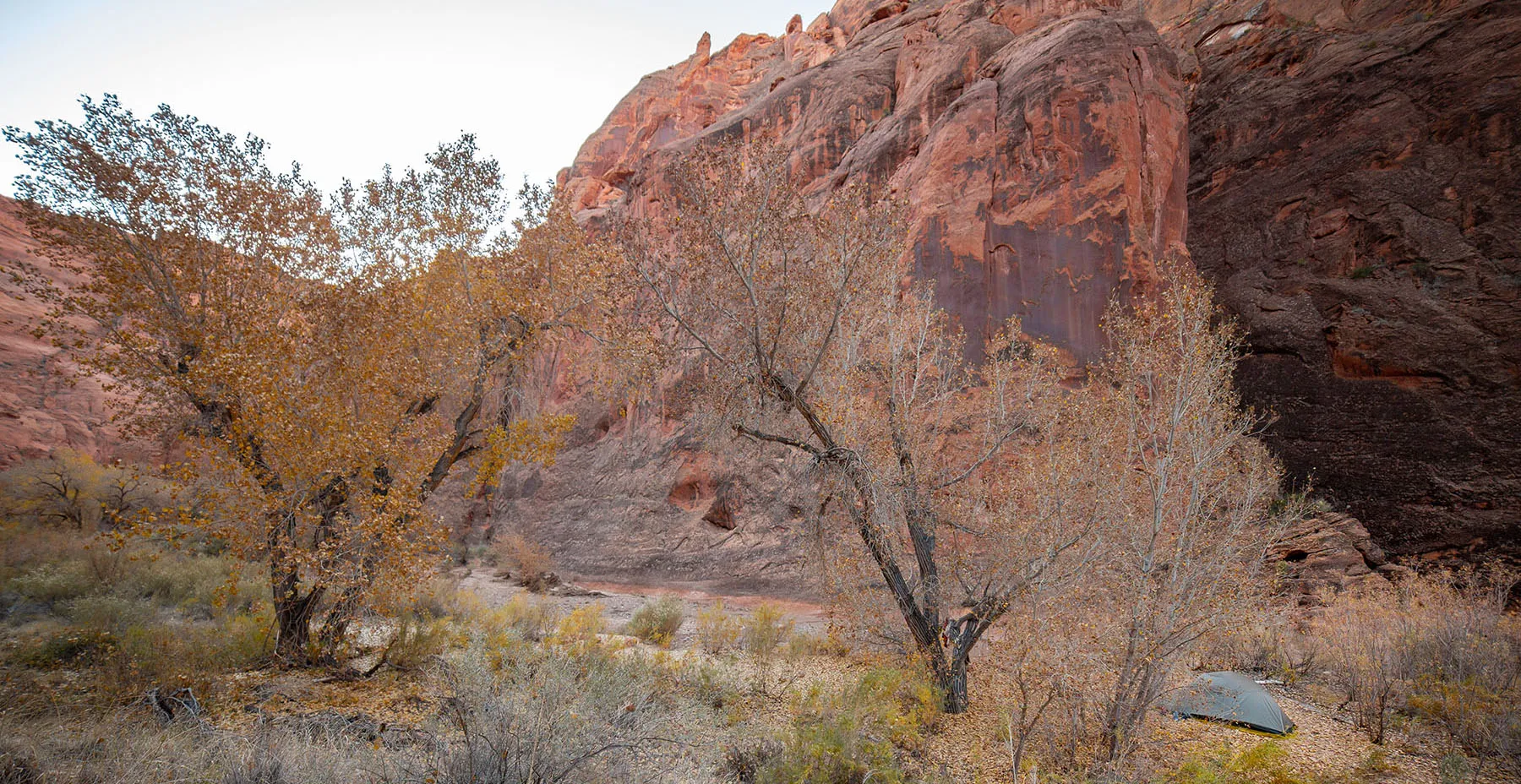
I spent some time looking at satellite pictures beforehand, so I knew where to expect the spring and campsite, and lo and behold, there was the bend with a huge three river left. Wall Spring – or more of a seep, was river right.
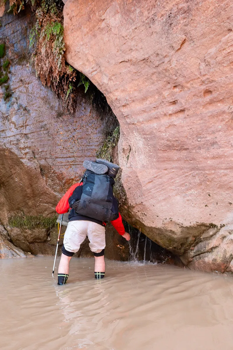
We climbed up the bank to the tree island and found a beautiful little campsite, perfect for us. Dry crossing the river from the campsite to the seep was not doable, so we decided to get as much water as possible, then dry out for the night.
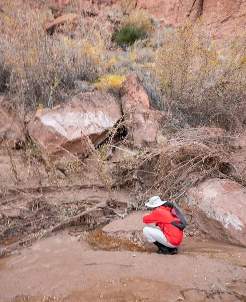
We dropped our packs, and while Em was getting changed, I went to take care of all that. Seep dripping down the wall filled up a tiny, shallow pool with crystal-clear water, but the bottom was fine sand, and it was extremely hard to get water without stirring it up. I scooped up a cupful, and sure enough, tiny grains of golden sand swirled in it. However, they were heavy and settled in a matter of seconds, so I could decant most of the cup's contents into one of our water bladders, eventually filling all of them. Then I filled the camp shower as well and lugged everything back.
By this time Em already changed and started unpacking. While darkness fell, we ate soup, washed up, pitched the tent, cooked dinner. The usual. It was getting cold, but thankfully, the wind didn't pick up. The campsite was very scenic, the bend in the canyon felt like our little private resort. The conversation kept turning to how cold the water was, and we both agreed that the Neoprene socks are saving us from suffering. We drained our soaked boots as much as feasible, but we knew there's a chance they'll be frozen by the morning.
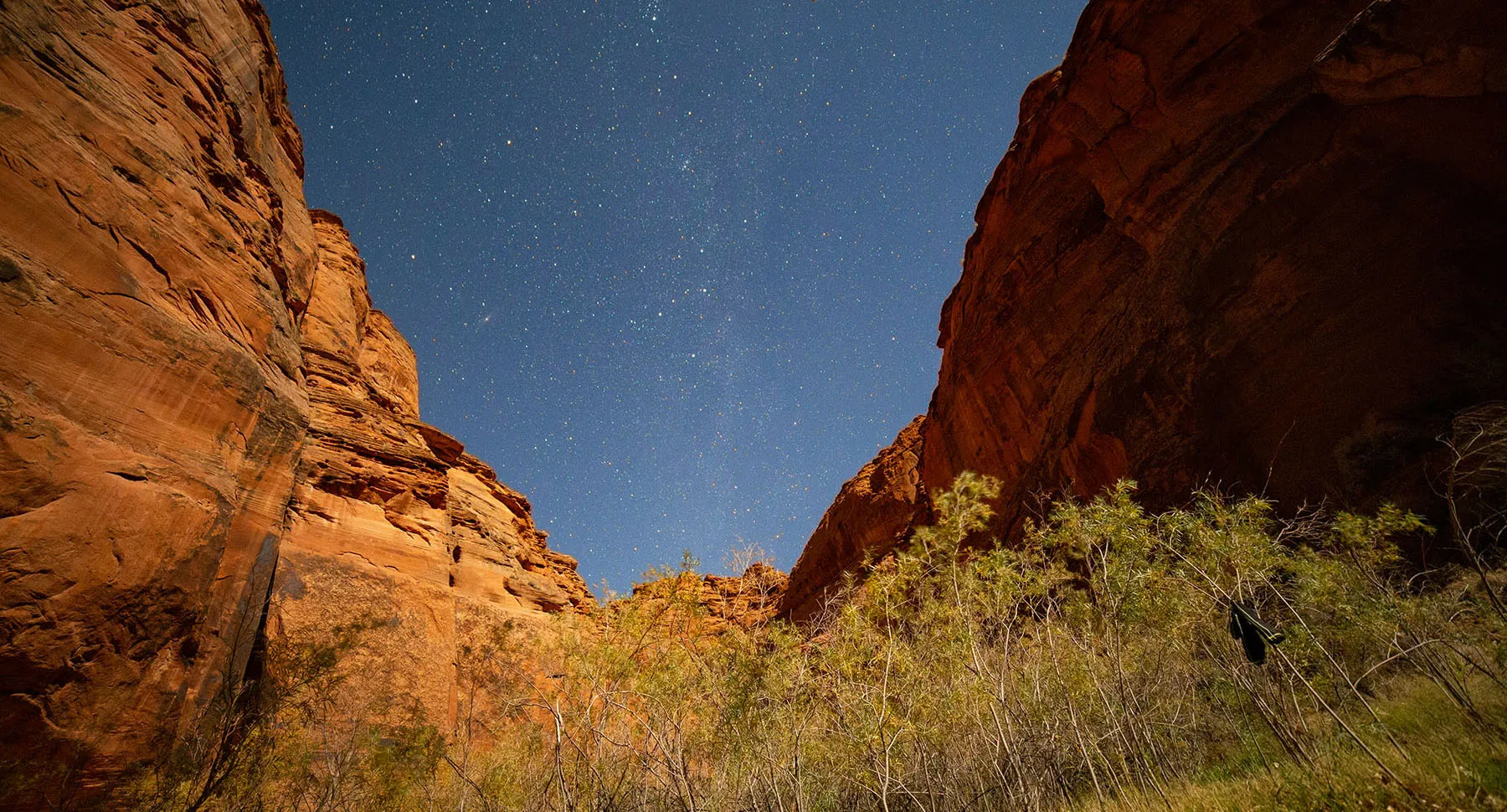
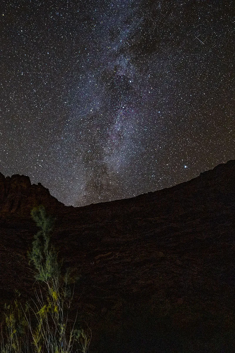
Before bed, I took some long-exposure shots, the dark canyon walls nicely framing the Milky Way beyond. Then the moon rose, making for very different pictures, just as gorgeous.
We were tired, mostly from the long day and being in the cold water. After securing all the food, we went to bed early, which is to say around 9pm. Regardless, we knew we won't be able to get up very early next morning.
Day 2 - Camp by Wall Spring to camp around Mile 18.5
We got up at 7am to a cold and relatively windy morning. Our boots were somewhat crispy, but not completely frozen. We decided to put them on only when ready to go. For breakfast, retreating to the top of the tree island got us in the lee of the rocks.
Somehow, we were even slower than usual, it took us a very long time to pack up. Putting the shoes on was not the most pleasant experience, but at least we started walking almost right away and it didn't feel too bad. Also, funny enough, entering the cold water made it somewhat better.
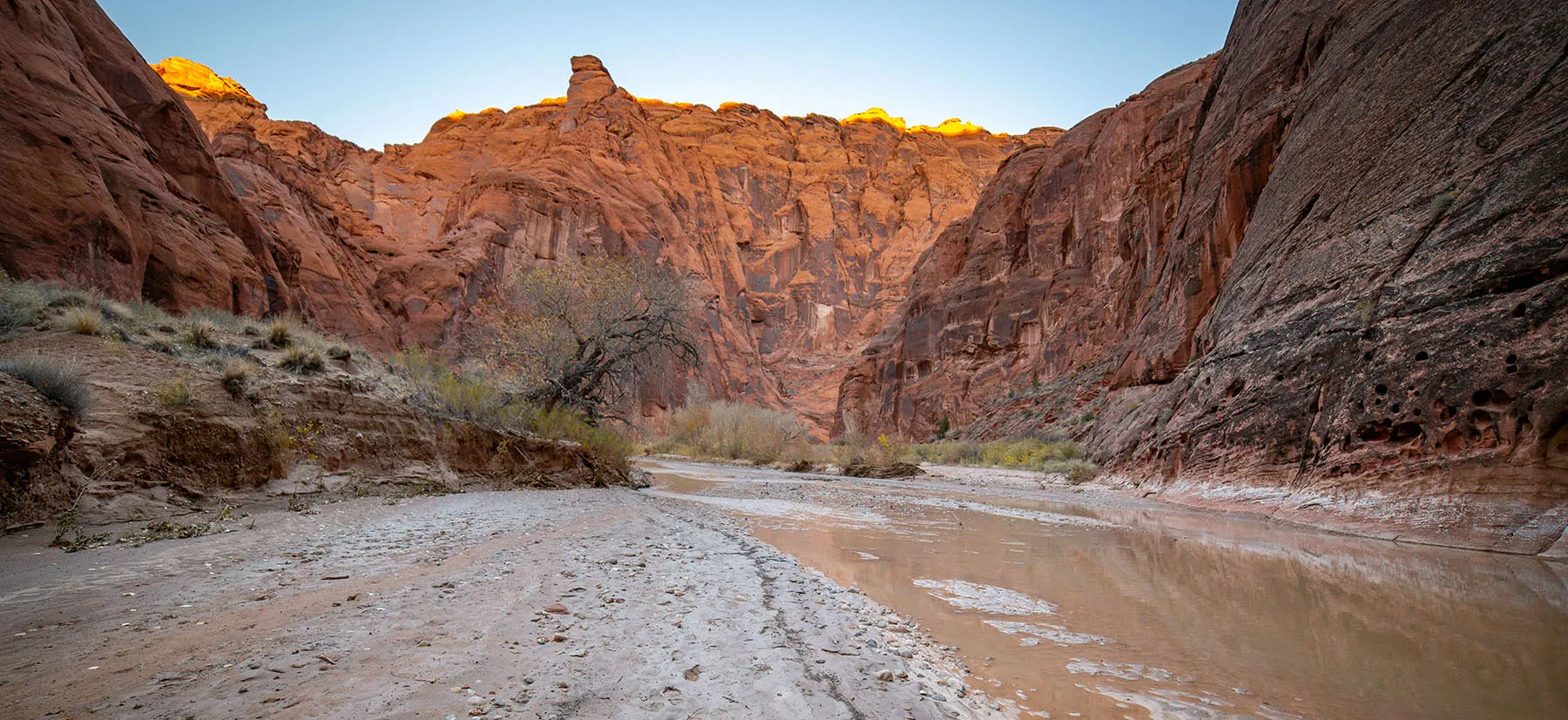
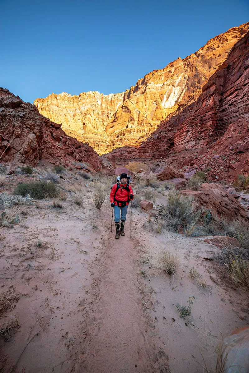
We left the camp around 10:15am, continuing downriver in the canyon. My goodness, was it gorgeous! The previous day's haze gave way to clear skies, the unimpeded sunlight now coloring the steep canyon walls in a zillion shades of yellowish-reddish-orange. It was extremely hard to warm up as we stopped every few paces to marvel at something (and take pictures, of course).
After a whopping two and a half hours, we managed to put in two miles and arrived at Big Spring. This is by far the biggest spring in the canyon, sitting river right in a relatively wide bend. There's a serious outflow of fresh water, right from the rock into the river. We decided against having lunch just yet, so I filled our water bottles. This was by far the easiest fill-up of the trip, I just had to hold the bottle into the strong flow.
Then we checked out the campsites. It's an extremely popular place, understandably so. Opposite the spring, among the trees, there are at least 10-12 spots to pitch tents. It was deserted now, but from what we heard, four to six people might have been there that morning or the day before.
Another reason for a later lunch was that this bend was still in the shade. Looking downriver, we were sure we'll find a place in the sun. Which we did, sitting down about half an hour later on a gravel-covered, sunlit bank, taking our shoes off, then eating heartily. The wind picked up a bit, but it wasn't terribly bad. We took a long time, trying to warm up as much as possible.
Then it was back in the water, walking in the river, looking at all the wonders.
This almost made me have the only quicksand mishap of the trip: once, only once I forgot to look where I was going while jostling for a better shot, and all of a sudden, I felt my left boot starting to sink. My momentum almost carried my other foot into the slurry too, but somehow I managed to stagger backwards, plant it on more solid ground and extract the sinking boot before it got completely covered. Em was a few feet away, saw what was happening, and she sprang to my aid, pulling me by my backpack.
The incident was pretty much nothing, but it gave me a good taste of just how forcefully the quicksand can grab you. If you walk into it even two paces, you're in trouble.
On we went, marveling and marveling, though a bit more carefully. Some bends had huge, natural alcoves, my new favorite geological feature. Some are big enough to stand inside them and feel like you're in some amphitheater's shell.
Like before, it was slow going. By 3:30pm, the sun was already low, and we stopped for a quick snack break to catch the last rays reaching the bottom of the canyon. A few minutes later, we came upon a large campsite, but there was no spring nearby. The skull of a bighorn sheep was propped up on a tree – the most we saw of the elusive creatures. We kept our eyes peeled for them all the time, but other than fresh footprints, we couldn't spot any.
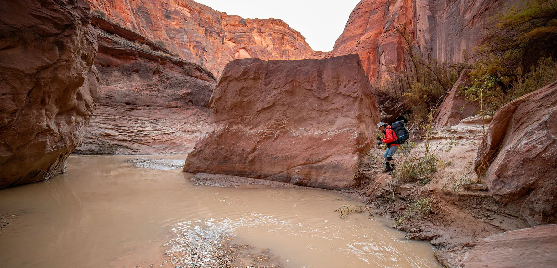
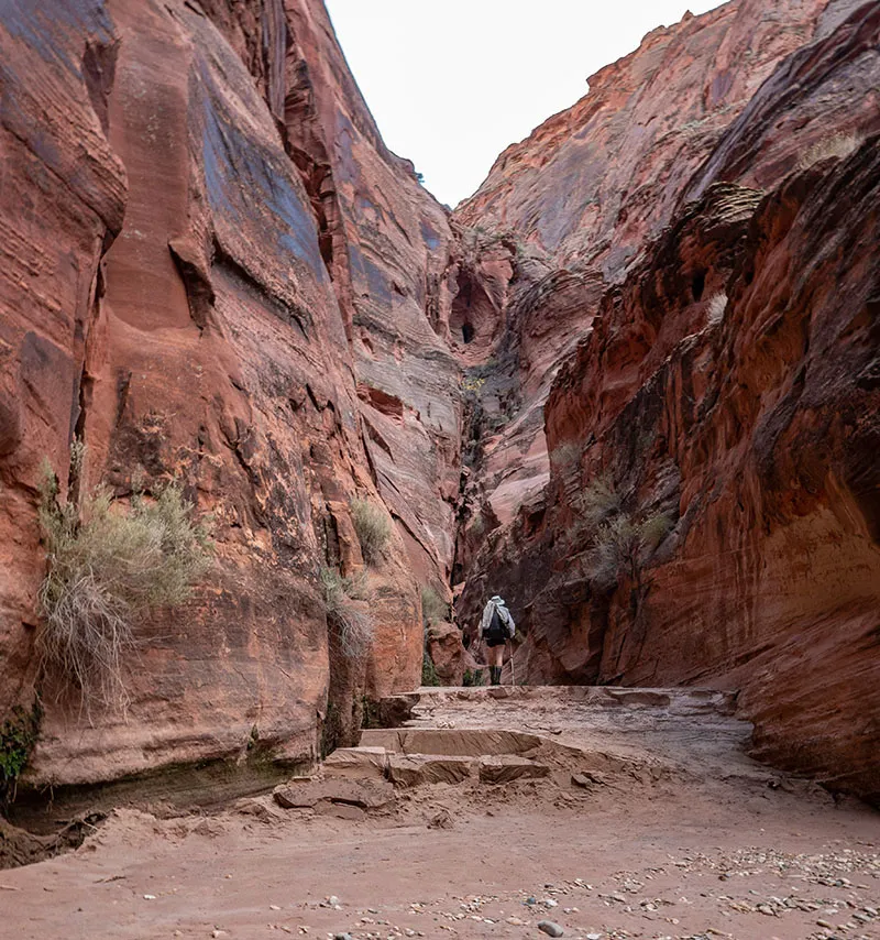
Further down, the canyon was blocked by some huge boulders, the trail went river left, climbing a bit, then descending very steeply for a few steps, back into the water. Some parts of the river were too deep, some were pure quicksand, so it took a bit of scouting to find a decent route, but it turned out well.
A place called Judd Hollow came next. In the 1940's they installed pumps and piping to get river water up to the plateau, but as far as I understand, the project was very short-lived and mostly a failure. Some equipment is still visible, rusting away.
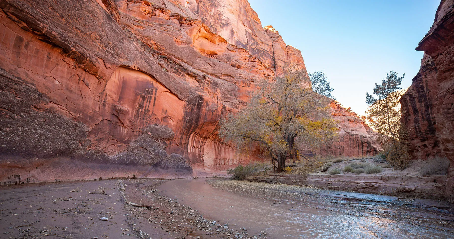
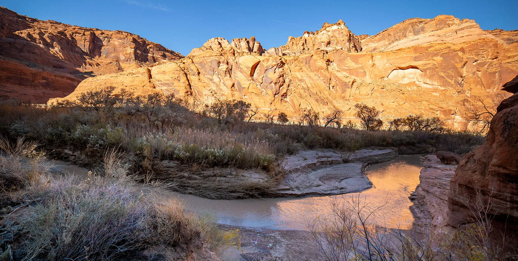
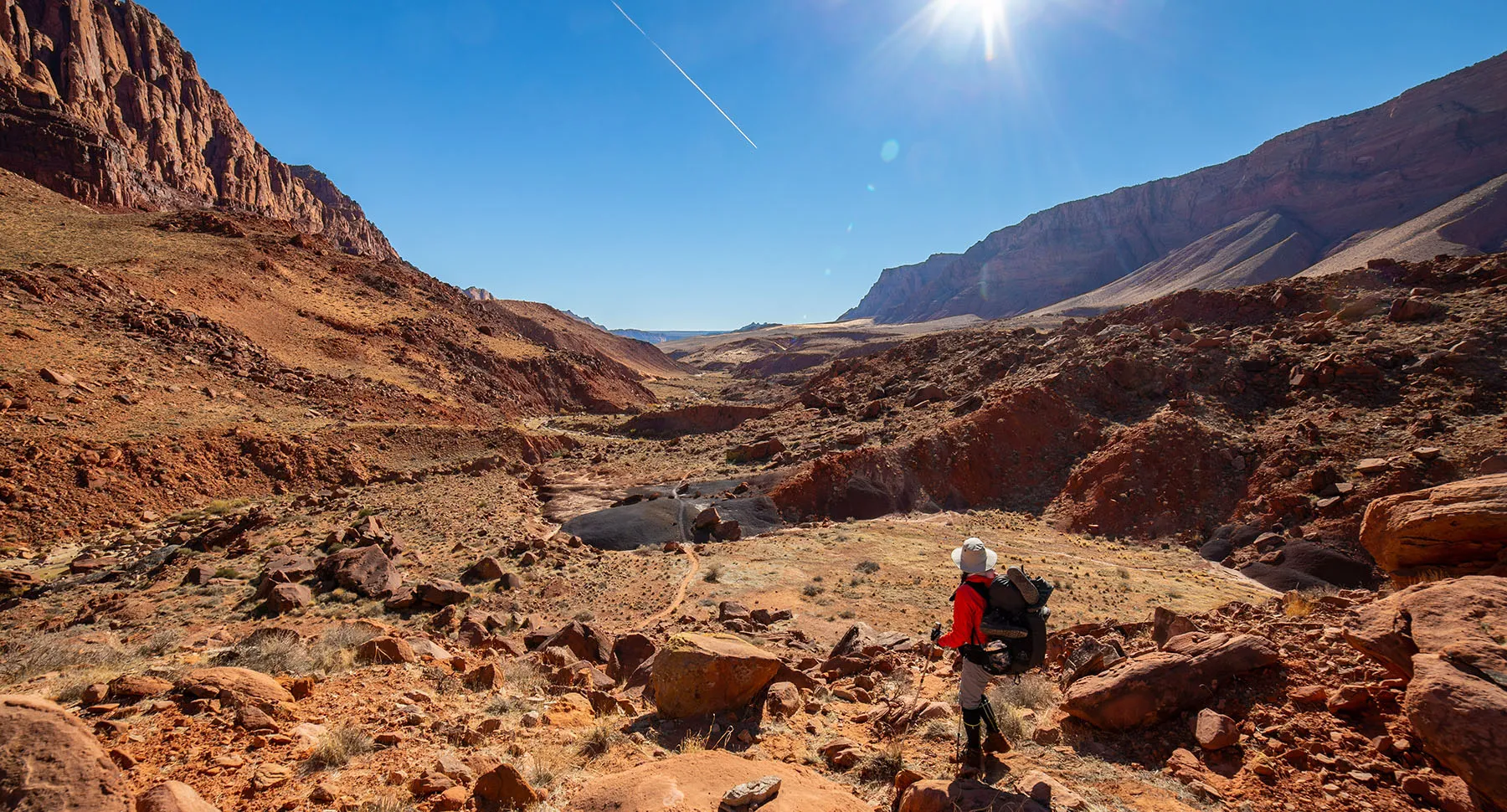
Starting about here, the canyon starts to widen out, with way more trees and high sand banks. Some people nicknamed these next few miles "the Marshlands", a somewhat fitting name.
According to the map, the spring and campsite should be another mile past Judd Hollow. Nightfall wasn't too far away, and setting up camp in the dark would have been no issue. However, looking for clean water by lamplight is a different story. This meant we "hurried up", and for a change managed to put in a full mile in half an hour, even accounting for photo breaks.
I kept checking the map to make sure we don't miss the spring. We had no idea what to look for, but it turned out easy to spot: in a wide part of the canyon, a small stream was flowing river right from among the bushes down to the bank.
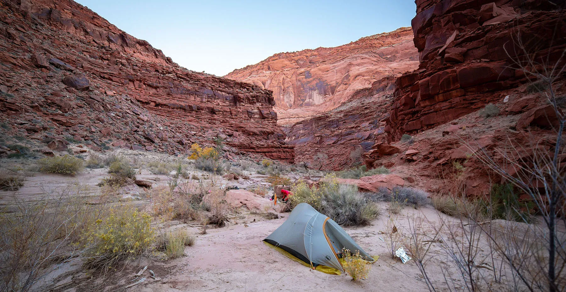
According to what I've read, campsites were a few hundred yards further down, river left. We walked that way, climbed the bank, and found several cozy spots among the trees. It was still somewhat windy, but we found a well-protected site. The strategy was like the day before: I went back to get water while Em dried up and started unpacking.
While still somewhat warm from the hike, we took a very quick and not too thorough shower – boy, did it feel good. By the time we ate soup, it was almost dark, but we still went and explored the area a bit, this being a much larger tree island than the one before. The wind died off, but the temperature plunged. The sky being clear meant this night will be colder than the previous.
Over dinner, we discussed the rest of the trip. The original plan was to spend two more nights in the canyon, but based on our progress and the cold water, we decided to push to Last Reliable Spring tomorrow and then hike out the next day.
Like always, we went to bed late, but slept well. The temperature kept falling, I was sure it will be well below freezing in the morning.
Day 3 – Camp at Mile 18.5 to Last Reliable Spring
When we got up at 7am, the thermometer read 26 °F. Our wet boots were frozen solid. No way we can put them on like that. After another slow breakfast and pack-up, Em went down to the river and thawed the boots in the ice-cold water. I put them on first, (yikes!) and walked up to the spring to get some more drinking water. By then, Em was ready and we started walking. A few puddles in permanent shade were still frozen.
The canyon was just as gorgeous as before, but somewhat different. The wider bottom meant longer sight lines, higher cliffs, more trees down below. In some bends, the trail cut across dry sections as long as a hundred yards.
Of course, it was still mostly about walking in the river. I was a bit upset as we missed a beautiful little side canyon called the Hole. I guess we were distracted by something else.
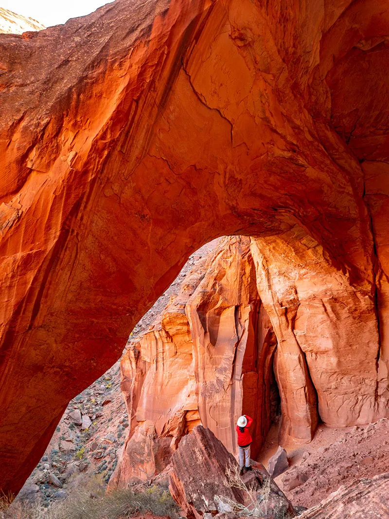
However, we were intent on exploring Wrather Canyon. At least was impossible to miss. Around 11:30am, we got to the entrance of the canyon, a small stream of clear water emanating from it. About a mile into the canyon, there's the eponymous Wrather Arch, a sandstone arch about 180' wide. Over the years, the canyon got a bit overused, so camping is now prohibited in there. Supposedly, there are some spots a bit downriver, on the other side.
We walked up into the canyon. First, there's a nice meadowish area with dozens of obvious campsites. It's easy to see why this was popular. We were hungry and had no idea how the sun and water situation will be further up ahead, so just past the meadow, we stopped for lunch. It was shady, thus cold, but at least there was fresh water.
From there, the canyon gets narrower, with the creek still flowing, lush green grass on its banks and lots of trees. In a few places, the going got tough, we had to climb over and under tree trunks, up and down steep embankments to proceed. It was unbelievably peaceful and beautiful. At some point we decided to ditch the packs and continue with some water and the photo gear. Then we wished we came all this way before lunch as we found an amazing spot in full sunshine with great seating on smooth rocks. Well, it's what it is.
The last part of the canyon is a steep, but very manageable climb on somewhat loose, sandy terrain. The view of Mather Arch is from the top of the rise. The arch itself is pretty and impressive, but we both agreed that the side canyon itself was even more interesting and would have been worth the effort even without the arch. Also, this was the first time we truly managed to warm up during walking.
There was no time for much delay, we made our way back down the hillside, through the bushes and trees, picking up our packs long the way, then to the Paria River, plunging our warmed feet in the ice-cold water again. It was 2pm and the idea was to make it to Last Reliable Spring, another 5 miles, before it got dark. We filled up on water again and got going.
The next spring on the map, Shower Spring, completely eluded us. Granted, we didn't need it, so we didn't look for it too hard.
For the next two miles or so, the canyon was still "marshy" as before, with the trail alternating between the river and some dry parts cutting off bends. Cliffs still towering on both sides, of course, featuring more alcoves now and then. Gorgeous.
Then the canyon changed again, getting narrower again with more rocky terrain. This whole new section brought new sights and wonders with all sorts of impossible-seeming boulders and cliffs shaped by water. The river was much more constrained here, flowing faster and "wilder", in narrower channels.
Like before, it was slow going. We just could keep any decent pace. There was the conflicting sense to hurry a bit to beat sundown, but then how can you walk past all those unbelievable visuals and not stop to appreciate them?
It was dusk by the time we were approaching Last Reliable Spring. According to the map, there's a large camping area river right with the spring river left. The camp was obvious enough. We crossed the river and started looking for the spring. There was a tiny seep with water dripping down some plants into a tiny bowl, but I was sure this can't be it, so we kept going. Another two hundred yards down I realized we're past the indicated point, and the seep must be it. It will have to make do.
Briefly we considered going back to the large campsite, but then we found a very nice spot on the same side as the spring. This meant that for once we can access fresh water without having get our feet wet.
We settled down, dried out feet, Em started unpacking. I went to get water. The "spring" was a small indentation in the rock wall with a small stream of water coming down in two separate braids. They were just a little too far apart to both drip into our pot. I tried putting the mug under one spot and the pot under another, but that risked knocking dirt into them. Ugh. Deep breath, no problem, let's find some residual patience.
It took a while, but finally, I got enough water for soup. I got that to Em, then returned with the mug to fill the other containers. Then I even left the shower for a while so it fills up somewhat.
It was already pitch dark by then, but we were having a great time. It was cold, but at least the wind died off almost completely. Eating soup and then proper dinner made our mood even better. We kept talking about the day, all the different things we saw: the wider canyon first, then Wrather, then the rocky river, now this stretch of canyon with our little campsite tucked away among the boulders.
I took some more photos of the Milky Way, then we went to bed early, preparing for the long day that would follow. We were about 13 miles from Lee's Ferry and after getting there, we planned on driving to Kingman, AZ.
Day 4 – Last Reliable Spring to Lee's Ferry
We got up at 6am, still dark outside. It was little bit less cold than the previous morning, but of course the wet boots were frozen. We lost of lot of time with all sorts of little distractions, including making sure we have enough water.
Finally, around 8:30am, I went down to the river, unthawed the boots, and soon we were off. Just as we left the campsite, we encountered four people, coming up the river. They were the first humans we saw since the confluence three days before.
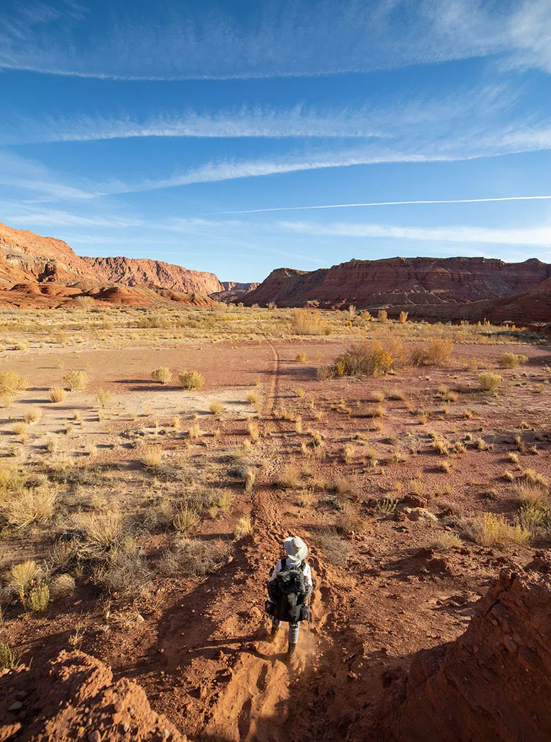
Apparently, they dry-camped somewhat further down. They were river right, desperately trying to cross without getting their shoes wet. They asked where the spring was – we explained; they asked where the camp was – we explained; and then they asked the funniest question of all: "How many more times will we have to cross the river?" "Umm, before you get to the spring?" "No, before we get to Whitehouse Trailhead." Em and I burst out laughing, then tried to patiently enlighten them that basically, from here on, they be walking in the river most of the time. This came as a surprise to them, which we thought strange as this information is first and foremost when you do any research about hking the Paria. Anyway, we left them and continued down, crossing into the next geological feature called the Chinle Formation.
The trail stayed on dry land for a while, at least 2 miles or so. We almost took the neoprene socks off; it's not much fun hiking on long dry stretches in them. However, more water crossings came up, so the decision to keep them on turned out to be correct. Another long dry stretch followed, with steep stretches, taking us as much as 200' above the river's level, then back down again. It was rocky, sandy, somewhat annoying and undeniably gorgeous.
The canyon kept getting wide and wider. The sun got high enough to hit us around 10am. For the first time on the trip, we applied sunscreen. We knew there no shade from here to Lee's Ferry. I'm not surprised many people call this stretch "the Oven" or "Hell" or "Mordor". It's a long, hard slog, but still very beautiful in its own right. In the far far distance, the general vicinity of Lee's Ferry came into view.
Lunch was on a group of nice big boulders, broken up almost like basalt columns, but larger and not as regular in shape.
We kept walking and walking. Then walked some more. The canyon is miles wide here, with the river meandering lazily in the middle. Several more crossings were necessary, almost none doable with dry feet.
This stretch felt way longer than it really is and despite all our efforts (and including a snack break), it was 3:45pm by the time we got to the signpost of the wilderness boundary and the trail log. The logbook itself was in horrible shape, unmaintained for months and months. The pages were all chock full, it was impossible to sign it properly. Well, I guess it's another small sign of budget cuts.
Finally, we approached Lonely Dell Ranch. First up is the old pump station where they tried to get water form the river. Those type of pumps only work when the river runs clear, which is – well, almost never. Then there's the humbling sight of the pioneer cemetery, where about 20 settlers are buried. Some are children, most of them died from diphtheria.
The old ranch proper begins just past that. We stopped to take a quick look. Some old buildings are preserved, some are kept as historical buildings, some are a bit modernized as part of the education center. There's a nice picnic area, too. Several well-done panels give you a history of the place.
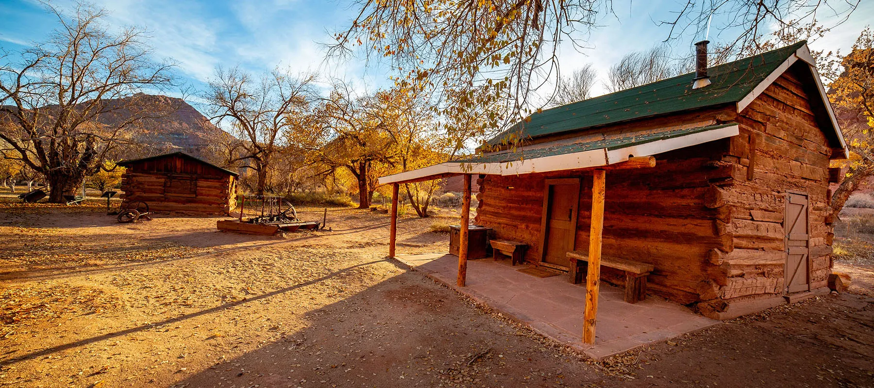
The orchard on the east side still has a few hundred fruit trees and there's a sign saying that you're welcome to come and take fresh fruit for yourself when they're ripe. This time, nothing was on them, of course.
There's a small daytime parking lot just outside the ranch. From here, our car was less than 1/4 mile as the bee flies, but the river and a thicket lay between. Going around on the road would be almost a mile.
We decided to climb down to the river, cross it one last time, then bushwhack to the car. It worked great, the thicket had a few use trails, all leading to the overnight parking lot.
At 4:30pm, we walked up to the car, the adventure over. We quickly drove to Lee's Ferry's daytime lot so we can use the proper restroom, wash up a bit, throw away the wag bags, eat, etc. A river party was getting ready to leave down the Colorado – we longingly looked at them, but it was time to go home.
That evening we drove back to Kingman, then next morning, after a quick stop in Oatman, back to L.A.
Outro
This double trip came together surprisingly well, especially given the short prep phase. If we'll do the Paria River again, we'll definitely take different shoes, something sturdy, but with good drainage. Alternatively, if the river is just a bit less high, I think it would be possible to do this with knee-high Neos overshoes, this keeping the feet dry. We'll see.
Make sure to check out all the pictures in the full gallery.