Intro
After an amazing trip to Mount Langley in 2014, we kept talking about repeating the adventure. It’s a summit with a very unassuming last approach, but with impossibly scenic views and a dramatic drop-off on the far side.
Plans were made, plans were cancelled. Our usual weeklong trek in August, this time to the Emigrant Wilderness, turned out great, but it left us itching for more. Weather and work schedule prevented us for going backpacking for over a month (gasp!). Finally, during the penultimate weekend of September, everything cooperated and it looked like we can get away.
We came up with a plan for a quick trip: leave Friday evening after work, pick up the permit from the “late box” at Lone Pine, sleep in the car at Horseshoe Meadows, then do a one-nighter via Soldier Lakes and the cross-country route up to the main Langley trail. We always wanted to explore the Soldier Lakes area anyway, and this seemed like a perfect opportunity.
Day 0 – L.A. to Horseshoe Meadows
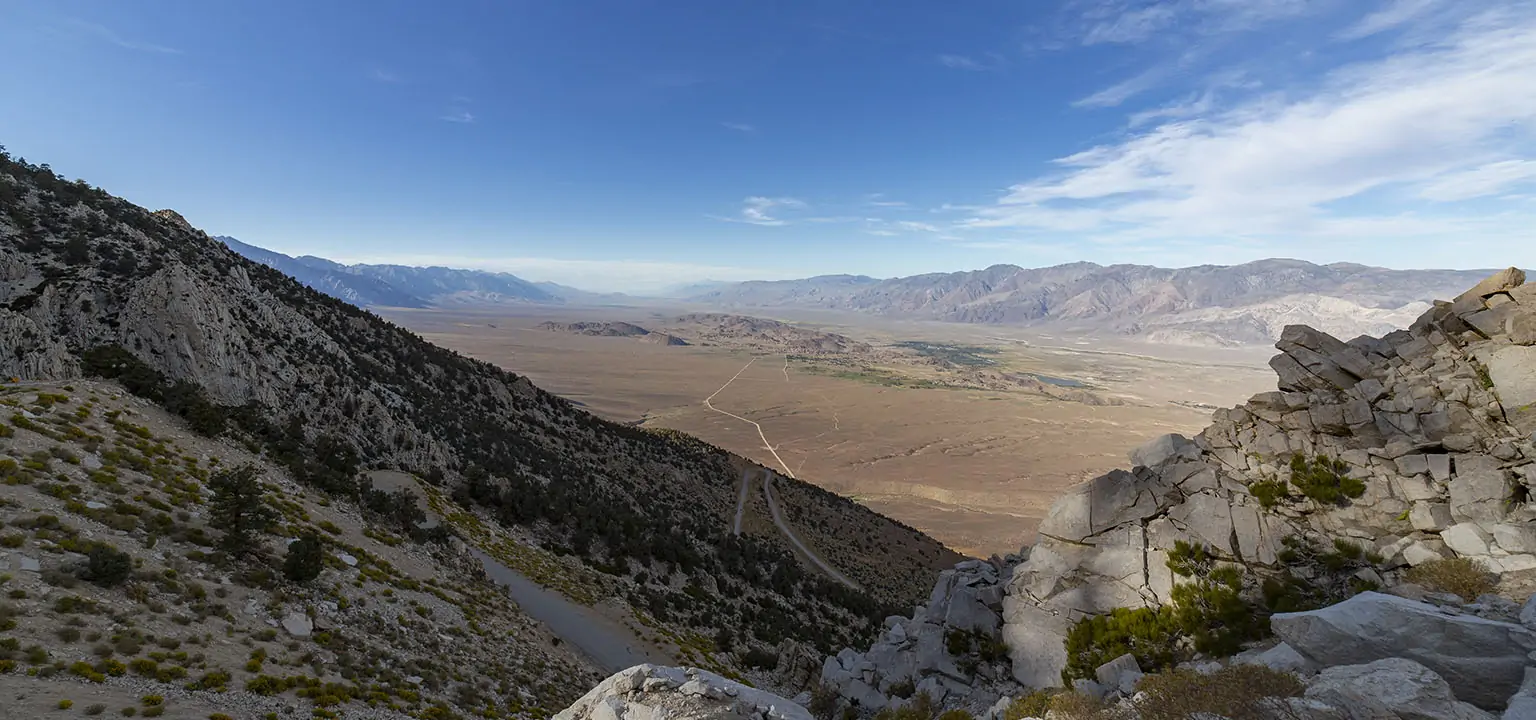
After a hard day’s work, we finally left L.A. in medium-heavy traffic around 6pm and drove to Lone Pine. The rules keep changing, but depending on your destination, it’s possible to call the visitor center in Lone Pine (mouthfull official name: Eastern Sierra Interagency Visitor Center) and arrange for your permit to be put in the after-hours box so you can pick it up after they close.
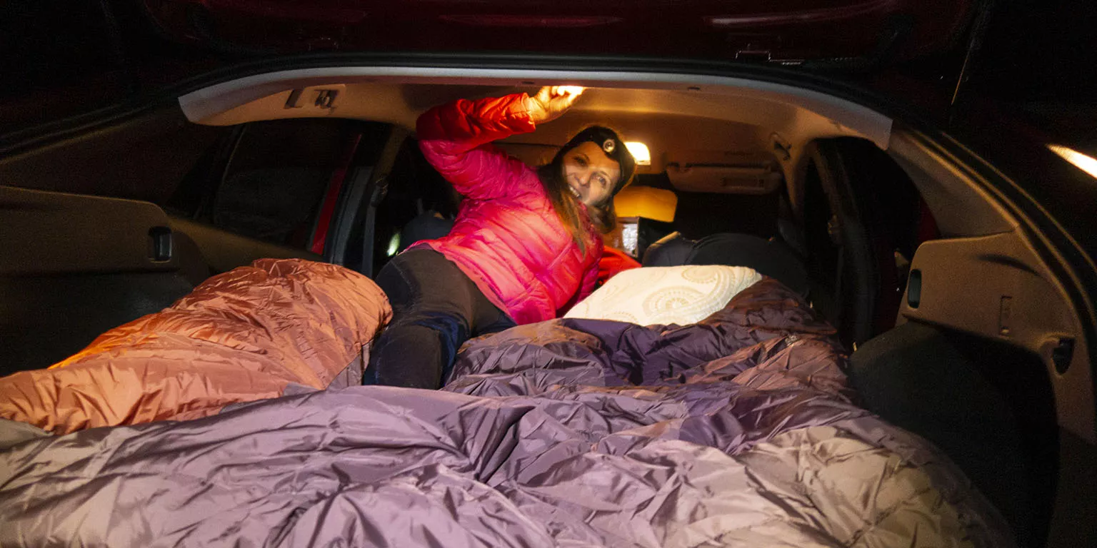
This is what we did, then drove the 25-ish uphill miles to Horseshoe Meadows, arriving there past 10pm. There were a few other cars in the lower lot, but it wasn’t very crowded. We chose a level, somewhat secluded spot and made the bed in the back. This was the first time we ever slept in this car, but the setup has been tried and rehearsed before, so it wasn’t too bad. Nonetheless, by the time as actually went to sleep, it was way past 11pm. The night was chilly, a few degrees below freezing, but we were toasty and comfortable.
Day 1 – Horseshoe Meadows to Upper Soldier Lake
The alarm woke us at 6am to frost everywhere, even the inside windows. Despite us having left some of them open a bit, all the moisture we exhaled couldn’t escape and we started by scraping off the ice from the inside so it doesn’t melt and drip later.
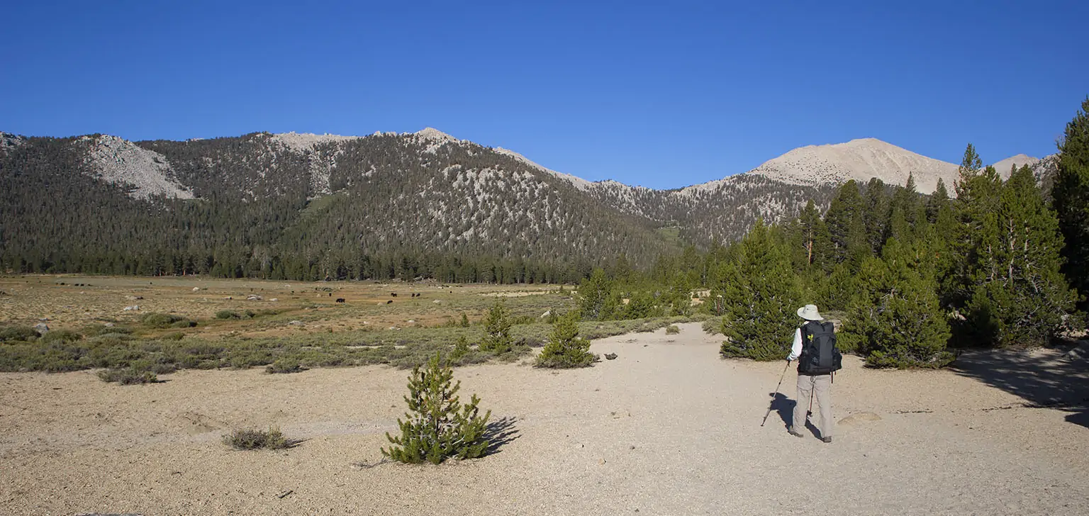
Then we had to eat, ready the packs and secure the car, meaning by the time we left, it was 8am, walking past the humongous, always-gorgeous Horseshoe Meadow and up toward Cottonwood Pass. We love this climb; the trail is well graded and the vista opens up more with every step.
We crested the pass at 10am and sat down for a nice break. As this was a short trip and we had small packs, I decided to take my extra lenses, the telephoto and the wide-angle. I took advantage of them both, taking pictures of the meadow and the pass with the latter and a Clark’s nutcracker (Nucifraga columbiana) with the former. The bird kept retuning to drink from a small puddle in a rock’s depression, giving us a great show. Then a chipmunk showed up, scurrying to and from the den with dried plant matter in its jaw.
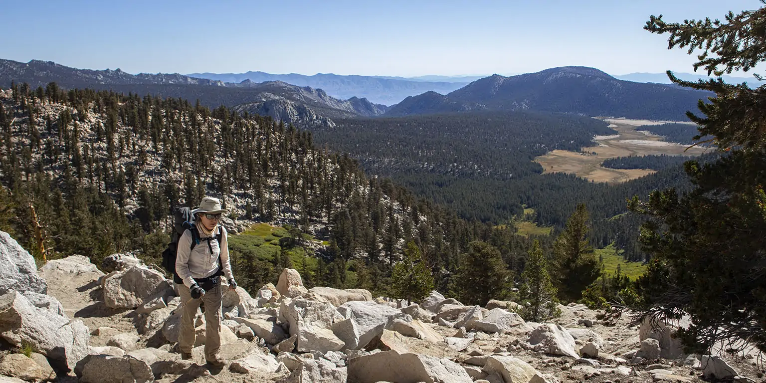
After all this, we continued north on the PCT and not much later, we walked past Chick Spring Lake (this name never fails to amuse us). Just past the outflow, there’s a steep, but short incline, affording great views of the lake on one side and the Sierra’s interior on the other, with Big Whitney Meadow being the closest and most prominent feature.
Past this, the PCT loses a few hundred feet in the next few miles, and there and many little rollercoaster climbs, making it a somewhat frustrating. It was all good and gorgeous, though.
After 12:30pm, we realized it’s late and we haven’t had lunch yet, so we found a nice spot off the trail with flat rocks and sat down to eat. We knew there’s no water on this stretch and we prepared accordingly.
Another bit later, we got to the junction to Siberian Pass (left) and to Rock Creek Trail (right). We went right, leaving the PCT, dropping somewhat to cross a dry, but striking meadow, and then to meet the trail we have treaded many times before. This is where the vegetation turns from dry to wetter, something like alpine-riparian. Turning west (left), we followed this trail for a little bit, but then abandoned it again for the trail to Soldier Lakes. At this junction, the vegetation is a veritable jungle, at least by Sierra standards. Also, there's a sign prohibiting camping, not surprsingly, given the fragile nature of the area and the traffic it sees.
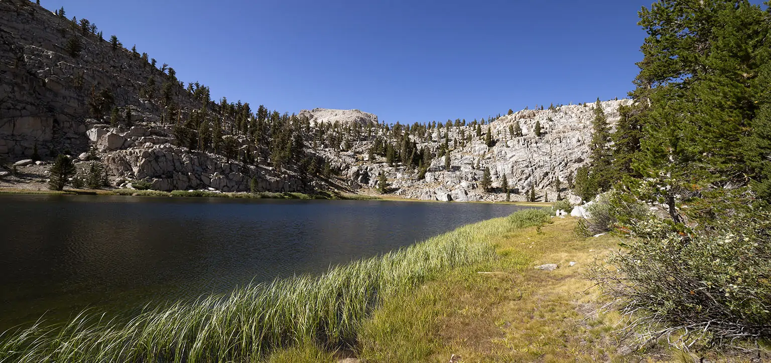
After a few minutes, the trail forks at the bottom of a great little meadow. Soldier Lake’s outflow is at the far end of this, but can’t be seen. A sign saying “Food Storage Box / Soldier Lake” is directing traffic to the right. The trail traverses a tiny hill, essentially circumnavigating a huge rock that borders the lake in the south. After emerging on the other side, part of the lake finally comes into view. The shoreline is surrounded by wide bogs an almost all sides. It was all very eye-pleasing, lush with vegetation, wet from several runoffs. One use trail goes off to the rock, leading to some campsites. We saw a tent pitched, but no humans. The other trail traverses the bog, then peters out on the rocks in the trees.
We took a quick photo- and rest break, then started climbing towards Upper Soldier Lake, which should be about 400’ higher and less than half a mile to the east.
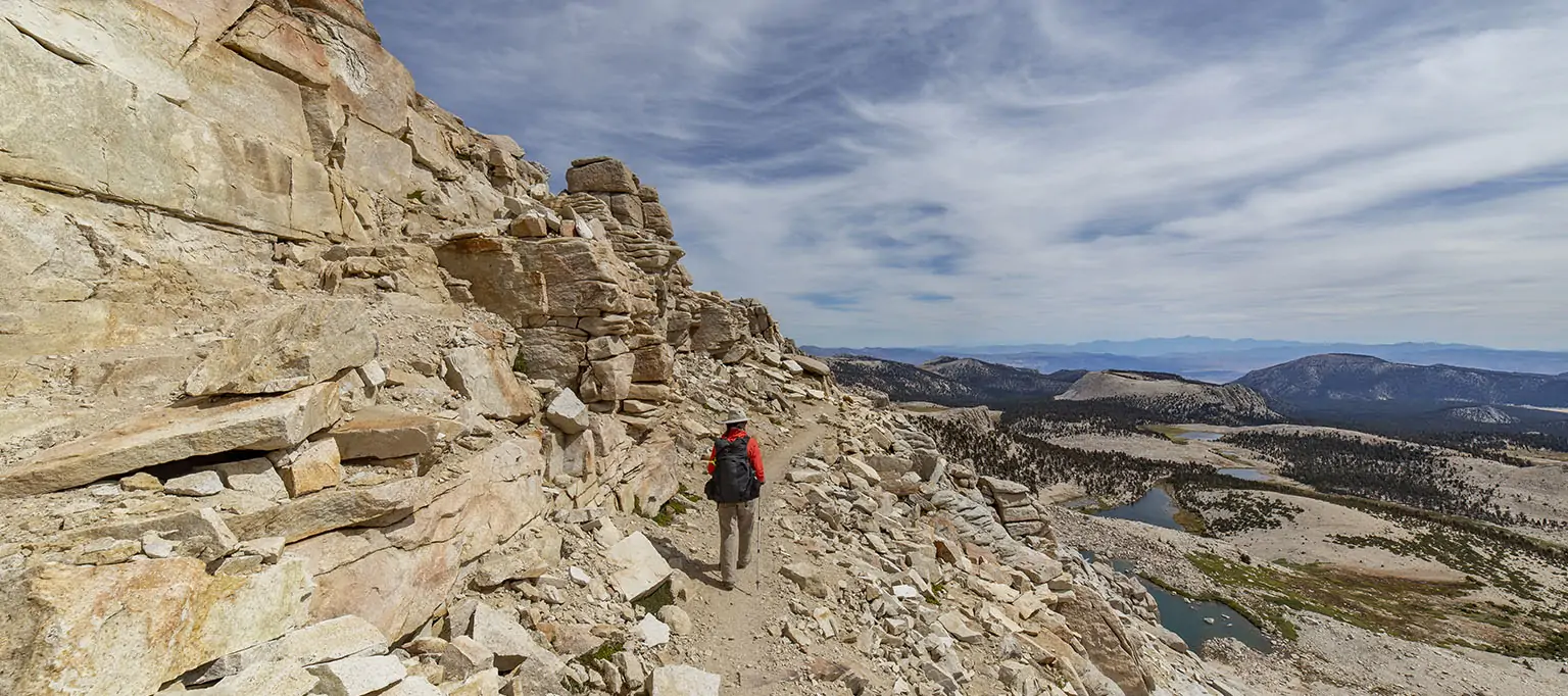
It was steep, but easy going, the only small difficulty we ran into was on the little shelf above lake: it was so thick with all sorts of plant life that we had to stop for a minute and scout a route that didn’t involve getting caught in manzanita bushes (or having to destroy any). This is a gorgeous place, totally serene and feeling very off the beaten path, despite its proximity to several high-traffic areas.
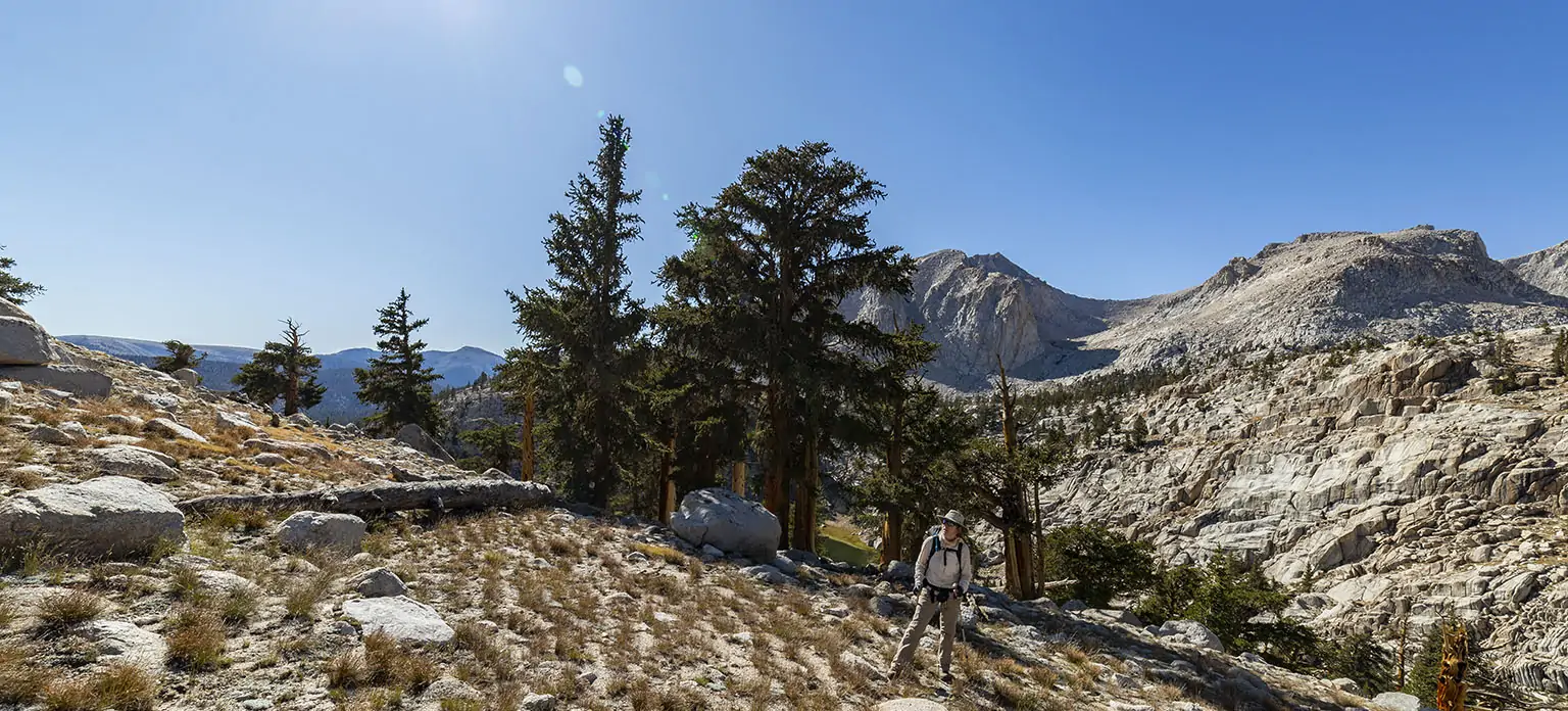
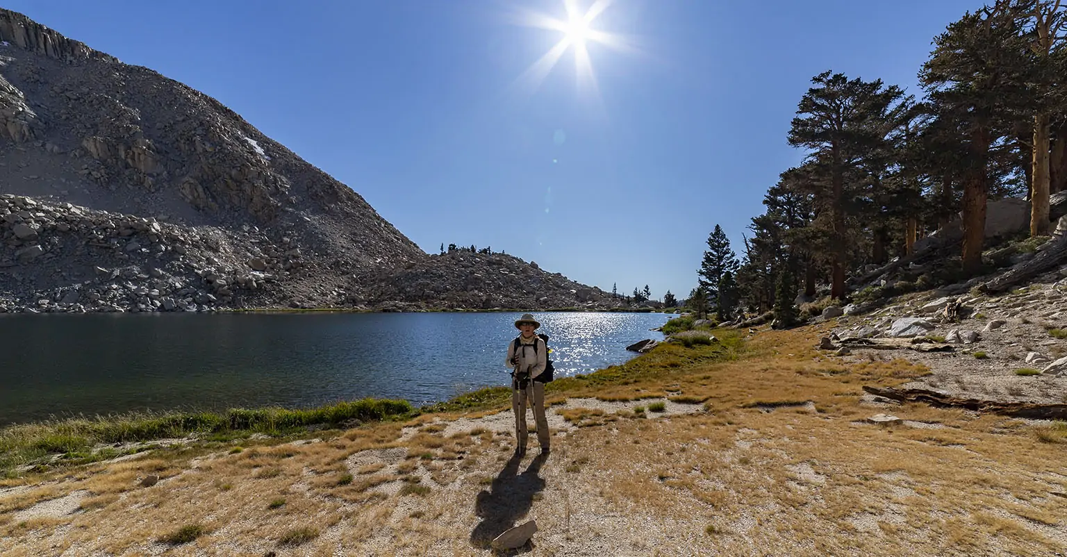
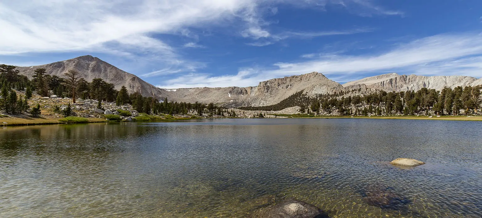
The vegeation soon thinned out, and another short climb later, we emerged at the outflow of Upper Soldier Lake. The southern shore is a steep talus field, but the northern is a bit friendlier with some trees. There was even a faint trail following the waterline.
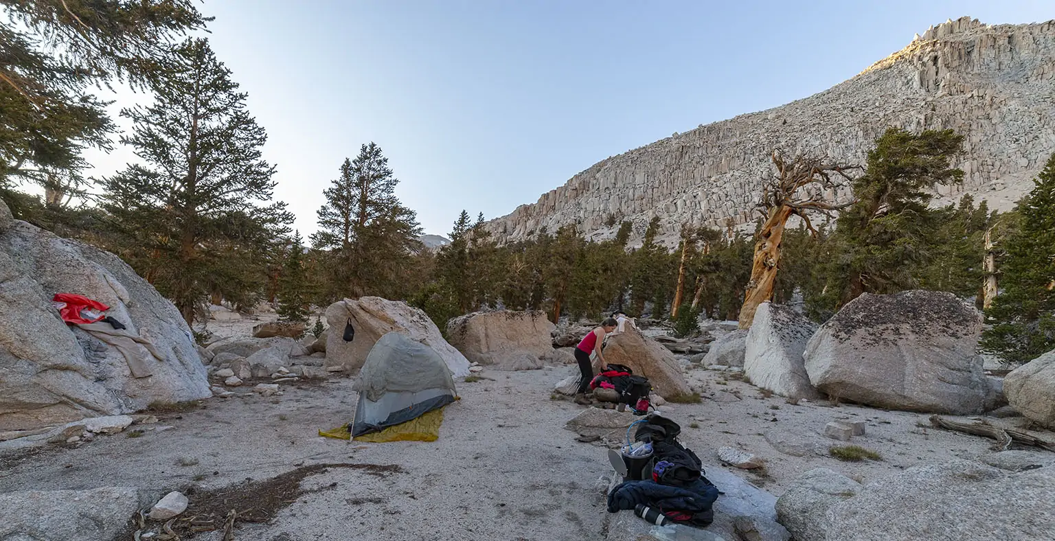
We found a nice spot just far enough from the water. It even had a fire ring. The lake is at about 11,200’, way above the legal fire boundary. The idiots who make a fire at this elevation never cease to perplex me.
First, we tough about settling there, we sat the packs down and relaxed. It was a bit windy, though, so we looked for alternatives and I found a fantastic spot, much better than the first, a few dozen feet higher up and better shielded from the wind. However, we decided not to decide anything yet: the bear canisters came out of the packs, we ate soup, then secured everything and left for a nice walk to preview next day’s route.
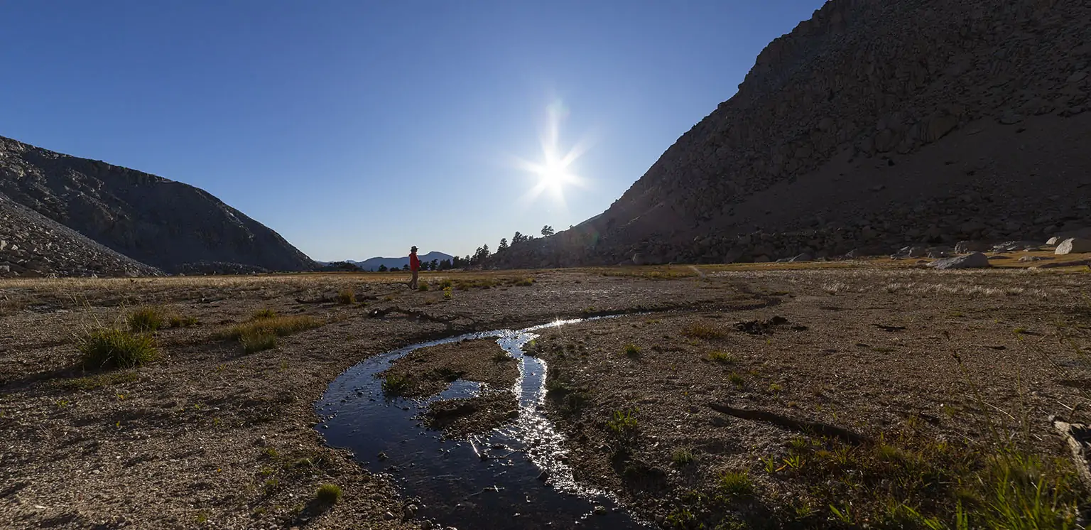
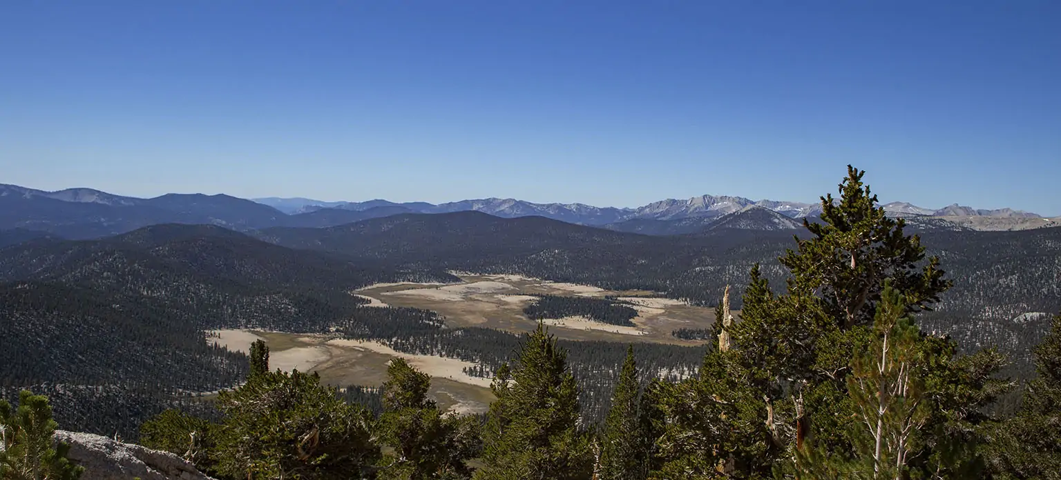
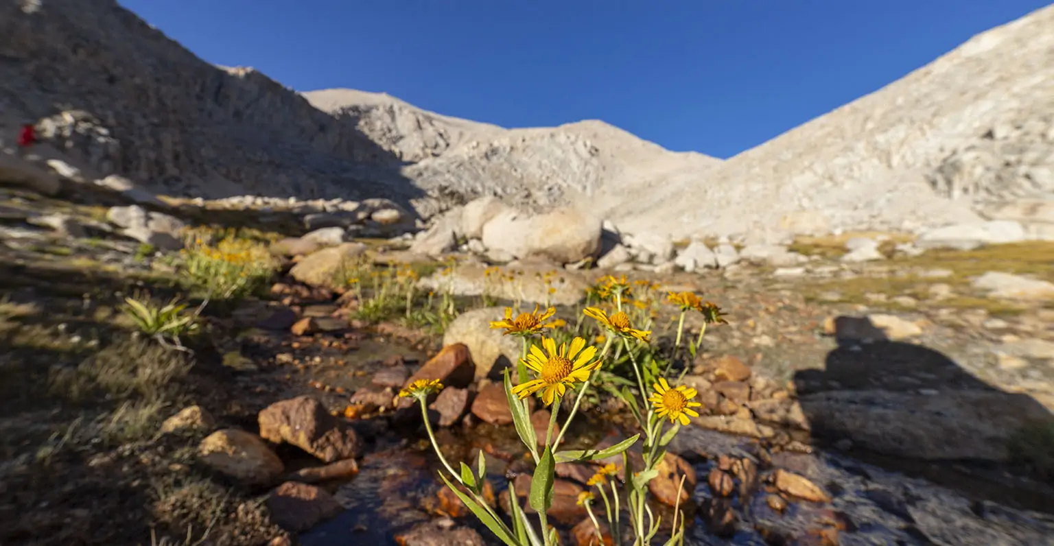
It was a beautiful late afternoon, with the low sun painting everything in warm hues. Just past the east end of Upper Soldier Lake, circa 100’ higher, there’s another small shelf, maybe a quarter mile across. It’s much drier, but there’s a creek running through it with several braids. Despite this being late September, a surprising amount of wildflowers still bloomed by the strands (mostly alpine gold). The higher part of the meadow looked like it could have been a small lake itself, though it must have been a while ago (Google Earth has imagery from 1984 where this place still looks almost the same as now).
We took our time, wandering almost all the way to the end, exploring every which way. Some decent campsites were evident on the side, but it was too windy. We made out where we’ll be climbing the next morning, the route looking obvious and easy.
Back at the lake, the wind was starting to die down, but we finally made the decision to settle at the higher spot. The sun set with the never-gets-old High Sierra light show, the temperature dropping rapidly.
After an early dinner, we tried to get to bed quickly, and unusually for us, we were tucked away by 8pm. There was good reason, as the alarm was set for 4:20 the next morning.
Funny enough, but in line with the warming forecast, the night was a bit less cold than what we experienced at Horseshoe Meadows, much lower in elevation.
Day 2 – Upper Soldier Lake to Mount Langley, then Horseshoe Meadows and back to L.A.
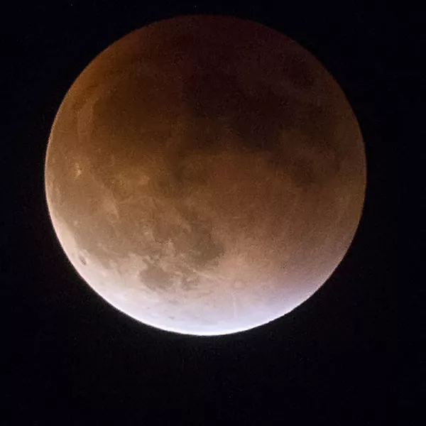
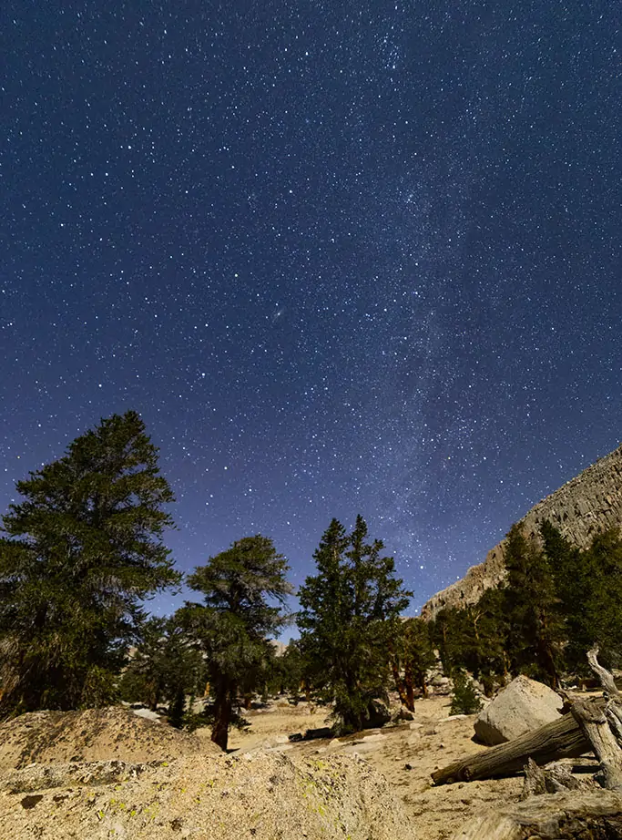
As planned, we woke at 4:20am. Great weather greeted us: no wind, clear skies, temperature about 30°F. First, I set out to take long-exposure pictures. The moon was eight days past full, meaning it still gave plenty of light to illuminate the landscape without ruining the stars.
Then we futzed around in our “normal” slowpoke style with breakfast and packing, and like most of the time, two hours went by before we left. I know, I know…
At least it was light by this time (not that it mattered much), though the sun was not up yet.
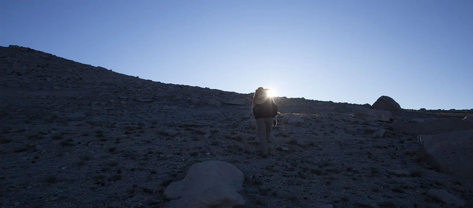
Fifteen minutes later we were yet again at the upper end of the high meadow, starting the ascent. On top of this incline, 1,200’ higher, we should find the Langley trail. The first part was by far the steepest, after that it was a steady uphill slog. There’s even a use trail, most of it easy to follow and in good shape, though a bit sandy. We took it very slow, doing some forced breathing now and then to compensate for the thin air.
As we ascended, Upper Solider Lake started shrinking slowly behind us, and the far away high peaks got their first taste of the day’s sunshine. The flank we were climbing still shielded us, and then a bit before we reached the crest, the light hit us, blazing and blinding, right from the front. Magnificent.
Ten minutes later, we found the trail and turned left (north). The plan was to leave most of the gear and only take the bare minimum to the summit. We stopped by some bigger rocks, extracted the bear canisters and placed them in the shade. Then we put every non-food item from my big pack into Em’s big pack, leaving only some snacks, water and safety items with me. Em took a tiny Sea-to-Summit backpack with water and her extra jacket.
Her big pack went into another shady area with a dated note that we went to the summit and should be back the same day. Don’t forget to do this if you leave gear in the wild.
We tried to hurry, but of course all that organizing took at least ten minutes. At least from there, the weight on our backs was considerably less.
It’s uphill, uphill, not terribly steep, but the ground is somewhat sandy and the thin air saps your energy quicker than usual (this is around 13,000').
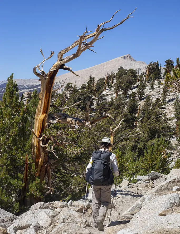
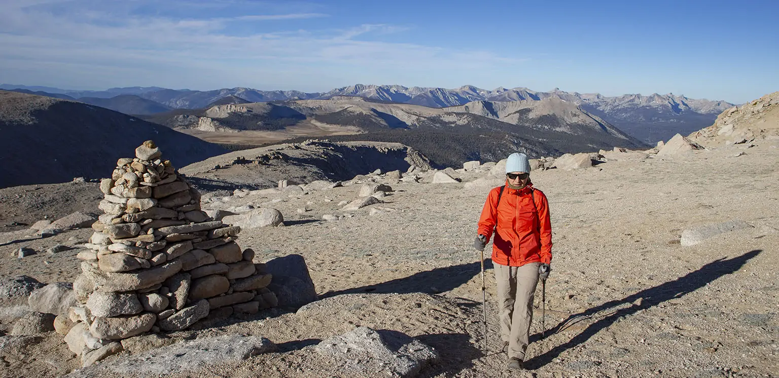
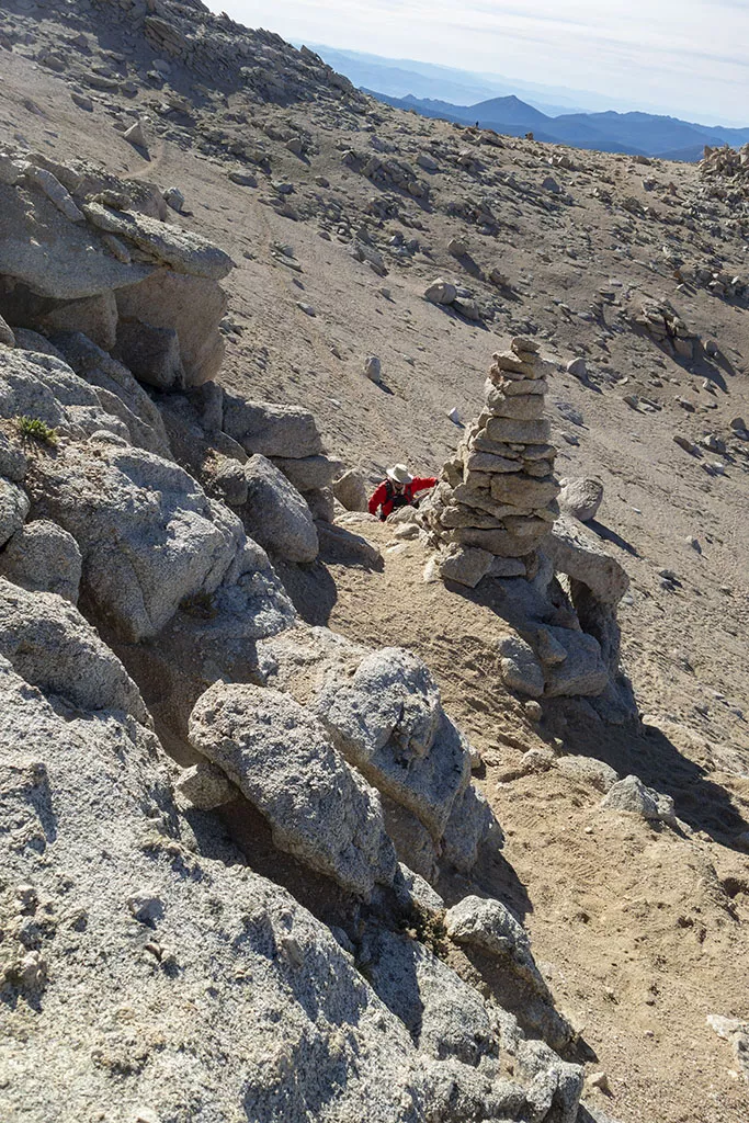
Like the first time, we took the cairned route. The rangers put out some signs advising to follow this “official” route for the best approach, and to mark the way, they constructed several huge cairns, and by that I mean anywhere from 5 to 7 feet in height.
We kept looking for bighorn sheep, as at this exact same place we were treated to a nice show the other time, but we couldn’t see any. A few people came down from the top, having summited earlier in the morning. They reported perfect conditions. By the way, these were the first humans we saw since leaving the PCT the day before.
The route curves away to the west, there’s a very short section where handholds are needed, and then the most annoying part begins: a few hundred vertical feet of climbing on very, very loose soil. It’s not dangerous, there’s no exposure, it’s just mind-numbing and muscle-tiring. At least this time, we knew what to expect and took it even slower than before. The use trail forks in countless ways, there’s not one perfect route, but we stopped for a few seconds every dozen steps, catching our breath and trying to find the best way. The next huge cairn is always visible, so the general direction is a given.
Two more people came down and said nobody else was up there. Great.
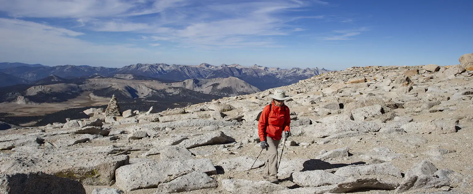
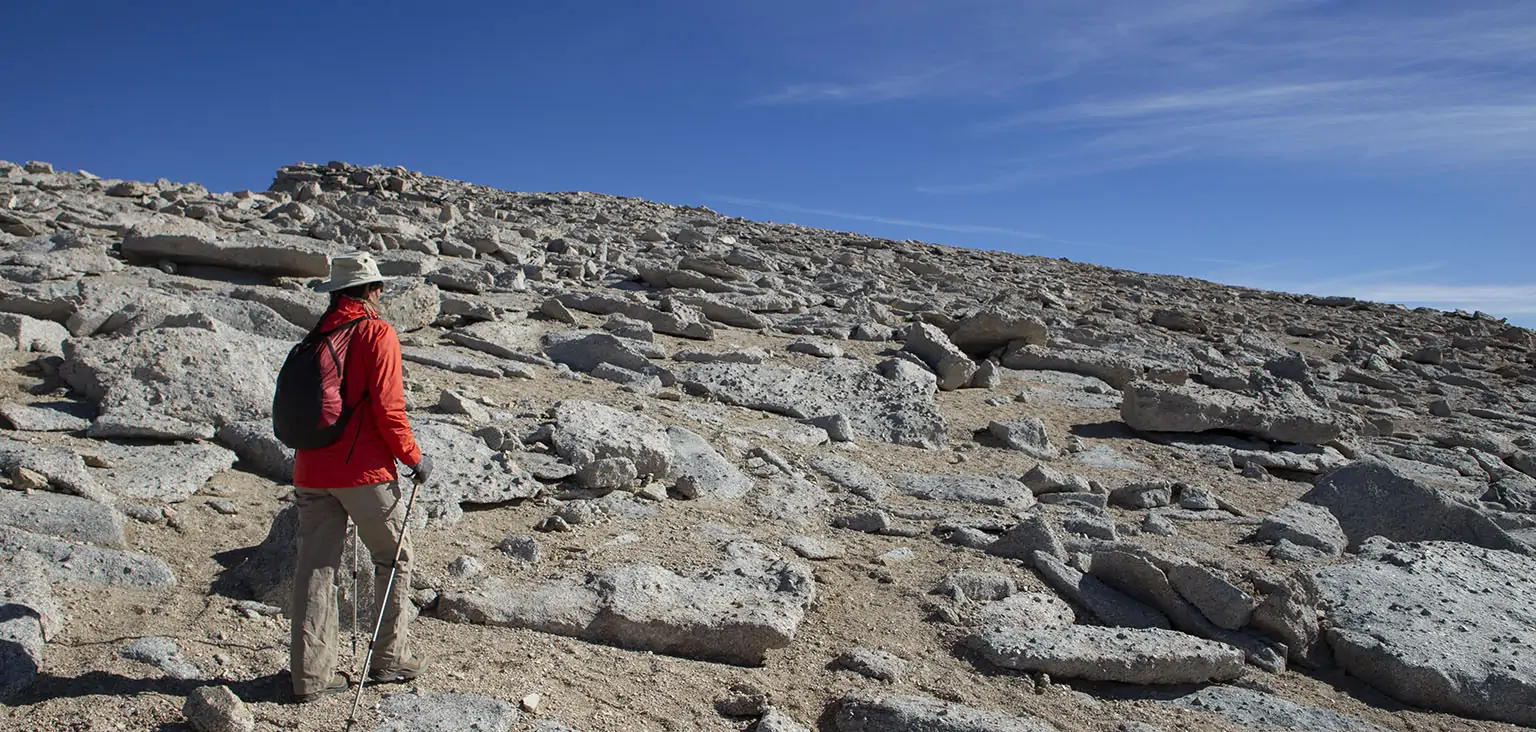
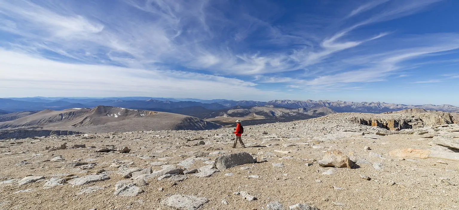
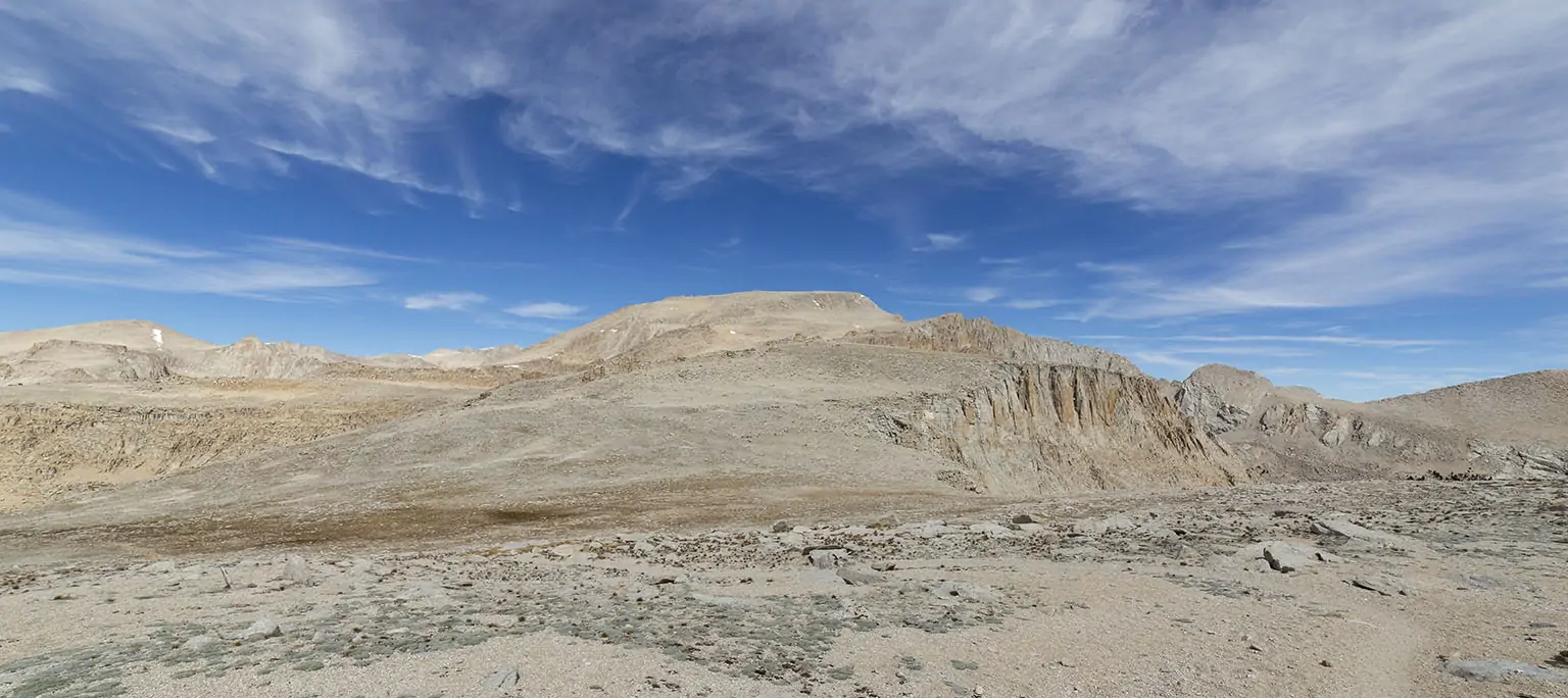
Past the last cairn, the route becomes somewhat less obvious. You’re now on the summit plateau, at cca. 13,800', on a wide, not very steep mound. The elevation gain to the summit is less than 300’, but it’s slow, tough going at that altitude. Also, the summit is not very well visible. My advice would be to keep heading east, not very close to the northern edge (too many diversions), but also not too far to the south where you lose elevation. Then keep looking to your left, watching the northern ridge, and a few hundred feet before it looks like the mountain is ending in front of you (east), you should be able to make out the highest point to your left, on the north. However, this “highest” point is by no means some finger that’s sticking out, just a small mound.
Walk up to it, and if you found the summit, you’ll see that every surrounding point to the east and west is a bit lower. Also, there’s an old ammo can with the register and a wooden sign proclaiming the name and the height: 14,026’.
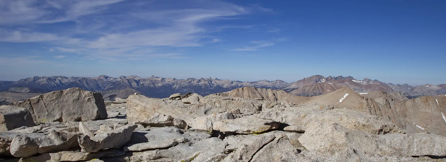
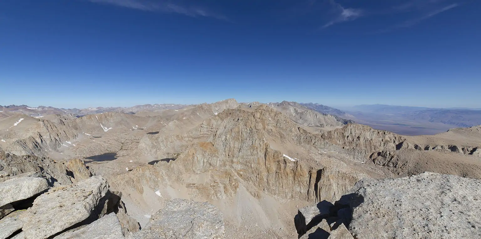
Now for the fun part: right in front of you is one of the most impressive drop-offs in the Sierra, at least one you can “simply” walk up to from the other side. The chasm is breathtakingly deep, seemingly ending all the way down in the valley (in reality, the bottom of the first canyon is around 2,400’ lower).
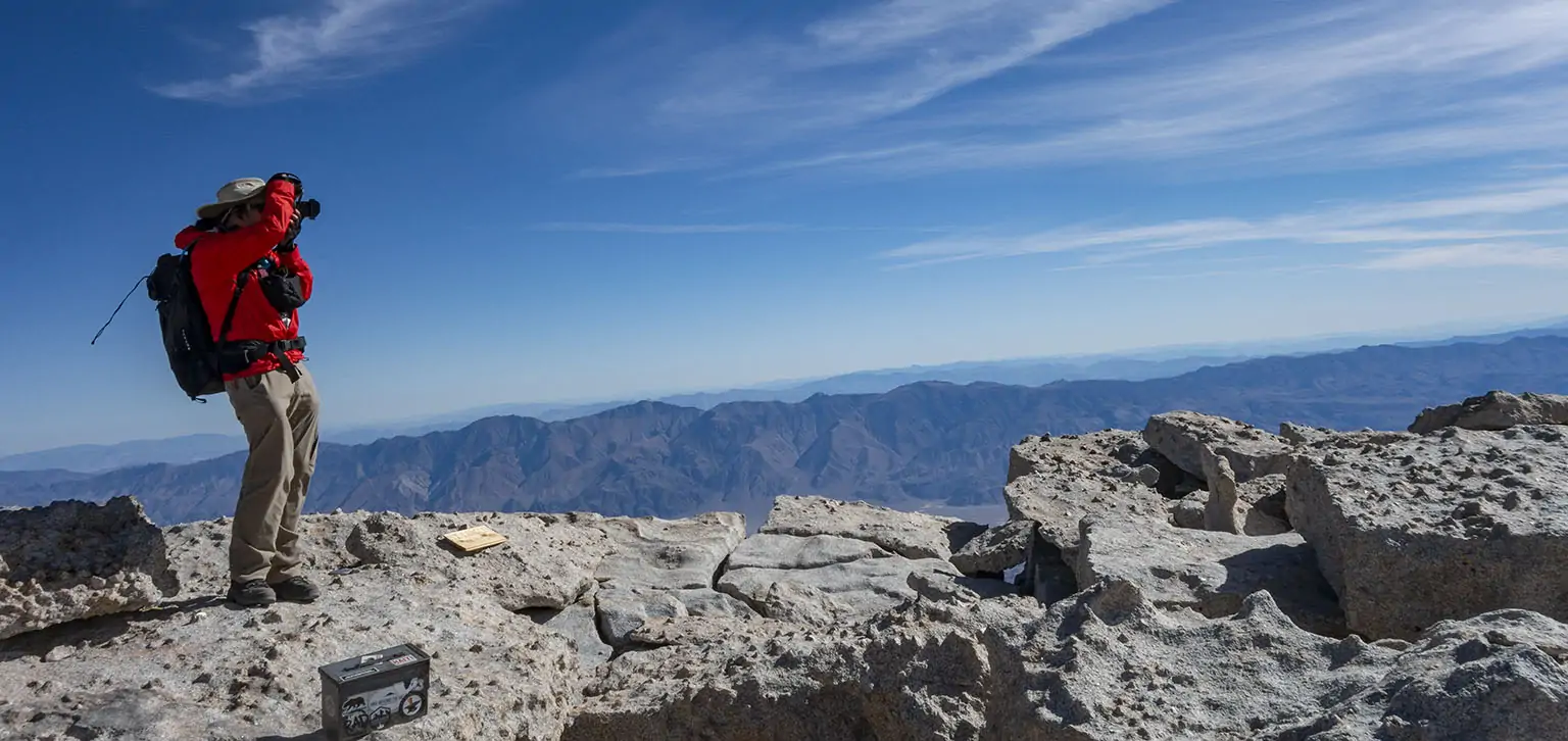
As for the view, well, go see for yourself. If you have binoculars or a long lens, look for the Whitney summit hut, in clear weather it’s easily visible.
We summited a few minutes before 10am. This time, it was crazy windy at the top. I had to be careful when taking pictures because there were a few gusts strong enough to push me over the edge. I was so happy I brought the wide-angle, I hope its photos convey the awesomeness of the place at least by some minor degree.
Em was much more cautious, she didn’t get close to the abyss. She was very happy, though, on the previous trip, she had a much harder time getting up here.
We enjoyed the moment, signed the register, snapped the pictures needed to the snapped, then left. In that wind, we didn’t linger more than ten minutes on the summit.
Unsurprisingly, going down was a hell of a lot easier. From where we left the packs, it took about two hours to summit, but less than an hour to get back. Our biggest concern was marmots chewing the pack straps, but we found everything untouched. We ate lunch, then continued on.
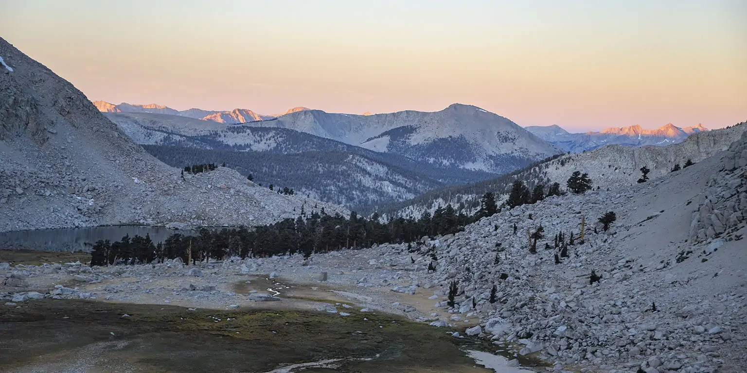
Another 45 minutes later, not much past noon, we were standing on top of New Army Pass, a perennial favorite. We simply love the view from here and then the route via South Fork Lakes and the shortcut to Horseshoe Meadows.
On earlier trips, we took a longer break at Long Lake, but this time, we were well fed and watered, so we just kept moving, abandoning the trail a bit past the lake, veering right, dropping to South Fork Lakes. It was perfect hiking and perfect weather and good spirits. We made great time, by 2pm we picked up the trail at the largest South Fork Lake and pressed on via the shortcut to the main Cottonwood Lakes trail.
In Horseshoe Meadows, this trail ends at the upper parking lot (and backpacker’s campground). As mentioned before, our car was at the lower. There’s no real trail between the two, other than walking the main road, which circles out of the way.
To optimize the distance, we took the horse trail to the equestrian area, then bushwhacked down the hillside to the lower lot. In hindsight, veering right even sooner and bypassing the horse camp to the west would be even easier – that’s what we’ll try next time.
A few minutes past 4pm, we were by the car, savoring the adventure we just had, the prospect of having to work the next day so much less daunting.
Outro
I still agree with many people that this summit is a bit tougher than Whitney, mostly in terms of energy required. The sandy, loose soil is truly tiring, making the last approach harder.
Update: Don’t take my word regarding the permitting, everything is in flux, especially after the 2020 pandemic.
Make sure to check out all the pictures in the full gallery.