Intro
Like most times, unexpected trips can end up being great. Two-in-one unexpected trips even better. Less than two weeks before Thanksgiving 2021, we learned that we won't have to work that entire week. Originally, we planned on going to Sespe Hot Springs Thursday-Saturday, but now we had lots more time. So, what to do?
The weather forecast for the mountains was bad. Joshua Tree, ditto. Grand Canyon, no chance.
All of a sudden, I found myself looking into river kayaking trips, and after a few dead ends ended up at Lake Powell. This entire area is part of the Glen Canyon National Recreation Area. While there are many opportunities here, one stood out: the first 15 river miles below the dam, including the famous Horseshoe Bend, are a prime kayak camping destination, with no whitewater and several campsites along the bank. Permits are not required, but a backhaul service is a must. More about this in a minute.
The only problem was, it didn't make much sense to spend more than one or two nights camping there. As soon as I realized this, I remembered the nearby Paria River. We've been planning on going there for a long time, and just a few months ago we discussed it in detail a friend who's been several times.
Another hour of research later I had a crazy plan to present to Em: drive to Arizona, sleep in a motel, kayak the Colorado, camp for one night, then another night at the motel, then four nights in the Paria River, then another motel night before driving home. She loved the idea; now it was about organizing everything.
First, I called the Glen Canyon NRA visitor center to confirm the camping/kayaking situation: no permits required. Water is flat between the dam and Lee's Ferry. Campsites are first-come. No potable water, but in a pinch, you can filter from the river. Even campfires are allowed, but only in fire rings and you have to bring your own wood.
Then came the issue of backhaul. The river is not accessible at the dam. You need to put it at Lee's Ferry and motor up the river; paddling it would be impossible. There are only class I rapids, no issue for any boat, but the current is still way too strong for any meaningful upriver paddle.
I started calling and calling, but most backhaul service providers were closed for the season, had no trips scheduled for that day, or the boat was full. Finally, Kayak the Colorado had a trip scheduled and space available. They were very friendly and helpful, we hashed out all the details and agreed to meet at the Lee's Ferry launch ramp on Sunday morning. Trout fishing is a big deal there, so I planned on taking some fishing gear and bought a two-day fishing license for Arizona.
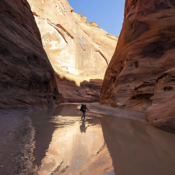
Then I booked a motel room in Marble Canyon for three nights, Saturday to Monday, and another on the way home in Kingman, AZ, for the following Saturday. Also, I took care of the details of the backpacking trip, including the shuttle service and the permit. Read all about this in the Paria River trip report.
After several hours on the phone, everything seemed to be coming together perfectly. The trip had so many different parts, I kept running through them in my mind, trying to find weak points, but other than the weather (forecast looked so-so), nothing popped up. Between the bookings and us actually leaving, we only had six days left, meaning a lot of packing and organizing ensued.
Day 0 – L.A. to Marble Canyon
The first destination was Kanab, Utah, to pick up the permit for the Paria hike.
We left L.A. around 7 in the morning, drove through Las Vegas (ugh), up into Arizona. Here we had to call the cops because a woman, obviously drunk, was driving her Mustang like a lunatic, almost crashing into us and several other people. The stunning Virgin River George came next, with less crazy drivers and unbelievable scenery, taking us into Utah. I did the math and concluded that if everything goes to plan, we'll be crossing the Arizona-Utah border six times on this trip.
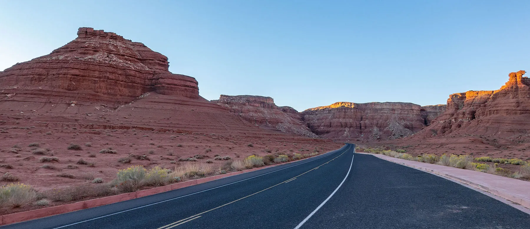
From the town of Hurricane (gotta love the name), we were tempted to take the more scenic road to Kanab through Zion (great memories), but we knew it would add hours to the trip and we had evening plans. This meant taking the faster way, backtracking into Arizona, then briefly back into Utah to Kanab. This road it still scenic, by the way, but not even close to northern route through Zion.
We arrived in Kanab about 5pm local time, found the visitor center, then the bear canisters in the back and picked up our permit and wag bag (all about this in the other trip report).
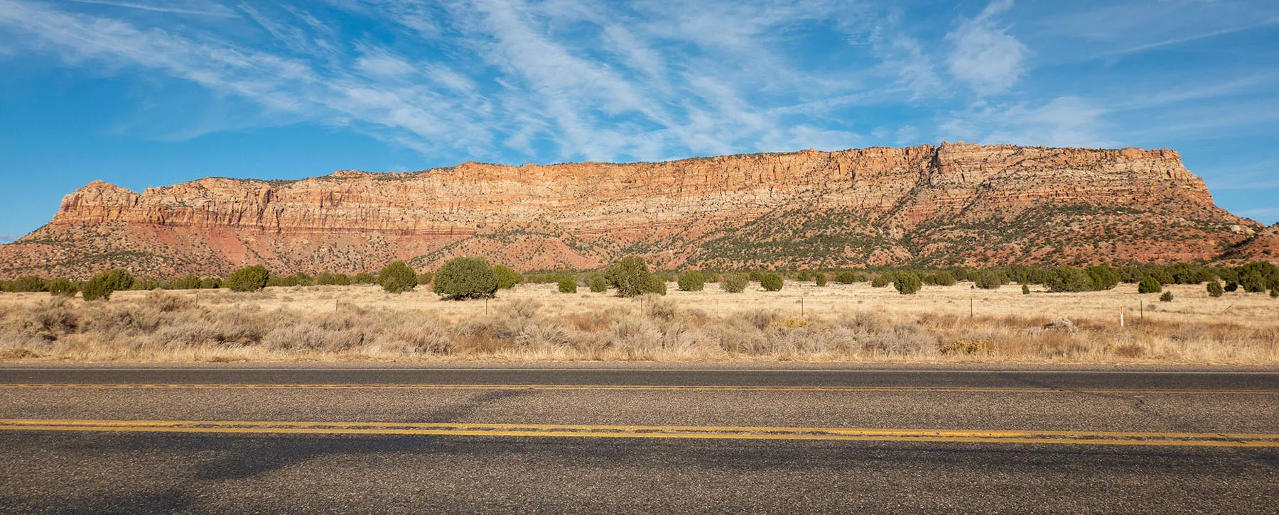
Back to Arizona again, up to the Kaibab Plateau. If you're ever here, make sure to stop at the LeFevre Overlook. It gives you a fantastic overview of the entire Grand Staircase. We got very lucky, the setting sun and the cumulus clouds made it even more dramatic.
Driving past Jacob Lake, we remarked we're only about 40 miles from the Grand Canyon's North Rim and reminisced about our Rim-to-Rim-to-Rim trip there, how fun it was to have had nobody else around. This road from Jacob Lake to the North Rim is closed winters, but it's allowed to ski or snowshoe up to the Grand Canyon. Not sure we'll ever be able to do it, though.
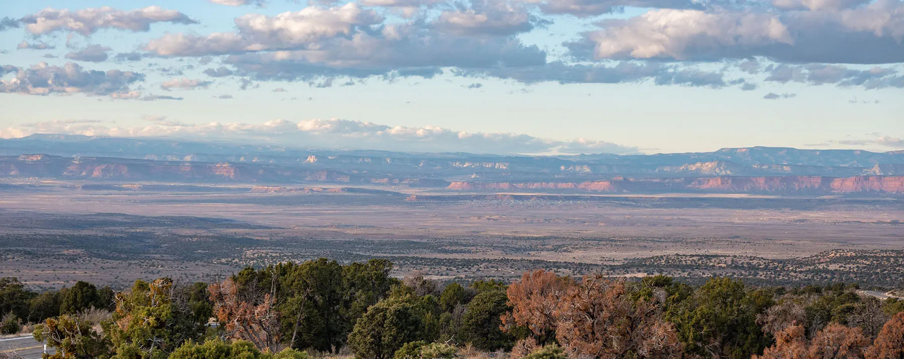
The last stretch before Marble Canyon, dropping down to the Colorado, it also gorgeous. It was just after sunset with all sorts of pinks and blues and purples, very little traffic, and a few clouds placed almost strategically to look great.
We arrived in Marble Canyon at 7pm, not much after darkness fell. This is a tiny desert town where the road crosses the river by the famous Navajo Bridge(s). It's quaint, but featuring a proper small airport, a diner, a lodge, and a post office.
After checking in at the lodge, we walked over to the gas station, in hopes of buying firewood. They were out. We even asked at the motel, trying to see if somebody living nearby could sell us a bundle. No dice. Finally, I called Kayak the Colorado. The owner was very nice, we said he'll bring us a bundle for a nominal fee next morning. Campfire taken a care of.
After eating dinner in our room, we went for a walk. It was a beautiful evening, not very cold, with the almost-full moon blazing in the desert sky.
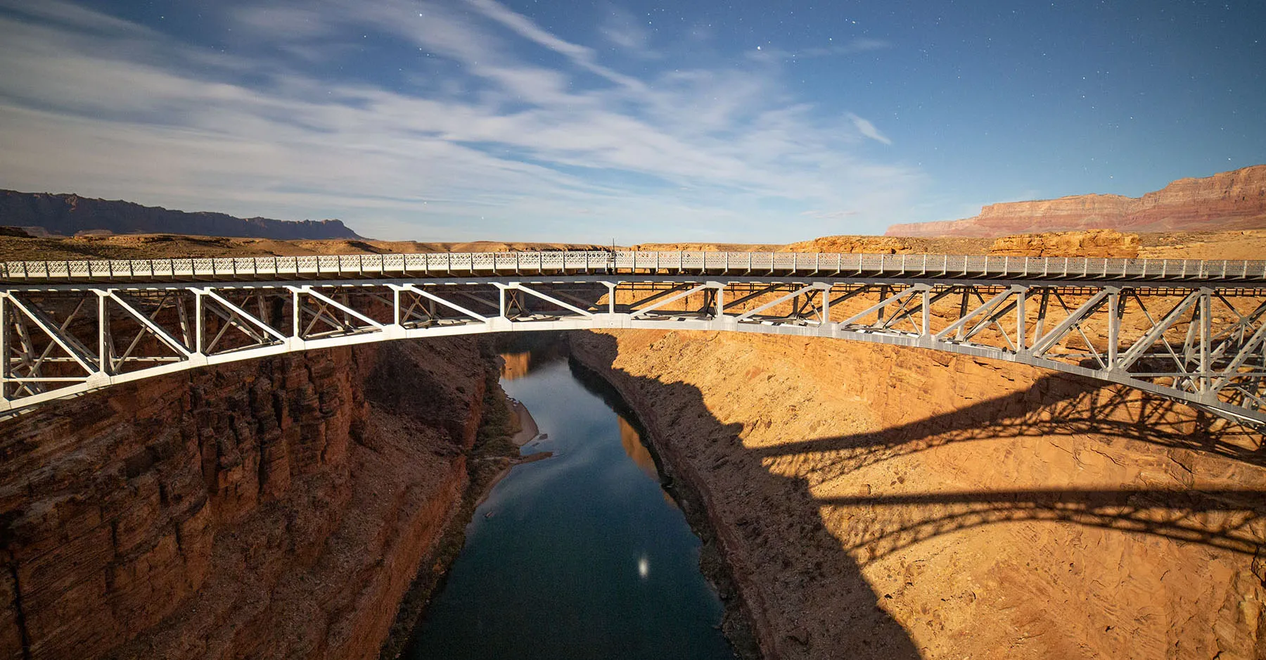
There are two bridges here, spanning the Colorado's gorge almost 500 feet above the river: the older, narrower, completed in 1929, now retired and only open to pedestrians. The newer, wider, in service since 1995, taking care of motorized traffic (more info here).
We walked past the rustic stone visitor center. Luckily, it was completely deserted, so we took our time, taking long exposure moonlight shots of both bridges from the parking lot, then walking onto the pedestrian bridge, marveling at the water below, taking more pictures.
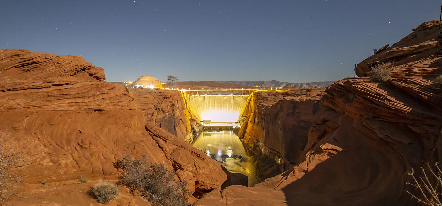
Then I had the crazy idea to drive up to the Horseshoe Bend overlook. This was the only time we could expect to do this, and looking at the bend by moonlight seemed too tempting to ignore. In a straight line, Horseshoe Bend is only about seven miles from Marble Canyon, due northwest. The drive, however, is almost 36 miles one way! The road goes south for about 14 miles to Bitter Springs before turning north to climb the plateau and head towards Page.
Well, we drove, and to our biggest chagrin, the overlook was closed. I was told it's a simple dirt parking lot with a mile-ish walk to the rim. No such thing. Because of the exploding popularity of the place, mostly no-thanks to social media, the place has been so crowded, the city of Page built a paid parking lot and closed the place sunset to sunrise. As far as I know, this happened in 2019 (shoot me an email if I'm wrong). We didn't even consider sneaking in, instead consulted our phone's map, and it showed a Glen Canyon Dam Overlook on the near side of Page. We drove the additional few miles, and this one was open.
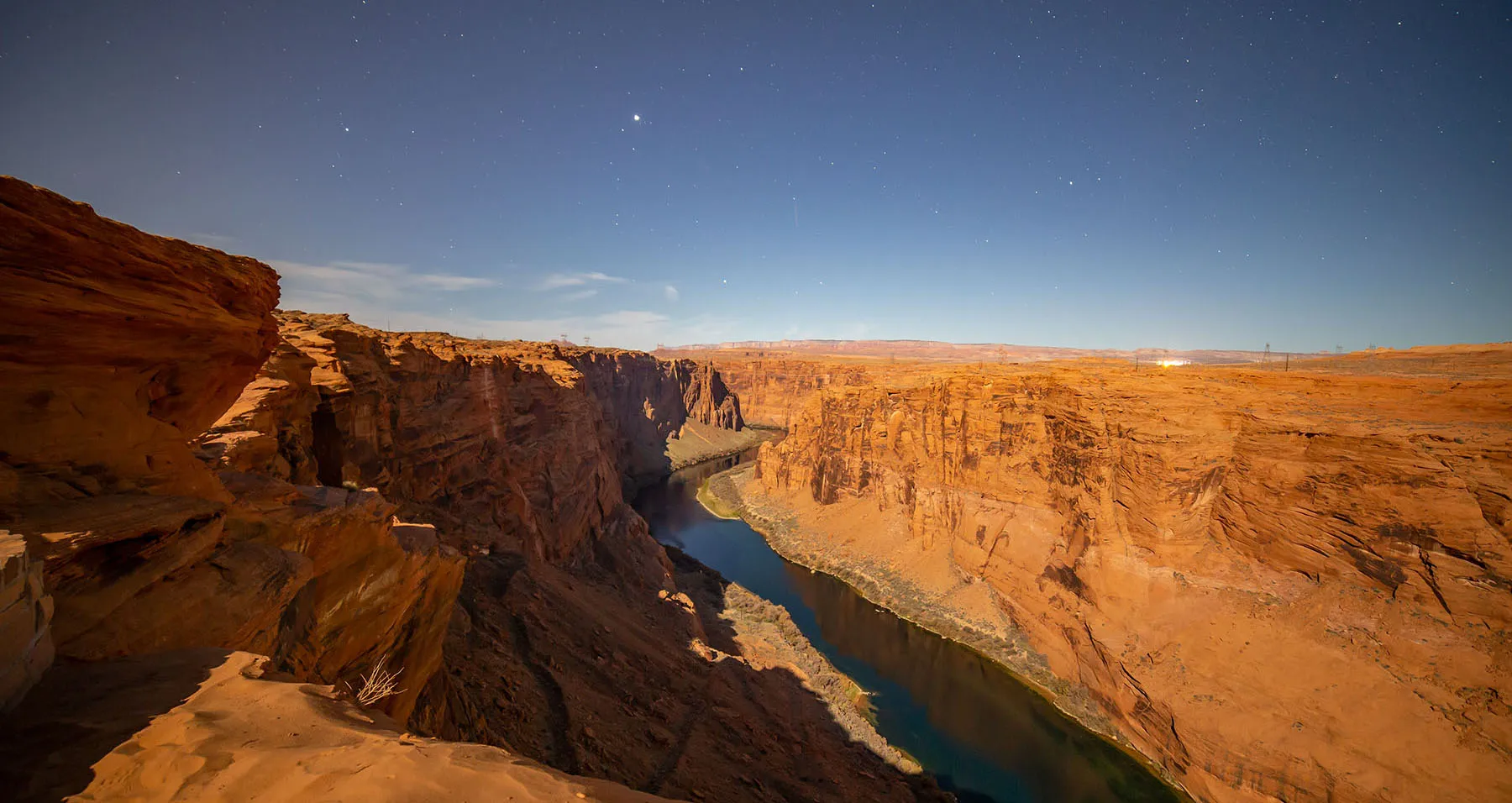
It was worth it, a short hike down some steps took us to a fantastic place, overlooking the dam to the north and parts of the river south. The full moon made everything even more interesting. It was late, but we still stayed for almost half an hour to soak in the view and take some more pictures. It was also great to see some of the river miles we'll be kayaking the next day.
Finally, it was time to drive back to Marble Canyon where we organized our gear quickly, then set the alarm to 6am so we can get ready in time.
Day 1 - Lee's Ferry to Glen Canyon Dam, then 9 Mile Camp at Horseshoe Bend
The boat was supposed to leave at 10am with loading beginning at 9:30. We got up at 6, ate a quick breakfast. Leaving most of the backpacking gear in the motel room, we drove to Lee's Ferry just as the sun rose. It was somewhat cold, just above freezing.
Despite that Lee's Ferry is only a few miles from Marble Canyon, we took a while as we had to stop to take some photos of the desert in the early morning light. Not much later, we drove by the campground and then arrived at the launch ramp. After a quick look-around, we started assembling the kayak.
Lee's Ferry is where a ferry service crossing the Colorado operated between 1873 and 1928. It was hugely important, pretty much the only place to cross the river for 600 miles as this is the only spot where the shore is easily accessible on both sides.
Now there's a campground (about a mile up the road) and launch ramp with a restroom and a pavilion. Overnight parking is not allowed at the launch ramp. For that, there's a large paved lot about a quarter mile back.
Lee's Ferry is the starting point for rafting trips down the Colorado through the Grand Canyon. Only permitted boats are allowed downriver form here, but upriver it's free game.
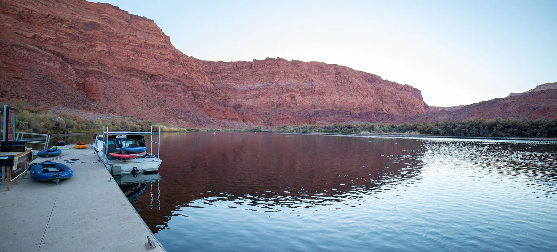
Our kayak was ready, with all the gear lined up next to it. Em stayed, I parked the car and walked back to her. Kayak the Colorado people showed up before 9am and we checked in. They showed us the promised firewood which they loaded onto the boat. Then we took care of the kayak, setting it up on the top rack of the boat.
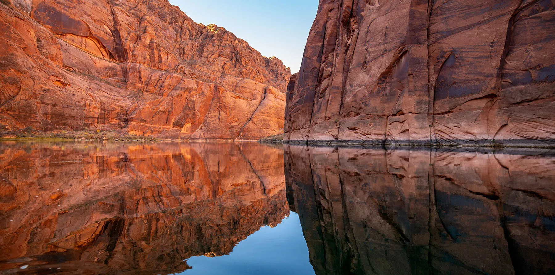
We left a few minutes after 10am, motoring upriver. The canyon at Lee's is wide, but it closes up soon afterward with sheer vertical walls hundreds of feet high.
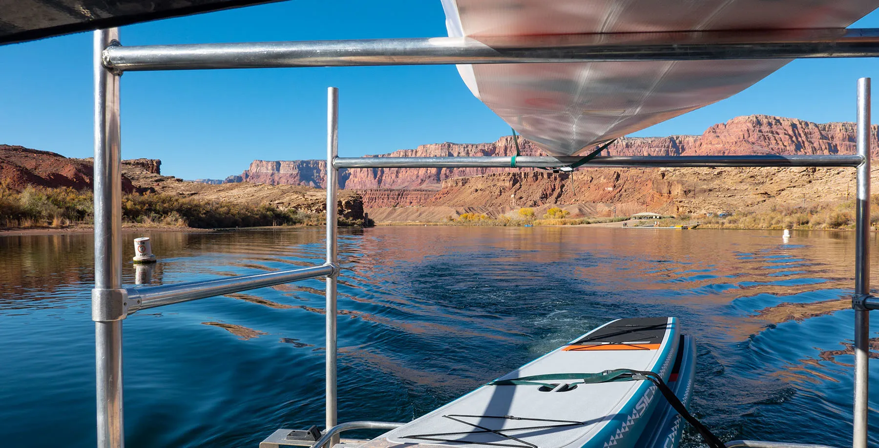
This backhaul also had another party, a father and daughter, plus their huge Great Pyrenees, all going paddleboard camping with two boards and several enormous drybags. I don't know what they had in there, but by volume, it was about four times the size of our gear. They said this was their first such outing and it seemed their gear is far from dialed in, but they were cheerful and optimistic.
Our driver was a very nice and knowledgeable guy, he kept pointing out features on the bank, giving us some detail.
Then there was the issue of dropping off the firewood. All our gear fit in the kayak comfortably, but the firewood would have been a problem. We agreed to drop it off at 9 Mile Camp, right at Horseshoe Bend, our planned spot to spend the night. When we drove past it, the driver pointed out the bush where we'll sort of hide the wood and promised to drop it off on his way back.
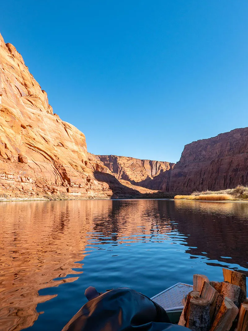
About 40 minutes after leaving Lee's Ferry, we got to the top, a point about half a mile below the dam. The boat hovered in the current for a few moments so we can take pictures, then backtracked a few dozen feet and put out on a sandy beach, perfect for staging. The water was protected from the current by a sandbar a bit upstream, ensuring easy access.
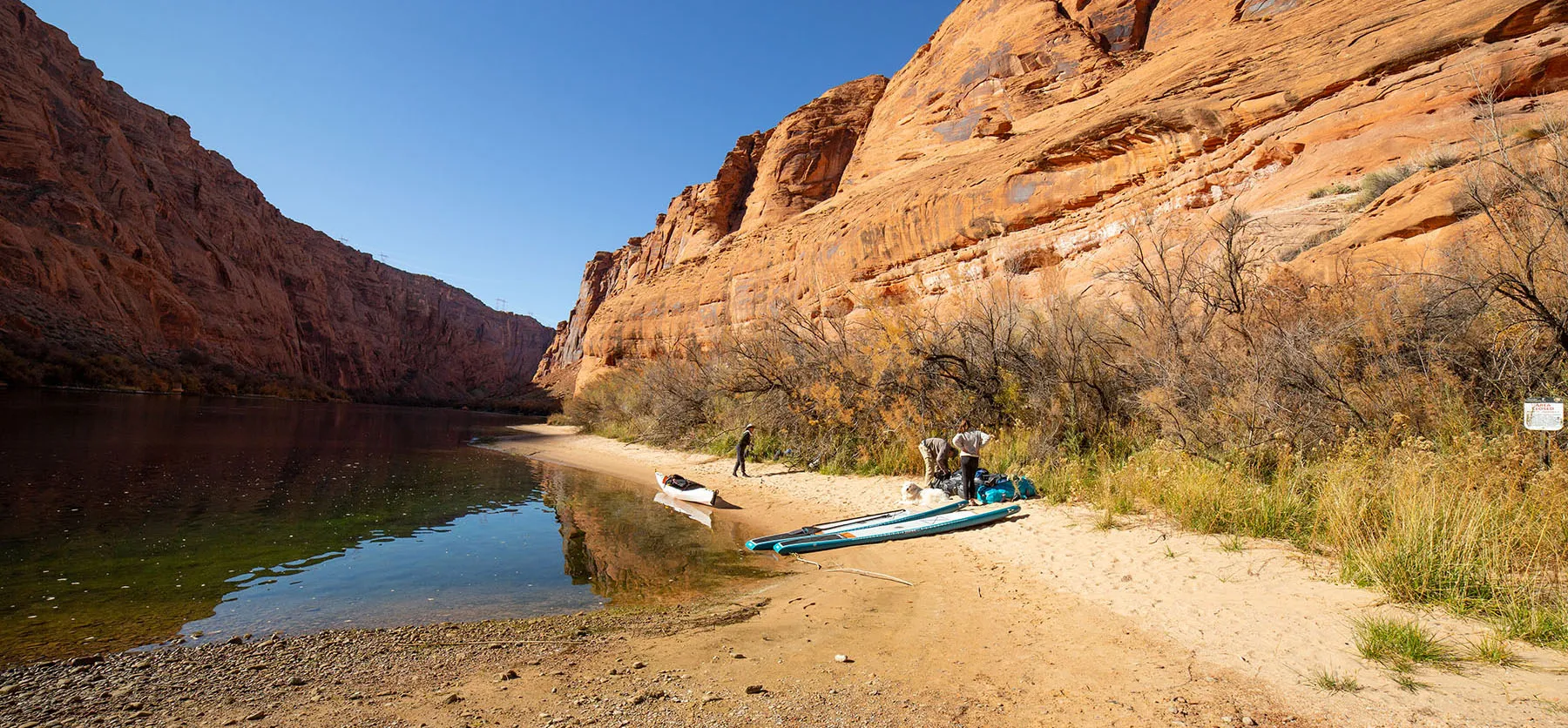
We unloaded, us helping the others with their boards and they helping us with the kayak. The motorboat left just as the sun hit the beach, warming us nicely. We to rig and load the kayak properly, something that took about half an hour. In the meantime, the paddleboarders were also getting ready. When we were leaving, the girl took a short trial run with a drybag and the dog. She looked a bit uncomfortable first, got soon seemed to get the hang of it.
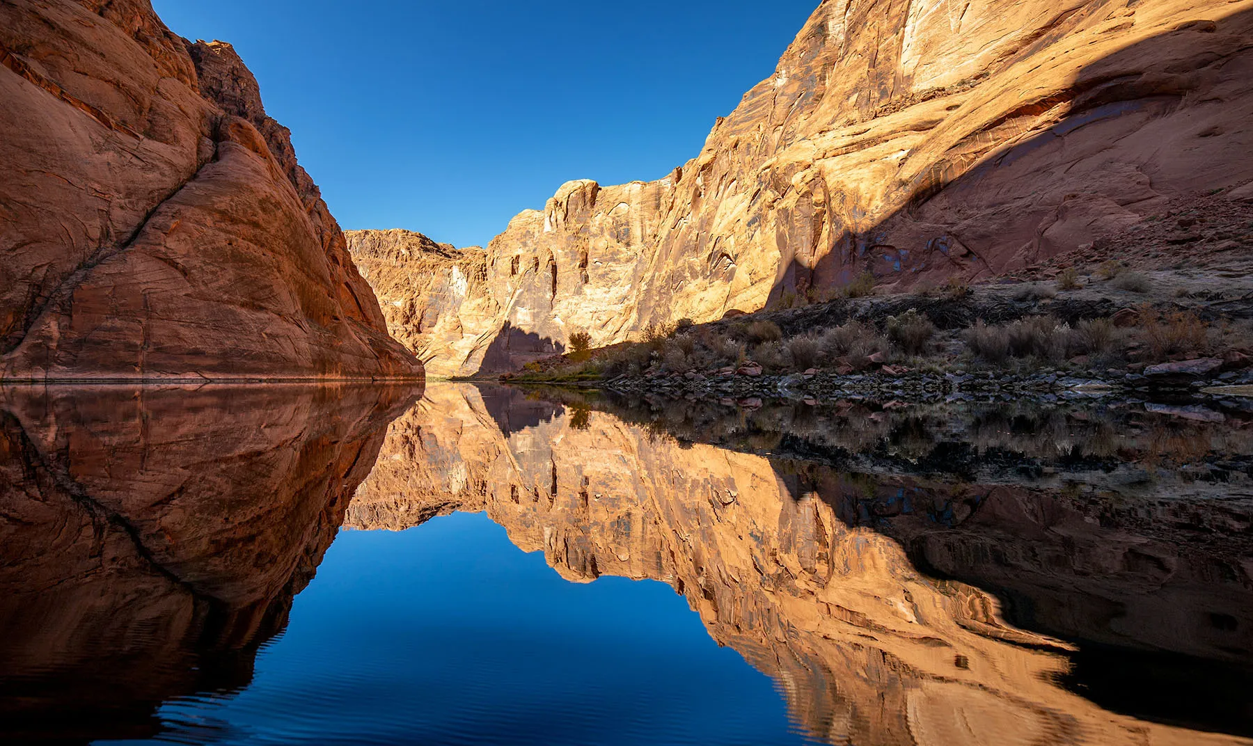
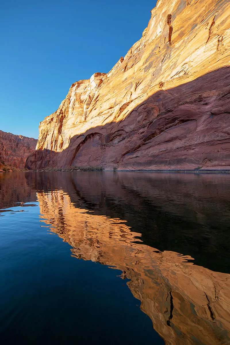
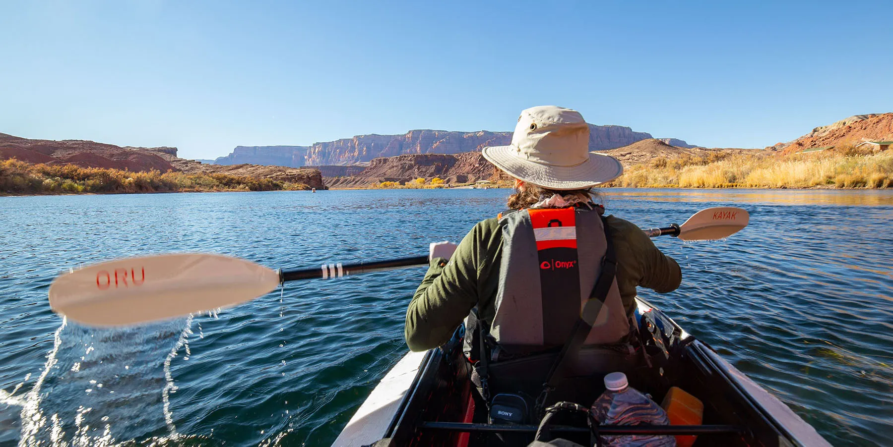
Saying our goodbyes, we got in the kayak. It was less loaded than on our Tomales Bay trip, but it still sat a lower in the water than usual. First, we paddled upstream a bit, staying the protection of the sandbar, to get another glimpse of the dam. Then a few strokes got us out into the current and we started drifting down. It was fantastic. No other boats, silence, gently flowing, crystal-clear water and stunning cliffs on both sides.
The first campsite is Ropes Trail Camp, on the right side. A bright yellow riverboat was out on shore and we could hear somebody playing an acoustic guitar, but couldn't see them. We also spied two people high on the trail. As far as I know, this one of the few places where the shore can be accessed from the top, by a steep and winding trail a few miles long.
The river was gorgeous, with great visibility of the underwater rocks, plants and unbelievable numbers of trout, most of them very nicely sized. I couldn't wait to start fishing.
Lunch was in order. We decided to stop on the left side, a scenic little beach already in the sun. We took over half an hour, eating slowly and enjoying the canyon. We haven't seen another boat on the water yet.
Back on the river we dropped through the first class I rapid. There was nothing dramatic about it, just a short stretch of river where the water is a little bit roiled and the current is obviously stronger. At it's top, the cool thing was how you could see the water actually bending away from you.

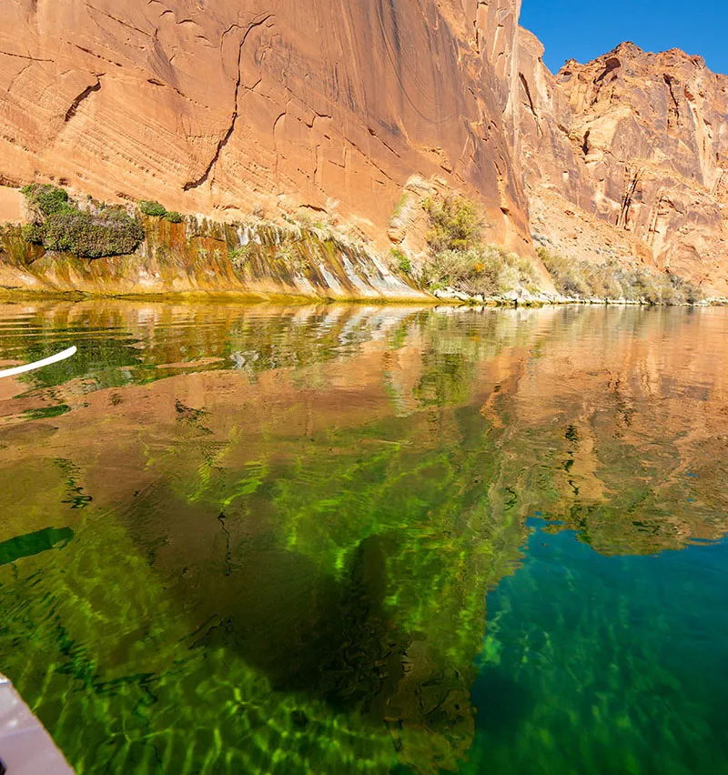
Other than that, we just kept drifting, paddling a little, marveling at the sights above and below. At one point, we drew up close to the canyon wall to see how it plunged into the depths, with countless trout milling about. I desperately wanted to fish, but decided against it as we wanted to take our time and storing any fish would have been an issue. In hindsight, I should have caught a few right there.
Then it was past a research camp on the left shore, a huge tent and lots of equipment visible, but no people in sight. Just downriver on the same side was Ferry Swale Camp, completely deserted.
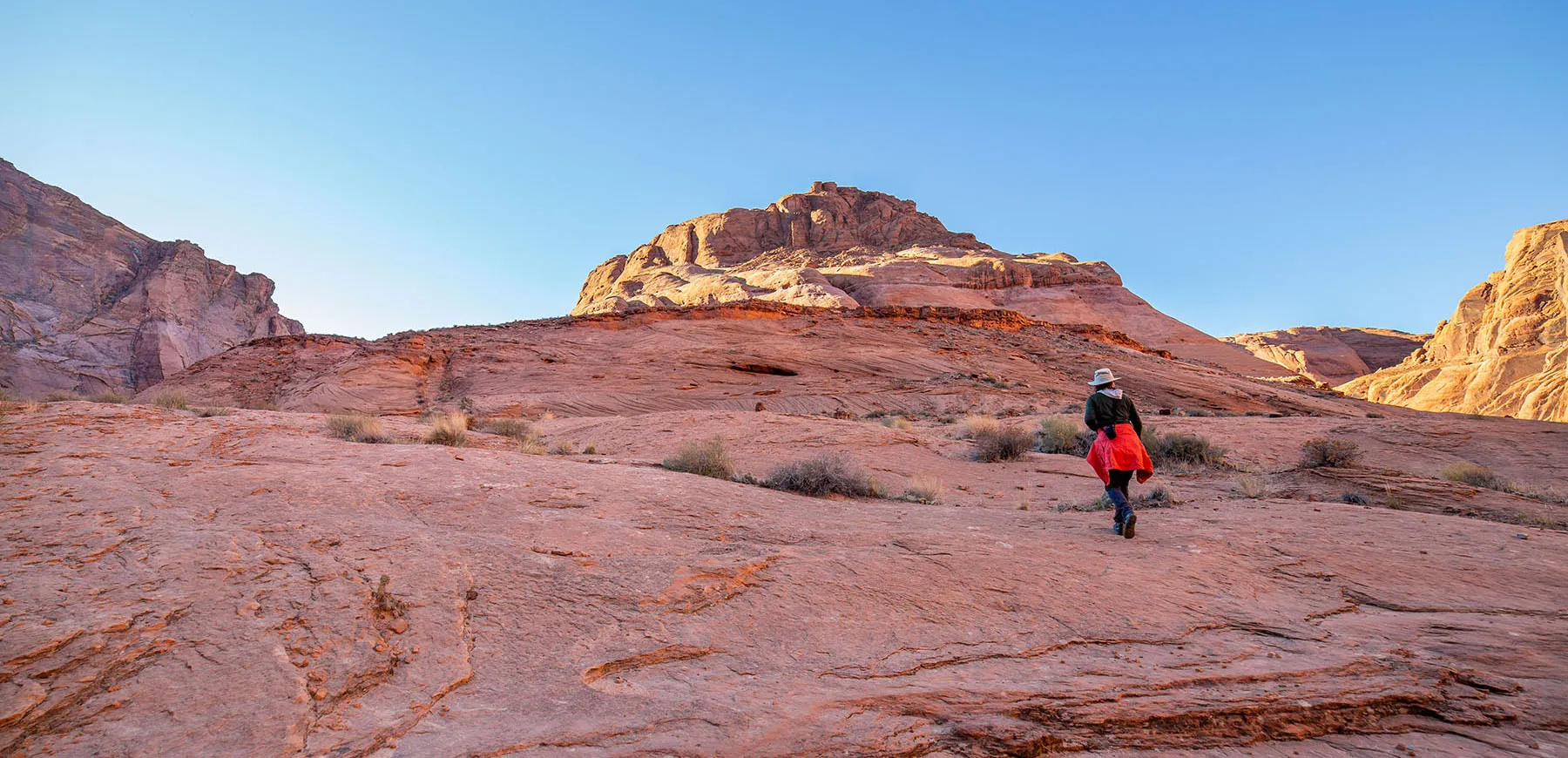
The Horseshoe Bend area came next. Before turning into the northern arm, we spotted a few bighorn sheep on the right bank. It was a group of four, grazing and ruminating on the hillside, close to the river. I put the long lens on started snapping away.
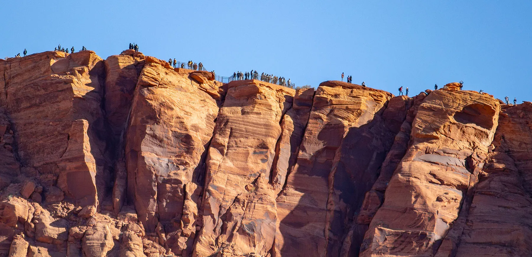
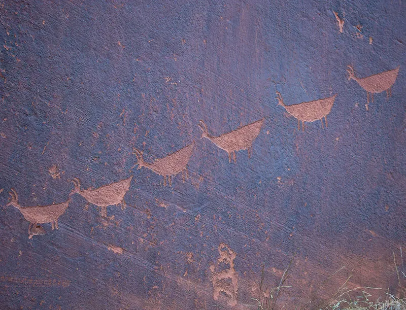
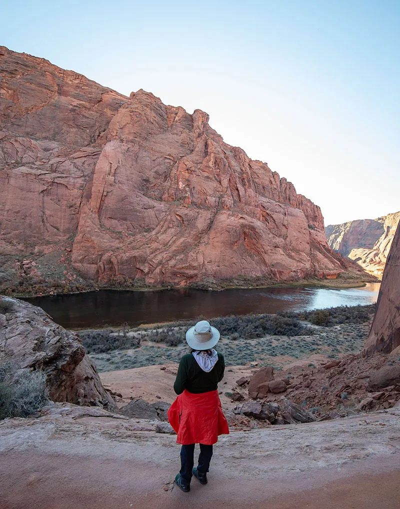
Opposite there we stopped again to take a look at the famous Anasazi Petroglyphs. If you look at a picture of Horseshoe Bend from above, this area is on the shore in the upper right-hand corner. Camping is not allowed here but because of the immense popularity of the place, there are two toilets, chemical, but very well made by wilderness standards.
As far as I understand, in high season this place is very crowded, but so far, we still haven't seen anybody else, at least down in the canyon. Of course, the Horseshoe Bend overlook is also visible from here and many people could be made out up there, especially through the long lens and binoculars.
After securing the boat, we walked the short trail and looked at the petroglyphs. It was amazing to see them so well preserved, and I guess we're no different from most modern humans by feeling some connection to those who made them, trying to figure out what went through their minds.
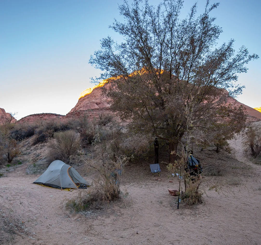
Returning to the boat, we could still see the sheep on the far side, so I couldn't resist a few more pictures, but then it was back on the water. After a very short paddle, we stopped on the other side, exactly in the focal point of the bend. This is 9 Mile Camp. The sun just ducked behind the lip of the canyon.
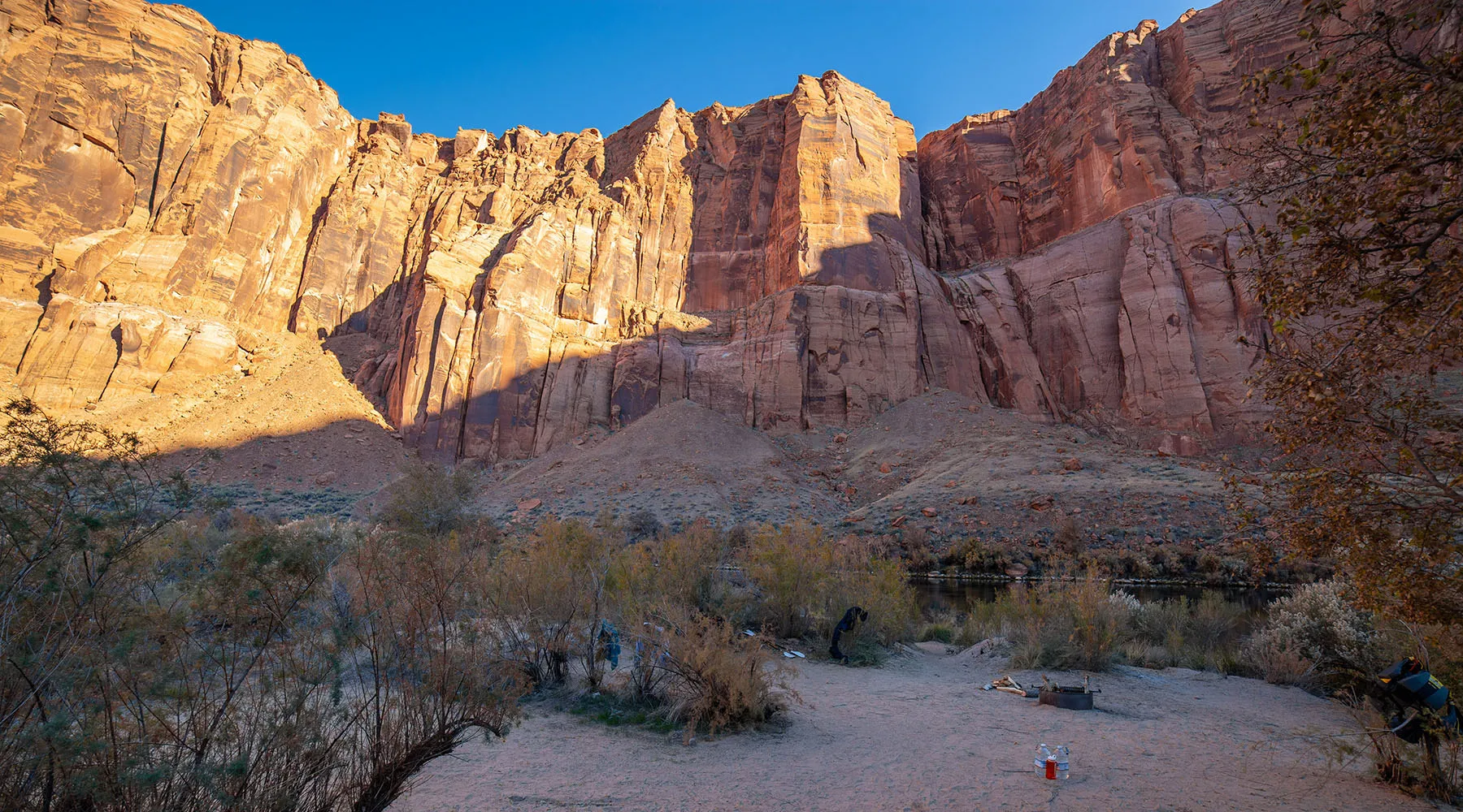
We looked around, trying to figure out where to camp. There are many spots with fire rings, perhaps a dozen, plus a chemical toilet. The nicest place was a little south from the middle, under the trees. The wind was not strong, but it seemed like it was picking up, and that part was a bit shielded. Also, it was the most private, and though we knew dozens of people are up at the overlook at any given moment, they will soon be gone. The campsite was otherwise perfect, but some idiot left a full wading suit, other neoprene items and some socks hanging on a tree.
The boat secured and unloaded, it was time for a walk. We went up the horseshoe's hill, exploring the base of the rock face extending far above. Venturing a bit more south, there was a great overview of Mile 8 camp and the river beyond. This camp looks great, too, a bit less exposed to the gawkers than Mile 9, and thinking back, maybe better for fishing. We scouted a route going down the rocks to the camp, but decided against descending, going back instead so I can do some fishing. As I was preparing the gear, Em said the yellow river boat we saw earlier drifted by us, and later we learned they camped at Mile 8. Other than them, we saw nobody else on the river the entire day.
It was late, and I chided myself for not having fished yet, but there were so many other things to do and fishing from the loaded-up boat would have been problematic.
First, I walked in the shore all the day downstream to the furthest point of Mile 9. Here a huge rock blocks the way, walking to Mile 8 would be impossible. After ten minutes of unsuccessful fishing, I got the kayak, walked it as far upstream as I could, then got it and paddled out. Both arms of the Bend have strong current (I think they are class I rapids), but the focal point is relatively calm, with the current mostly on the far side.
Just for fun, I wanted to see how far up I can paddle and really put myself into it. I could see the water rushing past me like crazy, but in relation to the ground, I was moving very slowly. OK, enough of that, I let the boat drift in the slowest current I could find and fished some more. I desperately wanted at least one trout so we can grill it on the campfire. No matter how and where I tried, no luck. Not even a nibble. Meanwhile, the sun set for good. Reluctantly, I went back, secured the kayak again, then we set up the tent as darkness fell.
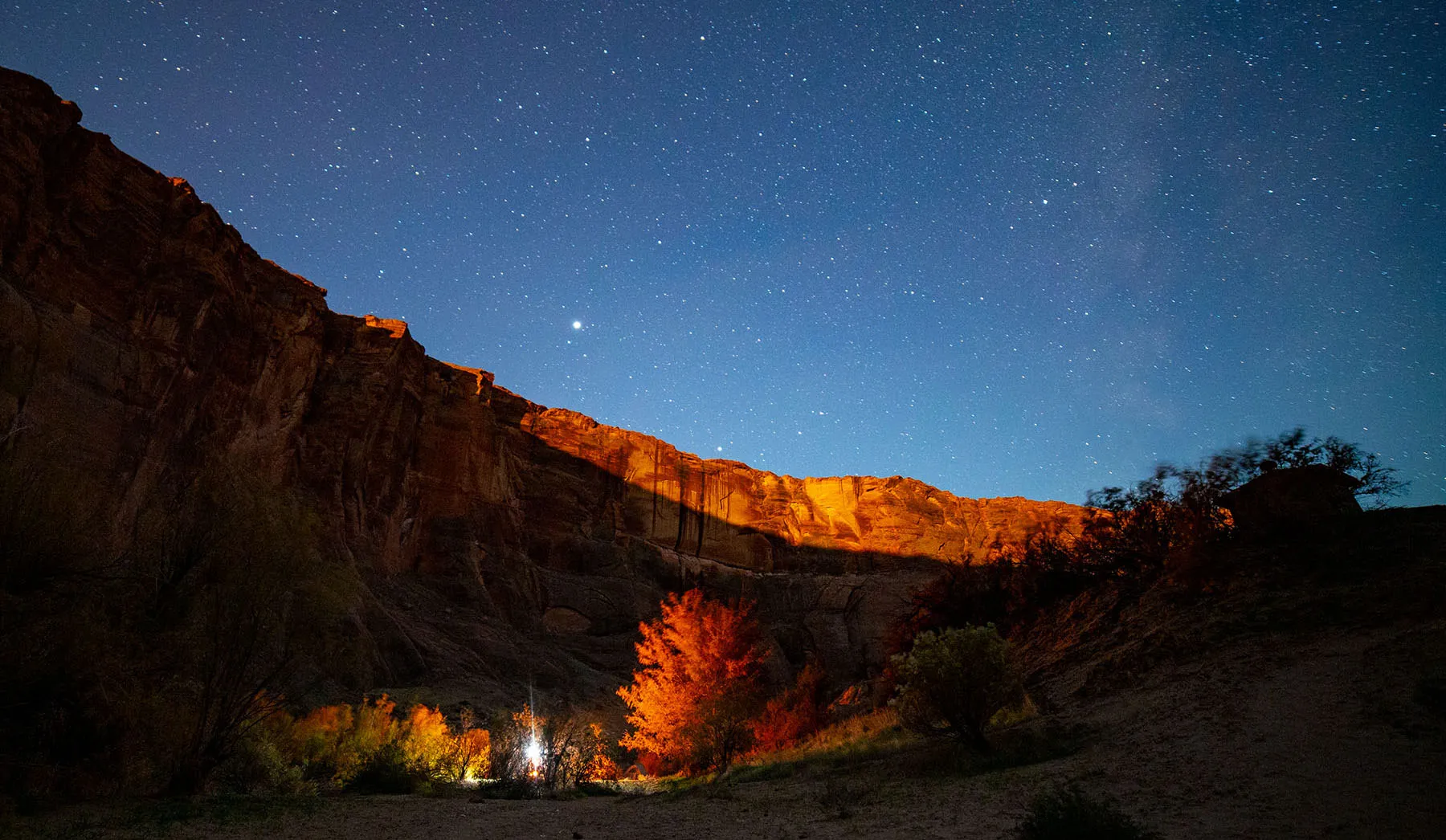
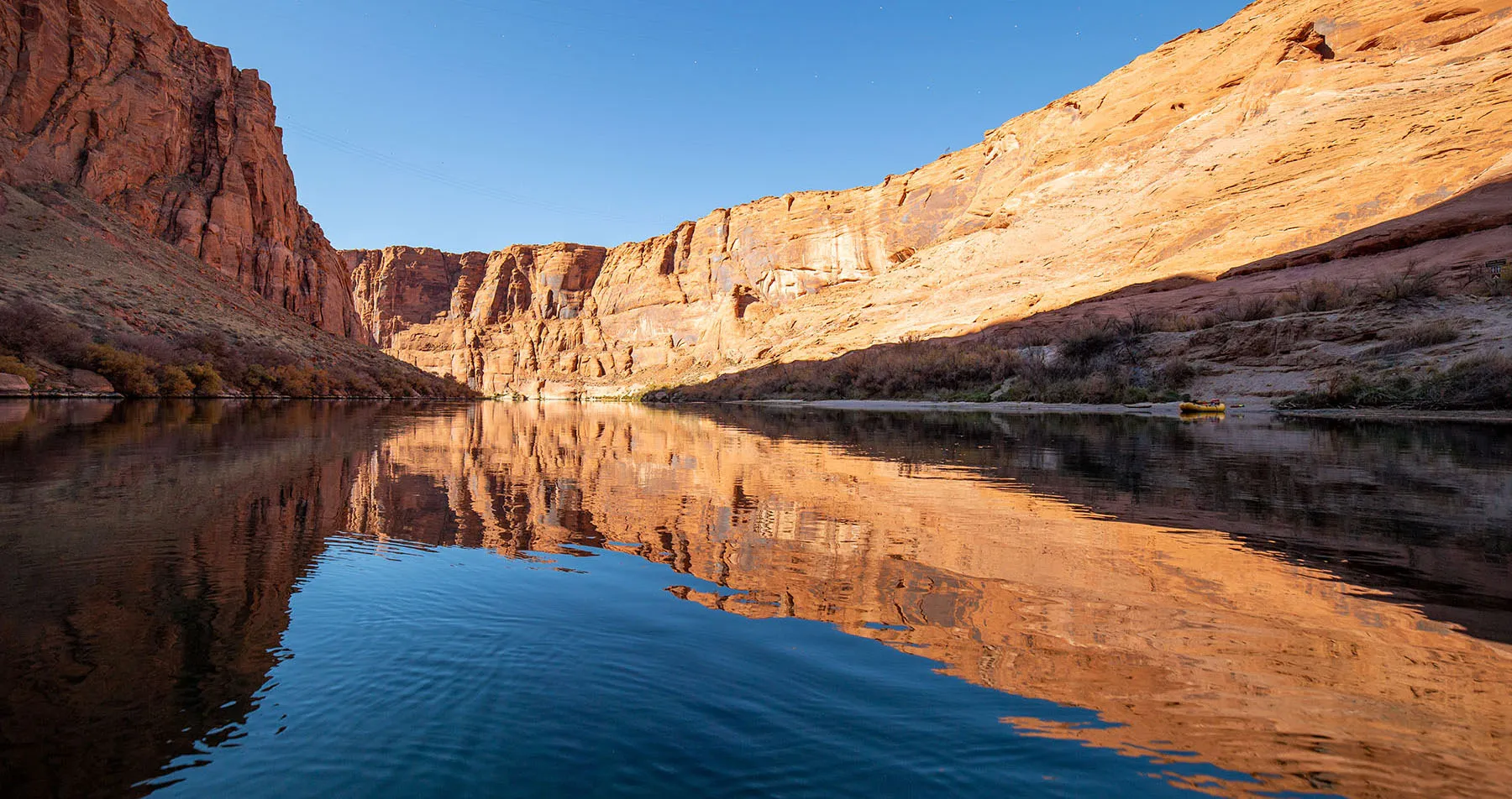
Fish or no fish, it was a fantastic evening. Aside from the occasional wind gust, we had great weather, the sky cleared up, and the moon rose soon, illuminating the far canyon walls first, creeping closer.
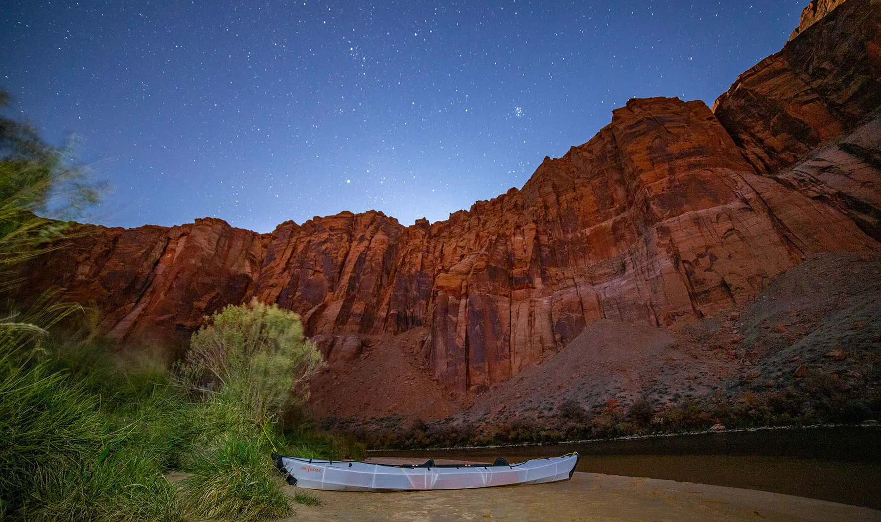
We made a nice campfire, sat on our little camp chairs, eating dinner, drinking a little bit of wine, then tea. I took long-expo shots of the moonlit canyon, then later, as the light hit our beach, of the kayak with the overlook in the back. We kept our eyes and ears open for wildlife, hoping to spot a ringtail or bobcat, but no luck.
Around 10pm, we made sure all the food is secure, double-checked the kayak again, then went to bed.
Day 2 – 9 Mile Camp to Lee's Ferry
As we had lots of time, no alarm was set, and we only got up after 7am. The morning was cool and calm. Unsurprisingly, some people were already up on the overlook.
We took it very slow. While Em was drinking her morning coffee, I shot a few pictures of the waxing moon setting behind the sunlit canyon wall, then we ate a two-course breakfast: backcountry hummus, followed by hot soup.
By the time we broke camp and loaded the boat it was 10:30am. Floating downriver was just as magnificent as the day before. We barely paddled, just let the current carry us. Across 8 Mile Camp was 7.5 Mile Camp, but as far as I understand, this is now closed to camping, only day use is allowed.
Then a bit further down is 6 Mile Camp, the last campsite before Lee's Ferry. According to the backhaul people, this is the busiest and first to get occupied. We saw two tents there on the way up, but now it looked like nobody was there.
This whole section is absolutely amazing. Four river miles (between the two class I rapids just above Camp Mile 8 and down to Waterholes Canyon) look like they can be paddled back and forth, almost like a lake. We came up the idea to return here someday, camp at 8 or 6 Mile for at least three nights, and explore this whole area in detail.
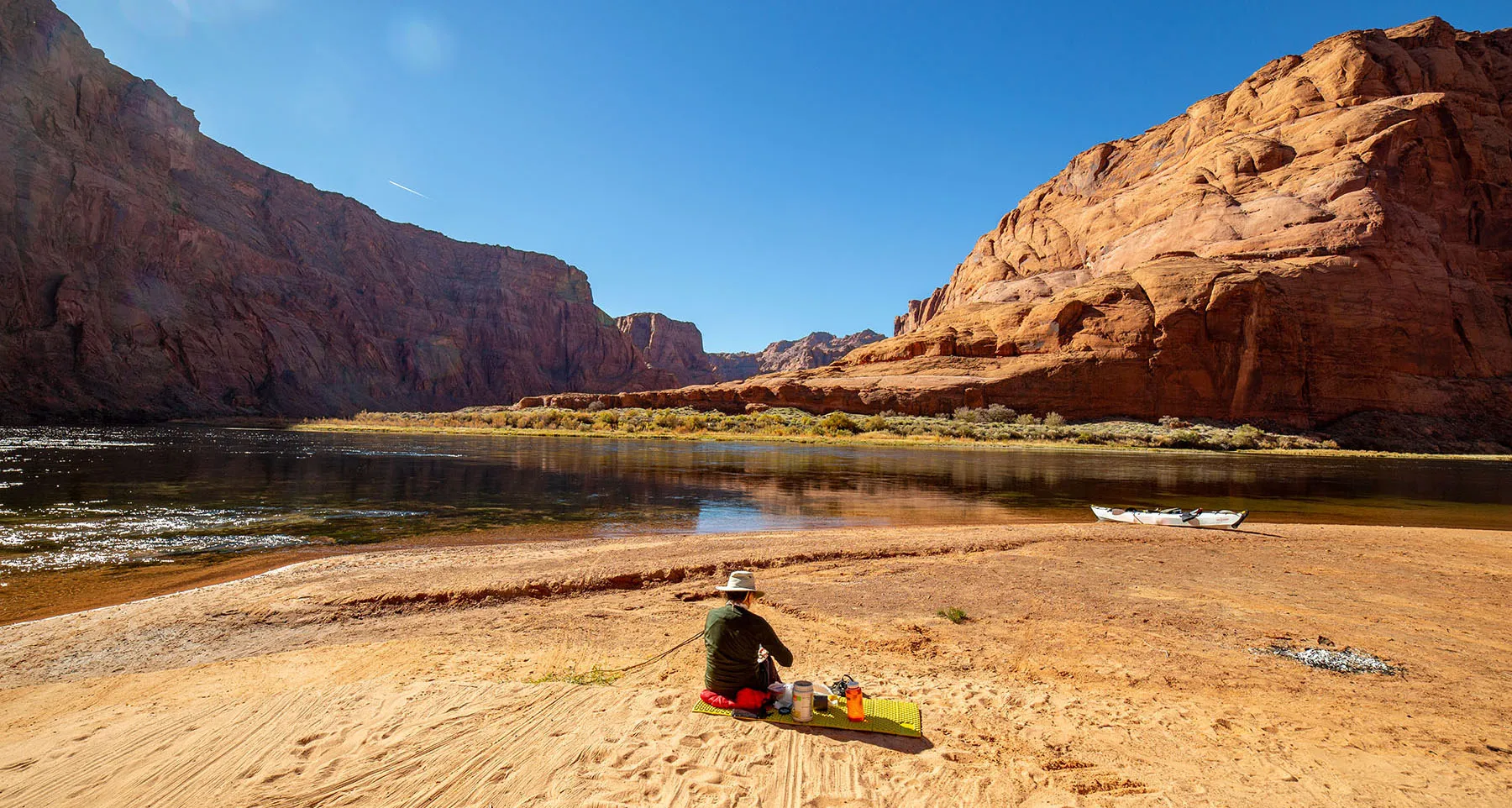
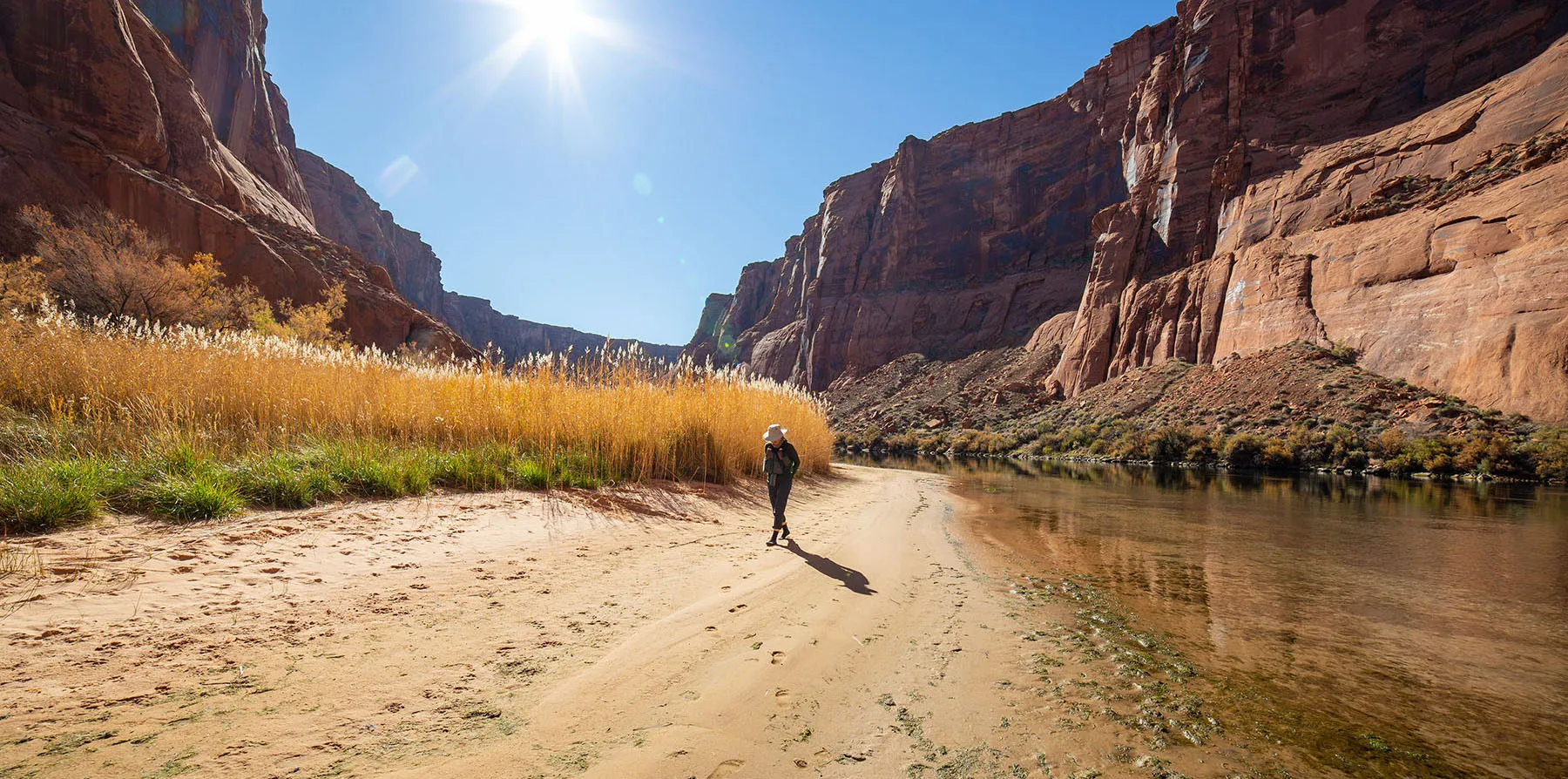
About two miles down from 6 Mile is another big bend, this one featuring the mouth of Waterholes Canyon going up on the left side. This is where we stopped for lunch, securing the kayak out on the sandy beach and sunning ourselves while eating. The yellow river boat was there, too, with a nice couple also having lunch next to us. We chatted and exchanged information about the various nearby features. Great guys.
We met the first two motorboats since the backhaul guys left: one was anchored river right, with a guy fishing nearby in a wader, the other came up and stopped not far away, some people fishing from the deck.
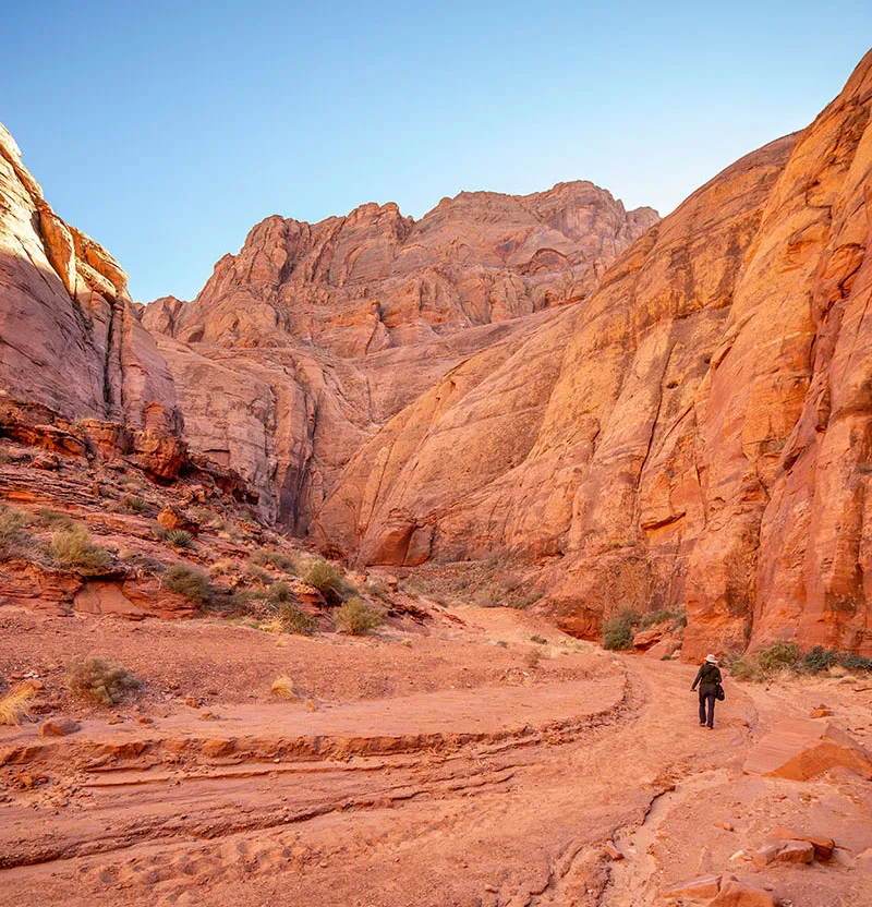
After we were done eating, we hid all the food in the kayak, then went for a short hike up the canyon. Needless to say, it's gorgeous, turning slotty (sic) very quickly, then widening out again. The upper reaches can be accessed from the main highway (US 89) above, but only by guided tour. If we ever return here, we'd love to do this more properly and I'll have to research how far up one can go from the bottom.

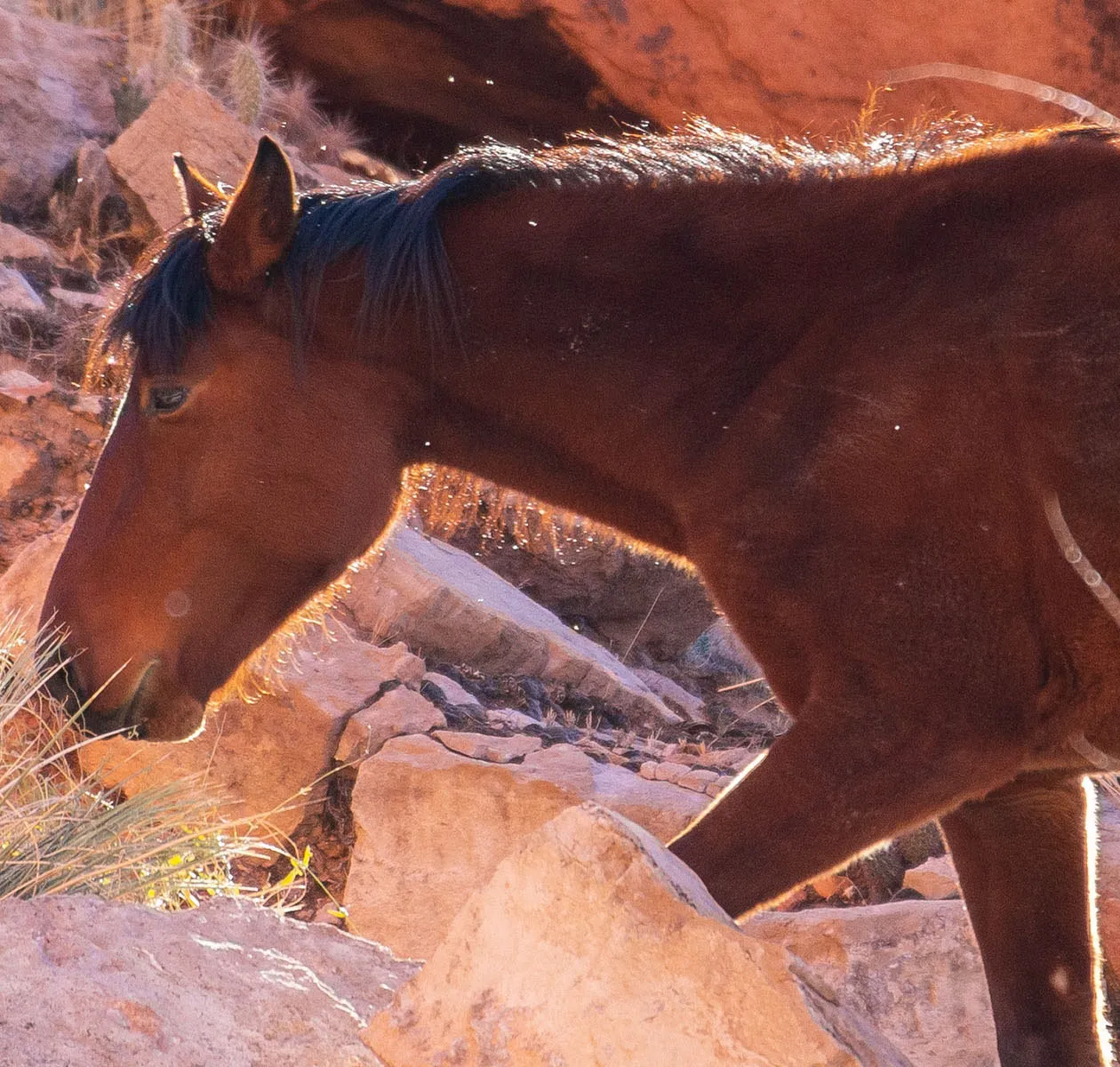
For now, we went back to the kayak and got on the water again for the last four-ish river miles. This is where the canyon starts to open up. We were told feral or semi-feral horses are to be found in this area, especially on the left side, so we kept our eyes open and the binoculars at the ready. Sure enough, soon we spotted a beautiful brown horse grazing on the hillside, then another closer to the river. They looked very relaxed, but I'm sure it's not easy living in this harsh environment.
Lee's Ferry came into view, the last stretch. We landed, pulled the boat out, I got the car. The parking lot was busier than before, a smallish downriver party was getting ready, and some rangers were about to leave upstream. We chatted with the rangers a bit, picking their brains about wildlife and such.
Stowing the kayak went surprisingly fast. We realized this was the first time it ever saw freshwater. Until now, it was always in saltwater (not open ocean, but protected harbors and estuaries). Not having to wash off the salt made it so much easier to clean.
We packed up everything, drove back to the motel room, had a nice dinner, followed by organizing the backpacking gear for the next day. Bedtime was early, anticipating a long and difficult day to follow.
Keep reading in the Paria trip report.
Notes
Glen Canyon can get notoriously windy, especially in the afternoons. Several people we talked to mentioned that the winds are worst is the spring, so that's a timeframe to avoid if possible.
About the clear water: historically, the Colorado ran slow, warm and muddy (even the name reflects this). After humans built dams, the water became swift, cold, and clear. This changed the entire ecosystem, most of it for the worse.
Make sure to check out all the pictures in the full gallery.