Intro
After planning and then abandoning the trip for two years in a row, in 2019 we finally decided to do it, come rain, shine or mosquitoes. Little did we know about the mosquitoes.
I first started looking at the area in 2017 and mapped out a nice big figure-8 loop. Then, as it was a late spring and we heard there were tons of mosquitoes, we did the Sequoia National Forest – Yosemite loop. The following year, the Emigrant was completely smoked in by the Bay Area wildfires, so we went on the Copper Mine Pass trip in the Sequoia National Park.
2019 had lots of late snow, too, but we were intent on it this time. Like always, we had a plan B, but the commitment was firm. It was an area we never explored before and according to most reports, not very crowded.
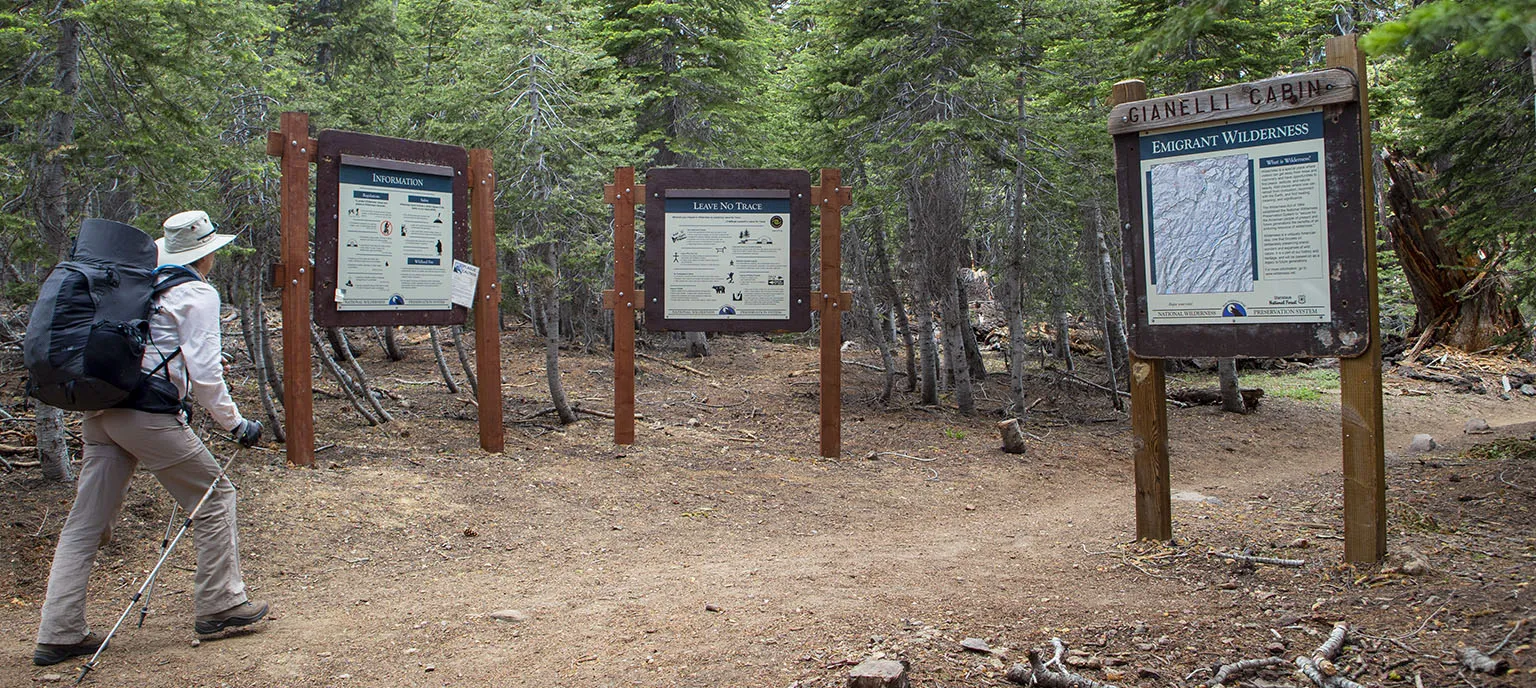
In late June, I talked to the rangers and they told me our starting trailhead, Gianelli, is still under snow, the road closed. They estimated to open it in early August, but they couldn’t give us any guarantees, of course. Our trip was slated for August 10. There were at least two alternative trailheads, but to explore the Emigrant Wilderness as much as possible, Gianelli was ideal.
Then there were the creek crossings. Several people who accessed the wilderness via those other trailheads reported lots of late snow and very high water levels, with some impossible crossings on our route. Of course, those levels were falling by the day and we were hopeful.
Finally, it all started looking OK. They opened Gianelli in the first days August, and according to all accounts, most the snow has melted and the creek crossings were doable.
At least the wilderness permit was no issue as there’s no quota, we just had to pick it up.
Like always, all our clothes were treated with permethrin, we had a full bottle of eucalyptus oil and for safety, a tiny bottle of 100% DEET (which we prefer to use only in a true emergency).
Day 1 – L.A. to Gianelli Trailhead and Long Lake
The Emigrant Wilderness is best accessible from Hwy 108, either via Kennedy Meadows (no, not that one) in the north or via the town of Pinecrest and then Crabtree Road from the west, leading to several trailheads, including Crabtree and Gianelli.
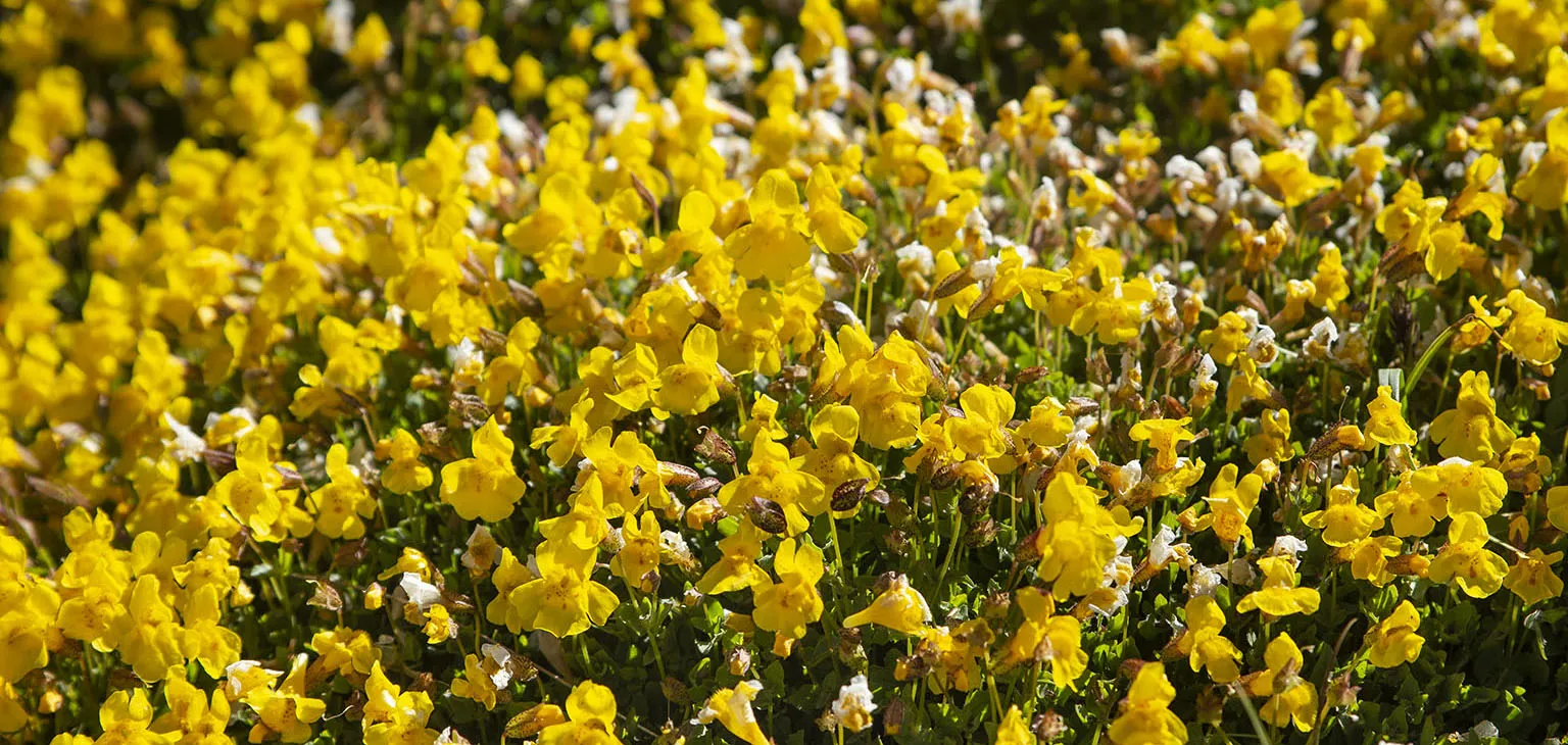
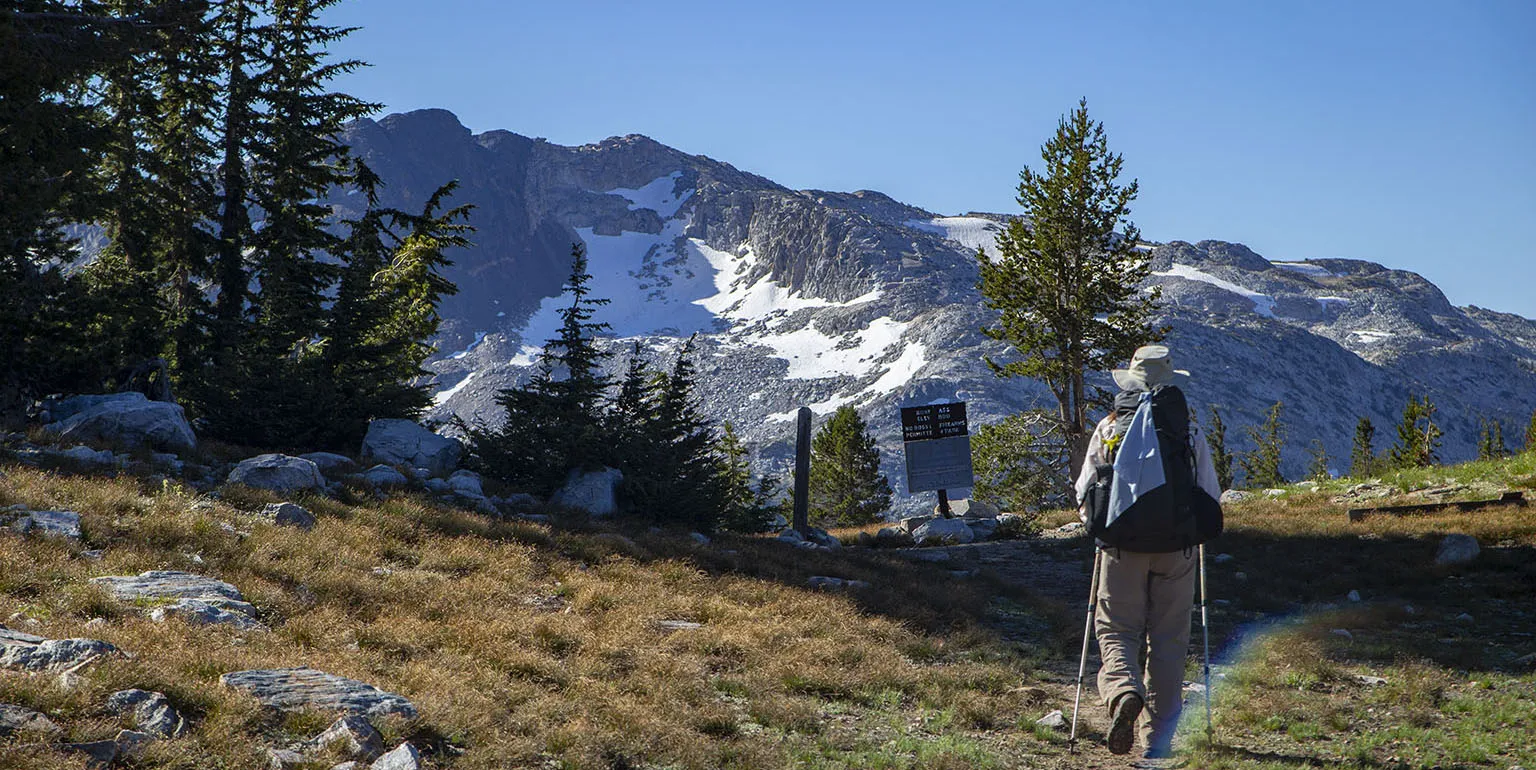
It was going to be a long drive and a then a long hike. We prepared ourselves for a strenuous day and left our home as early as possible. Regardless, we arrived in Pinecrest after 10am. The ranger station was relatively crowded, but we got the permit quickly and drove the additional 12 miles to the trailhead. The last bit is dirt, but in good shape, any car could handle it. The side of the road was already teeming with wildflowers, a taste of what was to come.
Gianelli has a big parking lot, but it was surprisingly busy, with only a few spots left. We secured the car, ate lunch, put the packs on, and then we were off. It was 12:20pm, with 11-ish miles to go.
Weather forecast looked great, with some clouds and a tiny possibility of rain for the first two days, then sunshine, sunshine! Too bad these forecasts don’t include anything about mosquitoes.
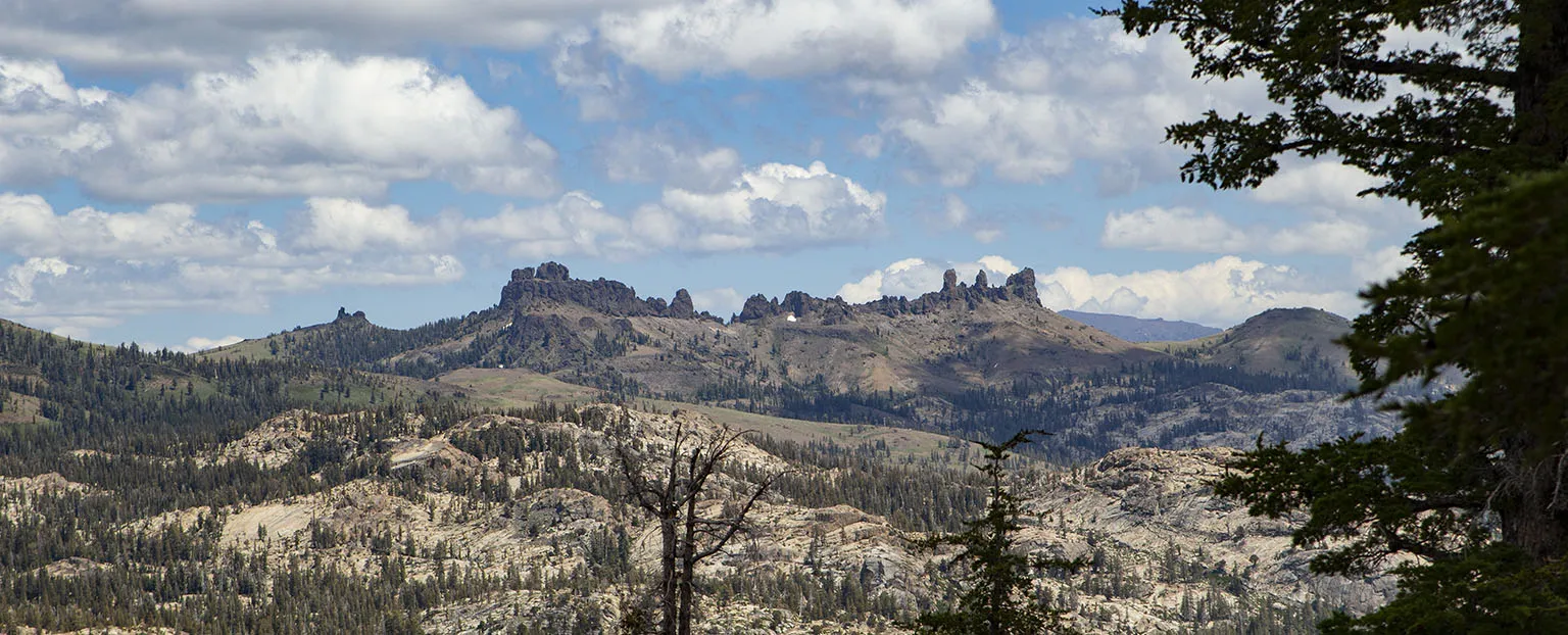
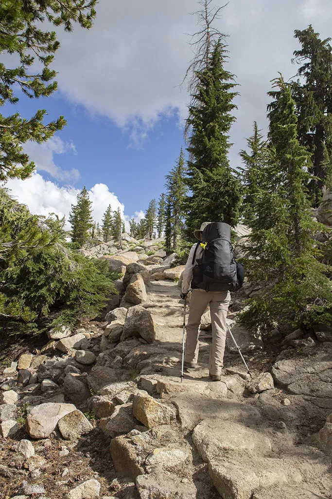
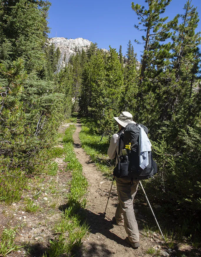
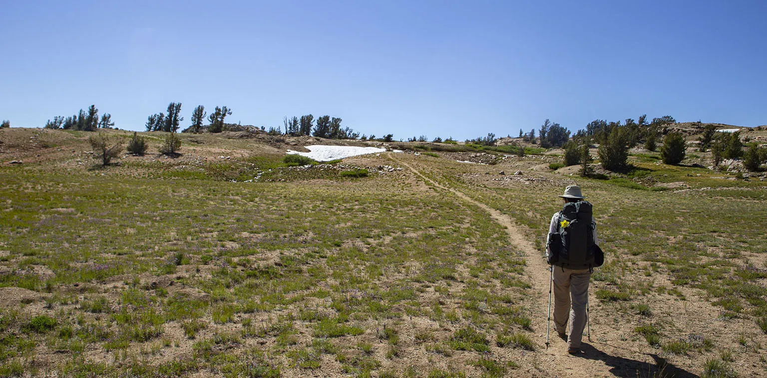
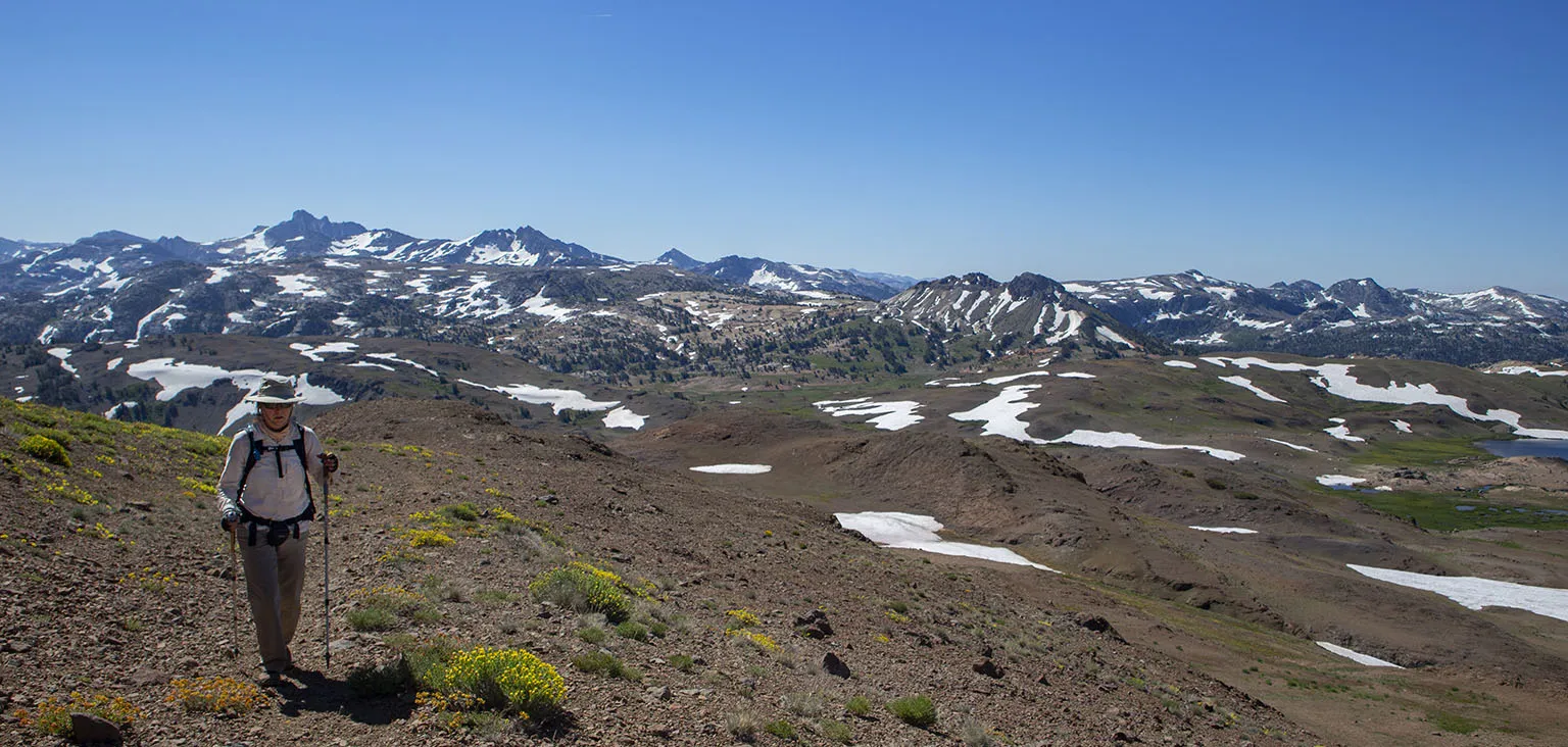
The trail climbs through the old-growth forest first, reaching the spine after about 1.5 miles and passing by Burst Rock. The great vista opens up with the headwaters of the Stanislaus River’s South Fork to the left. In the distance, the Three Chimneys and Castle Rock are a special sight to behold. These huge black granite outcroppings look like the inspiration for Tolkienesque novels.
The trail keeps climbing, though gently, and with a bit of rollercoastering passes several small bodies of water, first Powell Lake and then Chewing Gum Lake, though neither are well visible without a detour. These are very popular day hike and short backpacking destinations from what I hear. This time, we ran into quite a few people, but nothing compared to the crowds on the PCT/JMT.
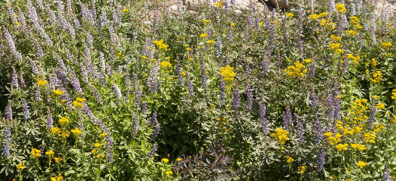
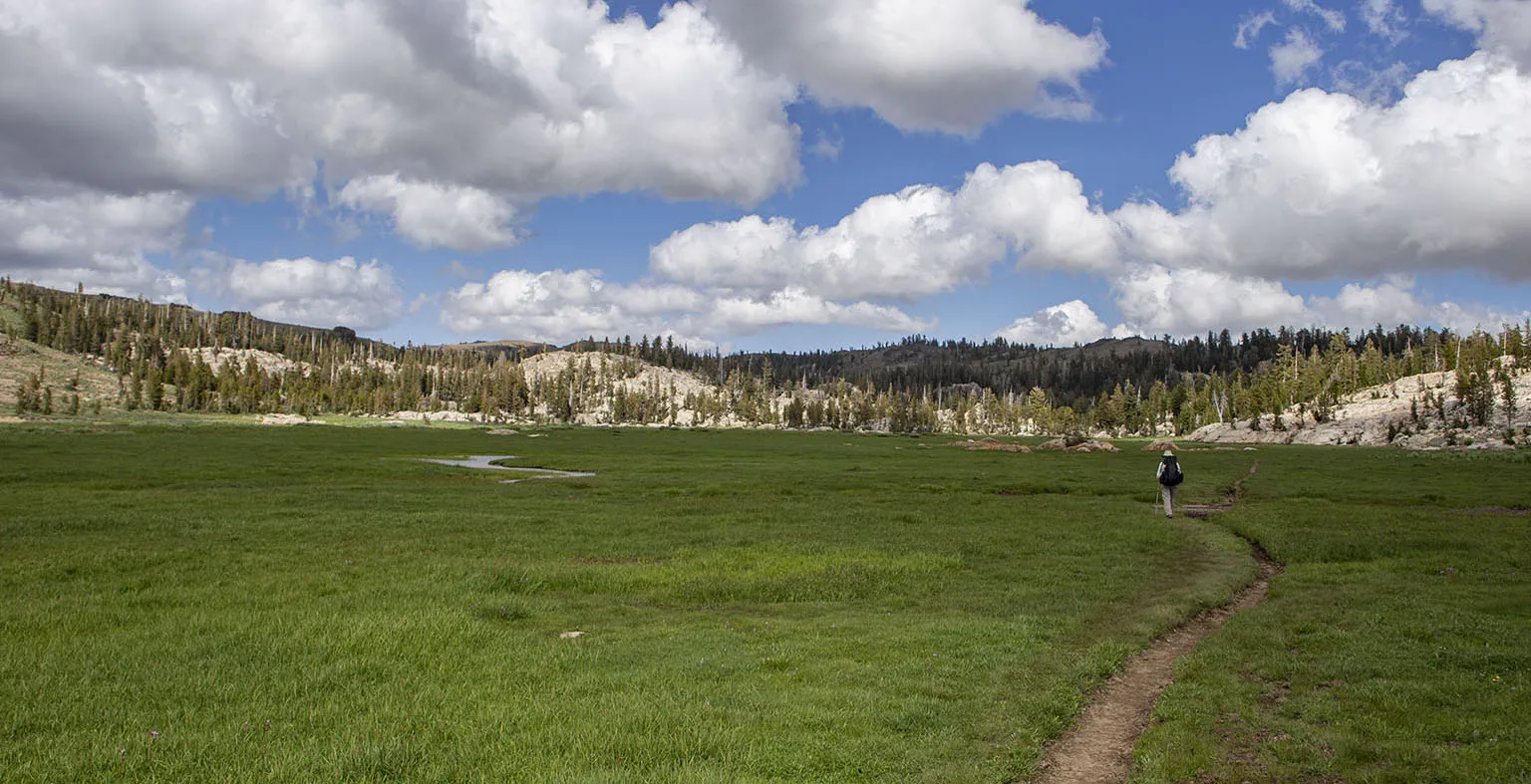
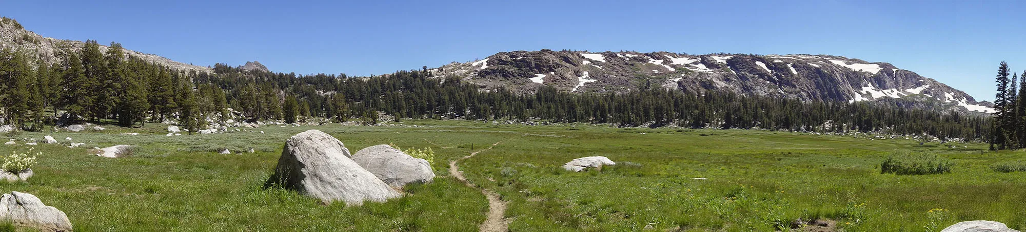
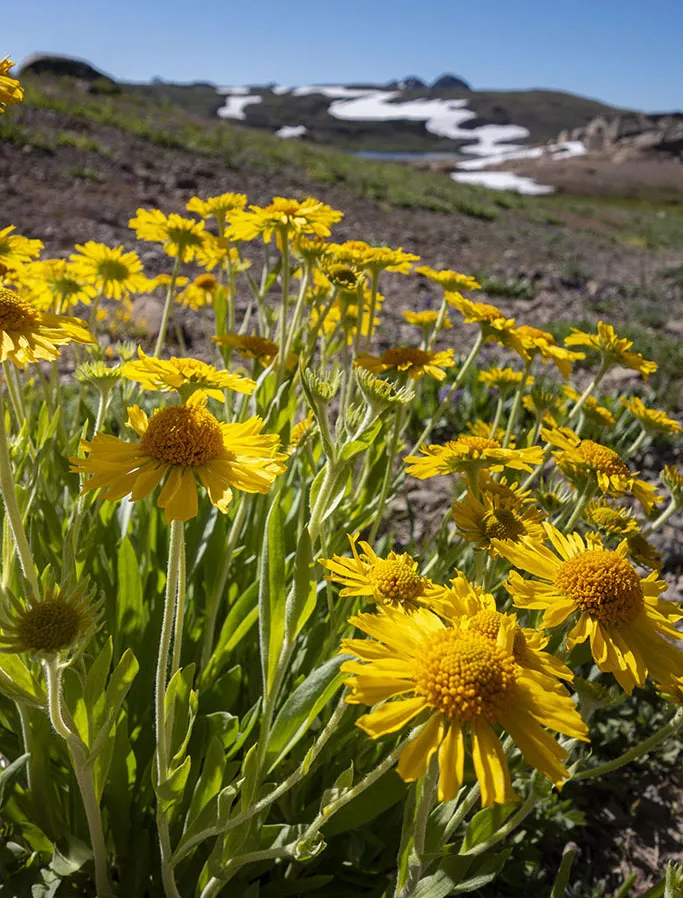
The wildflowers were out in force, with pussy paw and violets bunching and carpeting the trailside every so often. After descending a bit, the beautiful Whitesides Meadow spread before us, with several creeks and a tarn. Lupins were just starting to bloom. What made it truly special was the almost uninterrupted expanse of fresh, green grass. The trail junction to Eagle Pass (the aforementioned Three Chimneys) is here, but we continued straight. On the other side, we crossed one of the three snow banks we’ll encounter on the trail during the whole trip, this one maybe four feet wide and two feet tall.
The trail skirts the southern portion of Lower Relief Valley, then passes the turnoff to funny-named Toejam Lake, which is notable for one of the last wolverine sightings in the Sierra in 1996. (Update: there have been new wolverine sightings since, notably one in the Mammoth area. Look it up.)
After another short drop, we crossed beautiful Salt Lick Meadow, and the first potentially serious creek crossing awaited us here. However, the reports were right, it was nothing but an easy rock hop.
A bit further south, as we descended into Spring Meadow, we smelled smoke. Not wildfire smoke, but the fresh, campfire kind. Indeed, a few minutes later, we ran into a big mulepack camp. They had set up in a flat area among the trees, right on the side of the very scenic meadow, with wild beasts running all around.
Literarily. One cowboy was right on the trail, waving us back because they were trying to catch some mules on the loose and two of them were running straight toward us. We got out of the way, they reined the mules in, then we had a chat with the cowboy, a great guy, as friendly and nice as they come.
He explained there are some more loose mules in the meadow, his partner is bringing them in, but none of these are theirs, they must have gotten away from another mule party camped at Wire Lakes. That was generally in the direction we were headed, and he asked us if we see any of those guys, tell them their runaways are secured and ready for pickup.
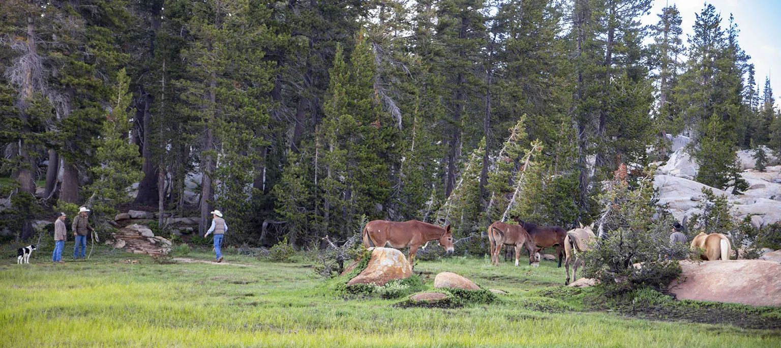
There was a bit more drama as we crossed the meadow, we had to hide behind a rock for a minute while they got the last errant mule and one of their own horses, who got a wee bit too excited by the rebellion. All was fine, though. We crossed the creek (easy again) and left gorgeous Salt Lick Meadow on the far side.
Going up the hill, a lone cowboy was riding down the trail, and when we asked whether he’s looking for some runaway mules, he only said: “Yep…” His face, however, said everything about how he knew it has been all his fault and he’ll be teased about this by his peers for ages to come. Of course, he was happy to hear when we told him where to find the lost animals.
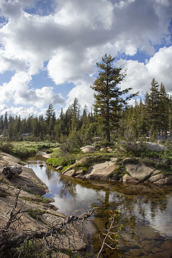
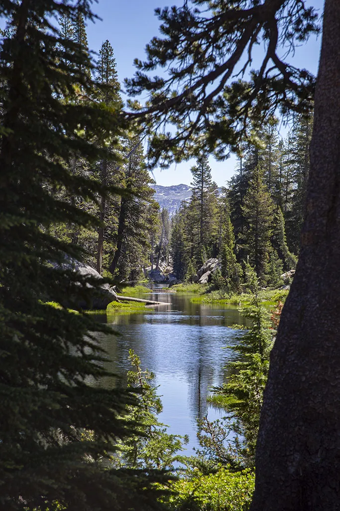
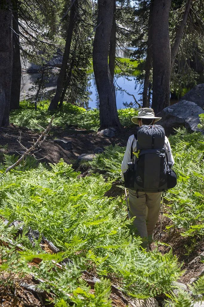
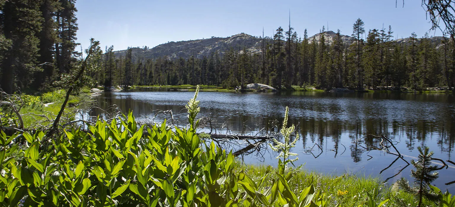
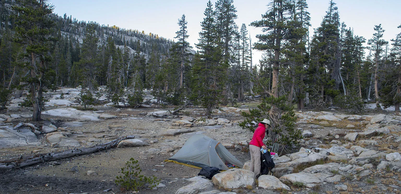
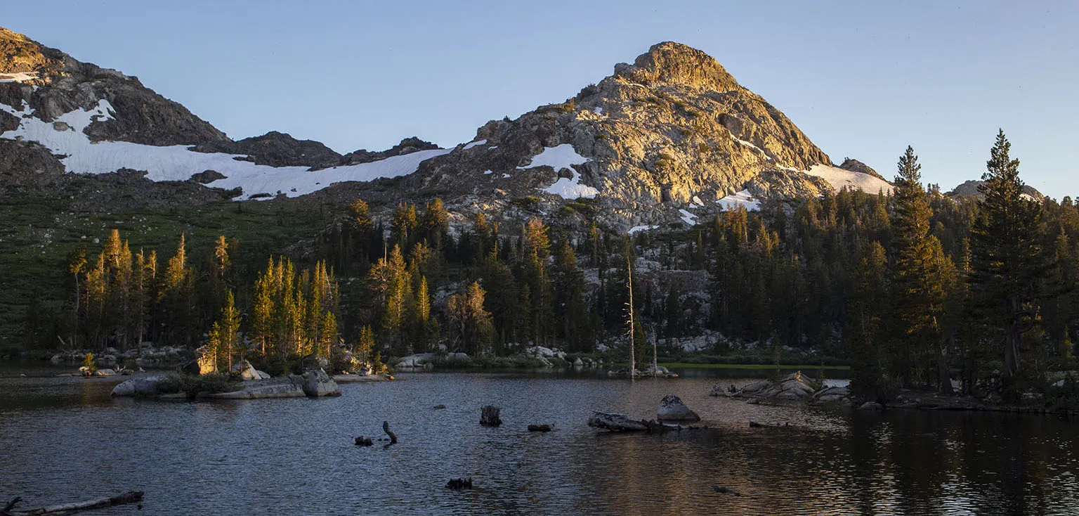
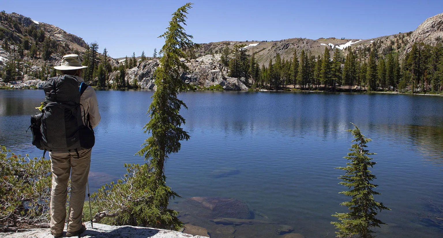
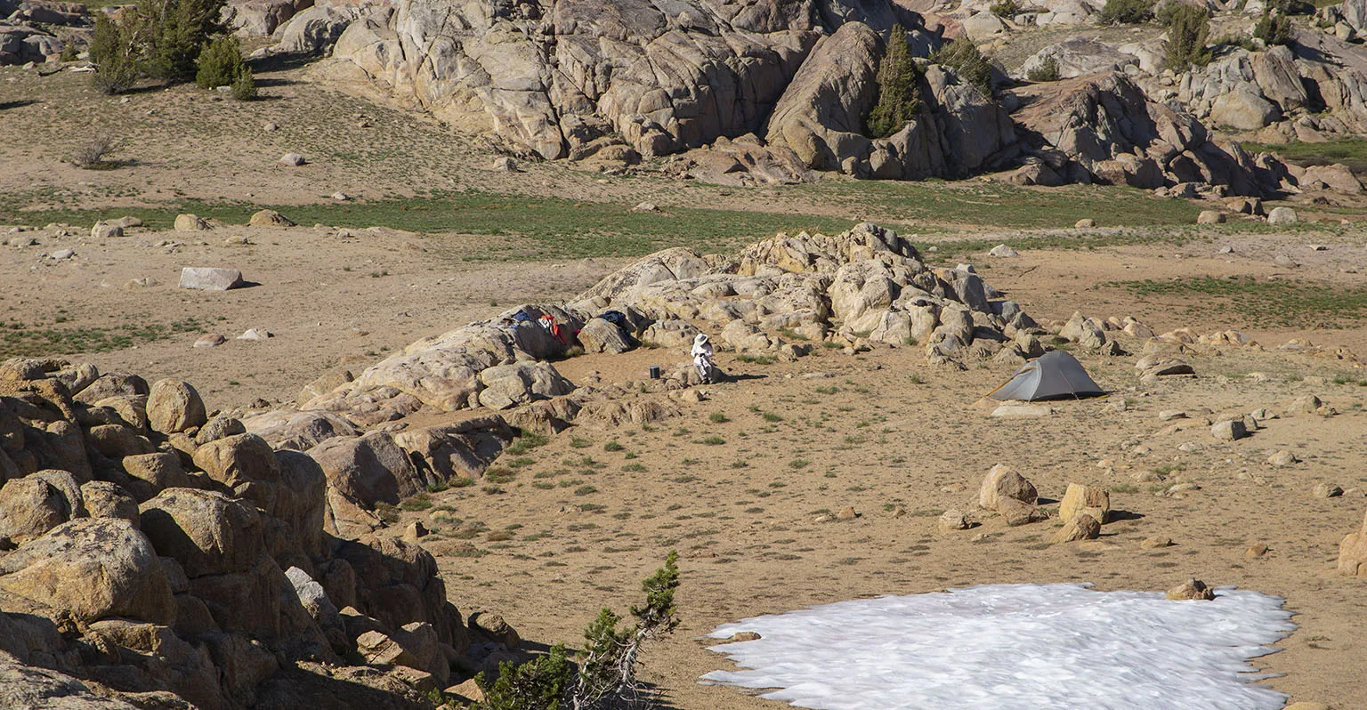
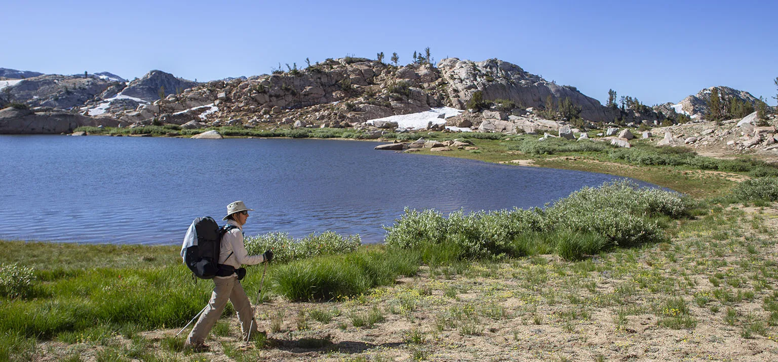
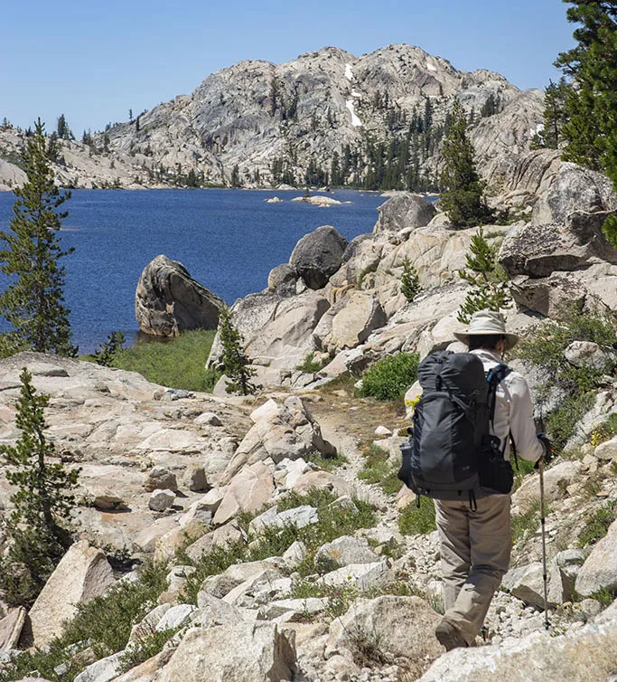
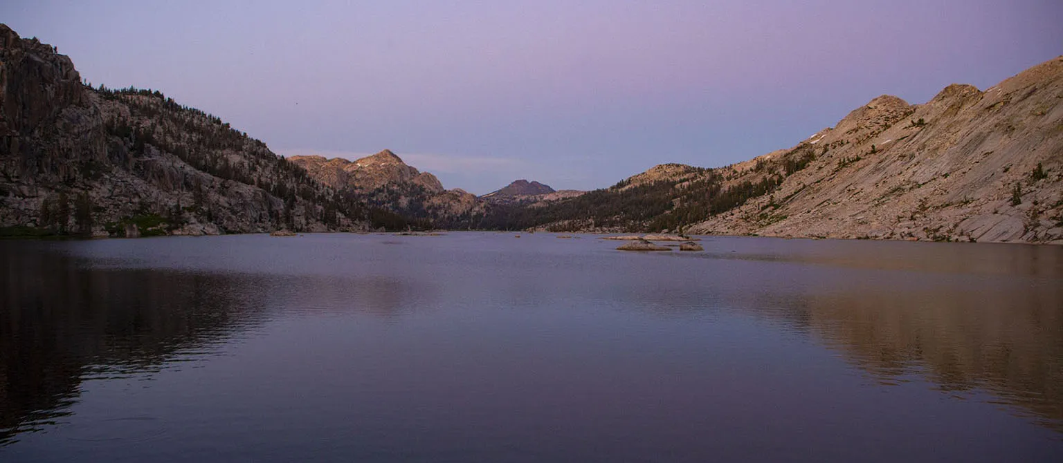
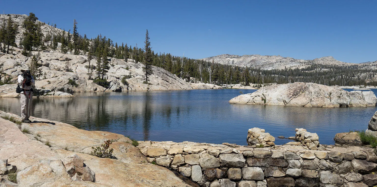
We got to the junction to Long Lake at 6pm. The mile-long spur to the lake is marked as “unmaintained” on the map, but it was in great shape, descending in the forest, emerging on the shore at the north end of the lake.
Here we found a relatively big camp area, and though nobody was around, we decided to explore a bit further, see if we find something more private. The terrain on the shore is very unforgiving, full of huge rocks, fallen trees and thickets. The trail thins out and then gets lost. We found some more camp spots, but none so good as the first, so we returned there and set up shop. It was a bit past 6:30pm.
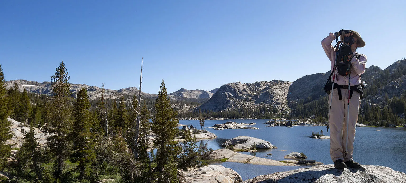
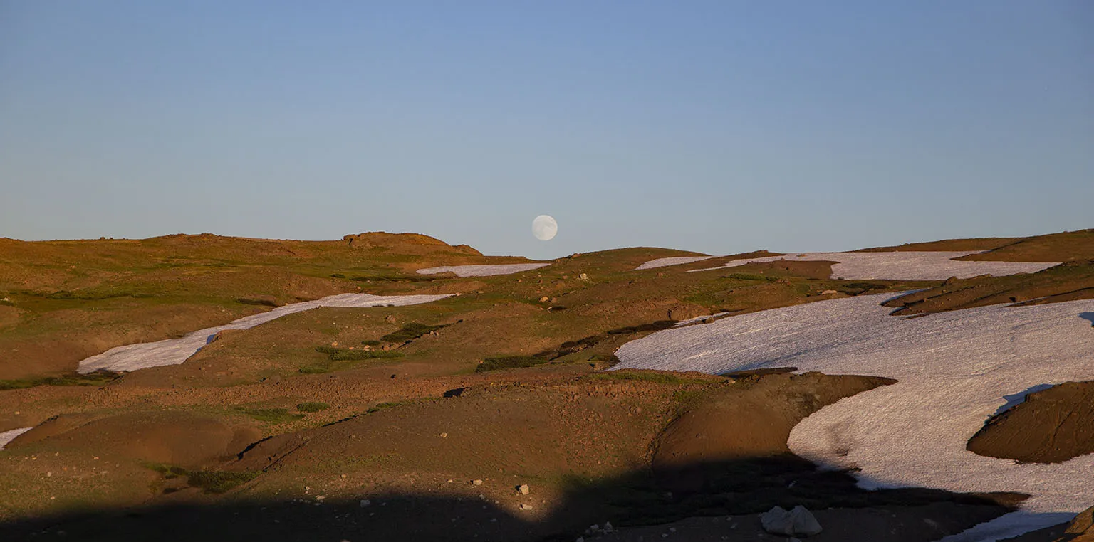
Long Lake is like its name, long, but also shallow, with many rocks protruding from the water, some forming little islands. The wind was blowing, but not very hard, and the clouds with the light of the setting sun made for a very photogenic evening.
A few mosquitoes attacked us, though nothing compared to what was to come in the following days. We made a quick, smoky fire (fires are legal here) to keep the buzzers at bay, and it worked, we even had a shower.
The temperature dropped quickly to 36°F, supposedly the coldest evening of the whole trip.
The hike from Gianelli had actually been easy and didn’t feel very long, but this being the first day with full packs and the drive, of course we were tired. No matter, though, true to our style, it was almost 10pm by the time we actually went to bed.
Day 2 – Long Lake to Huckleberry Lake
We decided to sleep an hour longer than usual and got up at 7am with the sunshine hitting the camp area a few minutes later. It was a great morning, no wind, few mosquitoes, still no other human in the neighborhood.
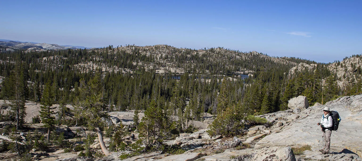
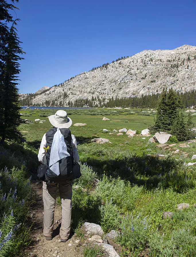
The day’s destination was the southern shore of Huckleberry Lake. If we wanted to stay on trails, we should have walked back on the spur the way we came, turn south, then east at Deer Lake. However, this made little sense. Though there was no trail, the map made it obvious that we should follow Long Lake, then its outlet, and it will deliver us right to Deer Lake on rugged, but manageable terrain.
That’s what we did, and funny enough the most rugged part was the lakeshore with all those broken-up obstacles. Past the outflow, we descended on wide slabs among sparse trees for about half a mile, then it got a bit steeper, the forest thicker, but it was still easy going.
Twenty minutes later we were on the trail again, Deer Lake mostly hidden in the trees. Another few hundred yards down we got to the next junction, the trail continuing east to Upper Buck Lake, south to Wood Lake.
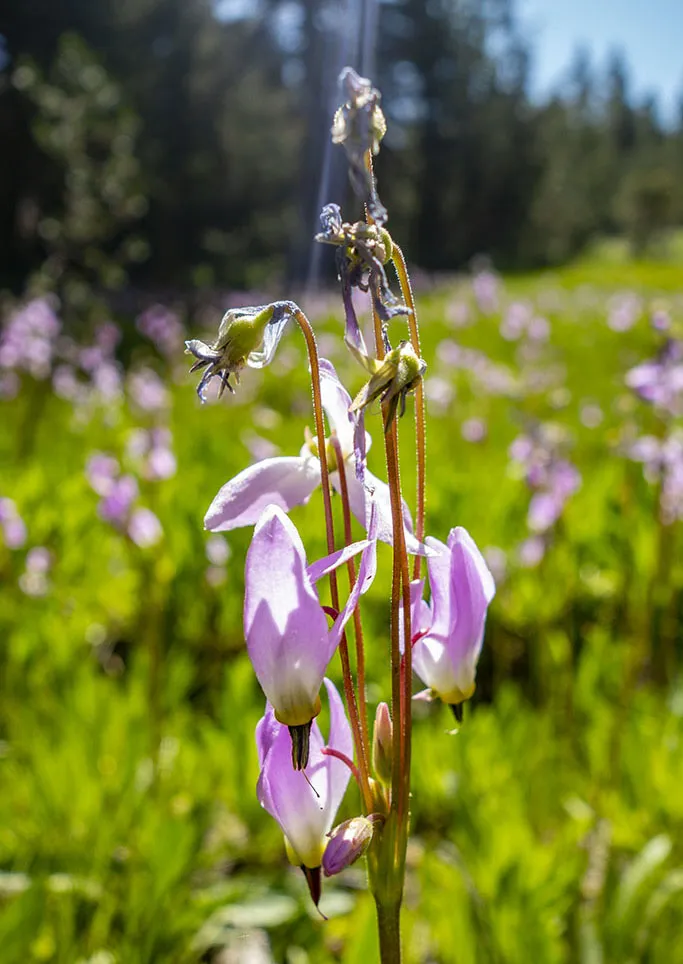
If all goes to plan, the Buck Lake Trail is where we’ll emerge from in six days. The small meadow by the junction was teeming with shooting stars in full bloom, and we took some time for pictures.
We turned south, towards Wood Lake. This short section is also marked as unmaintained on most maps, but it sure didn’t look like it, it was signed and in perfect shape.
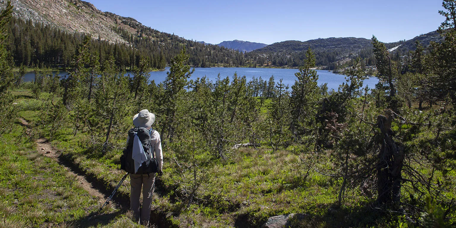
Half an hour and a short downhill hike later, Woods Lake emerged from the trees. This lake is rather small, but very scenic as it has an odd shape and a diverse shoreline with flat and rocky areas alternating. We decided it was time for a snack break, so we left the main trail, skirted the lakeshore a bit and found a cool and beautiful peninsula with ample shade, overlooking the main portion of the lake. Perfection. Some other guys were setting up a tent on the far side, but it was a great spot.
After finishing our break, we had two choices: either backtrack almost a quarter mile to the trail and follow it over some rocks past the outlet, or continue on and cross the outlet right at the lake’s end. This part was choked with hundreds of huge tree trunks carried down there by the water. We decided to try and climb over them.
It was a slow affair, we had to make sure each of those immense logs we’re stepping on are stable. Many weren’t. The problem would be, obviously, getting pinned by one of them. Imagine waiting for a rescue with your broken ankle locked between two tree trunks not even several people can move.
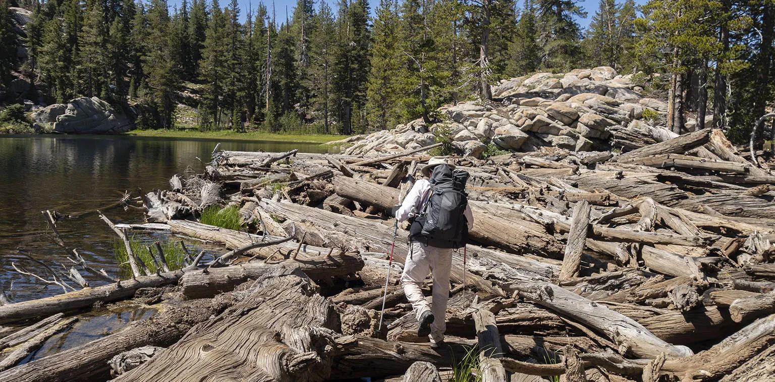
No such thing happened, we were very careful, reversed course a few times, helped each other to avoid traps. The whole thing was over in five minutes, but sure seemed longer.
We hit the trail on the far side and walked east, following the lakeshore.
This is one weird lake. The west end is the largest part, forming an odd-shaped, but proper lake. Then there’s a section that’s more like a river, only 50-100 feet wide, but a good half mile long. It’s even more scenic than the western end, as it looks like there’s an extremely calm, wide creek flowing gently westward. The trail climbs a few small rocks, but mostly it stays on the bank, this time full of blooming wildflowers. Tons of Indian paintbrush, lupins, heathers, violets, and more.
On the eastern end, there’s another “proper” lake, a body of water almost the same size as the other terminus. This part, however, is almost cut in half by a quasi-isthmus, with the trail crossing the water between the two sides. Later in the year, this must be either dry or with very little water. This time, it was about 60 feet wide and almost knee deep in the middle.
We decided against taking the shoes off, which meant circumnavigating the southern portion. This end of the lake looks surprisingly deep and is very nicely tucked away between some big rocks. The use trail peters out on the far end (there’s a big camp), so past that it was a bit of bushwhacking and climbing the small hill before emerging on the trail again. Another pond awaited us there, its surface strewn with many water lilies, though only a few were in bloom.
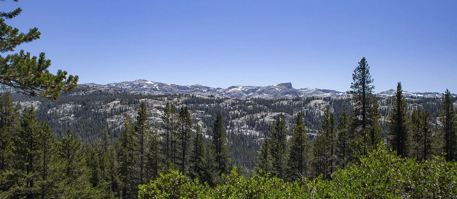
After another small incline, the vista opened up to the south-east, with many Yosemite Peaks visible, including Bigelow, Kendrick and Michie.
When studying the map, I completely neglected to register the fact that there’s a steep descent into Cow Meadow. Most of the time, I know what’s ahead and we prepare ourselves for long up- or downhill sections or stretches without water. Though the descent came as a surprise, it was no big deal, the loss was maybe 4-500 feet, with the far views slowly disappearing and Cow Meadow taking shape.
The meadow is more like a forest with some sparse, meadowish areas, and according to the map, there should even be a nice-sized lake.
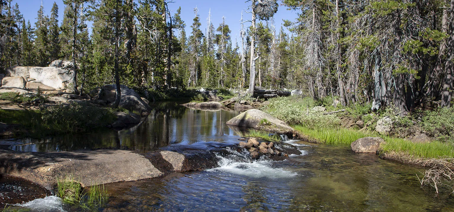
First, we had to cross the creek. It was wide and about calf-deep, but a few yards downstream, we found a stable log crossing. The trail then follows the creek, and here we decided to stop for lunch. The weather was warm and calm, sitting in the shade by the water felt as good as ever.
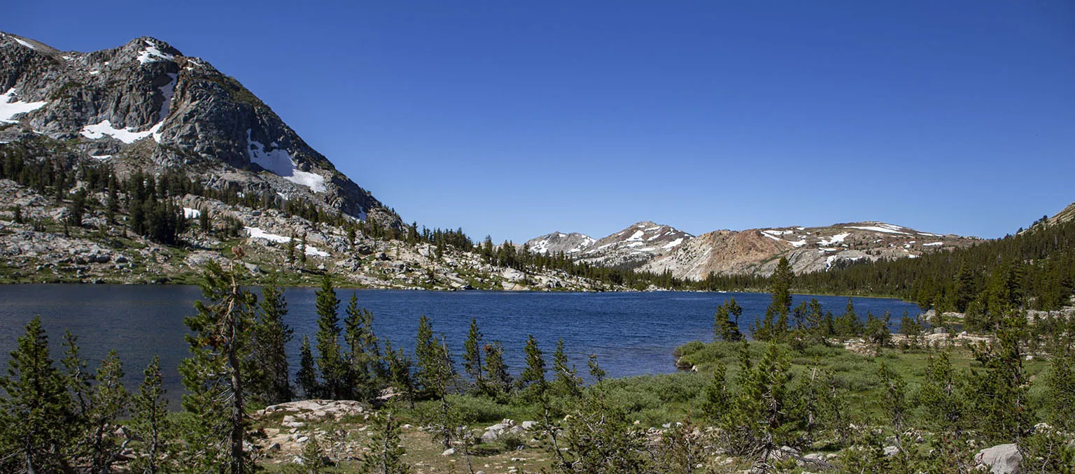
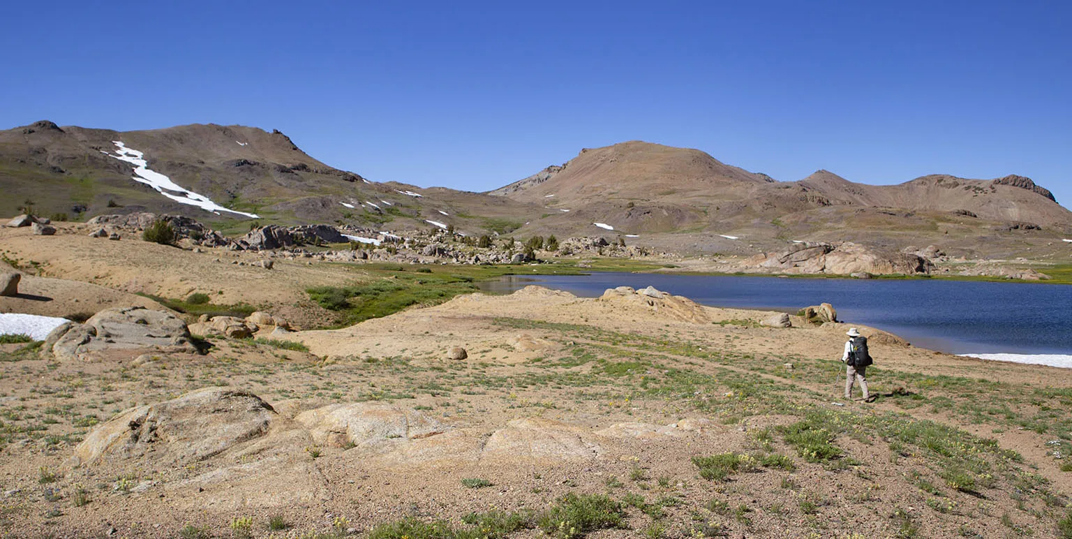
After some rest, we continued and Cow Meadow Lake came into view, serene and beautiful, with a rugged shoreline. The trail skirts the lake on the north side, then turns south and climbs out of the valley. The grade is very nice and the incline tops out after about 300’. The main trail goes further south and west, past Letoro Lake and eventually down to the east end of Huckleberry Lake.
Just before Letoro Lake, though, there’s an unmaintained trail cutting down to the western end of Huckleberry. This is where we went. First the trail was easy to follow past some very nice little tarns and small clearings with ferns, lupins and tons of cornflowers. Then it got steeper as it started descending, affording small glimpses of Huckleberry Lake. The trail soon petered out, but the direction was obvious and soon we saw the outflow of the lake, namely East Fork Cherry Creek. Here we met a gentleman camped in the thicket. He did not cross the creek at this point, but gave us a tip where to try.
We walked right up to the outflow. It was a beautiful, lush area with little ponds and braids. The crossing looked easy, but it was shoes-off as two of the three braids had narrow, but almost knee-deep sections.
Already while putting on the water shoes, the mosquitoes attacked, and this was on the sunnier and windier side. The other side of the creek was thick forest with lots of underbrush. As soon as we got there, the mosquitoes swarmed us. There was no chance of putting the hiking boots back on.
At least the trail was right there, so we hurried east, following the lakeshore. The lake itself, which is at least a mile long, is not very well visible unless you go off the trail. We didn’t stop for second, just kept moving in hopes of finding something more open. There was a peninsula with some less dense trees, but a tent was visible, somebody already set up camp there. It looked too vegetated anyway.
However, when doing my research, I remembered that the shore of the middle section looked way more barren.
Thankfully, I was right, after a short and quick hike, we found a great area, a rocky shore with a few trees, level tent sites and even a fire ring. There was great access to water and a small cove hidden nearby where the water looked very enticing.
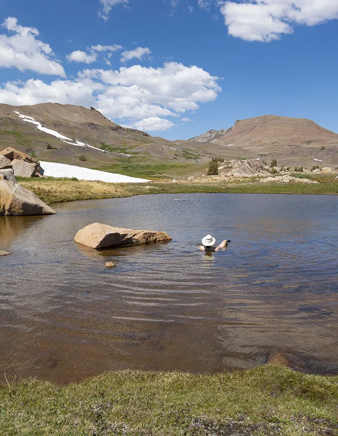
Compared to the thicket, the mosquitoes were almost non-existent. We laid out the tarp on the tent site, hid the bear canisters in the shade, then went to the cove for a swim.
This is when I realized I got tons of mosquito bites on my right ribcage. The shirt I had on has vents on the side, very helpful in hot weather and designed well. This time, in our big rush, I didn’t see that my shirt rode up all the way, and the backpack’s hip strap prevented it from falling back, opening those vents. The little monsters had a feast. We counted something like 16 bites in an area the size of a playing card.
We took a nice bath, the water was fantastic. It felt amazing to wash all the sweat and dust off. There was a gentle breeze, enough to keep the flying critters away, and drying in the sun felt great.
I put some hydrocortisone on the bites and the swelling went down right away.
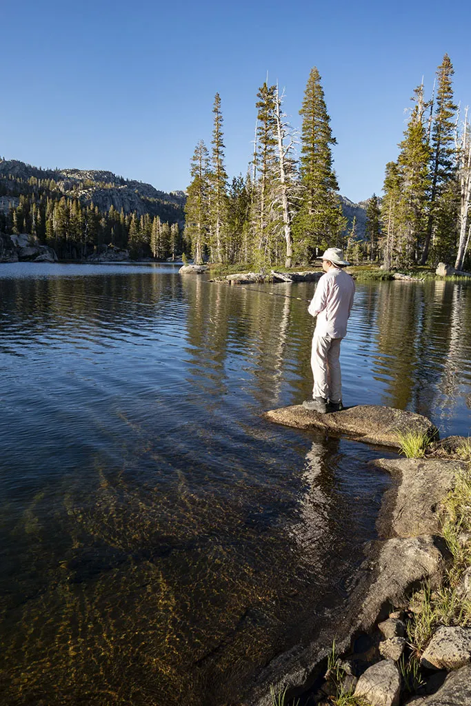
We cooked soup and I set out to fish. Meanwhile, Em gathered some wood and started a small fire to eventually cook the fish. The trout were not very active, but I eventually caught two nice sized specimens and they made an impossibly tasty first course before dinner.
The mosquitoes swarmed us a bit right around sunset, but we were covered up and with the purposefully smoky fire going, it wasn’t bad at all.
The evening was much warmer than at Long Lake, this being almost 1,000’ lower and a high-pressure system slowly moving in. We saw two people on the trail who only waved and moved on. They looked like they don’t have much of a pack on, we surmised they must be camped with that tent we saw earlier.
During dinner, we had a serious conversation about the mosquito situation. If it’s bad here, it should be even worse at lower elevations (or so we thought).
The original plan was as follows: from Huckleberry Lake, go east a bit, then north, past Emigrant Lake, over Mosquito Pass, down to Lunch Meadow, past Relief Reservoir, turn east to Kennedy Lake. From there, cross-country up to the trail north of Big Sam (almost touching the PCT), then over Emigrant Pass and back down to Emigrant Lake, re-crossing our path. Hence the figure-8 loop.
A huge part of this would be at lower elevations than here, and the Kennedy Lake area is especially boggy. We were convinced the mosquitoes are much worse there, so gaining elevation seemed like a good idea. I already studied the map for an alternative, and we came up with a totally different plan:
Let’s go up to Snow Lake, elevation 9,355’. It’s 1,500’ higher than our current position, there must be fewer mosquitoes. Spend one night. Then go over Bond Pass, down to the PCT, past Dorothy Lake and all those others, leave the PCT for Cinko Lake, climb over to Emigrant Pass and camp somewhere around High Emigrant Lake. If we like it there, we can stay two days, there was a non-moving day planned somewhere anyway. From that spot, we’ll continue down to Emigrant Lake, like originally planned.
After considering some alternatives, this is what we agreed on. Then it was to bed in the balmy night.
Day 3 – Huckleberry Lake to Snow Lake
It was a relatively mild, cloudless morning. We had around 11 miles to go with 1,500’ of gain. Like always, by the time we got ready, it was pretty late.
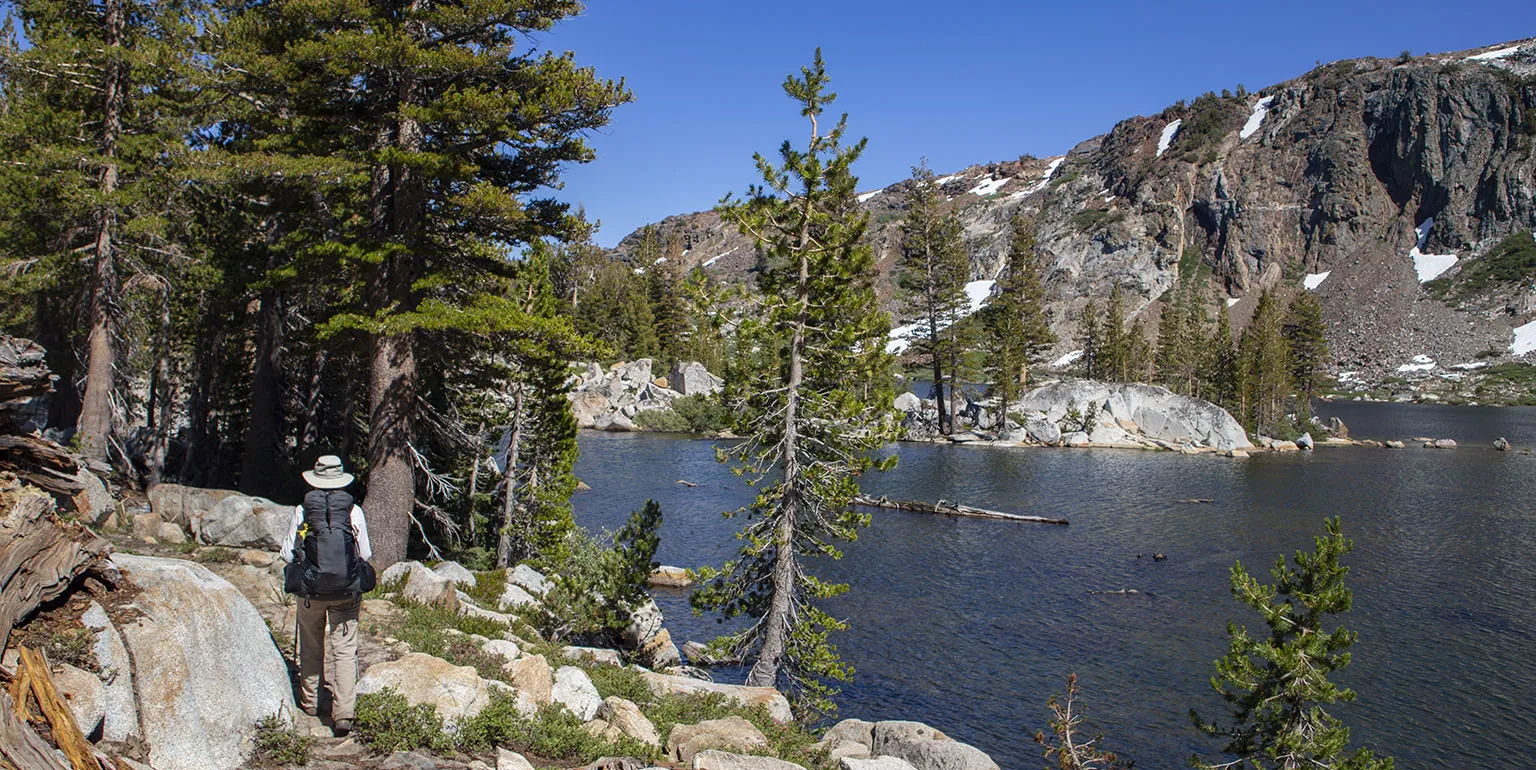
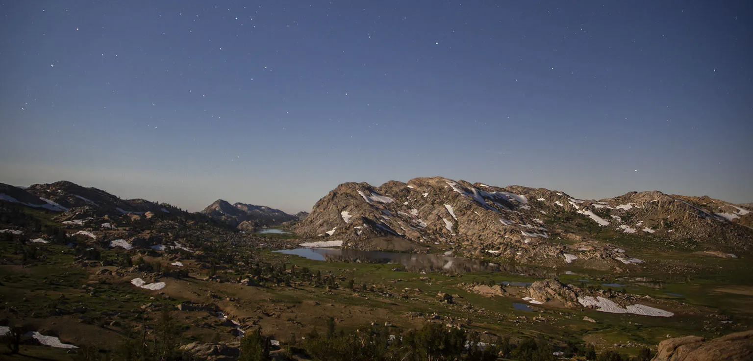
Towards the northeastern third of Huckleberry Lake, the trail hugs the shore, running right by the water. Gorgeous views. In the water, huge, beautiful trout swam around, making our mouths water.
We had to stop soon as I felt moisture around my lower back. I was afraid the Platypus bladder failed, but thank goodness it my only my own stupidity, somehow I neglected to tighten the hose enough and it leaked a little bit. Nothing got seriously wet.
Then it was forest again, with patchy wildflowers, butterflies and of course, mosquitoes. It’s another beautiful segment with the Sachse Monument towering on the far side of the creek, with the trail climbing a bit.
Before the creek crossing, there’s a break in the forest, this time sporting an impossible variety and density of wildflowers. We stopped for a quick snack and just marveled at everything around us.
The only truly questionable creek crossing was here, according to some people, the rushing water was waist-high only two weeks prior. However, the creek looked much tamer even downstream, and when we got to the crossing, it was down to calf-deep, with some rocks making it hoppable (that’s not a word, is it?)
Starting here, the trail runs on something that obviously used to be a dirt road. I had no idea back then, but this was the famous “Tungsten Road”, a conduit for two tungsten mines operating deep in the wilderness from the WWII era up until the Sixties.
Past the crossing, this road climbs sharply for a bit, right next to the creek with cool little rapids. Then it drops slightly into gorgeous Horse Meadow. It was green, vibrant, full of life, of course with the requisite mosquitoes included.
The main trail continues north to Emigrant Lake, with the other (our route) following the old road, running the length of the meadow. Here some sections of the roadway were in such good condition that even a regular car could have driven short stretches of it. On the far side of the meadow, we spotted some buildings with solar panels and obvious signs of recent occupation. The map does not show a ranger station here, but according to some information, that’s what it is.
We just couldn’t get enough of the meadow, leaving the trail several times to take pictures of the creek and the flowers.
Lunchtime was approaching, but we decided to keep going for another while. On the far side of the meadow, there’s another steep climb, but it was all easy going with all the wonders around us.
A bit before the junction to Emigrant Pass, we stopped for lunch at a creek crossing, sitting in the shadow and drinking the cool water.
Then it was uphill again, past the junction, and after another climb, there was Summit Meadow. It’s one of those typical gorgeous high Sierra meadows with lots of grass, a creek and a few rock outcroppings. Unfortunately, it didn’t look like there are less mosquitoes than at lower elevations.
The trail skirts the expanse on the side, leading towards Bond Pass. The junction to Snow Lake is right there, taking us through the boggy meadow. At one spot the creek formed small pools, some waist deep, and we had to find our way around them.
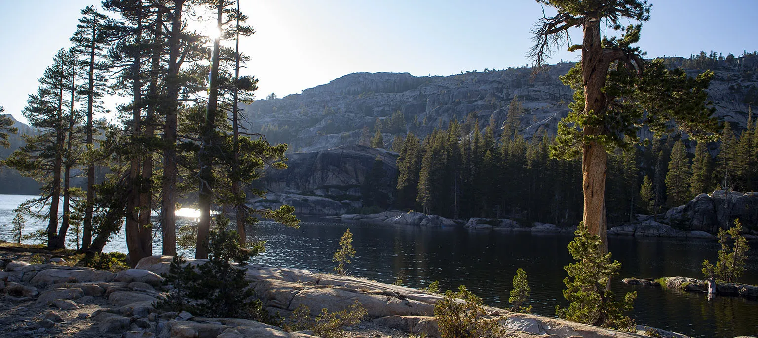
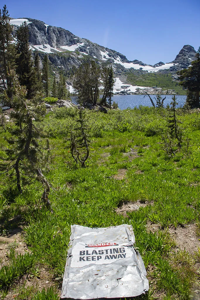
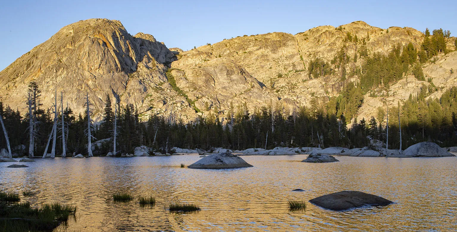
On the far side, past a tiny hill, we descended to Snow Lake, a true gem in a very wild place. Well, wild in the last few decades. This area used to be home to the Montezuma Mine, one of the tungsten mines I mentioned earlier. A building is still standing on the east side of the meadow. By the lake, several signs and pieces of equipment are still visible. Some look surprisingly modern, and later I learned the mine was still active until 1967.
We found some great campsites on the right side of the trail, but access to water looked awful. The lakeshore was close, but the way was blocked by huge fallen trees, thick underbrush and big rocks. Decent access was over a hundred yards away, not a problem, but we prefer it closer if possible.
We continued on, following the trail between the boulders and a creek crossing to the outlet and the lake’s dam. This was erected in the 1930’s, and despite its small size, it almost doubles the lake’s surface area.
We sat down by the dam to drink in the fantastic view while evaluating the situation. Between here and those sites, we couldn’t see anything else suitable. There wasn’t much of a choice, we went back and settled in a very nice area between some big boulders.
It became clear almost right away that the mosquito situation is not better than down by Huckleberry, if anything, it’s even worse. We didn’t get bitten, all our protection worked fine, but they were annoying, for sure. We tried to ignore them as much as possible, resting a bit and cooking soup. First, I fought my way through all the obstacles to the closest point of the lakeshore, but it was so cumbersome, I decided to walk longer to an easier place next time.
We took a nice stroll, I tried fishing - there was no movement. Later I heard there are no more trout here, but the tarns just downstream from the outlet supposedly still have some.
Other than for those pesky buzzers, it was an amazing evening with a little wind and the lake and the snow banks glittering in the afternoon sun. We took a shower one by one with the other fanning the mosquitoes.
Then we walked around some more, mainly to find spots a little bit more exposed to the wind. Every nook and cranny in the lee of trees and rocks had writhing balls of mosquitoes just waiting for a chance to come out.
Sunset was both beautiful and horrible, the light was amazing, but the wind died down completely and I kept joking that the air’s composition must be 50% nitrogen, 20% oxygen and 30% chitin. We were in good spirits, though, only having suffered a few bites here and there.
Thank goodness, by the time darkness fell and dinner came around, the situation got much better and we could have a normal meal.
We looked at the map again and discussed the following day’s plan. Our destination was only about four miles away by the most direct trail, but we affirmed to go with the plan discussed at Huckleberry and do the big loop via Bond Pass and the PCT.
Despite being much higher up, the evening was still very pleasant, way above freezing. Since those two hikers at Huckleberry, we’ve only seen three guys who came up to Snow Lake, but set up far away from us, out of sight.
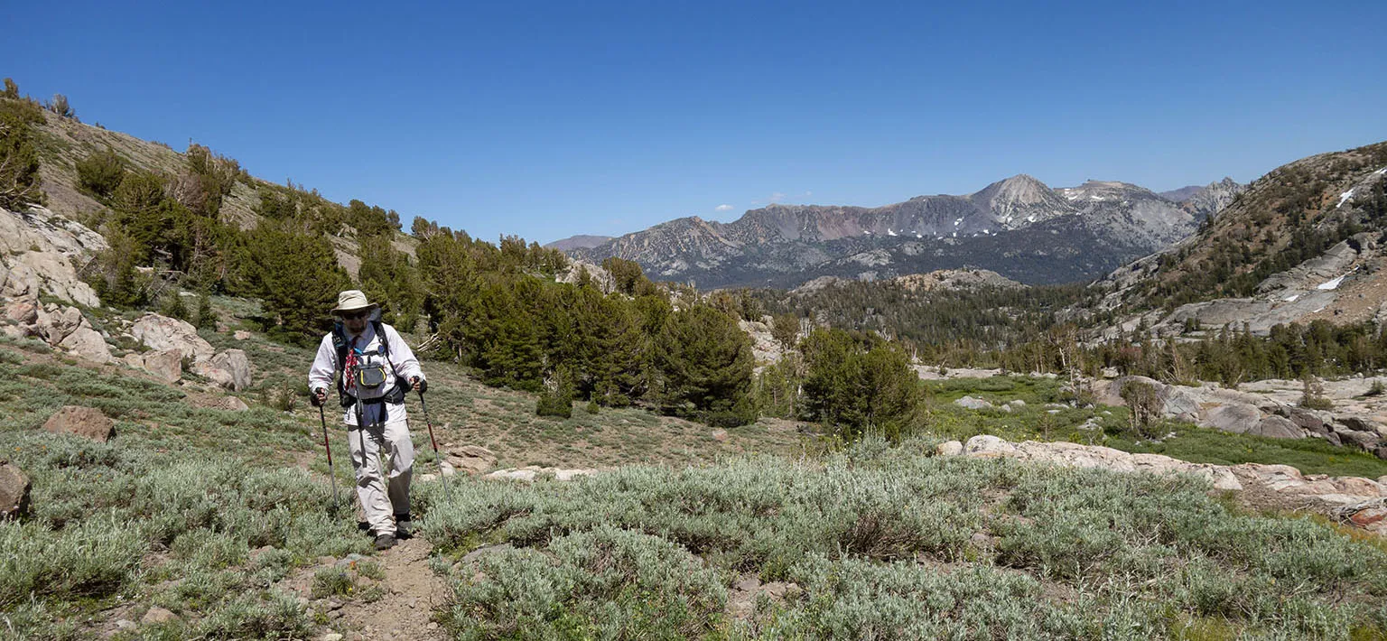
Day 4 – Snow Lake to High Emigrant Lake via Bond Pass, the PCT and Cinko Lake
This was going to be a medium-long day, about 13 miles, but with lots of ups and downs, so we tried to get going early. “Tried” is the operative word here.
We just left the campsite at around 8:30am when we met two guys walking down to the lake. They came up from the Kennedy Lake area, and they said only a few mosquitoes pestered them there. I realized they must have started hatching at lower elevations a few weeks ago, and higher regions, where we dwell, are next. Well, nothing to do now.
We followed the trail over the little hump back to the edge of Summit Meadow, but rather than going to the official junction again, we took the spur trail on the northeastern side. This was both a shortcut to the trail leading up to Bond Pass and a side trip to take a look at the old mining building. The medium-sized hut is in remarkably good condition. Maybe snow surveyors still use it. Or, if what I read is right, this patch is still under private ownership, and despite the mine having been inactive for over 50 years, some people come here now and then.
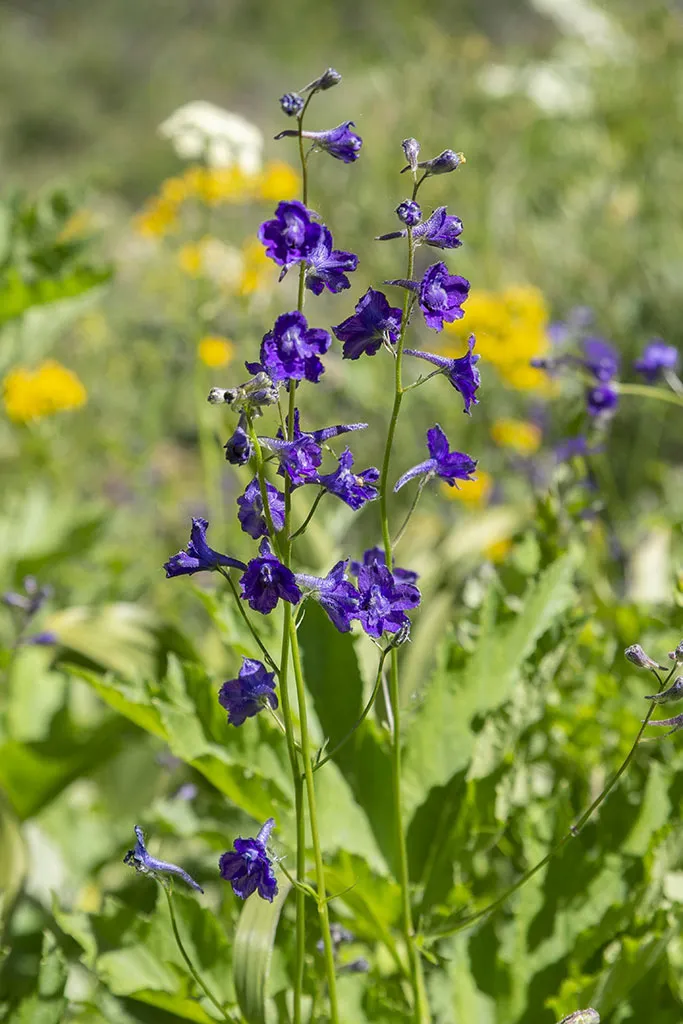
Past the hut, the use trail peters out, but we simply stayed by the trees in order to avoid the bog in the meadow, and soon we found the main trail, undulating uphill. The view was gorgeous with the mountains in the distance, the huge meadow, and everything adorned with lupins, Indian paintbrush and other assorted blossoms.
The route leading up to Bond Pass on the treeless hillside is not steep at all, and the pass itself is only a wide notch. Here the sign proclaims that you’re entering Yosemite National Park. The far (east) side is much steeper, the trail enters the trees and drops in elevation quickly, hitting the PCT 0.6 miles later.
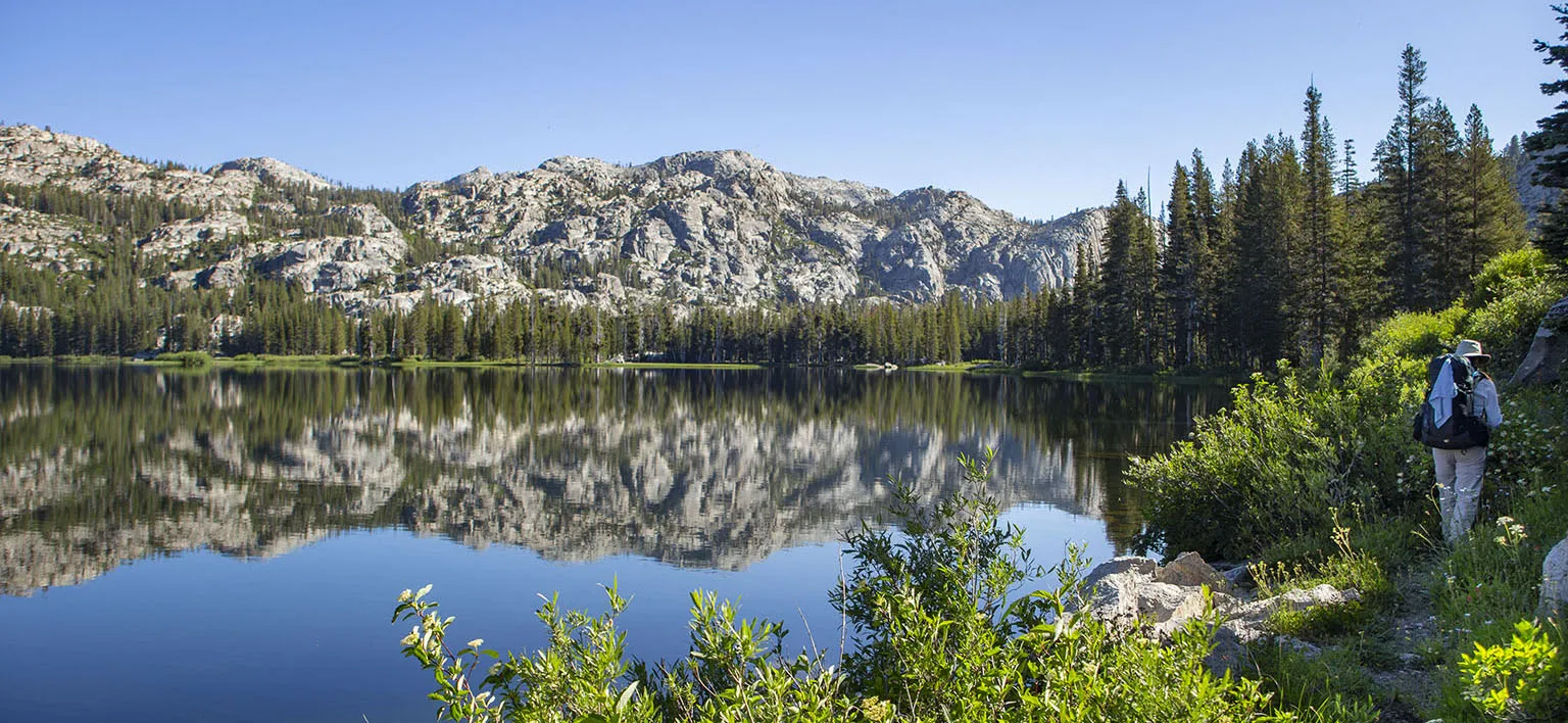
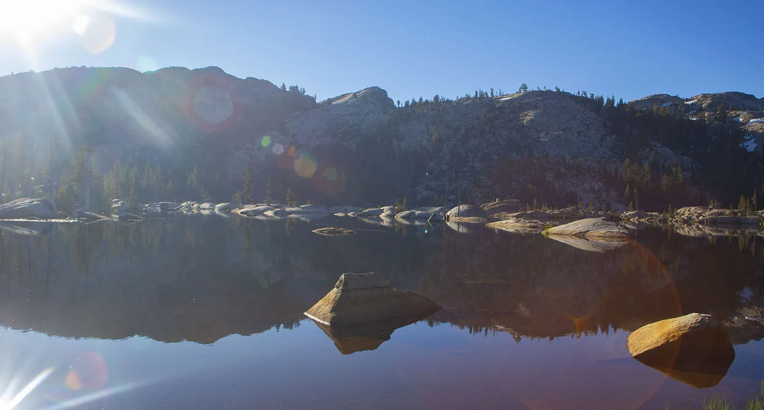
We turned north on the PCT, and soon the trees thinned out, with Forsythe Peak on the right and then Dorothy Lake appearing a bit further down the trail.
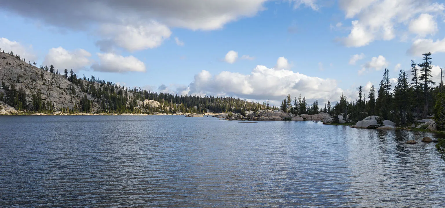
This is another one of those stunning sub-alpine Sierra Lakes with a diverse shoreline and clear water. We sat down on a rock overlooking the lake, ate a quick snack, then walked down to the beach. The water looked and felt great, but we decided against a swim, there was much more ground to cover.
I was sure we’ll see many people here, but it was deserted. The big tent area showed signs of recent use, but I guess all though-hikers have already left and the ones on the way did not arrive yet.
Skirting the lake and looking back, even more gorgeous vistas presented themselves with the lake and Forsythe Peak on the back. There was a small hill to climb to Dorothy Lake Pass, and thus we left Yosemite National Park again and entered the Humboldt-Toiyabe National Forest’s Hoover Wilderness.
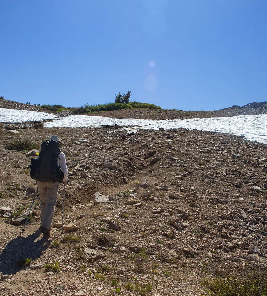
It’s all downhill from the pass, with amazing lakes, tarns, rocks and of course, wildflowers. Also, there was another snow bank to be crossed in a shadowy spot - an easy affair.
Most lakes bear ladies’ name here, like Stella, Cora, Harriett, Bonnie, and others. They are all so beautiful, I’d be hard pressed to choose the fairest of them all.
On a side note, we also realized that there seem to be a little less mosquitos here than on the other side.
Somewhat further downhill, at the crossing of Cascade Creek, we met a lady, the first human on the PCT so far. She had a nice dog with her, and they were going towards Yosemite. I guess she just risked taking the dog there, but I sure wouldn’t do that. Well, her thing. (In case you don’t know: dogs are strictly prohibited on wilderness trails in almost all National Parks and there’s a steep fine if they catch you).
It was easy downhill hiking in a beautiful place, punctuated by some rock hops over the creek. Soon we got to the Cinko Lake junction and left the PCT. The trail slowly climbs, passes a nice little tarn, and then there’s small but scenic Cinko Lake. The western end of the lake sports a large camp area, but only one tent was there with nobody around.
Another quarter mile past the lake, the trail bottoms out in a gorgeous meadow. Here we had to cross the West Fork of Walker Creek. There were obvious signs that the water was much higher recently. By now, the main crossing was just a bit deeper than our mid-height boots, but just a few yards upstream we found some rocks to use, so taking the boots off was not necessary. On the far side for the creek, the main trail turns north and goes back to the PCT at Walker Meadows. A supposedly unmaintained trail goes west towards Emigrant Pass. This is what we took.
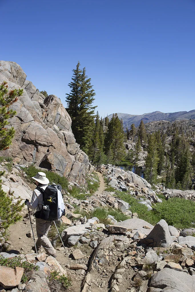
The very first section of the trail is crazy steep. Almost class 2+ climbing steep. However, this section is also very short and then it levels out, gaining elevations much more gently on the side of the canyon, mostly around the treeline.
It was a fantastic day. Unlimited sunshine, a cooling breeze, and other than that, silence, serenity and no other humans. Greenery and wildflowers everywhere with hundreds of butterflies flitting between. We had a great time just following the faint trail, stopping for pictures, then for late lunch by a small side creek.
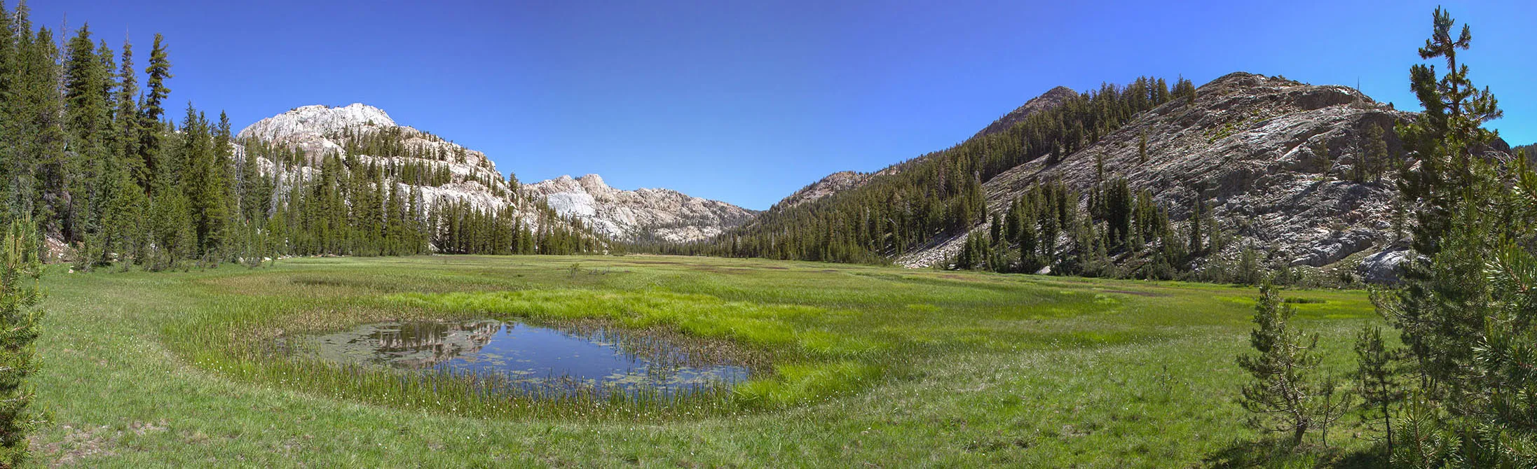
On top of the canyon, we lost the trail, the but the route was obvious. Here lies an amazing, huge meadow just below Emigrant Pass. It’s well over half a mile long, unbroken by trees or rock outcroppings, only crossed by the creek.
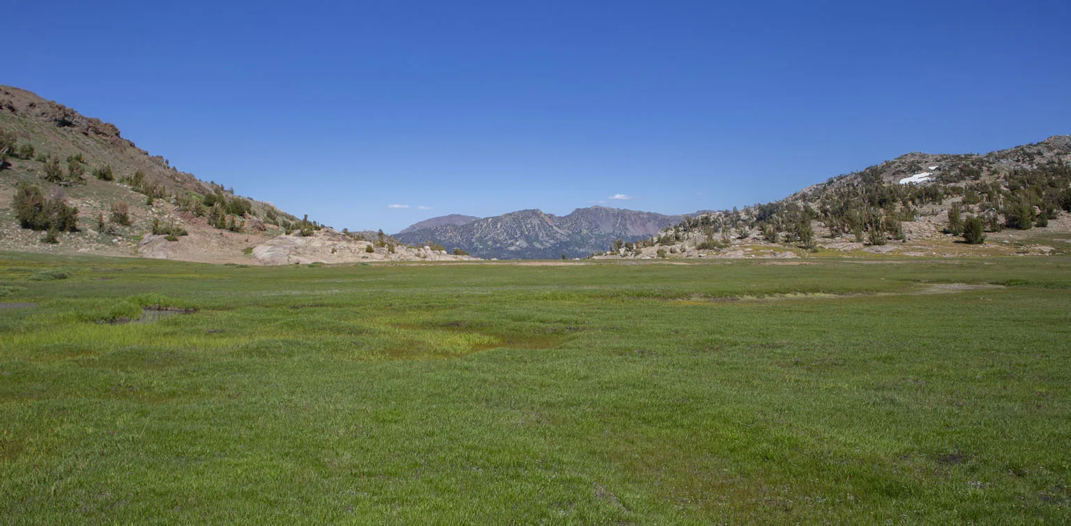
Everything was lush, green, dotted with countless flowers. It’s hard to describe how gorgeous it looked and felt.
Our destination, High Emigrant Lake, was to the northwest. We could have walk cross-country and saved as much as a mile, but instead we decided to follow the mapped route (there was still no visible trail) southwest so we can take a look at the pass and scout other possible campsites between there and the lake.
In the middle of the meadow, the creek created a few swampy patches, but we found our way around and slowly crossed this wonderland. On the far side, the creek emerged from under a snowbank and the ice-cold water evaporating on the warmer rocks made it look like a steaming hot spring (which it wasn’t).
Here, at the obvious exit point, we found the trail again and climbed the small hill taking us out of the meadow. On top, an expansive plateau awaited us, with the trail (and the old road) from the south joining in the middle. The morning’s campsite at Snow Lake was only about 2.5 miles that way. We have walked over 10 miles with this loop.
The old road was visible again, crossing the open plateau, in some places completely washed out by the creek.
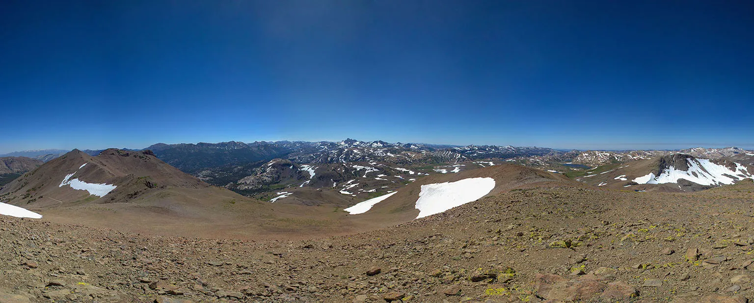
Emigrant Pass is another wide notch on a small hump with some sparse trees and great vistas all around. Then it was a bit downhill again, contouring towards High Emigrant Lake. Two hawks played and hunted in the meadow below. The lake came into view in a notch between some rock outcroppings.
Another 15 minutes later, we got to the outlet, the water held up by a small dam. The lake is medium-sized, almost round, with a relatively featureless shore. One side still had a huge snow bank, another a green meadow, some other parts were rocky. The trail skirts the west bank, and there it was rather sandy.
The hunt for a campsite began. There were suitable spots on the shore, but the mosquitoes were bad. As soon as you stopped for a second, they were all over you. Our protection worked, but it was annoying. The wind was very weak here, making their job easier.
We considered trying the rocks on the far side, but then decided against it. I climbed the hill to the west, and realized the wind is blowing over the crest. After running around a bit, I found two candidate spots and Em joined me. We settled in a sandy spot by some very comfortable rocks. They were perfect as tables, chairs and general storage. Also, a small tarn was nearby, meaning water access was taken care of. The tent we pitched a bit further away so it’s in the breeze as much as possible, with the entrance looking upwind.
Back around Emigrant Pass, we saw two people in the distance, but since then, nobody else was visible.
It was late, almost 5pm, but we quickly ate some soup, then went down to the tarn to bathe. We helped each other fanning the mosquitoes and got away with only a bite each.
It’s hard to explain how bad they were up at camp. Huge clouds surrounded us. When the wind blew, they broke up into smaller fuzzballs and hid behind everything offering protection, even surprisingly small rocks and patches of grass. Behind us, too, of course. The trick was to move around and turn in place so they scatter. As soon as the wind died down, they appeared seemingly out of nowhere and united into a new cloud around us. We were so well covered, we didn’t get bitten, it was more astonishment and wonder, and of course, annoyance.
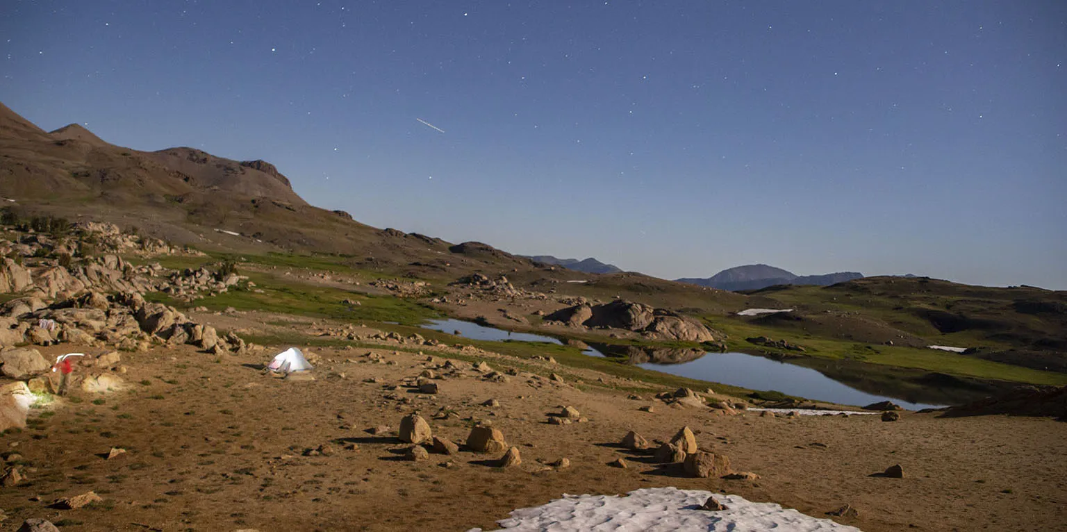
Dusk was impossibly beautiful. Warm sunshine, the almost-full moon rising, colors coming alive all around. We climbed the rock next to camp and enjoyed the view west with all the mountains and Emigrant Meadow Lake right in front of us. We realized there’s a big group camped down in the meadow, with gear looking like it was hauled in by mule train. There were no animals visible, though. What made us mad was the huge bonfire those idiots had going. I’m sure they knew fires are prohibited there, they just didn’t give a damn.
Regardless, we enjoyed the evening. The buzzers really went into overdrive just before sunset, made worse by the dying wind, but it was OK, we had a great time. They disappeared soon after, thank goodness, and we had a “normal dinner”. We discussed plans for the next few days, and the verdict was to stay in place, make this our two-night-spot. We concluded the mosquitoes would only be worse at any lower and wetter place, so do a day hike, spend another night, then go down to Emigrant Lake.
Darkness never really fell as the moon beautifully illuminated everything. I climbed the rock again to take some long-exposure pictures of the view.
With the mosquitoes gone, it was an amazing night, calm and clear. The temperature only dropped to about 45°F.
Once in the tent, we mounted a serious effort to find any mosquitoes we may have dragged in. Two were found and met their fate, and we must have been thorough, none bothered us during the night.

Day 5 – Upper Emigrant Lake to Big Sam and back
We tried to sleep in, with not much luck as the sun hit the tent almost right after sunup. At least a hundred mosquitoes gathered between the rainfly and the tent body, already eyeing us like delicious servings of food.
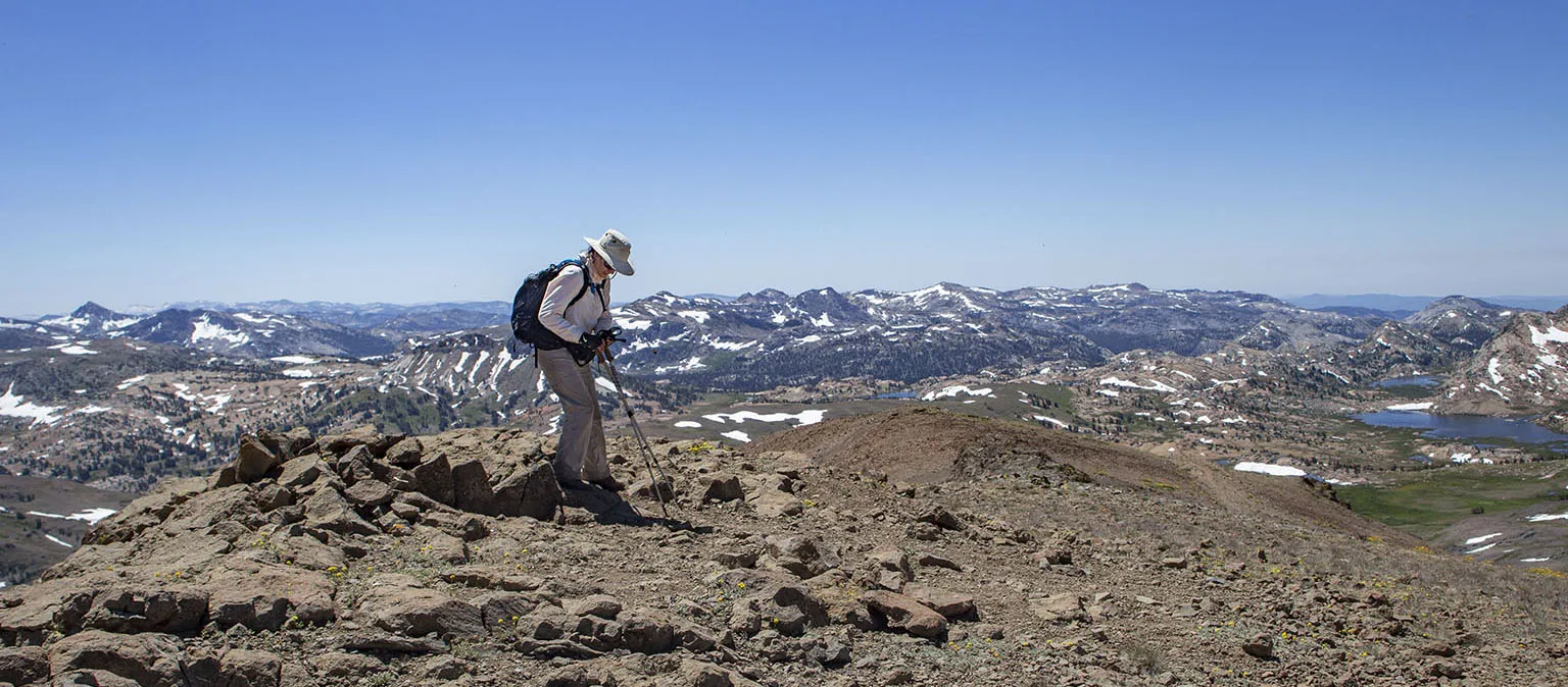
It was a sparkling, fresh morning, almost no wind. We ate breakfast, then taking our time, packed daypacks and walked back to the trail. The goal was to hike to the top of Big Sam, a dome-shaped mountain only a few miles north. It’s not technical or even steep, the old road’s path is clearly visible snaking up the side.
It was slow going, we stopped every few steps to take pictures, buzzers be damned.
It’s tough to convey how amazing it was. This area is relatively barren, just above the treeline, covered mostly in different grasses and small shrubs. However, it was sizzling with life. Flowers, flowers, and more flowers, with butterflies, frogs and of course, millions of mosquitoes in between. The colors and shapes were almost impossible to comprehend.
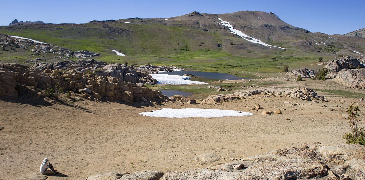
Just past the lake, there was a huge grassy area with a creek, then a snow bank and another creek crossing. Here the climb began, zigzagging up the road’s remnants. It was easy going, slowed only by all the photo opportunities. The view to the south and west kept opening up, and as we approached the top, slowly Kennedy Lake came into view to the north.
The actual summit of Big Sam is a bit east of the trail. First, we walked past it to the north side to some rock outcroppings to enjoy the view that way. The PCT was clearly visible, climbing steeply out of Kennedy Canyon, then undulating on the barren crest towards Levitt Peak and eventually Sonora Pass. The use trail from Kennedy Lake was also obvious, at least in some parts.
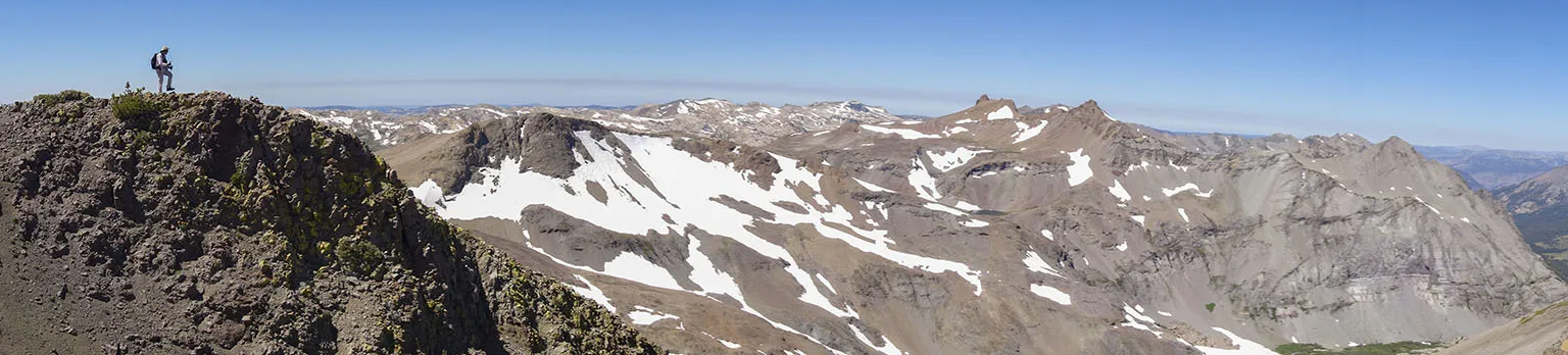
We walked up to the summit, a flat, wide area. It was almost unbelievable, but the mosquitoes were at least as bad, if not worse, than back at camp. Despite being on the highest point for miles, the wind was not very strong, and in the usual pattern, as soon as there was the tiniest break, the buzzers attacked. It might also be interesting to mention that there were no discernible bodies of water anywhere near.
However, we were getting used to the onslaught, and another spectacle demanded our attention: hundreds of thousands, maybe millions of butterflies, were migrating over the summit. They were mostly swift-tails, yellow and black, braving the wind. It was unbelievable. We just sat there for almost an hour, ate lunch, and enjoyed the show.
Then it was downhill again, retracing our steps. Like before, we took it slow, not getting enough of the flowers and the views. If possible, the flowers were in even more bloom since morning, especially in the meadow by the lake.
Around 2pm, we were back at camp. Taking a nap in the tent was out of the question as it was baking in the sun. A few fluffy little clouds showed up, but they didn’t provide much shade, only helped making pictures even more scenic.
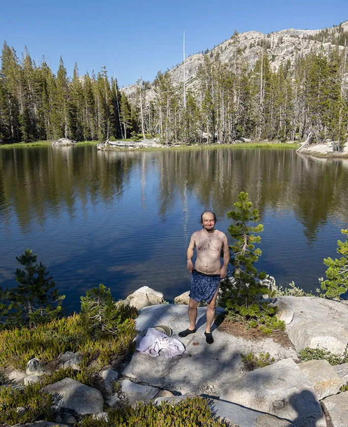
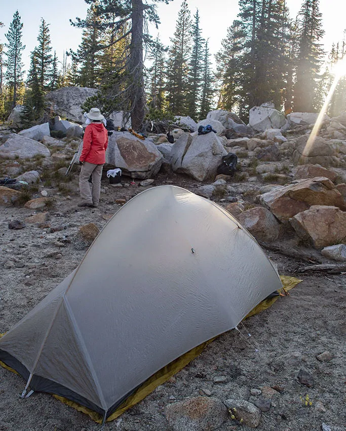
We went down to the tarn, took another bath with the usual precautions and then I helped Em do laundry. Side note: the picture in the gallery with her and the bear canister bucket is deceptive, the soapy water I dumped way further up the hillside, at least 200’ from the tarn.
At camp, we had a visitor in form of a Sierra tree frog. Three quick things about these adorable amphibians: (1) you can easily recognize them by the line on their face going through their eyes, (2) they are never found in trees, and (3) they can change color to mimic their environment. They can’t do it as quickly as a chameleon, it takes hours to days, but they can be bright green, gray, brown – whatever the immediate medium is. This one was gray with black spots to mimic the rocks. Earlier, we saw a light brown one on rocks of matching color.
The afternoon was very pleasant and warm, with the wind keeping the mosquitoes somewhat in check (the air was still at least 25% chitin, though). We lounged around, mended some clothing, ate soup.
Around 6pm, we took a nice walk, climbing the rocks and venturing a bit further north. The idiots were still camped in the meadow, their fire going.
We explored the area and scouted a cross-country route down to the lake. It was obvious enough, just down downhill and keep south-ish.
Sunset was just as spectacular as the day before, the moon following later behind. Full moon was at dawn the following day.
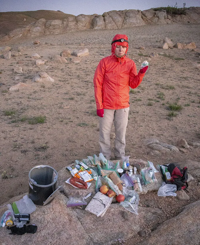
True to our usual custom, we did inventory. Everything was unpacked from the bear canisters, and we examined our food supply for quantity and quality. The inspection was satisfying in both respects, looked like we have plenty and nothing seemed spoiled.
Sure enough, the mosquito raid was relentless and reached its peak in the minutes after sundown, but then right on schedule, they disappeared. Dinner in the dark was very pleasant.
The moon came up, and this was a great time for taking some more pictures.
Another side note: though poets often call moonlight “silver”, ”blue” or “cold”, it’s anything but. Full moonlight is about 6 to 7 orders of magnitude weaker than full sunlight (this means it’s between 100,000 and 1,000,000 times darker). Our eyes can see well in low light, but it comes at a cost to color vision; we see shapes well, but colors are muted as the low-light receptors in our eyes are not sensitive to color. Moonlight (well, it’s sunlight reflected by the moon’s surface) is warm in color temperature (yellow), but we perceive it as almost monochrome. If you take nighttime pictures at long exposures, it’s easy to see. For those who want to get technical: full moonlight is about 4,200°K.
Notwithstanding (or because) of all this, we had another amazing, calm, quiet evening. Other than the people camped in the meadow, we only saw a small party in the distance earlier in the day.
Day 6 – High Emigrant Lake to Emigrant Lake
It was to be a short day, only a few miles, mostly downhill to the supposedly gemlike Emigrant Lake. The Emigrant Lake, the big one, the proper one, the one without any prefixes.
The alarm went up at 6am with the sun hitting the tent 20 minutes later. Of course, our dear stinging friends were out by the thousands, happily greeting us. We took our time getting ready and it was almost 8:30 by the time we left camp.
Walking down the hillside to Emigrant Meadow was easy, we took aim at the lake’s northeastern tip, where an unmaintained trail should take us southeast to Middle Emigrant Lake, Blackbird Lake, and eventually Emigrant Lake. All these Emigrant names are a bit confusing, I know.
We crossed the main trail and found the unmaintained track skirting the lake. This trail was faint, indeed, many parts completely lost in the grass and the bog. The general direction was still a no-brainer.
The lakeshore had lots of vegetation and standing water. The mosquitoes… Wow, holy whatever… We’ve never seen anything like this. They were all over us and everything else. Millions, sizzling and humming and buzzing all around. It was hard to breathe. I took a few pictures while moving and we just kept walking and walking, as fast as possible. The scenery was gorgeous, though.
Past Emigrant Meadow Lake, a bit downhill, there’s Middle Emigrant Lake (yes, I have “Emigrant” on the clipboard and keep pasting it). The trail (though still not visible in many places) takes the east side, going between the rocks and the water. Before you get there, though, there’s a huge bog and a creek crossing. We met two elderly gentlemen coming up, they said they camped somewhere in the area and of course complained about being bitten countless times. They also said the creek is too deep to cross with shoes on.
That we took as bad news, we didn’t want to get our shoes wet, but we also didn’t want get eaten alive while stopping to put shoes on and off.
The bog was as bad as it gets, with the air becoming almost pure chitin. It was like a tropical jungle.
However, we got crazy lucky. We hit the creek, and at first, it looked hopeless, it was at least knee deep and wide. We tried to make a quick decision regarding wet shoes vs. bites, but then Em looked a bit further upstream, and found what looked like a possible crossing. Previously obscured from view, a small island of rocks and sand was in the middle of the creek, and it looked like a big jump can get you there. The near side of this was guarded a by terribly thick phalanx of bushes, but it still seemed easier than any alternative.
It worked. First, I fought my way through the thicket, then skipped, jumped and landed on the other side. Em followed. It was close, she even got a few drops of water in one shoe, but nothing of concern. There was no time for celebration, though, we kept moving.
As far as Middle Emigrant Lake goes, it’s very beautiful as well, sitting in a small valley with rocks all around and some boggy areas. A huge field of blooming lupins awaited us on the far side, and pictures were taken again while moving.
Another downhill section followed with the hard-to-see trail going down in this amazing little canyon with lots of diverse vegetation. Here we had to negotiate the next creek crossing. The stream had much more water than the one above the lake, and in most places, it was deep (up to waist-deep). Regardless, the crossing was easy, some huge boulders are strewn around one of the bends, and while there’s no straight way, if one can figure out the proper order, it’s possible to jump across. It was a bit like Super Mario, but the boulders didn’t sink.
Another 15 minutes later we walked past Blackbird Lake (very scenic as well, of course) and hit the main trail. If we had kept to our original plan, two days ago we would have come on this route from the south.
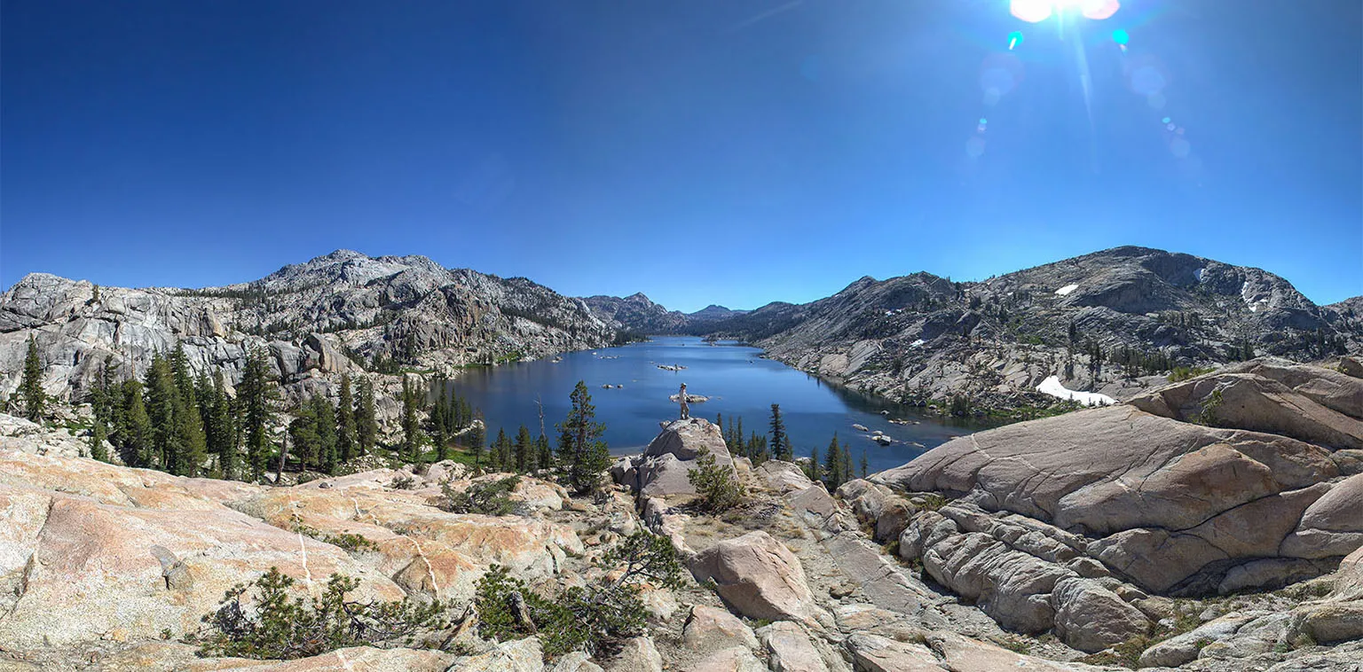
A short, much steeper downhill section in the trees took us towards the meadow on the west end of Emigrant Lake. While still in the trees, we found a shady spot with comparatively few mosquitoes and sat down for a quick snack. A few minutes later, we walked through the gorgeous meadow to the inlet of Emigrant Lake (actually, this is North Fork Cherry Creek). The lake itself stretched languidly into the distance, visible, but not in its full glory yet.
Since leaving camp, less than two and a half hours went by, including the break.
The crossing proved to be the second shoes-off affair of the entire trip. The water was wide, only calf deep and flowing very gently. The cold water felt great on our hot feet and we sat down on the far side to dry ourselves. Despite the thick grassy meadow around us, the buzzers were surprisingly sparse.
Just past this crossing, there’s the junction leading north to Mosquito Pass or east along the lake. We took the latter, first stopping by the beach for some photos, then past the main camp. This area looked very nice as far as the view goes, but it was one of the “village” type places. Some tents were already set up, but nobody was around.
A bit further down, there was a fantastic little peninsula with an established campsite and a fire ring. Just a reminder: fires are prohibited half a mile around this lake and the campsite, prime location or not, is also highly illegal, being too close to the water.
Compared to what we endured only short time ago, the mosquito situation was amazing, with only a handful showing up now and then.
We met a couple on their way out, they said they’ve camped here for the last three days and the buzzers have diminished significantly in the last 24 hours; it was much worse only the day before. Great news.
The trail continues on the rocky shore with impossibly scenic views of the lake. Finally, about a quarter mile before it reaches the outlet, it turns north and starts climbing. I was a bit concerned where to find camping before having to leave the lake. We didn't want to go further up, but defrinitely didn't want to return to the "village", wither. Thankfully, my concern was unfounded, there was a great spot just past the trail, not too far away from the lake and offering decent privacy.
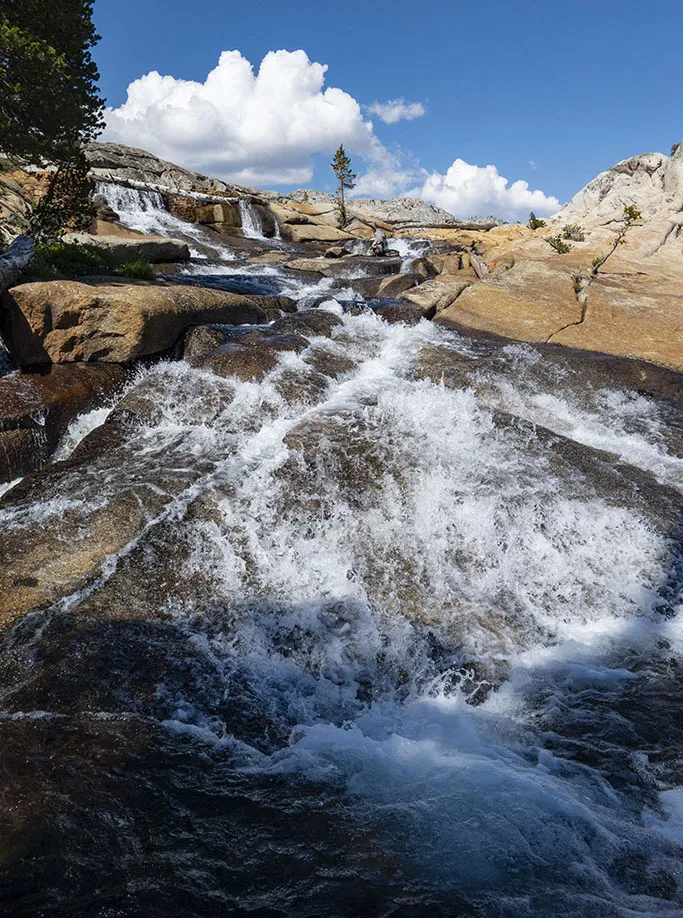
We settled down, ate lunch, then ventured a bit further towards the outlet to this amazing beach with a sandy shore. We took a bath, then went even further down. When researching this trip, I saw on the satellite imagery that Emigrant Lake’s outlet is a series of beautiful cascades, but access looked dodgy. However, we found a use trail, and following that with a bit of boulder hopping and bushwhacking, we got to the outlet in no time. There’s a little dam, in bad shape I must say, and past it, the water rushes down a wide, steep, long slide. With the recent melt, it was unbelievably cool. We spent lots of time exploring the features, including climbing down to the bottom for a better view.
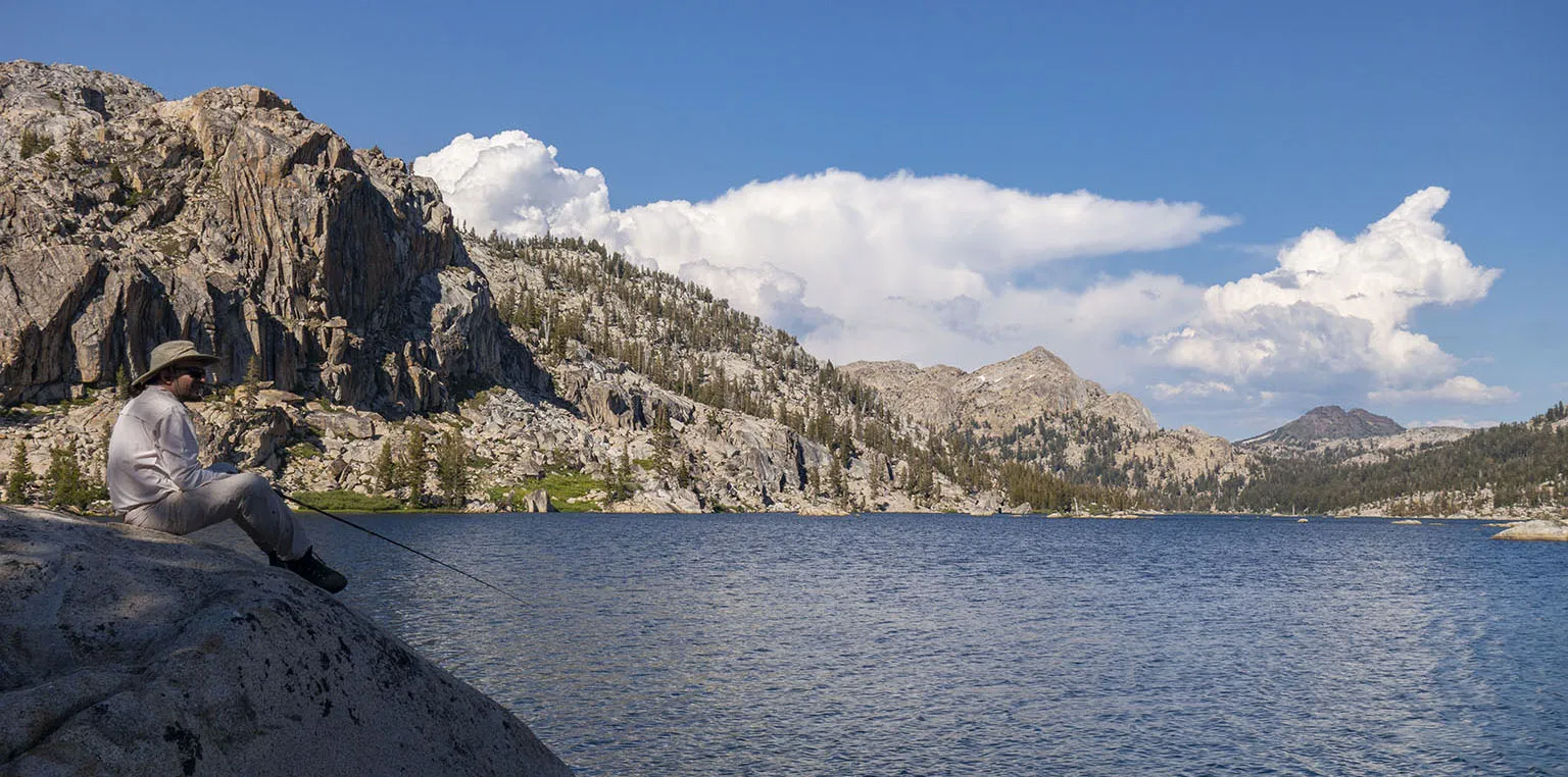
Then we went back to camp, picked up the fishing gear and found a very nice rock jutting out into the water, offering perfect opportunities to cast in several directions. The experience was enhanced by the view of the lake with the afternoon sun and some clouds in the distance.
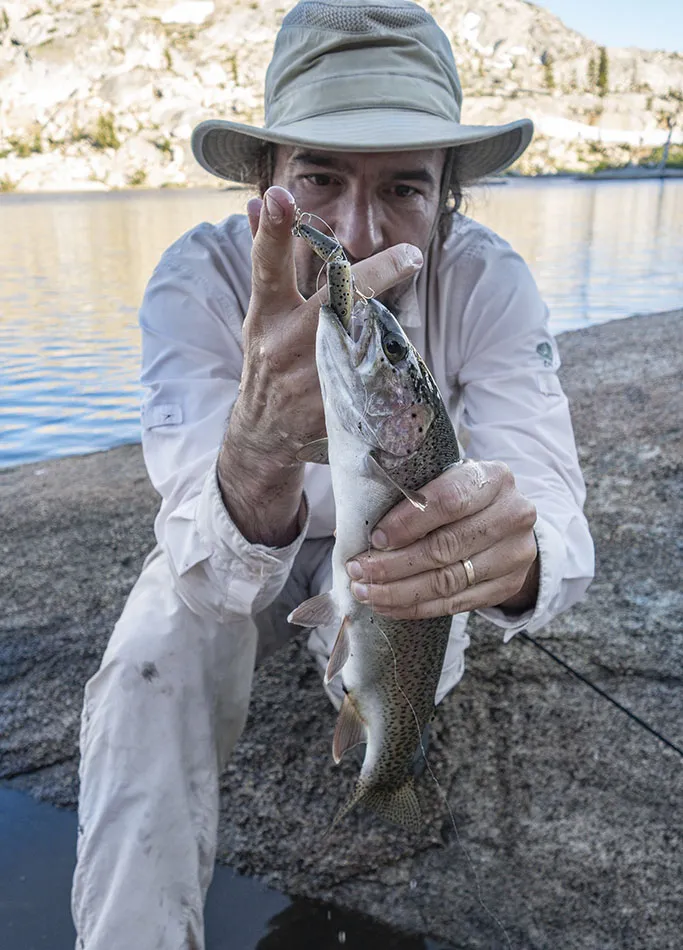
Fishing was fantastic, I caught several big trout, even had to throw back a few. Meanwhile we figured we’ll eat them here by the lake, so Em walked back to camp to retrieve the stove and other trappings. Just when she got back, something happened I swore would never happen to me: the fishing hook caught me.
I’ve been poked by hooks countless times, but when my uncle was teaching me fishing starting the age of three, he always warned me so strongly against getting the barb into my flesh that I kept being extra careful and it never happened in almost 40 years of fishing. Now, as I was removing the hook from a nice big trout, he jumped, and the treble’s other branch burrowed deep into my finger, barb and all. It was painful, but I was laughing, telling Em how stupid I am. It took it out, of course, pressing the hook sideways, away from the barb’s side. It bled a bit, but no big deal.
Then I cleaned a fish, and some of them had decent amounts of roe. There are several ways to eat roe, we did it like back home: a squirt of olive oil, salt, citric acid. Whisk forcefully until it’s almost a cream. Enjoy with bread. What a great appetizer!
While the fish were cooking, I caught another trout by mistake: I didn’t see that my lure got loose, slipped in the water and the current carried it a few feet into deeper water. This was one of those lures mimicking a tiny trout, and usually it only works when moving, but I guess it got the attention of a hungry individual while floating placidly, because all of a sudden, we heard a splash, and saw there’s a fish on the line. I retrieved it and it turned out to be a beautiful, sizable rainbow. Then it happened for a second time: while I removing the hook, the fish jumped and the hook caught my other finger, barb deep in the meat again. This was even more painful than the first, but I was laughing even harder. Twice in a row after such a long time!
Em helped by keeping the fish still, I yanked the hook out, and released the trout. It was still in great shape and swam away happily.
It was late by this time, past 7pm. We ate the fish, delicious like only fresh trout can be. Then we just sat on the beach, watching the sunset colors turn pink, then blue. Though there was no wind, the mosquitoes were a million times less pesky then by High Emigrant Lake and the evening was just perfect. After some dessert, we walked back to the campsite and went to bed.
Day 7 – Emigrant Lake to Long Lake
The adventure was almost over, the penultimate day dawned. Well, at dawn we were still sleeping, the tent in the shade well past sunrise. We only had to walk about 7 miles that day, so there was no alarm set. Finally, we emerged from the tent at 8am. Few mosquitoes, beautiful weather. After a nice, long breakfast, we walked a few hundred yards towards the outlet again, but this time, we climbed the rock overlooking the lake. I was already scouting this vantage point the day before as it gives a perfect perspective of the entire body of water lengthwise and knew the light should be great in the morning. It turned out well, the conditions were perfect, we had an amazing time and took some pretty decent pictures.
We would have loved to stay another night, but that was not possible, the car was almost 19 miles away. We can hike that long in a day, but driving home for another 6-7 hours after such a hike would be very tiresome.
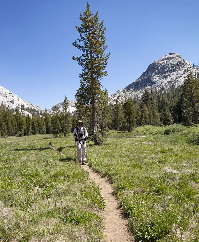
By the time we broke camp and left, it was almost 11am. The trail climbs away from the lake, then drops to Buck Meadow. This is another amazing place with a beautiful creek, tons of greenery, and flowers, flowers, more flowers. Here several huge fields of bright pink pussypaws stood out.
Noon found us at gorgeous Upper Buck Lake. There were many large campsites in the trees by the shore, all abandoned at that moment. We were hungry and there was a perfect spot in the shade, so we ate our lunch, not hurrying.
From here, we followed the trail west, first by a steep but short climb, then a bit of a drop to Deer Lake. This was the junction where we turned south four days ago, the one with all the shooting stars. They were even more abundant now, so we had to stop and take some additional pictures.
Then we found the use trail going up towards Long Lake (it’s on the east side of Long Lake’s creek). After a short and easy climb, we were below Long Lake again, this time on the other side of the creek.
The outlet area is super gorgeous with all sorts of cool rock formations and tiny tarns in the twisting creek. We walked up to the dam, still featuring a wheel that could raise a sluice gate. However, the entire mechanism looked so old and rusty, I doubt it would be easy to get it going again.
There was a campsite right below the dam, a bit exposed, but otherwise not bad. However, we decided to go back to our old spot on the other side of the lake. As I mentioned before, the terrain on the lakeshore is very broken up, making for a slow going. Saving that time and distance the next day was on our minds.
Thankfully, the campsite at the other end was still deserted. We settled down and went for a swim. The water was pure heaven: clear, almost warm, the bottom sandy, not muddy. I swam around for a long time, thoroughly enjoying myself. Em took a shorter bath, she’s doesn’t like non-hot water very much.
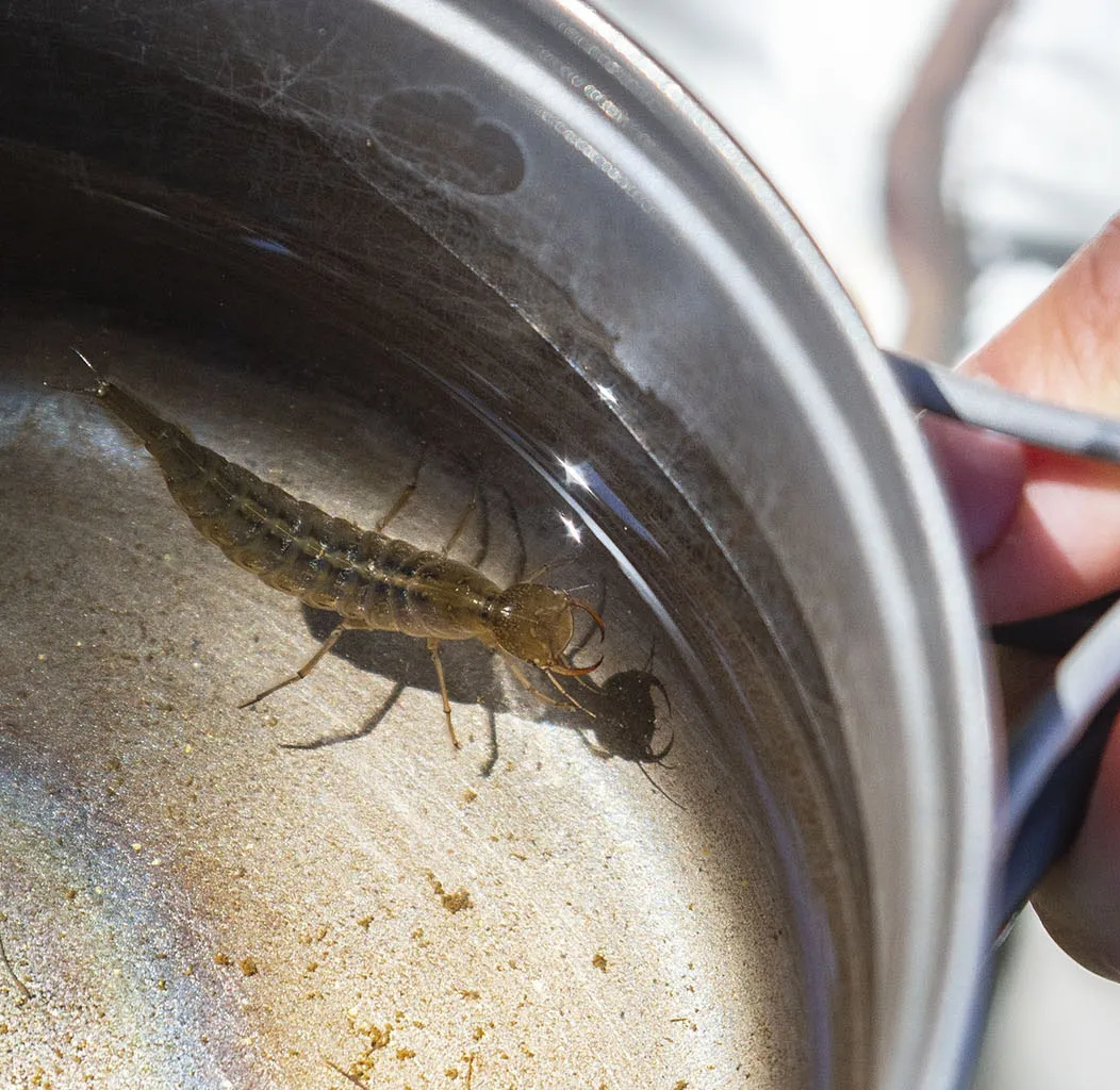
An interesting side note: I found a huge waterbug in the shallows and scooped it out with the cooking pot to take a better look. It was almost three inches in length and looked like a menacing predator. We let it go, of course. Later we found out that this was the aquatic stage of a dragonfly, called a nymph or naiad. Dragonflies lay their eggs in the water where they hatch and they spend several months or up to five years (!) growing. They are so fierce in this stage, they even catch small fish. Their lower jaw is an extremely powerful weapon, capable of reaching forward several inches, delivering deadly blows. Their makeup was also the inspiration for the creature’s mouth in Alien, designed by the famous Hans Ruedi Giger. To finish the story: these naiads then crawl out of the water, cocoon themselves and emerge as the colorful and amazing dragonflies we all know well, living only a few weeks at most.
Back at the lake, it was a perfect last evening of a fantastic trip, mosquitoes or not. A group of guys showed up, looking for a place to camp. We advised them to look further down on the shore. Also, they complained about too many mosquitoes on the trail, and we laughed them off, regaling tales of the swarms up by High Emigrant Lake.
Then we had a great last supper, and enjoyed the last of the dessert. However, like always, we still had plenty of food left.
Thinking of the day ahead, we tried (and failed) to go to bed early, the Nunatak quilt way too warm in the pleasant night.
Day 8 – Long Lake to Gianelli Trailhead and L.A.
Up at the usual 6am, start breaking camp while making breakfast. We mixed the remainder of our dehydrated hummus and dehydrated baba ganoush, thus making “hummuganoush”. Tasted wonderful.
Lo and behold, contrary to our normal slowpoke pace, we were on the trail in less than two hours. Not a record, but way better than the average two-plus hours.
We retraced our steps up the hill, back to the main trail, through the valleys and meadows, creek crossing and rollercoasters. Everything was even more beautiful with the wildflowers truly going crazy by this time. Whites Meadow had one of the thickest lupin fields I’ve ever laid eyes upon.
Starting around the Chewing Gum Lake turnoff, we started seeing more and more people, almost like on the PCT/JMT. They couldn’t spoil our great mood, though. At noon, we realized we’re very hungry and though we were only about two miles from the car, we stopped for lunch, sitting on a rock overlooking Powell Lake.
Not much later, we walked down the hill and into the parking lot, our car waiting for us, very dusty, but otherwise unharmed. On the drive out, we saw a deer with two fawn, both tiny and spotted. Unfortunately, they ran away quickly, I could only get a half-decent picture of one of them.
The rest of the drive home was long, but we weren’t that tired and kept discussing future plans in the amazing Emigrant Wilderness.
Make sure to check out all the pictures in the full gallery.