Intro
After having done the first few miles of the Trans Catalina Trail in November 2012, we couldn't wait to go back and do the rest.
The entire trail is 37.5 miles, but hiking only this exact distance is almost impossible. The TCT starts east of Avalon at Renton Mine Road, so the trailhead is already almost at mile 2 (counting from the harbor). The northern terminus, Starlight Beach, is in the middle of nowhere, meaning unless you have a way to arrange for a boat pickup at that spot, you have to hike back at least to Two Harbors, which is circa 13 miles. Our total ended up being somewhat over 50 miles with all the small side trips, even after shaving off 4 miles on the first day.
We decided to go in March. The the island should still be nice and green and the weather pleasant. Also, 90% of this trail is fully exposed, so hiking under the hot summer sun was very unappealing, not to mention the crowds that descend on the island in the high season.
Camping is stupid crazy expensive. As no wilderness camping is allowed whatsoever, you have to stay in one of the few designated campgrounds, some of which could almost be called backcountry. All sites can (and have to) be reserved online, and the prices are beyond pale. You have to pay by person, and at Parson's Landing, you don't really have much of a choice other than buying locker keys for water and firewood (more about that later). For the five nights we spent on the island, the camping bill was exactly $200! In many cities, you can get a hotel room for less. If you really want to splurge, there's even a baggage hauling service, a bit like a motorized version of a mule pack. For a steep fee, all your gear is in camp by the time you arrive, even with the tent set up and the fire going, if you say so. Obviously, we did no such thing.
However, I remembered there's a tiny post office in Two Harbors. I looked into the possibility of mailing ourselves a package ahead of time so we can have a mini-resupply halfway through the trip.
So, after biting the bullet and paying for all that expensive camping, we bought the boat tickets, departing from Avalon on a Sunday, coming back from Two Harbors next Friday. We took a flat-rate USPS box, filled it with some spare clothing, a bottle of wine, and dehydrated food items, then mailed it to Two Harbors almost a week ahead of time. They told us the guaranteed delivery time is 4-5 days, so we should allow for some delay.
Day 1 – L.A. to Avalon, then Black Jack Mountain Camp
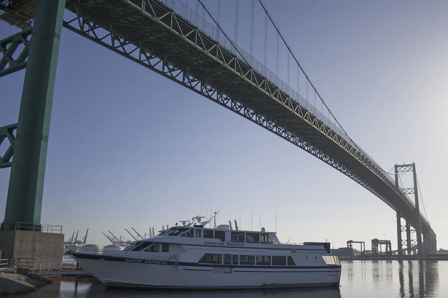
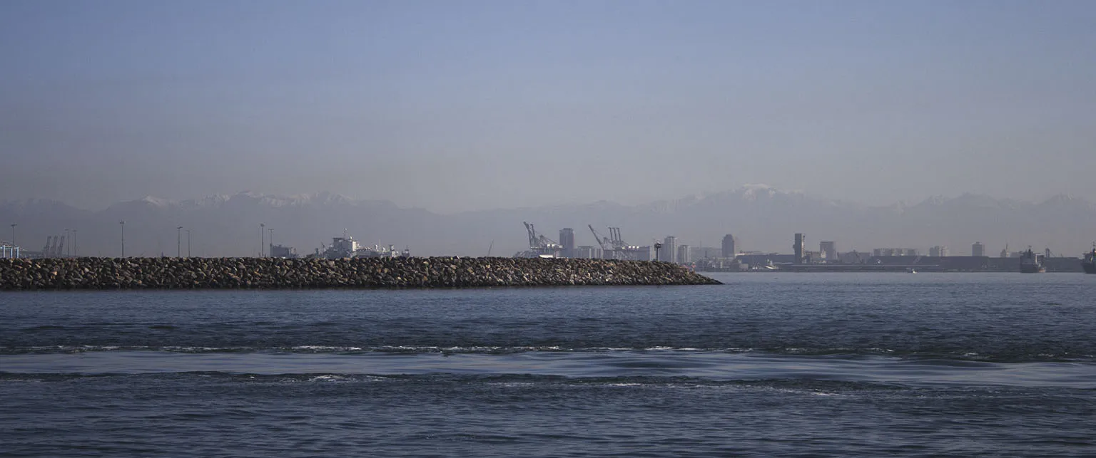
We got up bright and early and drove to San Pedro. The departure port is right under the impressive Vincent Thomas Bridge. The ticket lady gave us a hard time for a few minutes, she saw our Y-shaped itinerary, and somehow didn't want to believe that we'll walk from Avalon to Two Harbors and we didn't need boat or bus tickets. Trying to explain the fact that we'll walk beyond and back would have been even worse. Anyway, we sorted that out. Thankfully, the boat was not very full, and we could keep our backpacks. As soon as the boat pulled out of the dock, we were treated to a great show of dolphins jumping and seals swimming around, with pelicans follwing them low over the water. Past the harbor, the snow-covered peaks of the San Gabriel Mountains were on the horizon.
With clear skies and calms seas we were in Avalon in no time. The camping reservations include the hiking permit, but we still had to check in at the Conservancy's office. After taking care of that, we hiked through town up to Avalon Canyon. As we did the first section of the TCT last time, the plan was to skip it, instead go up to the trail at Hermit Gulch and then to Black Jack Mountain, the first "backcountry" campsite.
Hermit Gulch Campground was much greener and nicer than in the winter. We stopped there for lunch and to fill our Platypuses with water. Some not-so-smart people - who were camped in the exact same spot we had in November – obviously went for a day hike and left a big Styrofoam cooler next to their table. The ravens must have taken only a few moments to pick through the soft material, and all the food wrappings were strewn about the place, with no food visible, just one very content raven sitting nearby, almost too stuffed to fly. The funny part is, the campground has free lockers just 50 feet away.
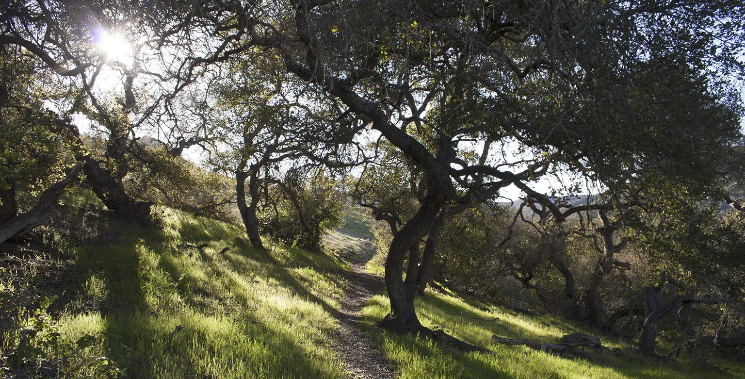
After marveling at this display of human stupidity and raven cleverness, we proceeded up the steep Hermit Gulch Trail to the ridge and met the TCT. By the way, be forewarned, you'll be hearing the word "steep" a lot. We thought this was steep. Oh, man, compared to the really steep parts, it was nothing.
Anyway, so the TCT on the ridge. It's a big, wide fire road, going north, almost meeting Stage Road (the paved road between Avalon and the airport), then turning northwest towards Haypress Reservoir.
We encountered several interesting things here: first, the Christmas tree dump. There's a hillside where for some reason all of Avalon dumps their Christmas trees. It's not trash in the traditional sense, all plastic or other non-plant trappings have been removed. The Christmans trees just look very out of place, dozens of them laying on the ground.
Then there's the Haypress Recreation Area. It's next to a small lake (reservoir), desperately lacking water. Oh, and it has a playground. I'm mean yes, it's next to the paved road to the airport, but it's in the middle of nowhere. I guess it's intended as a weekend getaway for folks living in Avalon. From the look of it, it's very well kept and very clean. There are picnic tables, water faucets (very important for us) and restrooms.
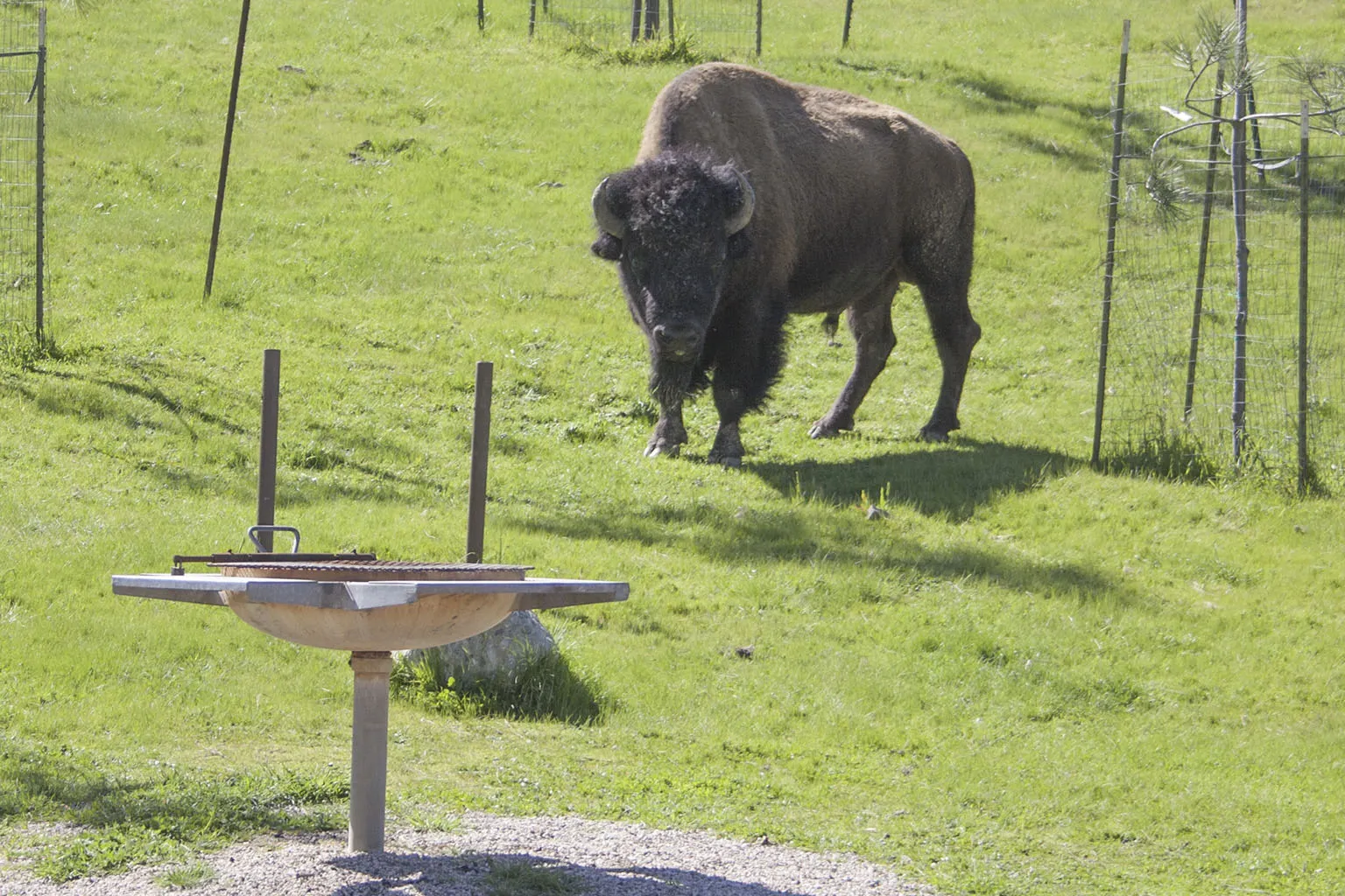
Here we saw our first bison. A lady hiking our way an hour before mentioned there's one at on the picnic grounds.
Side note: a few bison were taken to Catalina in the 1920's, supposedly for a film shoot. Then they were left there and eventually their population grew to over 600 individuals. Now, there are around 150 of them, their population managed by the Conservancy by keeping them on birth control. Some more info about them on Wikipedia.
Our first specimen was a huge bull, a magnificent animal, grazing peacefully on the far side of the picnic area, not even 50 feet from the water faucet – our destination. As we approached cautiously, he stopped and looked at us. We stopped and looked at him. After a few snorts apparently he decided that we were not worthy of more attention, and resumed his grazing, slowly inching away from us.
We drank some water, filled the hydration bladders and took a nice long snack break, always keeping an eye on our friend.
When we were leaving, we had to try the playground for a little bit. Not every day has the average hiker the opportunity to do something like this. We even left the packs on, to prove they're so light we can have some fun on the teeter-totter with them on our backs.
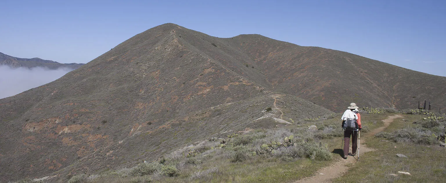
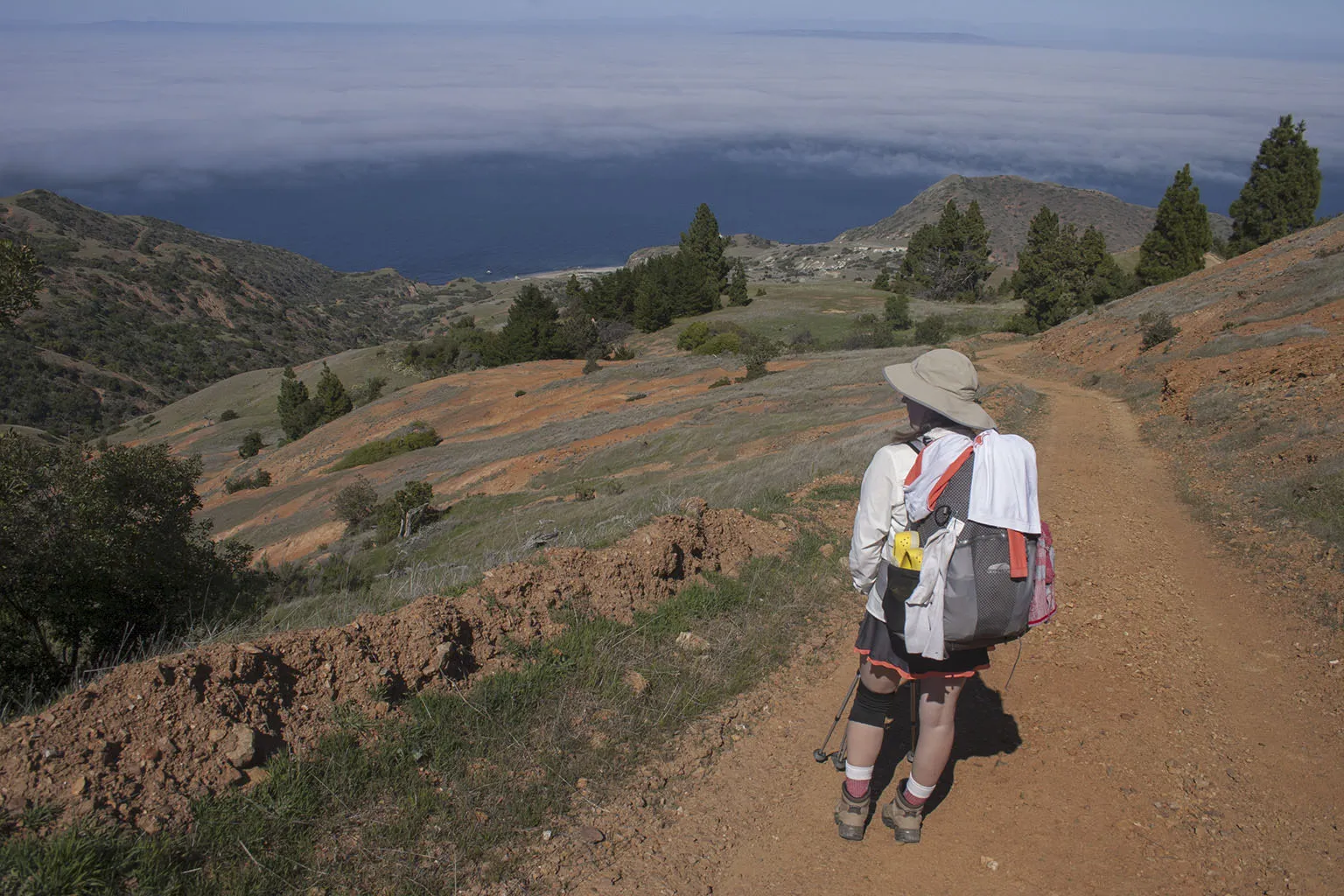
The trail passes by the reservoir, then climbs a little hill, and rollercoasters through a few very scenic canyons, finally arriving at Black Jack Mountain at the top of the fourth big incline (counting from Haypress).
It was past 6pm by the time we got to Black Jack camp. It's just below the mountain of the same name in a very cozy meadow. It's a pretty big campground with many sites, but there was only one other couple there. We learned later that they were doing almost the exact same route as us, almost on the same schedule. They had firewood delivered and were trying to get a fire going, but without much of a result. They didn't really know what they were doing, so there was way more smoke than fire.
We pretty much never build a fire in the backcountry, and we definitely didn't want our gear to get smoky, so we hiked all the way to the far side of the camp and set up near the place that used to be the amphitheater. This was not a specific camp spot, but it was the only level place far enough from the smoke.
We cooked dinner, enjoyed a sip of tequila, and we were about to go on a nice walk up the hill when… a fox stole Em's knife.
I have to stop for a second to talk about Catalina's foxes: they are a subspecies endemic to this island, the size of a big house cat, very cute and very smart. The poor things were almost wiped out by disease not long ago, only a few survived, but due to an aggressive breeding program, their population is back to healthy number. It's OK that they're cute, but they are also very important to the ecosystem, mostly for keeping rodents in check. Some other islands in the vicinity (e.g. Santa Cruz, Santa Rosa) also have their own version of the fox, but they are all different sub-species.
During dinner, we saw a fox circling us, begging for food or trying to steal some, but of course, we didn't give him any. As soon as we were finished, we were packing up the food when both of us had to go to the restroom at the same time. The food packing was taken care of, but we left Em's small hunting knife on the bench, and we cut sausage with it earlier, so it must have smelled like heaven to the fox. Also, it had a stag handle (which should have felt like bone).
About a dozen porta-potties were lined up around the "main square" of the camp, so went down there. After we got back, Em realized her knife is gone. There was nobody else around, that couple on the other side could not have come over without us hearing them. The fox was still there, though, looking for more food.
We looked for more than an hour, headlamps at full blast. Sometimes we met the fox and tried to follow it for a while, looking under bushes and at the bottom of trees. We found several caches of all sorts of stolen food, including unopened small milk cartons and energy bars with nice holes chewed into them. No matter how long we searched, though, there was no sign of the knife.
Finally, we didn't have much of a choice, we gave up and went for a walk up to the ridge so we can see the mainland. It looked pretty cool. We wanted to hike all the way to the top of Black Jack Mountain, but with all that fox-chasing, and being up since 5am, we were way too tired. By the way, if you're approaching Catalina, Black Jack is one of the most prominent mountains. You can see it with a huge antenna on top, west of Avalon. It's not the highest point, thought, that's Mt. Orizaba, on the other side of the camp.
Of course, even though we decided to go to sleep, there was another hour spent by crawling around in the bushes, looking for the knife. No luck. Lots of trash, but no knife. So we gave up and went to sleep. It was balmy calm. I woke up a few times, hearing the fox running around, but otherwise we slept really well.
Day 2 – Black Jack Campground to Little Harbor
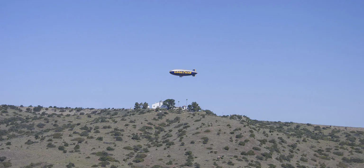
In the morning, after yet another fruitless search for the knife, we got going around 11am. First, up the hill again, with views of the mainland and a few buildings on the other side of the canyon: the "Airport in the Sky". It's the island's main airport, 6 miles by road from Avalon, sitting on a plateau at 1,602 feet.
Small planes were landing and taking off every few minutes, and first I thought I was imagining things: it looked like a big, blue, cigar-shaped zeppelin was floating towards the island. As it got closer, it turned out to be the Goodyear Blimp. I have no idea what it was doing so far out there, but it circled the general vicinity of the airport, then left.
Before ascending to the airport, the trail took us down into a nice little canyon with a pond at the bottom. This small body of water must have had a thousand frogs, and they were all croaking in a huge, happy choir. I never heard such loud frog-song.
On top of the hill, we trudged into the airport's cantina, which is essentially a small souvenir store combined with an even smaller restaurant. It's a nice place, though, with a cool patio. We had a big lunch of bison burgers and French fries, then soldiered on.
The trail takes you right below the end of the runway, with planes taking off above your head. It's pretty cool. From there, it's almost all downhill on a ridge towards Little Harbor that can be seen 2-3 miles in the distance. It was great hiking.
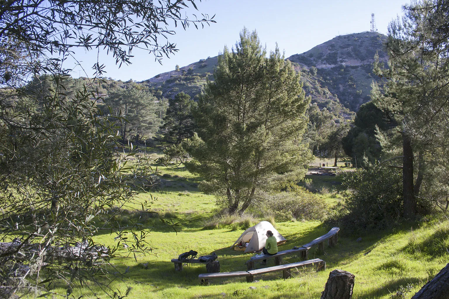
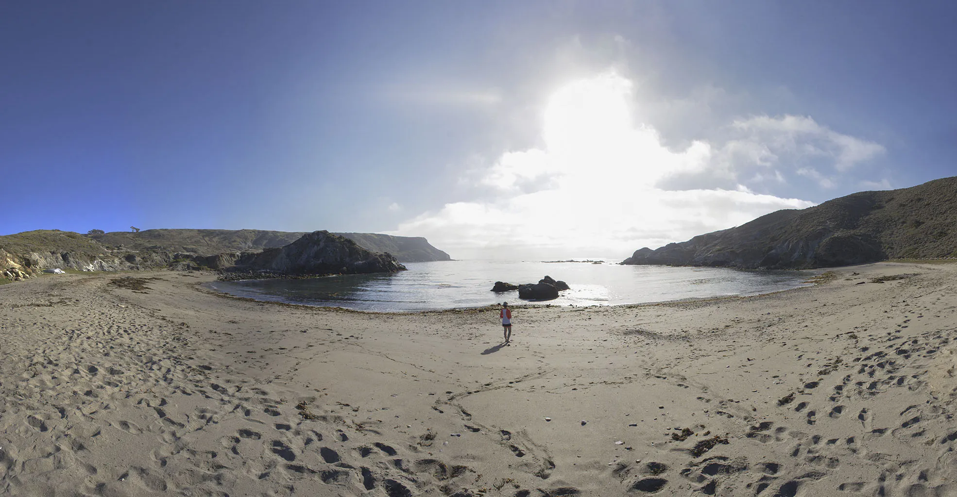
We got to Little Harbor a bit past 3:30pm. This is the only campground on the windward side of the island, looking southwest. It's accessible by bus from Two Harbors (I think from Avalon, too), and it's a huuuge campground. There's one main area on the beach and one a bit further inland, behind a small hill, with a few spots in between. The beach area looked great, but it was windy, and that other couple already set up there. We decided to move inland and took a spot in the meadow between the hills. There was almost no wind.
Those guys on the beach told us they left their backpack on their spot's table, and while they went down to the water for a few minutes, the squirrels took the opportunity and chewed a huge hole in one of the pack's back panel to get at some trail mix. So much for a brand new, $300 Osprey pack.
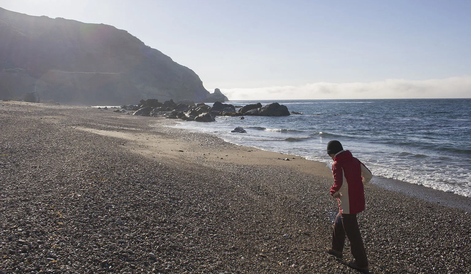
We took their advice by heart, and after setting up the tent we went down to the beach again, but took all our food with us in the small Sea-to-Summit silnylon pack. The main area of the campground (next to the then-closed ranger station) has water faucets, outdoor showers, and even sinks. Em did some laundry in the sink, and we took a nice shower in the cool water.
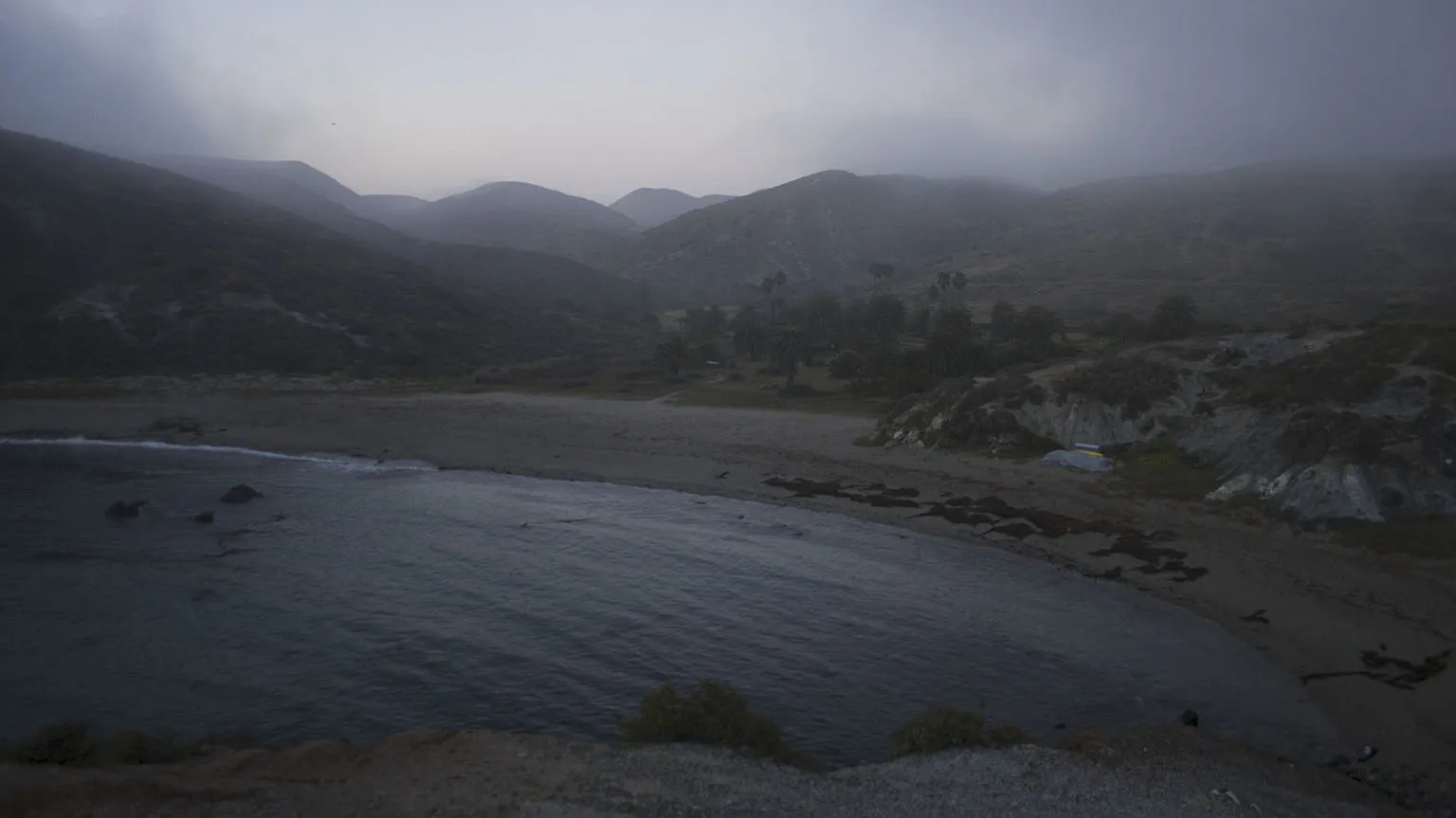
The sun was going down and fog started rolling in. At least it wasn't windy. We put on some clothes and took another trip to the beach, taking dramatic pictures of the darkening sky and the fog.
After a nice, big meal by the tent, we took yet one more trip down to the beach, this time in total darkness and thick fog. Some people might have found this scary or unsettling, but we really liked it.
Day 3 – Little Harbor to Two Harbors
By the morning, some of the fog cleared, but of course, the outside of the tent was soaked, so we hung it up to dry while having breakfast. As most of the time, we took forever to get ready, and it was past 10am by the time we left. We only had 5 miles to go, so there was no hurry.
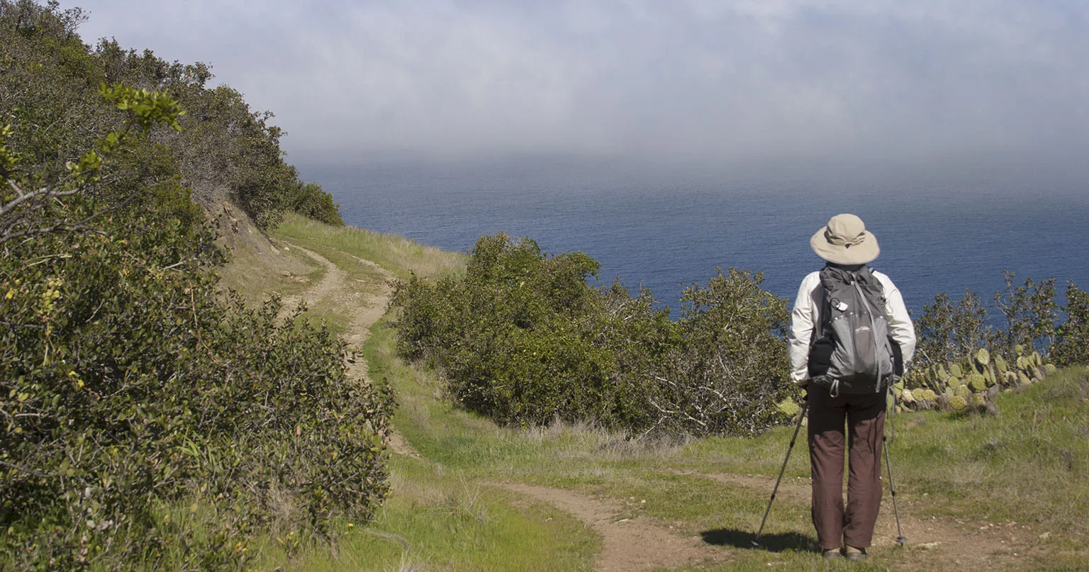
There's a "regular" dirt road to two Harbors used by the vehicular traffic, but the TCT takes a much more scenic route, going up the hill, with a great vista of Little Harbor from above.
It was still a bit foggy and chilly, but then the trail climbed way above the clouds and the sun came out.
It's up and up and up, next to the cliffs, up a ridge going up some more, then some more. No switchbacks, very steep trail, but it's very much worth it and the hard part is pretty short. It finally tops out on a hill with amazing views all around.
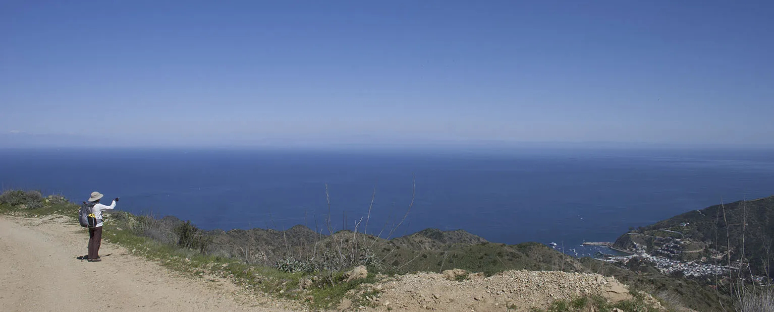
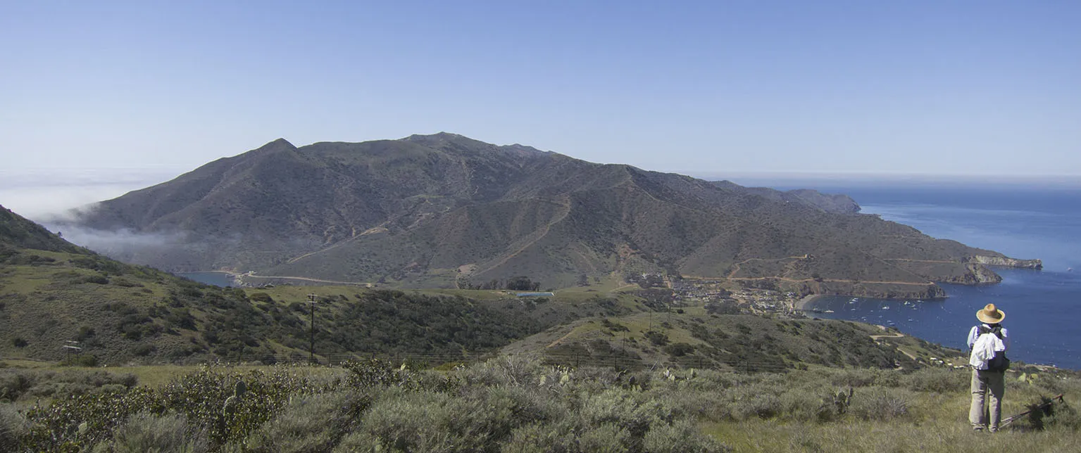
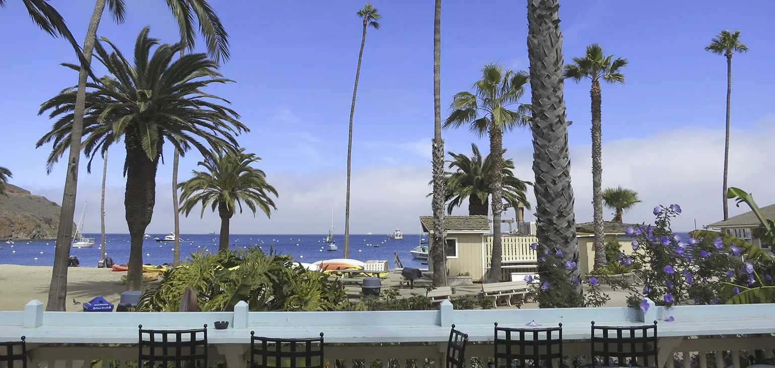
Then it's down again towards Two Harbors on the dirt road. We found a very nice spot in the shade of some trees and took a really long break, eating, laying around, nearly dozing off. We walked into Two Harbors at 3pm. We love this place. At the isthmus, the island is only about 750 yards wide. Two Harbors is right at this spot, taking advantage of having full access to both sides.
It's a tiny village with one hotel, a restaurant, a store, and a few dozen buildings. First we visited the post office which is not much more than a tiny shack at the pier. They are so relaxed, the office door was wide open, but there was noone around, we had to wait for somebody to show up and give us our package.
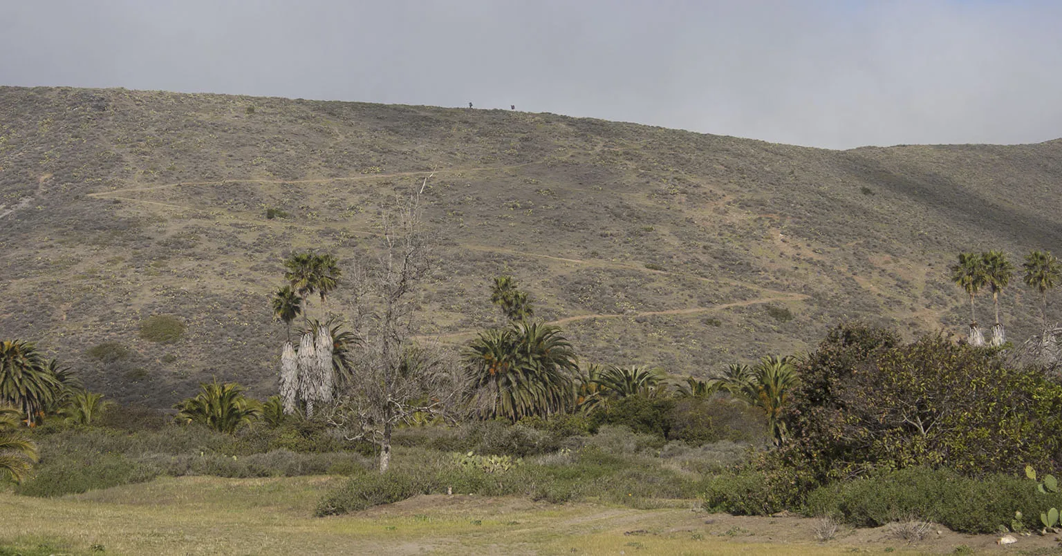
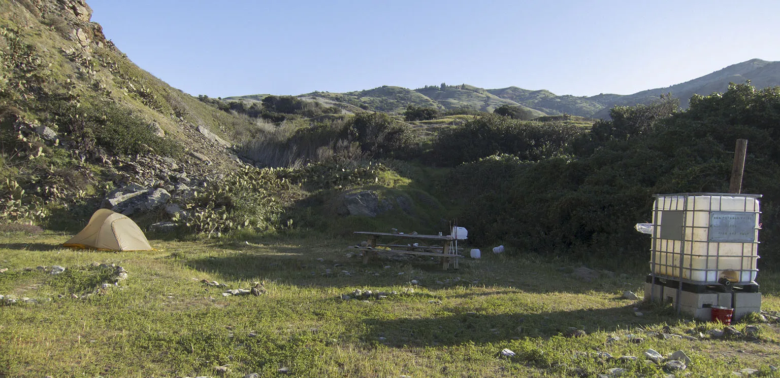
Next stop: the campground. It's outside of town, about half a mile east, at the end of a scenic cliff-side trail. It's mostly pretty nice and green, with a few shaded spots and great views of the ocean. As nobody else was there, we could choose a site that fitted us best. It was pretty windy, so we looked for the most sheltered spot and settled on one without much of a view, but with good protection. Some guys were mowing the lawn on the other side and we had to ask them to stop as the breeze was blowing huge amounts of dust right onto us.
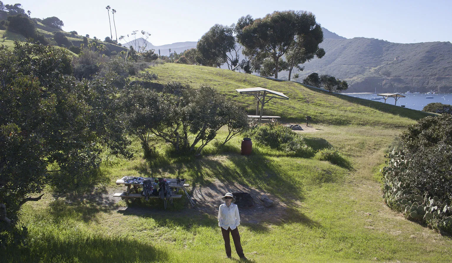
We set up camp, then opened the bottle of wine from the package and Em made a nice soup.
Big plans were in the works for the evening. A comet by the poetic name of C/2011 L4 (PANSTARRS) was passing by Earth, and the astronomers predicted that it might be visible with the naked eye for a few days after it swings around the sun. The best bet to see it was that day, just after sunset. It was also a new moon, and the info was to look somewhere close to the setting moon. The biggest problem was that from Two Harbors, the view west is obscured by the 1,336-foot bulk of Mt. Torquemada.
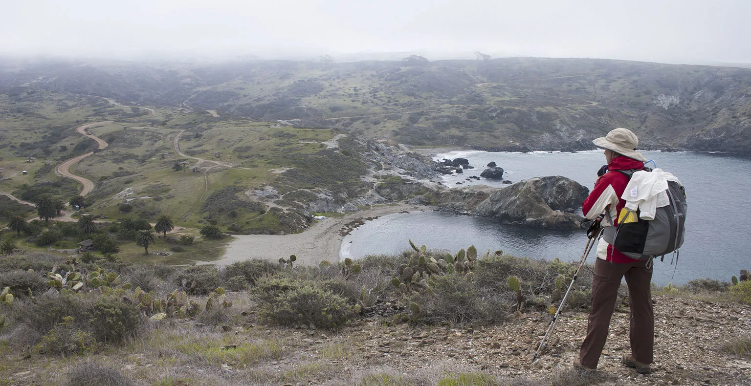
First, we walked into town. There was almost nobody around, and the buildings and palm trees looked eerie in the breezy and foggy afternoon. The restaurant was open, though, and we had a very expensive, but very tasty dinner. To have a chance at seeing the comet, we hiked for about half a mile back the way we came from Little Harbor, then turned right and climbed to the Catalina Harbor Overlook. Comet or not, this is a fantastic place, by the way. Isthmus, island, mainland, you name it.
There's a multi-row barbed wire fence along the road, and somebody made use of it by twisting pieces of the barbed wire into small works of art. One of them says "Beach Access" and points to a thousand-foot drop-off.
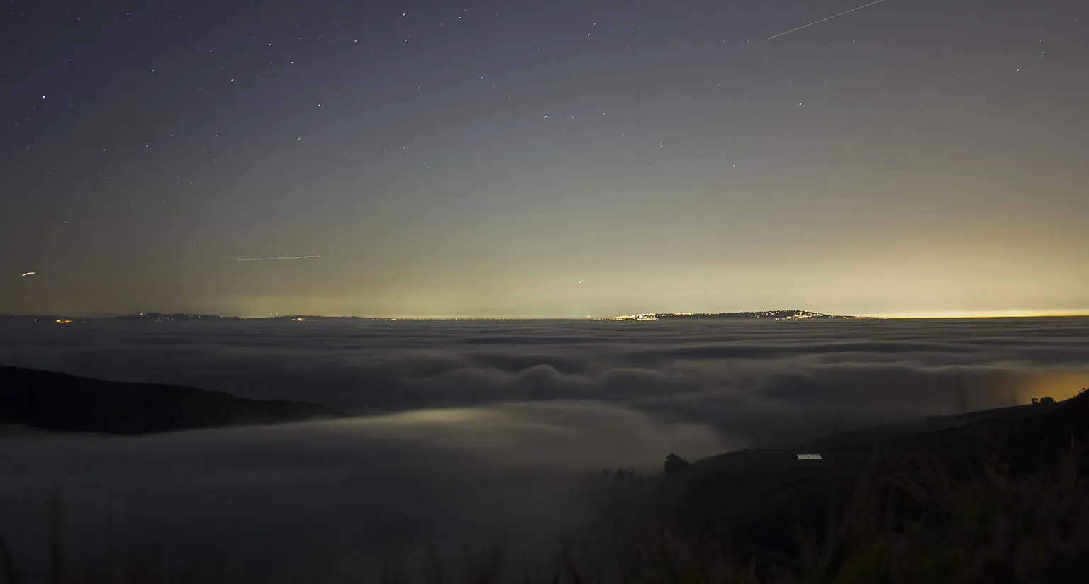
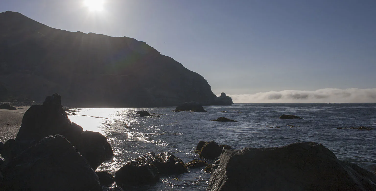
We got lucky, by the time we arrived at the overlook, the sun went down and we were way above to fog. The moon was just setting, and alas, the comet was there, faint, but beautiful. As I didn't have a tripod, it was impossible to take a decent picture, but at least I got one where it's somewhat visible.
The other great view was that of the mainland, partially covered in low fog, glowing from all the lights underneath. On the way back, we even caught a glimpse of a bison on the hill, silhouetted against the lighter sky. Back at the tent around 9:30pm, we were happy to find that the wind is not too bad. After finishing the little wine we had left, sleep came easy.
Day 4 – Two Harbors to Parson's Landing
All that running around the previous day had it's effect, we slept in. To my surprise, we woke up at 9am. Maybe it would be time get going?
The morning was gorgeous, with breaking fog drifting around and brilliant sunshine sparkling on the dew covering everything. Em did some laundry the day before, but of course they were still wet.
We slowly got ourselves together and left the campground around 11am. We only had to walk about 7 miles that day.
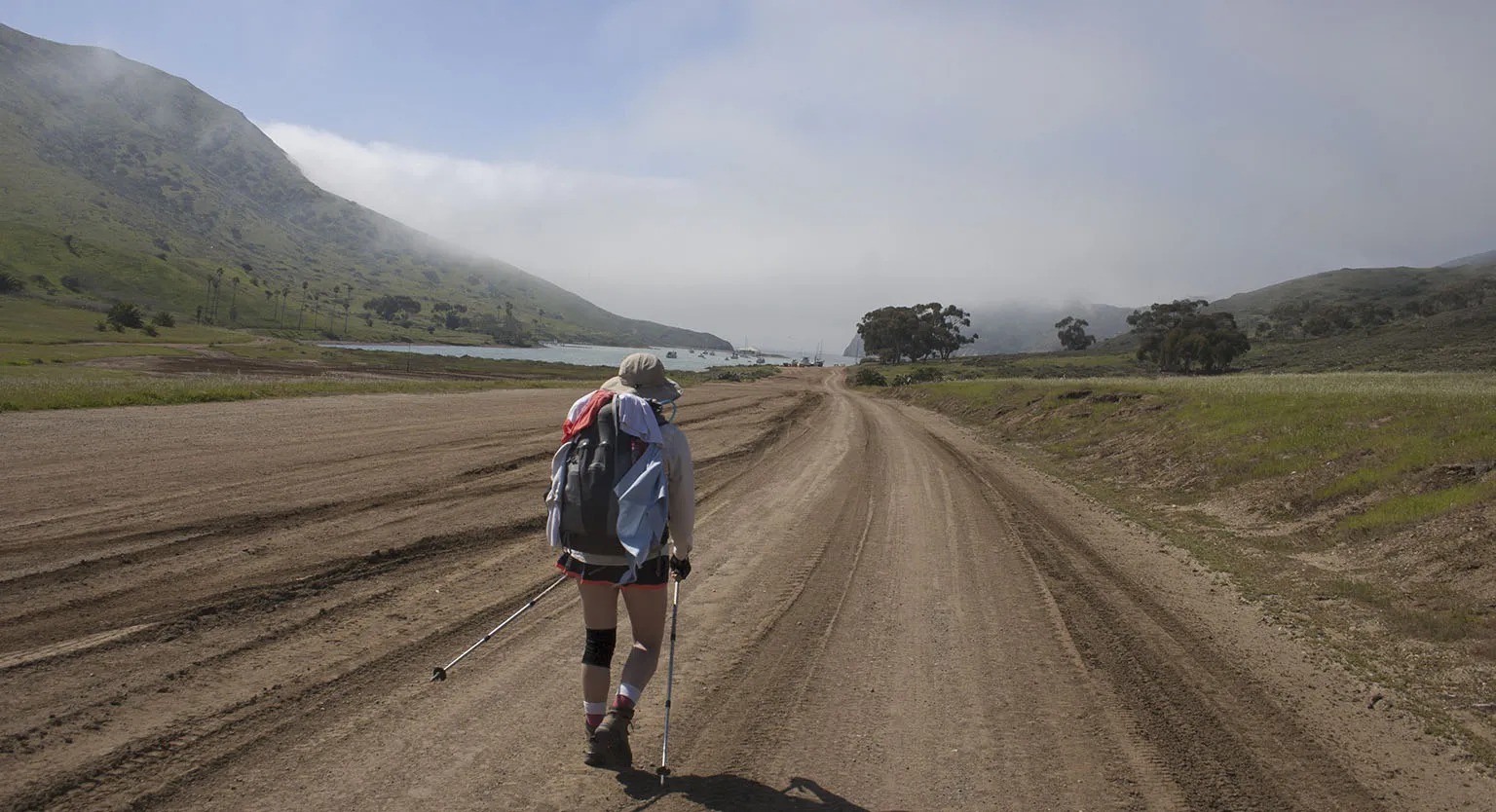
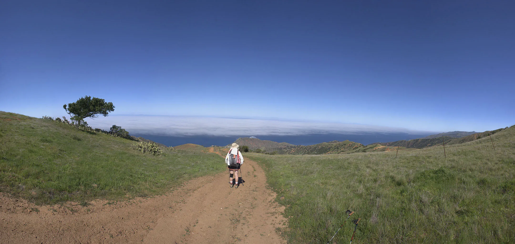
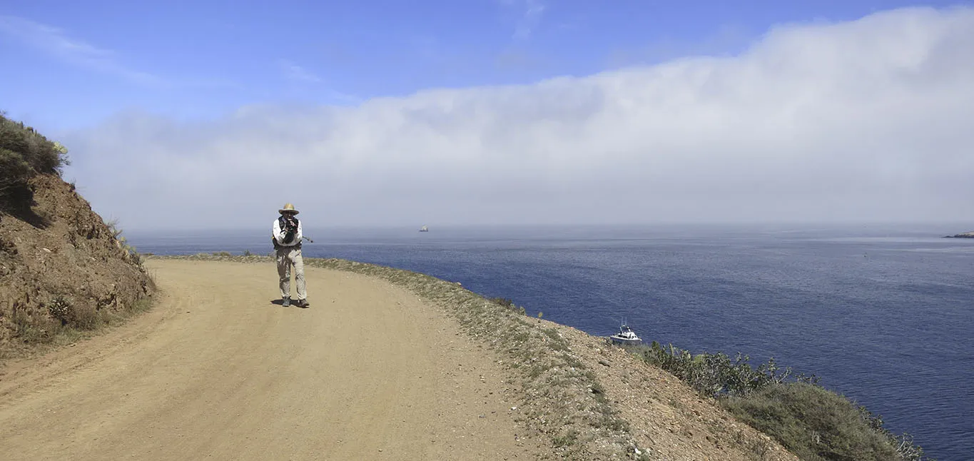
After crossing the town of Two Harbors again, we kept on the right (west) side of the Isthmus, passing by what you could call a small industrial area, then following the TCT up on the Silver Peak Trail. "Steep" doesn't describe it. It follows the old ranch road, there are absolutely no switchbacks, and some parts are almost unbelievably steep, maybe even as much as 30-35°.
Our solution was to "make your own switchback", zigzagging the width of the dirt road. I'm sure it added quite some distance, but it was worth it. A day hiker came our way, first laughed at our technique, but then admitted that he'll try it on the next uphill.
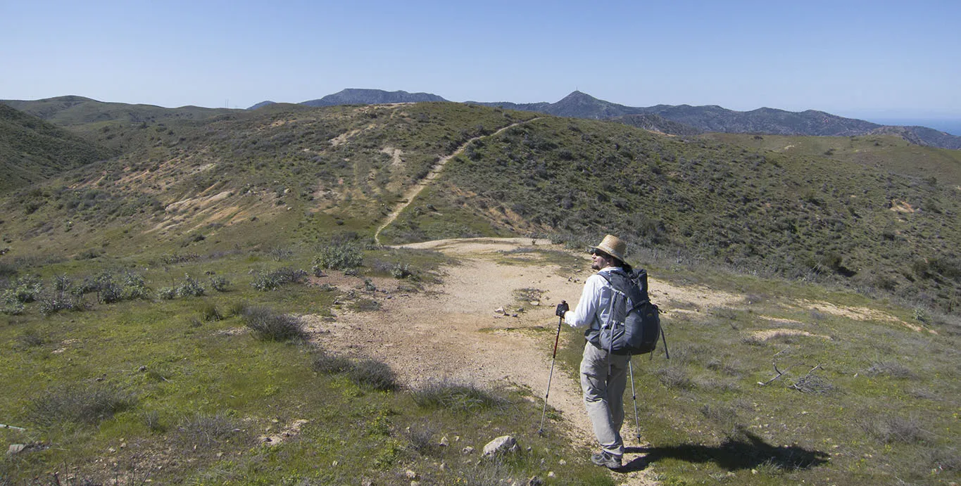
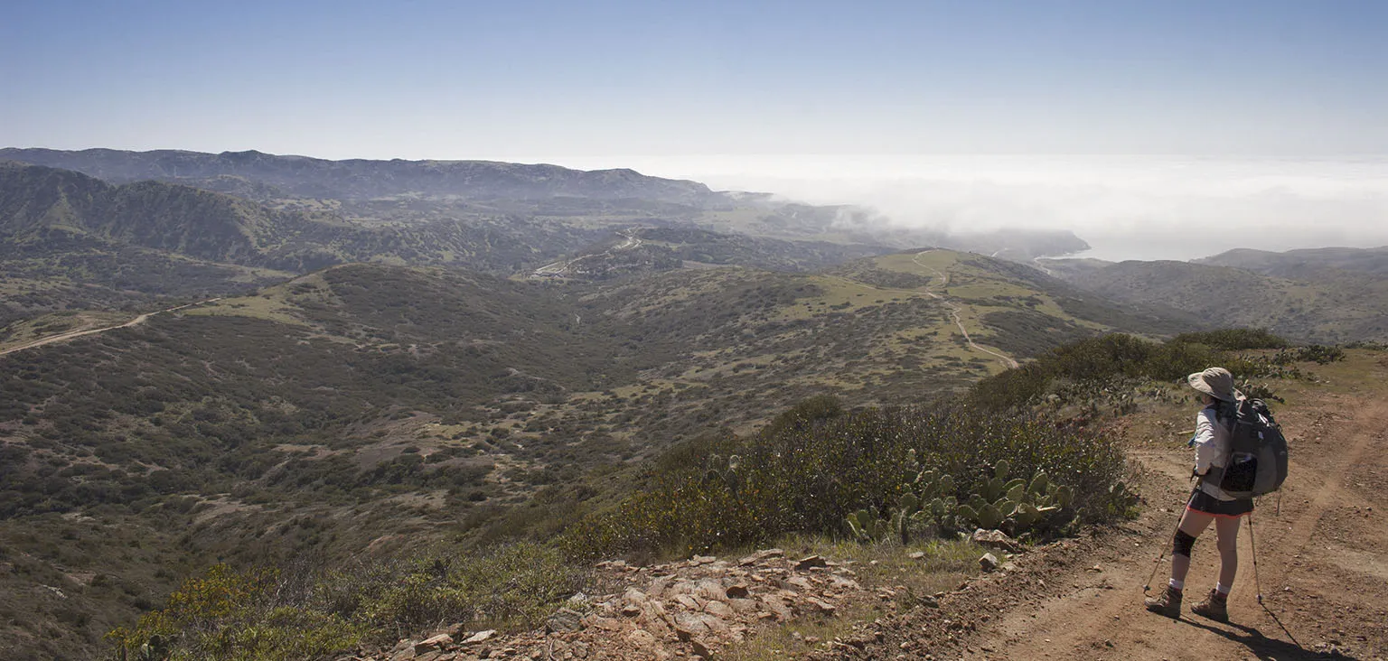
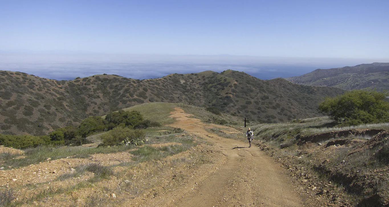
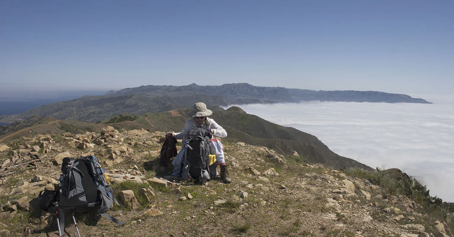
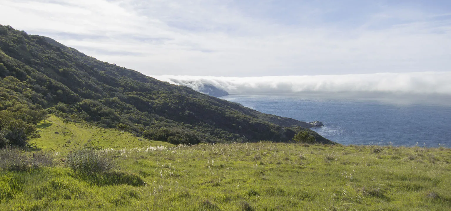
The trail climbs to the top of the ridge, then follows it towards Silver Peak. It's a real rollercoaster ride with countless short ascents and descents between the various small peaks. There are amazing views up and down the whole length of the island with fog filling large areas down below. There was an unnamed (?) peak somewhere between mile 29 and 30 where we took a long break. Different creatures left different marks on top: there was a weather station, a survey mark, a small quartz rock, a few coins, and some fox scat.
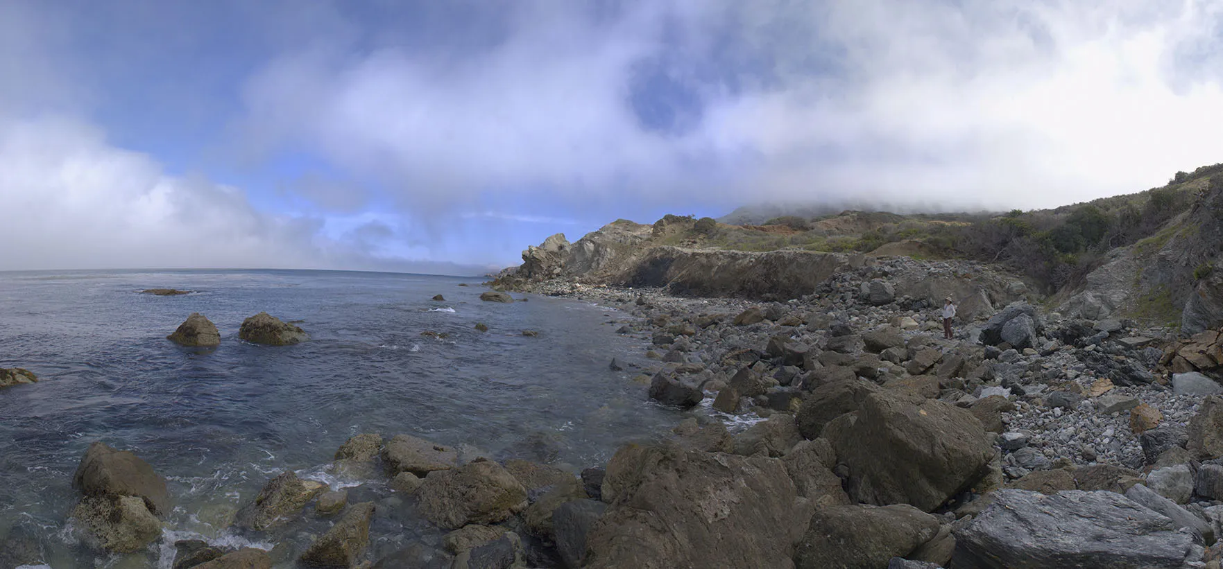
A bit further the TCT turns north from the Silver Peak Trail, descending to the coast. It's a very, very scenic spot, but holy cow, some sections of the trail are beyond steep. There was one point where the dirt just rolled under my soles and I was sliding downhill. Not even the hiking poles could stop me. Somehow I managed to keep my balance and not fall on my butt, but Em was laughing hers off while observing me from the other side of the trail, which happened to be a bit less slippery. A minute later, it was my turn, of course, as she ended up in the same predicament.
I can't say enough how beautiful this place is, though. The rolling hills, the ocean, the low clouds, everything came together for a perfect tableau. We even spotted a pretty big herd of bison in the distance.
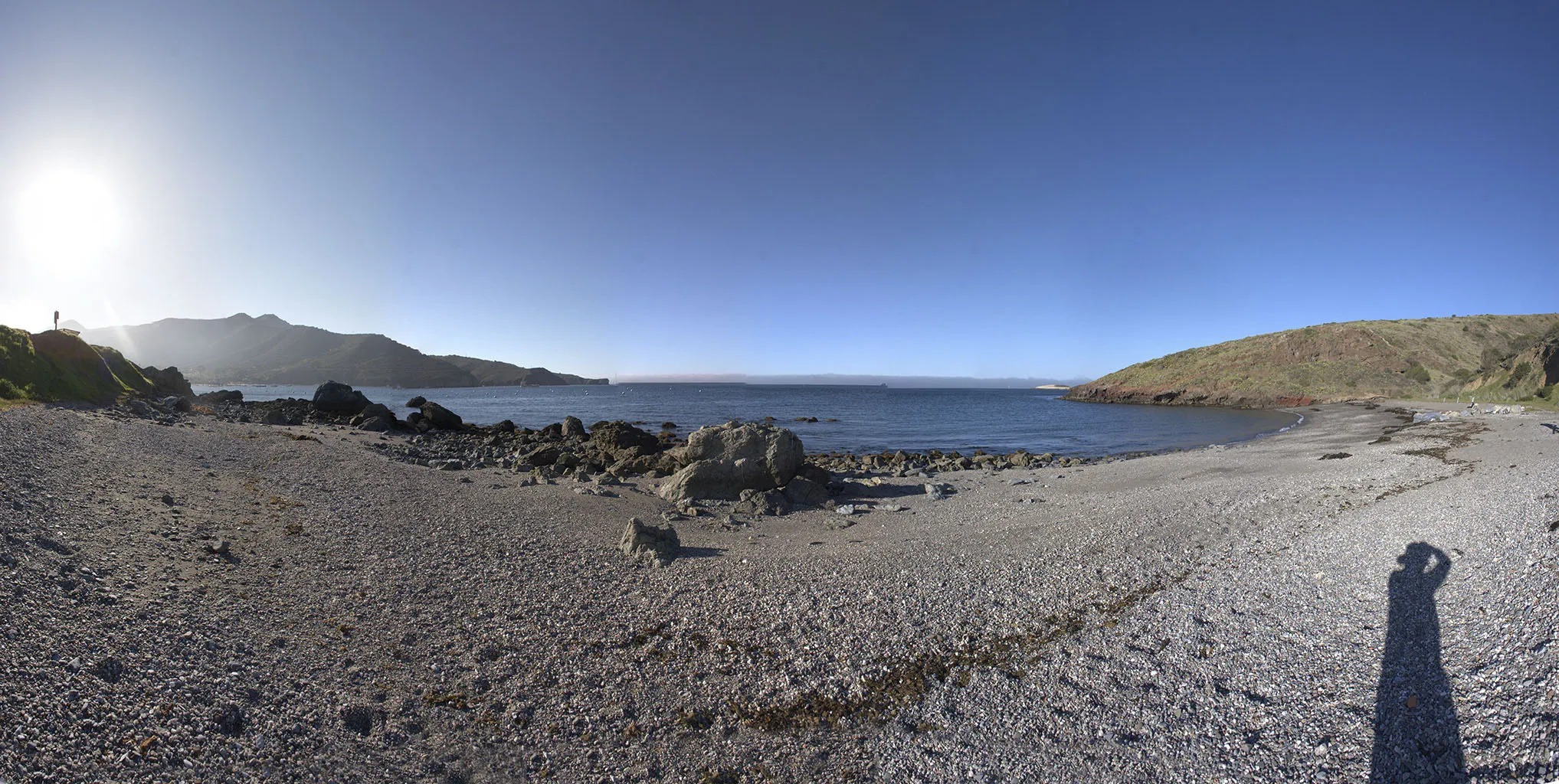
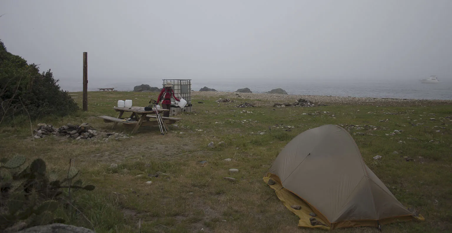
So, we descended into Parson's Landing. The campground is on a very nice beach, about quarter of a mile long. At the "entrance" there's a parking lot for the local vehicles with Porta Potties and a group of lockers. As there's no potable water here, the lockers are part of a system to provide drinking water to the campers. You can purchase as many locker keys as you think you'll need, and each locker contains a 2.5-gallon water bottle and a small bundle of firewood. As we were going to stay two night, we bought as many (and picked them up in Two Harbors).
A hiker who was just leaving told us he saw bison on the beach in the morning (cool!), but he also warned us of smart ravens, he said he left is backpack for a short while and the birds opened the zipper, feasting on his energy bars by the time he got back (not cool!).
The campground was almost deserted. The other couple we last saw in Little Harbor (they were staying at the hotel in Two Harbors) was all the way at the western end of the beach, and we set up at the penultimate site on the eastern end. The very last spot, hidden behind a huge rock, was occupied by some local guys, who worked for the baggage hauling service, and as such, had vehicular access to this place. They showed up with a bunch of stuff a perpared for a big party. Regardless that they were less than 200 feet from us, we didn't see or hear from them much because of that big rock between us.

It was around 4pm, so we set up camp and went for a long walk on the beach. The only ugly, though necessary eyesore are the big plastic water tanks, cubes of about 6 feet on one side, set up all along the beach, containing sea water for firefighting purposes. Apparently, somebody couldn't make much use of it as we found the remnants of a tent that burned completely to the ground. Other than that, it's an amazing place.
The wind kept blowing, so we retreated to the tent, took a short nap, and hoped for a calmer evening so we can make a fire. As I mentioned before, we almost never make a fire on our wilderness trips. When car camping, and if there's enough firewood around, we love sitting by a nice big bonfire and talking late into the night. However, places we're backpacking in (e.g. High Sierra), making wood fires is prohibited anyway, and even where it isn't, we're trying to conserve resources and don't want to smoke up our wilderness gear. Our little Primus stove takes care of hot food and drinks very well.
This was to be an exception. There was no choice but to get the firewood if we wanted the water, and the area had more than enough space to make a fire far away from the tent and all of our gear.
Around 7pm, I left the tent for a potty break, and when I was returning, a bison was standing in the bushes just above the tent, about 60 feet away. Em was looking right at me, and I gestured to her that she should slowly get out and look behind herself, but the bison got spooked and ran away. This was the only one we've seen during our two days there.
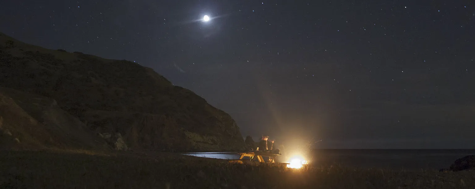
The wind did calm down in the evening. It was very nice, a little cool, but clear. We made dinner with the Primus stove, and then I walked over to our neighbors (the local guys) to borrow an axe. I saw earlier they had one. The bundle didn't contain any kindling, and while I can chop some off with the hunting knife, it's totally unnecessary if there's an axe around. The guys were very friendly and gave me their axe, so we had a nice little fire going quickly. We only used about half of one of the bundles, saving most for the second night.
Day 5 – Parson's Landing to Starlight Beach and back
It would have been possible to finish the trip on this day. We could have hiked to Starlight Beach (the official northern end of the TCT) the day before, and then out today. We could also have gotten up early, done Starlight in the morning and been back at Two Harbors by the time the ship left. However, there was no point. We could get away for five nights, so why not do it in a leisurely pace?
The morning was foggy and chilly, with dramatic shapes lurking in the mist. I kept waiting to see bison, but there were none. It was still pretty foggy when we left around 10am. The hike from Parson's to Starlight is almost 5 miles one way, so we packed lunch to make sure we can spend some time there.
The trail goes up and down the small hills like the EKG of an arrhythmic heart, with some mind-bogglingly steep sections, but it's also unbelievably diverse and beautiful. We soon rose above the mist and continued in the sparkling sunshine, with some fog still swirling around us sometimes.
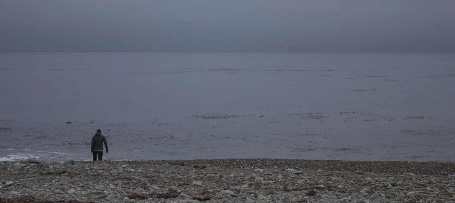
…and so we got to the end of the Trans Catalina Trail. Starlight Beach is a handsome, rocky beach about a mile away from the physical end of the island. No camping and no fires are allowed here. We sat on the rocks, dipped our feet in the water, had a nice, big lunch, and relaxed. A seal kept swimming close by and examining us curiously.
After lingering there for more than two hours, it was time to leave and head back to camp. We took it slow and arrived at Parson's Landing just before 6pm. It was windy again, so after a quick snack, we retreated to the tent for some rest and only emerged more than an hour later, as it was getting dark.
Like the night before, the wind slowed to a small breeze, and as we had relatively much firewood, we lit the fire and sat around for a quite a while, eating our dinner and drinking the little tequila we had left. Of course, the wood was not enough for a terribly long fire, and we were tired anyway, so we went to bed a bit before 11pm. It was great night, it's been a great trip.
Day 6 – Parson's Landing to Two Harbors and then the mainland
Our final day: walk back to Two Harbors on the coastal road, then take the ship to San Pedro and drive home. Funny enough, the distance to Two Harbors via the TCT is a bit shorter than on the coastal road, as the latter meanders around a lot, following the coastline into the canyons (7.2 vs. 7.8 miles). However, there's almost no elevation gain, so the two can't even be compared.
Got up late, got ready late, lingered around the foggy beach some more, then left at 10:30am. A huge pod of seals swam by Parson's less than a quarter mile from the shore. It must have been thousands of animals, jumping out of the water frequently as they quickly made their way west.
We made good time on the road, passing by the camps of Emerald Bay, Howland's Landing, Cherry Cove and a few smaller ones. These are diverse establishments kept by the Boy Scouts and other organizations. Some host kids for summer camp programs (oh, how I would have loved to come to such a place as a child), some also host corporate team building events. We even saw the American Pride, the ship that took us to Buccaneer Days, sailing away after it dropped off a group of students.
Despite all the photo breaks, we trudged into Two Harbors a bit before 1:30pm. The ship was supposed to leave only at 6, so we had plenty of time. We also considered going for another hike, but then decided against it. A huge bunch of kids was just boarding a ship to take them to the mainland, and as they were leaving, their camp counselors dove into the frigid waters from the docks to enormous cheers from the children. We were told it's a tradition, they always do it if the kids behaved themselves.
The next few hours were spent on the deck of the restaurant and on the beach, doing pretty much nothing. After the group left, very few people were around, so we just enjoyed the quiet afternoon. Our boat showed up right on time, then left even a bit earlier (as I'm guessing everybody on the manifest has been accounted for).
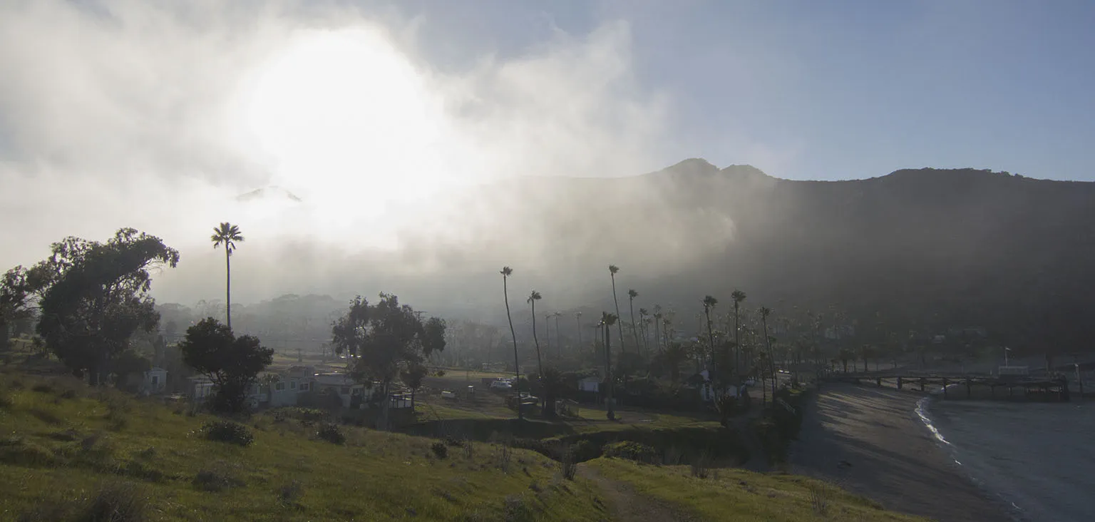
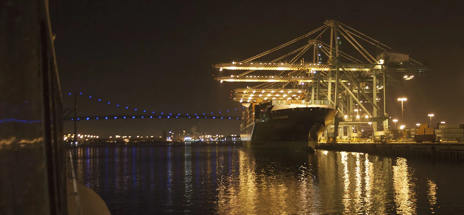
We made a stop in Avalon just as it was getting dark and the fog started rolling in. By the time we got to San Pedro, it was pitch dark, but the Los Angeles Harbor looked like a big city with all the ships and cranes lit up.
Notes:
This trip is highly recommended, however, there are a few reservations the "wild" trekker should be aware of. One item is the cost. The ship is $79 per person, round trip. Camping is around $15-$20 per night, per person, depending on how much time you spend and where. The trail can be done in 2-3 days, sure, but it's worth taking longer and enjoying it.
Be prepared that it's not wild at all compared to the Sierra or the middle of the Mojave. Most of the hiking is on dirt roads, and you will always see at least a few cars each day, if not your road, then on adjacent ones. We even saw a relatively big construction project going on at one of the ranches (I think it was El Rancho Escondido).
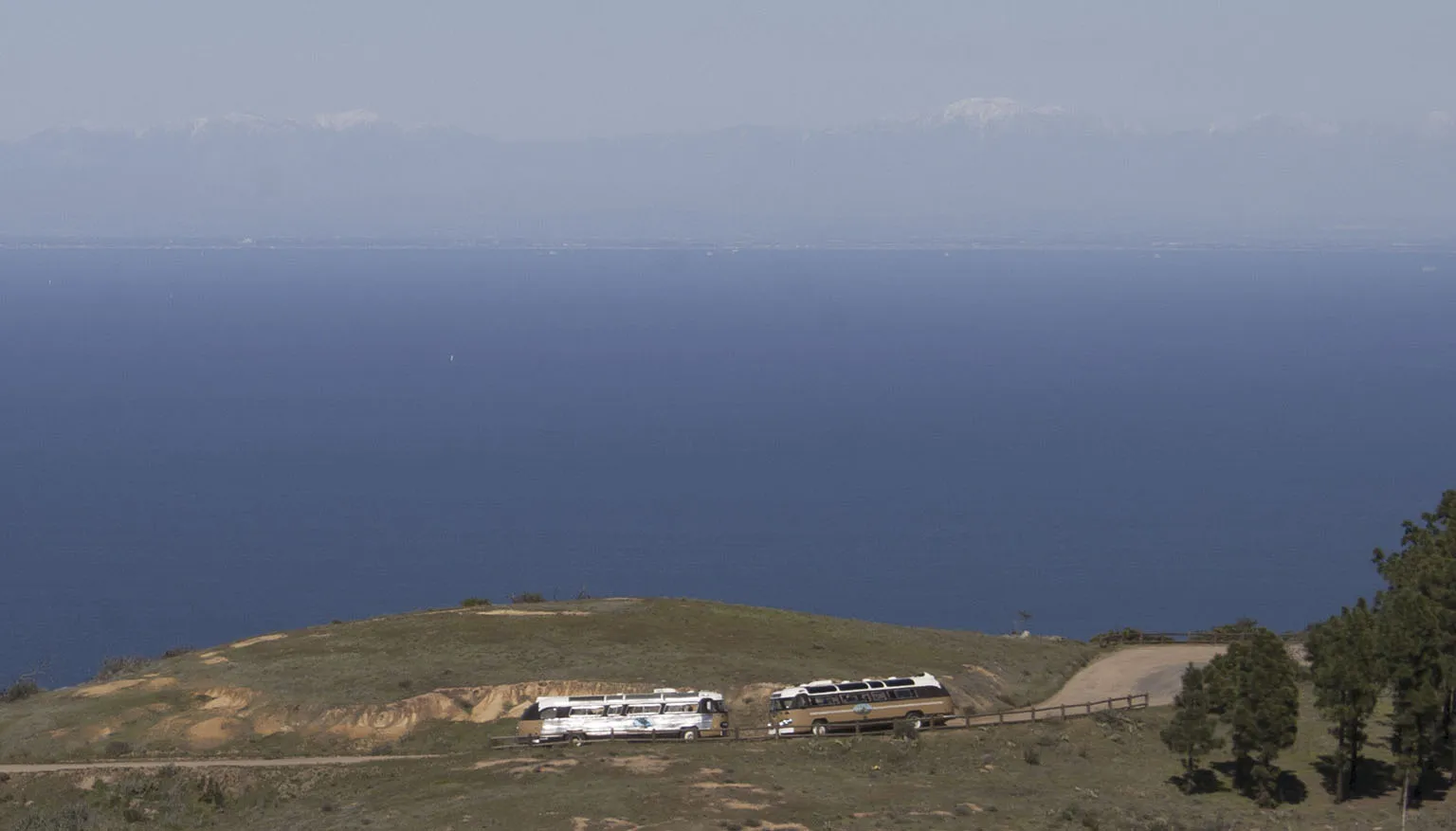
I've read several reports that in the summer, when Avalon is really crowded, hiking on the TCT can get very annoying as tour buses and 4x4s keep passing by you and kicking up dust. When we did it in March, this was not the case. Spring is a really nice time anyway, as everything is as green as it can be, and the weather is much more pleasant. Keep in mind that almost all of the trail is exposed. I would do this trip again in a heartbeat, but under no circumstances in the summer.
Now for the good things: it's not just pretty, it's unbelievably gorgeous. Despite (and because of) all the steep and remote parts, the TCT takes a tour of the best Catalina has to offer as far as Mediterranean island geography and flora/fauna. There are meadows, small forests, coastal sagebrush, almost desert-like interior valleys, each amazing on its own.
Also, as it's not that wild, it's possible to hike it while adapting a hybrid approach to backpacking, meaning a few nights (Black Jack, Little Harbor, Parson's Landing) can be almost like a true backcountry experience – tough with chemical toilets nearby – a few can be different, as there are showers, restaurants and even shops within walking distance (Avalon, Two Harbors).
Take a look at the full gallery here.