

Intro
I'm pretty good at not knowing about well-known things. So I wasn't surprised at myself when I found out about the Backbone Trail only in July of 2011. We drove by that trailhead that's just south of Piuma Road in Malibu Canyon quite a few times and always talked about going for a hike there, and finally did it in the summer of 2011, while training for the mini trans-Sierra trip (gallery | trip report). That trailhead features a nice big "Backbone Trail" marker, and as it made no sense whatsoever to us, we decided to look it up.
So we learned that this trail starts at the Ray Miller trailhead, north of Malibu, and - mostly keeping to the high ridges- goes on for 69 miles, all the way to Will Rogers State Park, just off Sunset Blvd. in Malibu proper. I also found a Park Service website, announcing that come October, a limited number of people can sign up for a hike of the entire BBT, led by rangers and volunteers. It will be split into eight segments, one hike every second and fourth Saturday of each month between January and April. It also said that while on the hike, you'll be able to learn about the place's ecology, geology, history, etc. Em and I both agreed that this aspect is what makes is most attractive to us. We can organize our own hikes, but to meet new people and learn a lot about the local environment from experts is a unique opportunity.
We had another reason, too. After our mini Trans-Sierra in August we decided to do a week-long trip to Mt. Whitney in August 2012. We were fully aware that this was something way more serious than we ever did before, so we knew we have to start training early. The regimen of these hikes every two weeks was a pretty good start.
I set a reminder for myself and sure enough, in October, I was lucky enough to secure two spots.
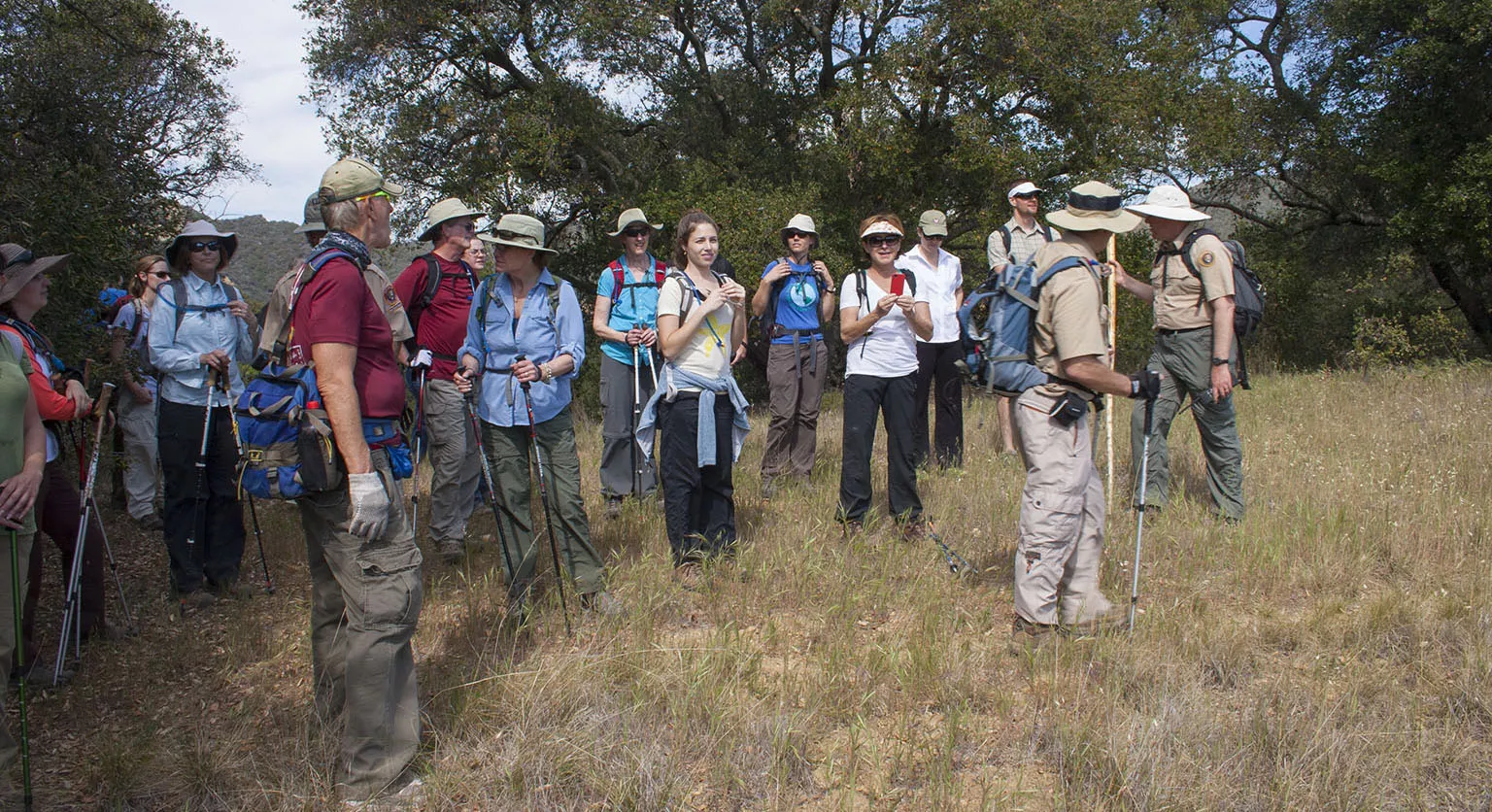
Those guys organized it very well. It all started with a meeting in December. We all came together in a small conference room near the King Gillette Ranch (which later opened as the main visitor center) for cookies and coffee. They introduced Mike Theune, the ranger, and the team of volunteers who will lead the hike. We went through all the information we needed to know, mostly geared towards those who are inexperienced: keep hiking to build up some strength, break in boots, prepare for long days, bring food, etc. We were a bit concerned, too, Em had a pretty bad knee injury in the middle of November, and she was still limping at this time. We were very much in doubt whether she'll be able to do this.
However, it worked out fine. Her knee healed pretty quickly, we did a few short hikes to make sure it doesn't blow up, and as it didn't, we happily went to the first segment on January 14.
Segment 1 - Ray Miller Trailhead to Danielson Ranch
We woke up at 5am, drove to Rancho Sierra Vista and waited for the gate to open. After everybody parked, we piled into as few cars as possible and drove all the way around to the Ray Miller trailhead. This practice would be the norm for all hikes. They always asked for a few people to volunteer to use their vehicles for carpooling, and then they were driven back to their cars at the end.
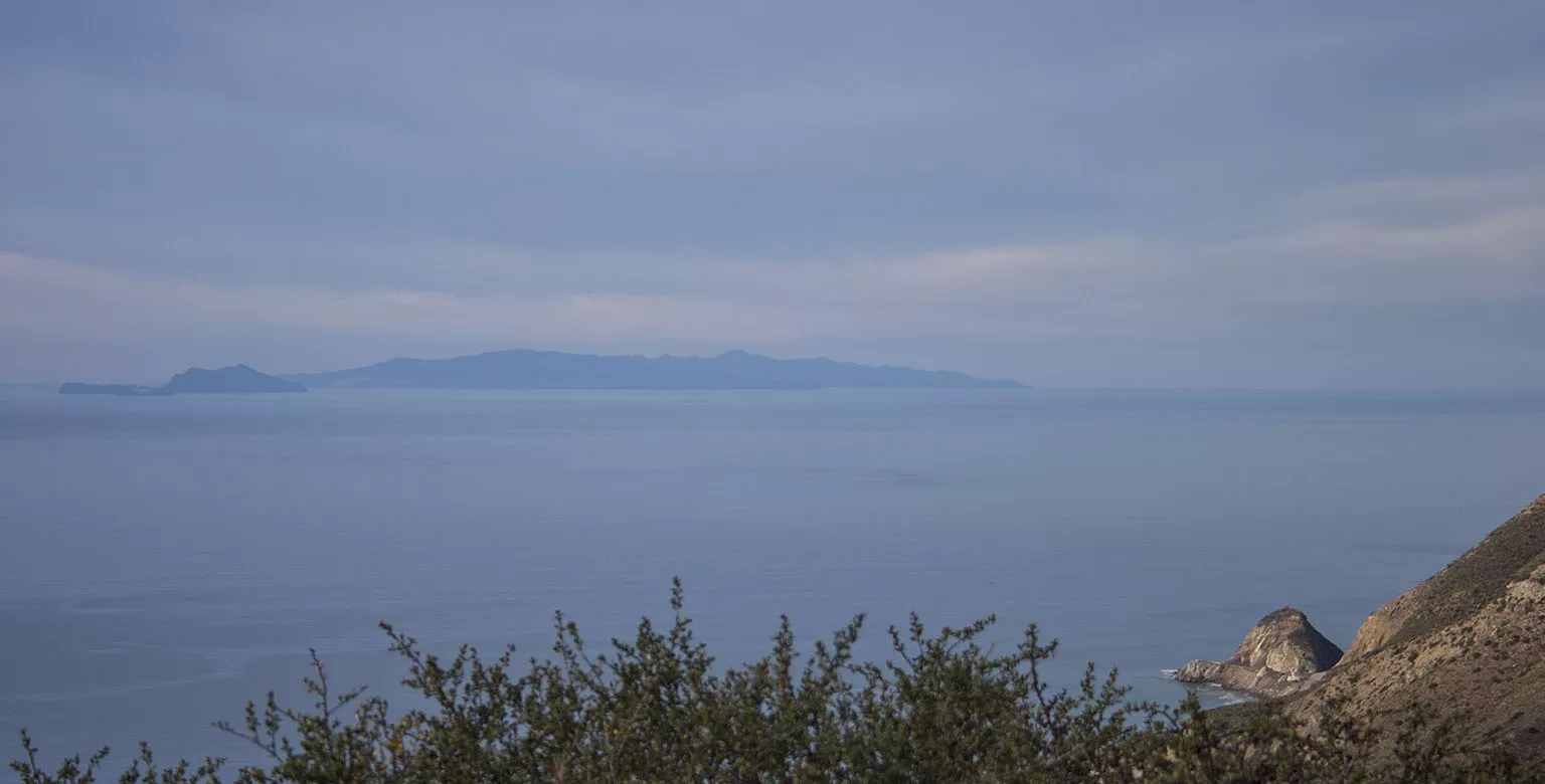
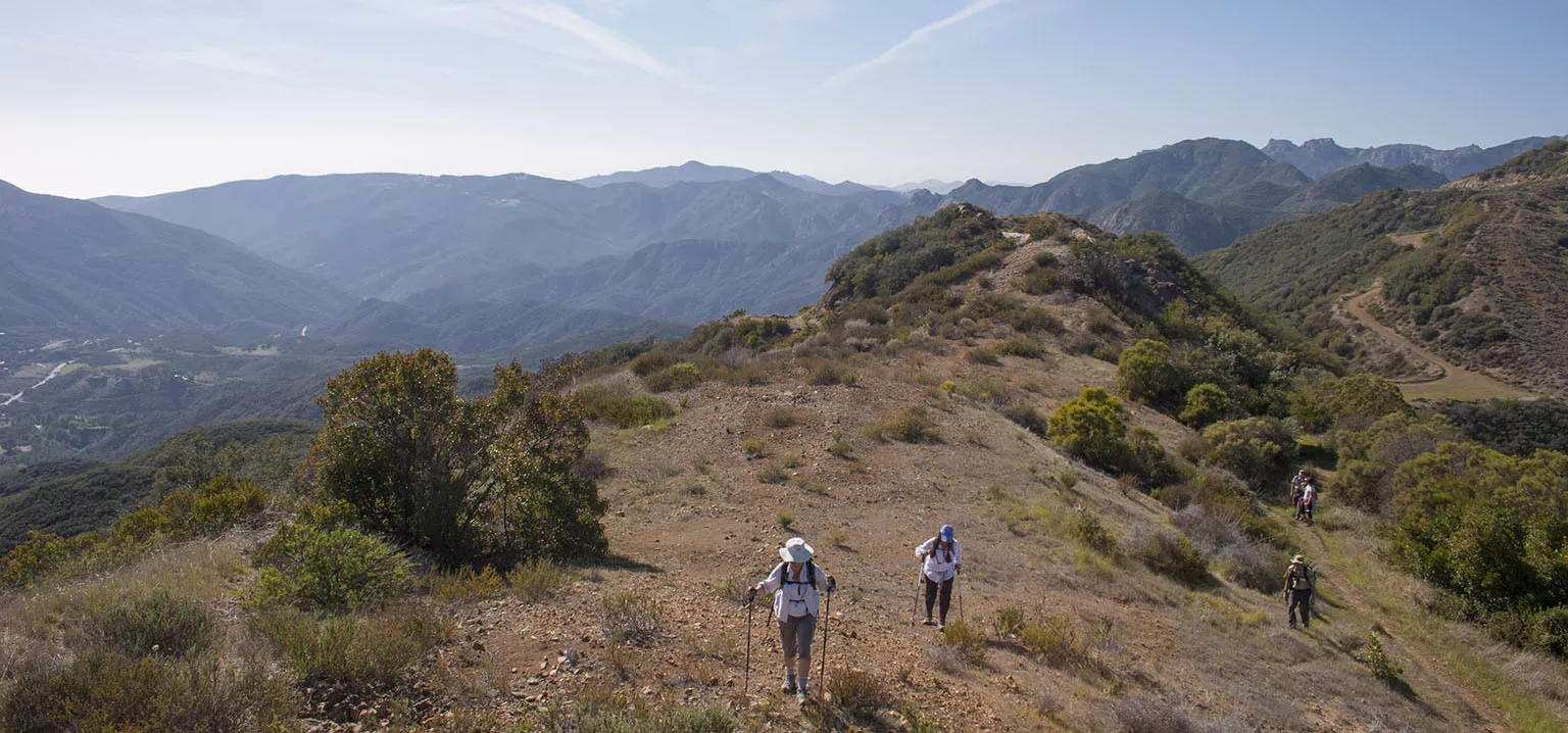
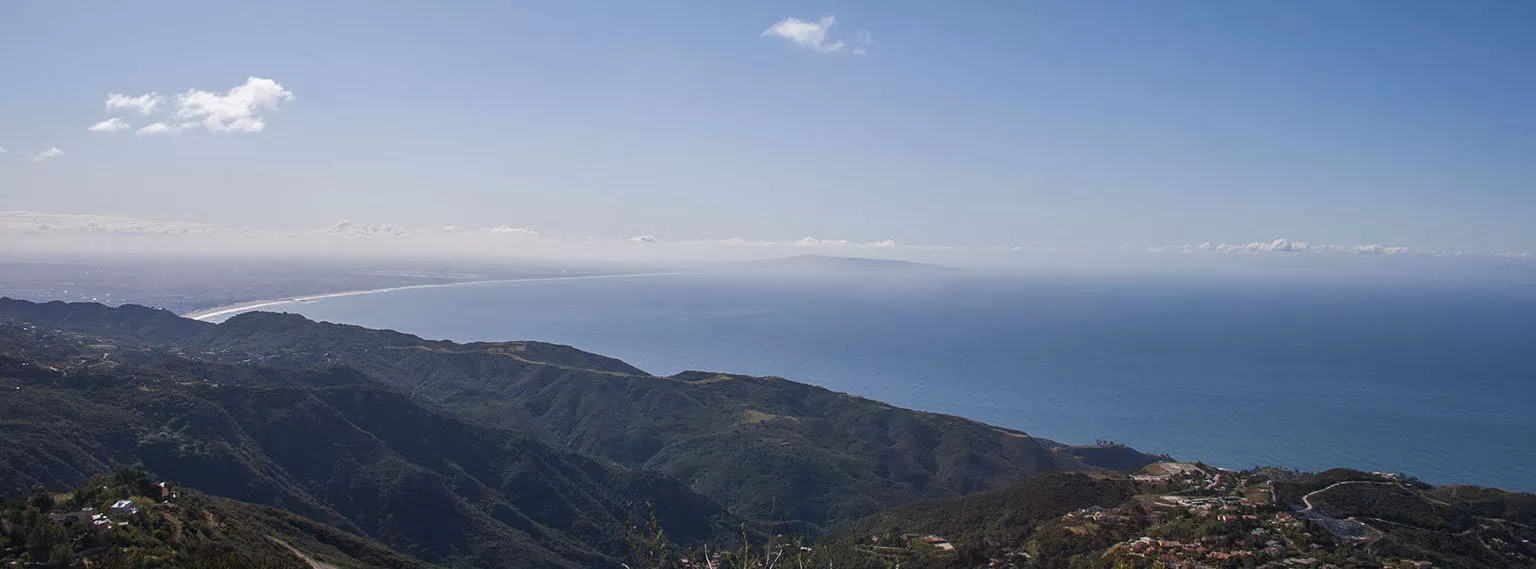
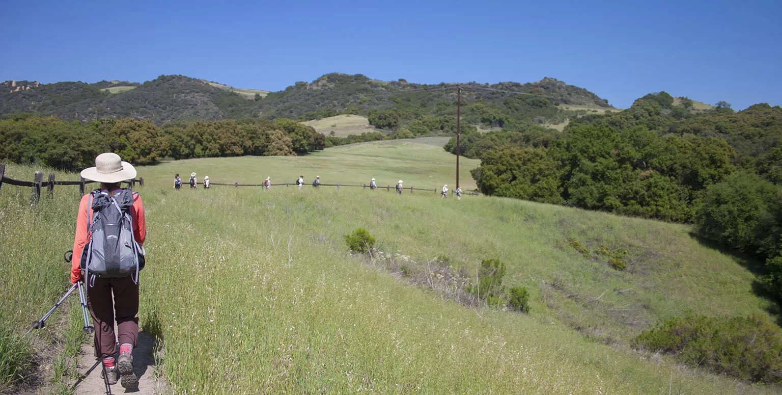
It took us a while to get organized, but we finally took off from the trailhead around 10am. I couldn't help myself, and after a few steps, I asked loudly: "Are we there yet?". The trail took us up, offering nice view of the ocean and the Channel Islands, then turned inland and descended into Sycamore Canyon, where we took a lunch break. Everybody was pretty upbeat, though there were a few to whom it was already too much. After lunch, we walked up to Danielson Ranch and they shuttled us up to the top of "Heart Attack Hill" from where we still had about half a mile to walk to our cars.
As promised, a few times during the hike, we stopped for short breaks and one of the volunteers spoke for a few minutes. The first was about how unique this environment is: only five places in the world have Mediterranean climate, and only 1-2% of that is still left undisturbed. We're in the spot that comprises the vast majority of that little what's left. Another was about the coastal sagebrush, the main plant community of the Mediterranean climate. Yet another, down in Sycamore canyon, about the riparian zone surrounding the little creek.
Segment 2 - Mishe Mokwa parking to Danielson Ranch
This hike was supposed to take place on January 28, but last minute, they canceled it because of a red flag warning. 2010-11 was a high precipitation year, as far as I remember they even declared an end to the drought, but that didn't last long. The winter of 2011-12 saw very little rain, and the rangers said that given the circumstances, the red flag warning in January is unusual, but not unexpected.
Finally, we ended up doing this segment on February 11. We met at Rancho Sierra Vista again, because this part was set up so we do it the reverse direction. They wanted to make it a bit easier on people because this way, the total elevation gain was around 1,000', but the other way it would have been over 3,000'. Even so, about 6-8 people who were there on the first hike gave notice that they would be abandoning the hike.
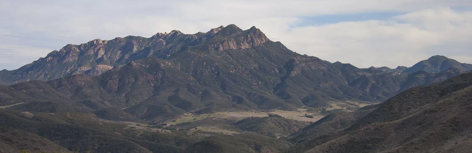
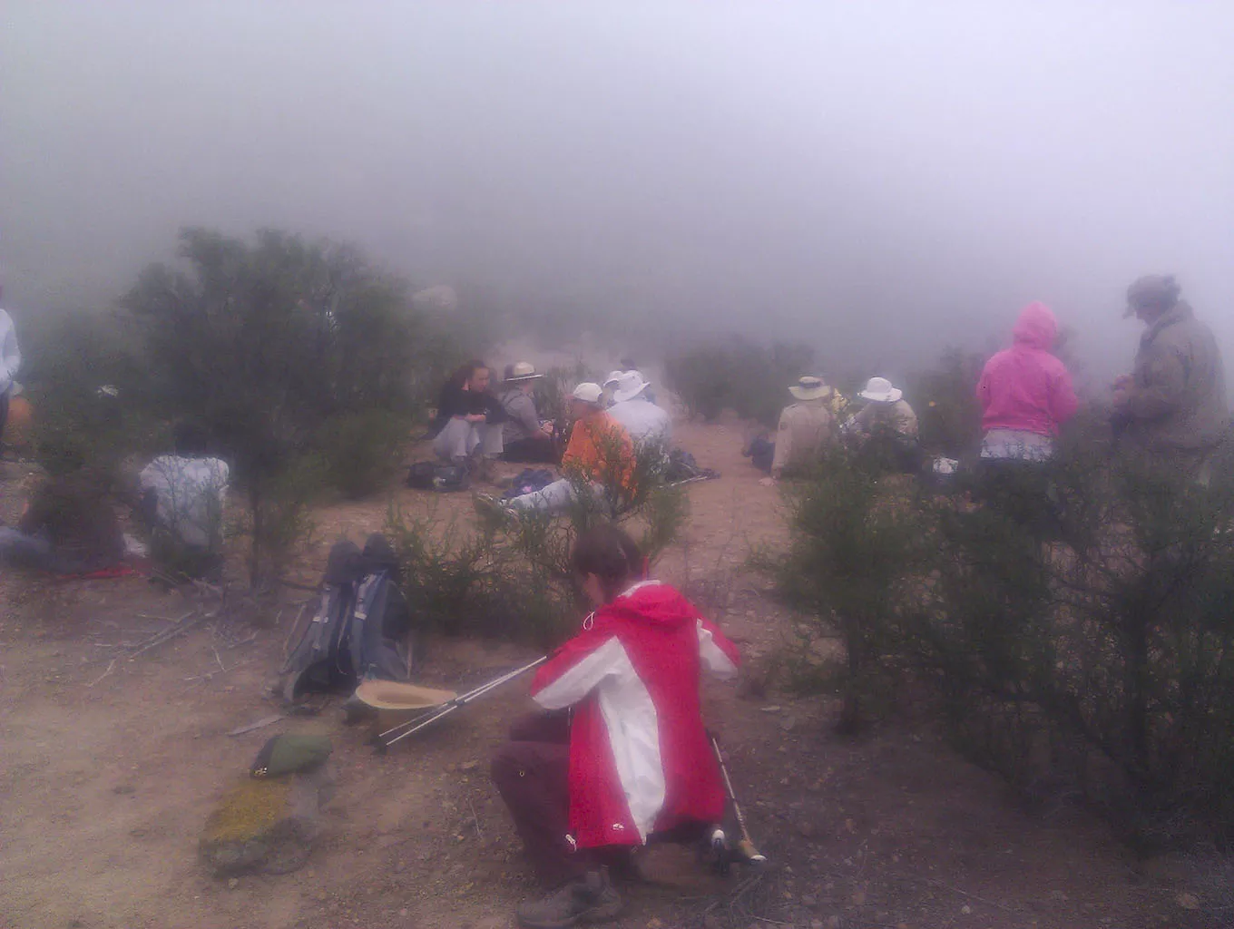
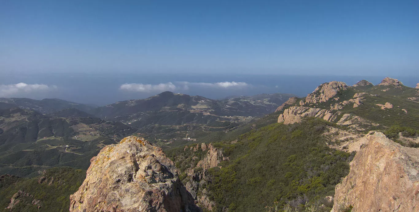
When starting at the Mishe Mokwa parking area, the trail goes up a nice, graded slope to the turnoff to the spur trail that sharply climbs to Sandstone Peak, the highest peak of the Santa Monica Mountains. This peak at 3,111' is the only reason these mountains can be officially called mountains. If it would be under 3,000', it would be the Santa Monica Hills. Also, it's name is misleading, Sandstone peak is not sandstone, it's volcanic. All the technicalities aside, it's a very nice little peak with cool views of the ocean, the mountains, and the valley. Or so they say. On this day, we could barely see anything. There was a thick marine layer coming up all the way to the peak, obscuring almost everything. Oh, and my camera. I forgot my camera. Now, I'm not the most organized person, but I don't forget my camera very often. This time, I did, so the only picture we have from this hike is the one I took with my phone in the fog when we were having our lunch break. I call this "Gorillas in the Mist.
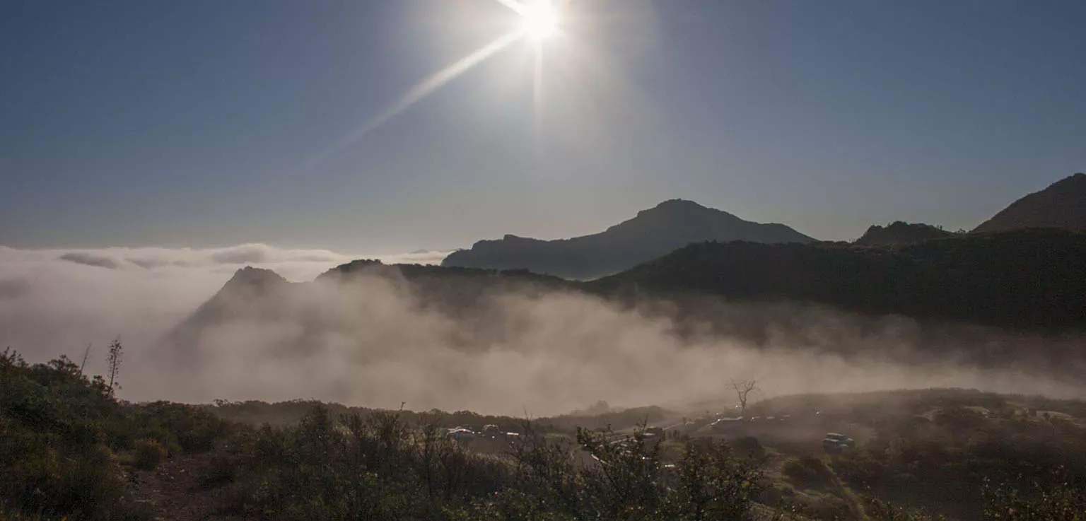
Continuing, we descended under the clouds and they even broke up a bit, so by the time we got down to Danielson, it was pretty sunny. Again, we got shuttled up Heart Attack Hill, and as we were driving one of the carpool cars that morning, Em and I got driven back to our car we left up at Mishe Mokwa. I was still pretty mad at myself becasue of the camera, but after that much hiking, you care less and less.
Segment 3a/3b - Mishe Mokwa parking area - Yerba Buena Road/Encinal Canyon - Clark Ranch Road
This one was tricky. There's a segment of the trail here that runs on private property, and the NPS did not have an easement agreement with the owner.
So we carpooled twice that day, doing one segment at a time. The second segment was not a one-way hike, like usually, but we had to climb the hill and the go back to the cars the same way. It was still worth it, though.
Update, 2017: Finally, the trail is complete! The NPS cleared the easement right and the BBT can now be done as one continouous hike.
In the morning, there was an ultra-marathon on our route. They started at Ray Millet TH, ran all the way on the BBT up to somewhere on Section 3a, turned around and ran back, 50 miles altogether, with a total elevation gain of at least 5-6,000'. We saw the man who was in the lead (by about 20 minutes). He was past mile 30 and didn't even look very tired. All my respect to these people, what they are doing is bordering on superhuman.
Another lucky coincidence happened, too: during the first carpool ride, we ended up talking to a couple who said they missed Segment 2 and are looking to "make it up". A bit of background on this: all those who completed all eight segments were due a certificate of completion. If somebody missed a hike, the only way they could still be up for the certificate if they somehow went and did the same segment, preferably with other people from the group. That's what this couple was looking for. We were hiking almost every weekend anyway and we told them we'd be interested. More about this later.
Segment 4 - Encinal parking to Latigo Canyon
By this time, the hiking group got pretty organized, people started to know each other and we started acting a bit like a tribe. Of course, there were a few skirmishes here and there, but we were a happy bunch for the most part.
The segment took us down into the canyon, then up to Kanan Road. About half a mile before we got there, we found a stroller in the bushes that some idiot just abandoned in the middle of nowhere. Maybe they got tired of the child, too? Anyway, we took turns carying it, then Ranger Mike ended up leaving it by the dumpsters at Kanan. This is a very neat area, with ample parking and even a possibilty to reach it via public transportation. From here, the trail goes steeply up the hill, then crosses above one of the tunnels. On the other side, we stopped in a very nice place on the ridge for an interpretation about the Native American tribes that used to inhabit the area.
Segment 5 - Latigo Canyon parking to Malibu Canyon
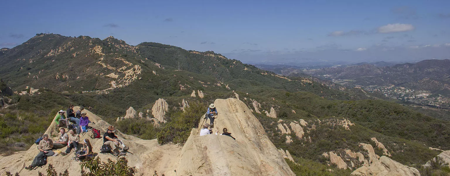
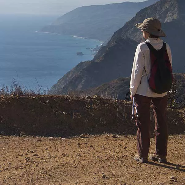
Finally, we got to the section that took us to the place where we discovered the BBT. We met at that parking lot just south of Piuma/Malibu Canyon and carpooled to the Latigo parking area in the middle of nowhere. The first part climbed up to the top, where tooth-like rocks of various sizes jutted out like the backbone of a dinosaur. We had lunch there, then continued on the ridge and finally descended sharply back into Malibu Canyon. If you want a good, steep hike as training, do this part of the trail from the parking lot up the BBT going north.
Segment 6 - Saddle Peak Road to Malibu Canyon
Like #2, mostly for elevation change reasons, we did this segment the "wrong" way, too. We met at the same parking lot as for #5, then drive to the top of the hill and start going backwards. At Saddle Peak, we finally started glimpsing the neighborhood where the end of the trail would be. The day was pretty clear and we had sweeping vistas of the LA basin. The last part of the trail before we got to Piuma road was like a jungle - very dense, green shrubbery with a wet, bog-like terrain underfoot. A very welcome change from all the dirt roads.
Segment 7 - Saddle Peak Road through Hondo Canyon to Topanga State Park
I would hard pressed to choose a favorite segment from this hike, but I think #2 and this one would top the list. We met at Trippet Ranch in Topanga State Park. This in itself is a very cool place and a good starting point for many nice hikes, from very easy to more challenging ones. While waiting for a few latecomers, everybody got busy taking photos of a deer and her fawn loitering around the camping tables.
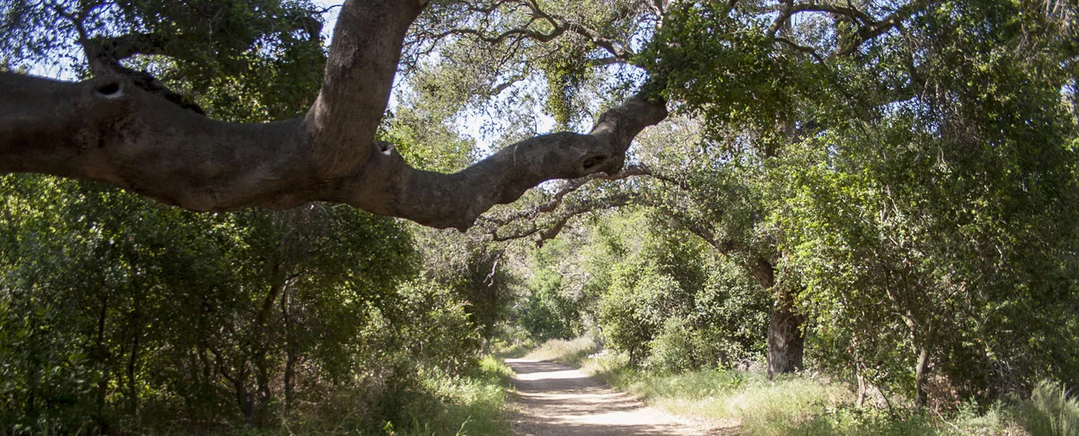
After carpooling to the Saddle Peak parking area, we dropped down into Hondo Canyon - very wild and seemingly remote - and when climbing out, we met a gentleman from UCLA who was recoding bird sounds for study. He explained in length how a few birds have a language-like structure to their singing and how they are studying it. We then climbed up the ridge to the former missile site, now covered in graffiti, then over to Trippet. The last mile before the ranch is my favorite, it's a green, lush grassland with some trees and a few big open views.
Segment 2 again
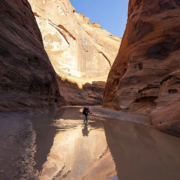
We talked to the couple who missed #2 and committed to do it on this day with them. The organizers sent an email to everybody, offering the opportunity, but nobody else took it, so it was just the four of us. There was no way for us to organize a shuttle from Danielson up the hill to Rancho Vista, so we decided to hike out in Sycamore Canyon to the beach. It's longer, but it's a very even, almost flat-looking road that descends gently to the beach in the scenic canyon. So we all met on the beach at Sycamore Cove, left one car there, then drove up to the Mishe Mokwa parking area.
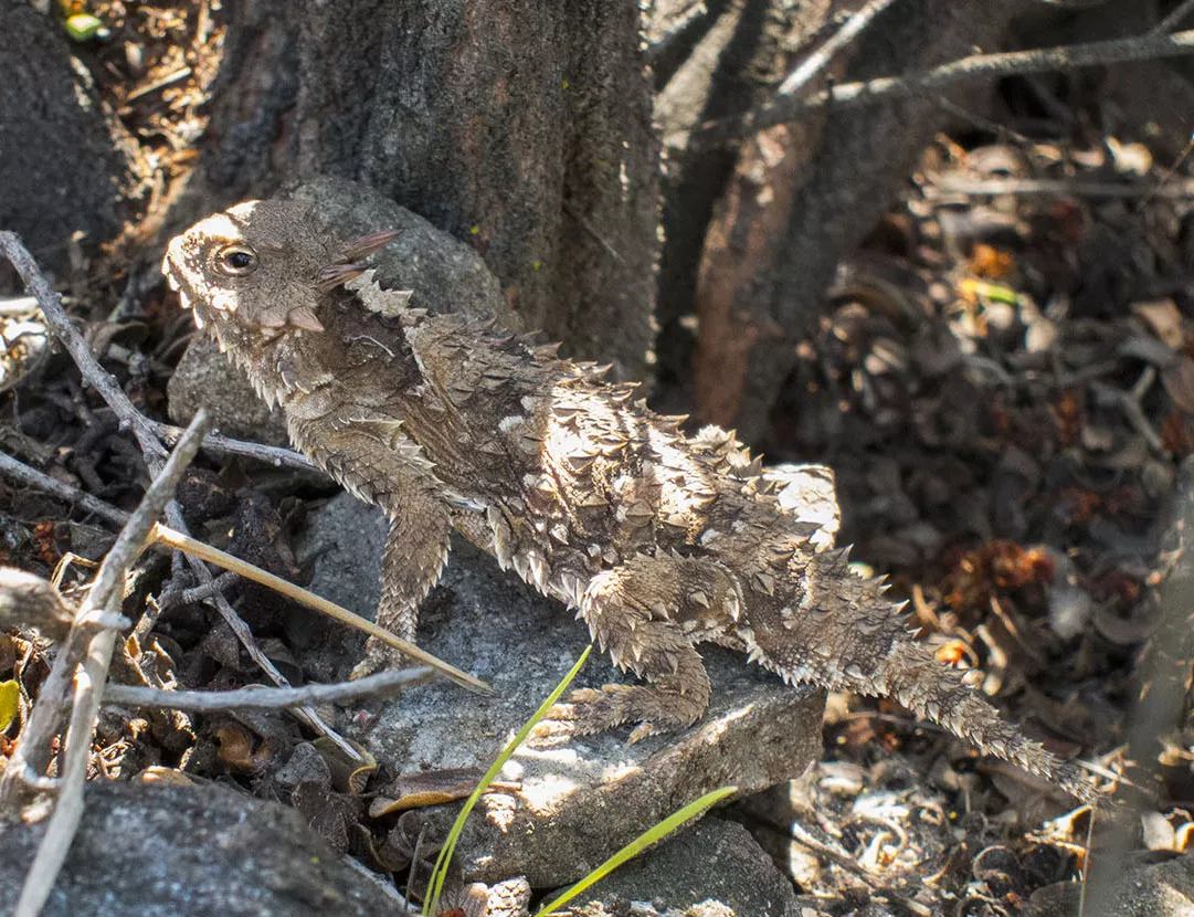
I made sure I did not forget my camera, Em brought hers (she took the picture above), and it was very much worth it. It was a beautiful, clear day with amazing views from top of Sandstone Peak. While descending, Em spotted a horned lizard and managed to take a few decent pictures of it. We previously saw a few in Joshua Tree NP, and read about them afterwards, and I remember it said they mostly dwell in the desert. When we asked the rangers about this, they said they are there, but are very rare and it's a big deal that we got such a good photo of it.
At Danielson, we ran into a group of BBT through-hikers. Some organization put together a hike where they would do the entire trail in one week, sleeping at three different campgrounds along the trail, shuttle the people back and forth to the trailheads of the respective sections. I'm not sure whether they are still doing this, if anybody has been on this hike or has more info, let me know.
From Danielson, we almost leisurely walked down the canyon towards the beach - almost, because by then, we had almost 10 miles in our knees, mostly steep downhill. It was very peaceful, despite the trial's popularity. We even say the green amazon parrot community that took up residence here, and what I jokingly call the famous "Malibu twitching grass", which is a gopher chewing on the root underground, and to you it just looks like the plant is shaking by itself.
One thing's sure: doing the segment this way is much more scenic then going up to Rancho Vista. Maybe it's just me, but despite all the cars and other signs of civilization, it's an almost primordial feeling when you get out to the beach after the long walk in the canyon. Unlike the people of old, at least we didn't have to hunt for food, so we raided the car, sat in the sand and consumed a huge picnic of assorted cold food. Side note: Sycamore Grove is one of the most scenic picnic beaches on the SoCal coast. Visit if you haven't been there before.
Segment 8 - Trippet Ranch, Topanga State Park to Will Rogers State Historic Park
...and we came to the last part. Park at Will Rogers, carpool to Trippet, then walk the 10 or so miles between them back to the park.
As always, the green grasslands around Trippet were gorgeous, especially in the morning, as the marine layer was still hanging over the place, slowly breaking up. After less than a mile from the trailhead, we got to Musch Trial camp. Currently, this is the only "true" trail camp on the BBT, meaning people can walk up to it, pitch their tent, and spend a night. The camp itself is pretty drab, but the general area is very nice. There's a restroom and tables, but it lies on a pretty busy intersection of two main trails, and it's definitely not a place where you'd want to spend a few days. If I'd be doing a real through-hike of the BBT, of course I'd love to sleep there.
We stopped there for a quick interp and snacks, then continued on, up towards Eagle Rock. That's a pretty famous rock (even I knew about it), and always teeming with people. This time, a couple took up residence in that small cave just below the peak, and our ranger gave them a hard time, mostly because they used a big, orange tarp to shade the cave, and the ranger was concerned that somebody could mistake that for an emergency signal.
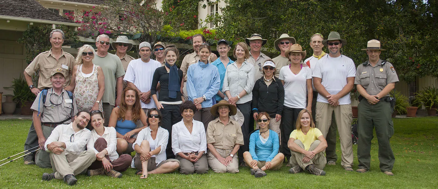
After lunch at Eagle, we pressed on for the last bit, continuing along the ridge, then dropping down to Will Rogers State Historic park, where we took our well-deserved group photo, got our certificates, and spent a few more hours eating a nice picnic.
Notes
Of course, this hike was nothing compared to a "serious" trek in the mountains, but there's not real point in comparing them anyway. It was a very, very good experience, we made friends, we learned many interesting facts about our local environment, and it was truly part of our life for almost five months. It was also a great training regimen to start building up strength in Em's injured knee and in general for our longer summer hikes.
Looks like they're still doing the hike every year, the official site is here: http://www.nps.gov/samo/planyourvisit/backbonetrail.htm.


